
Overall Dry Pattern - Next 4 Days
Cool This Friday and Saturday, then warmer next week

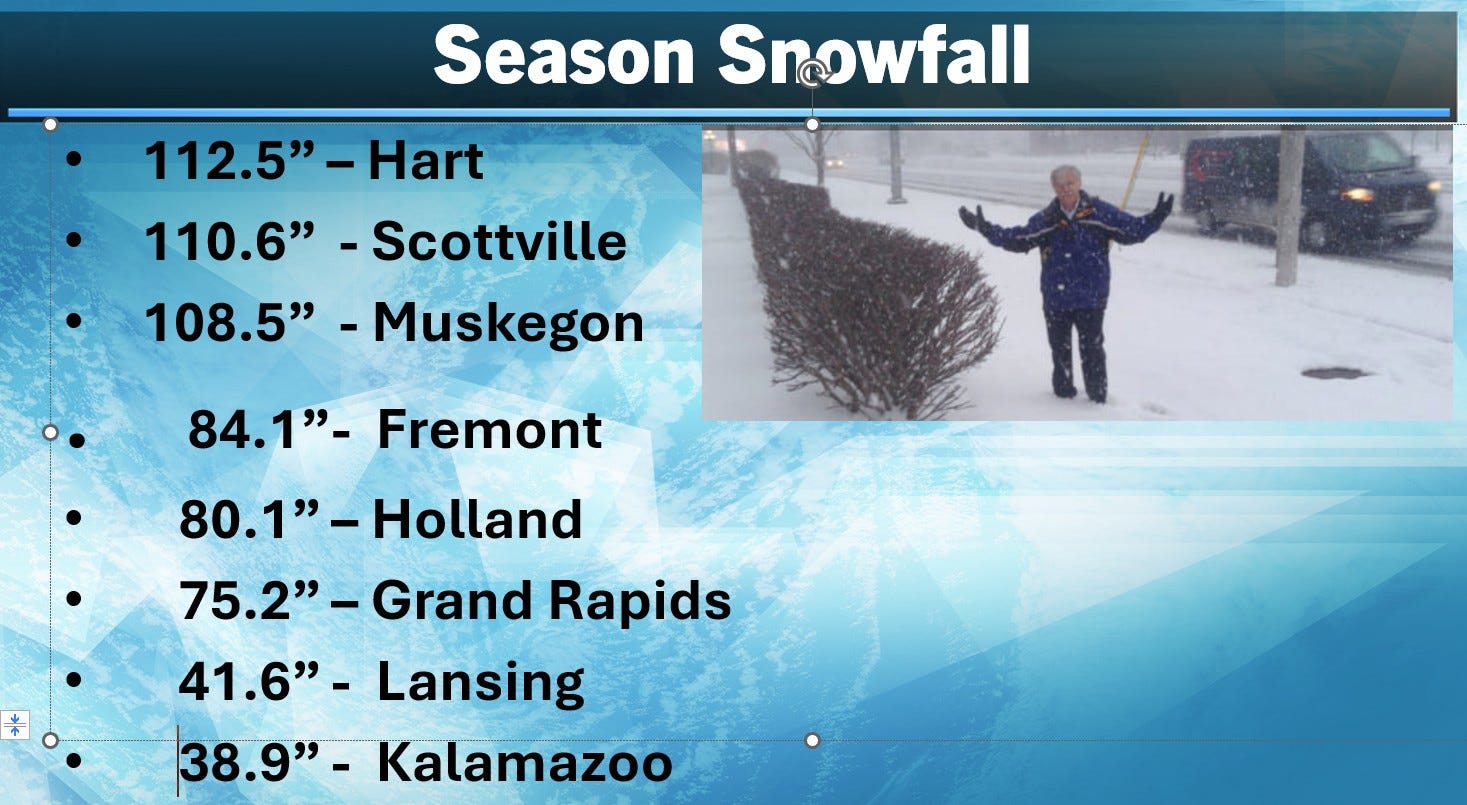
Let’s start with season snow cover. Hart, Scottville and Muskegon have reached the “Hundred-Inch Club”. Grand Rapids 75.2” is within an inch of average-to-date. Muskegon is 23.5” above average-to-date.
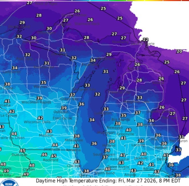
Here’s forecast high temperatures for this Friday. With some sunshine, we should climb to the low 40s in southern Lower Michigan. It’ll hold in the mid-upper 30s near Lake Michigan. It will be cooler as you head north…just low-mid 30’s for Ludington and Houghton Lake. Some places in the U.P. and northern Lower Michigan may not get out of the 20s…just 22 for a mid-afternoon temperature at S. Ste. Marie, where they still have 31” of snow on the ground.
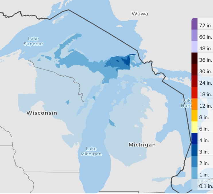
Over the next 3 days, there may be a few snow flurries, mainly north of Grand Rapids and maybe an inch up toward Manistee. There could be a dusting on the grass in the early AM. Roads should be mostly in good shape. In the U.P. up to 1-4” could fall in the darker blue areas on the map…certainly no big storms.
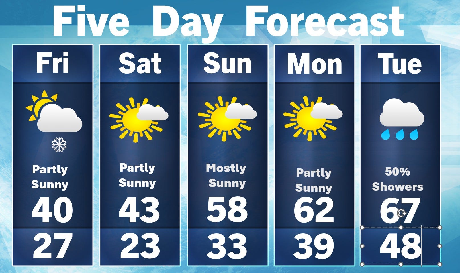
Here’s my 5-day forecast…40 is about the best we can do today…43 tomorrow. Palm Sunday looks like a nice day - warmer. Monday still looks dry, but showers (and maybe thundershowers) will move in Monday night and while it won’t be raining much of the time, the period from Tuesday - Thursday of next week should bring several rounds of showers and thunderstorms. The average high temperature in West Michigan climbs above 50 next week.
Hope you have a nice day.
Thanks for updating us on season snow totals. I sure hope they stay “as is” and we get no more snow storms, but until we get past Mother’s Day I never feel like we are truly out of the woods.
Let the gardening commence! Peas ,spinach, lettuce and onions. Whoop pea!