
Winter Weather Advisory Has Expired


The Winter Weather Advisory that was in effect until 1 am Saturday for the lakeshore counties and the next set of counties east of the lakeshore counties (Kalamazoo, Barry, Kent, Newaygo and Lake) plus Calhoun County has expired.

Advisories also cover much of Northwest Lower Michigan, including Manistee, Cadillac, Traverse City, Houghton Lake and Gaylord, and also part of Eastern Upper Michigan. In northwest Lower Michigan 2-8” of snow will fall and up to 8-14” in the eastern U.P.
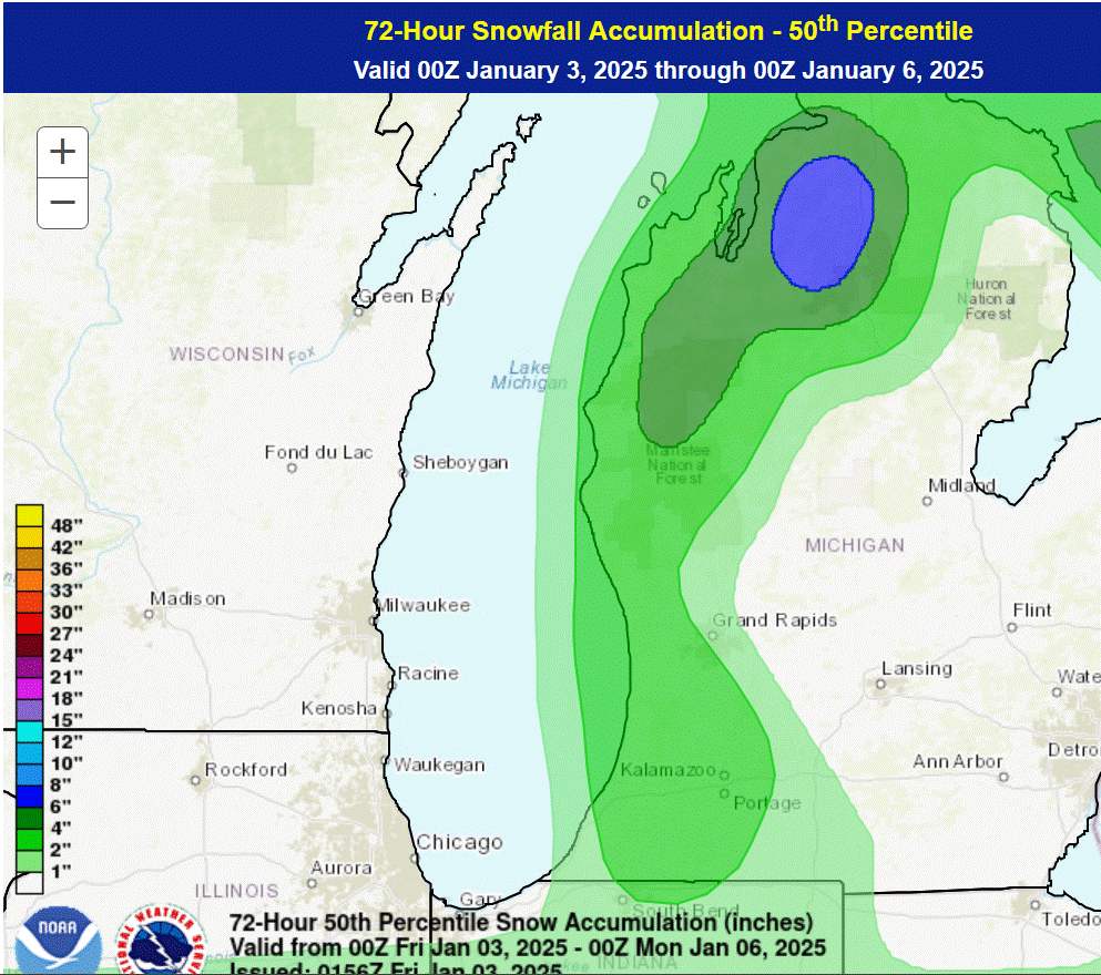
Here’s forecast snowfall from the Weather Prediction Center. Looks like most areas see 2-4 inches with the heavier +6” amounts east of Traverse Bay (Mancelona, Kalkaska, southwest of Gaylord).

Radar
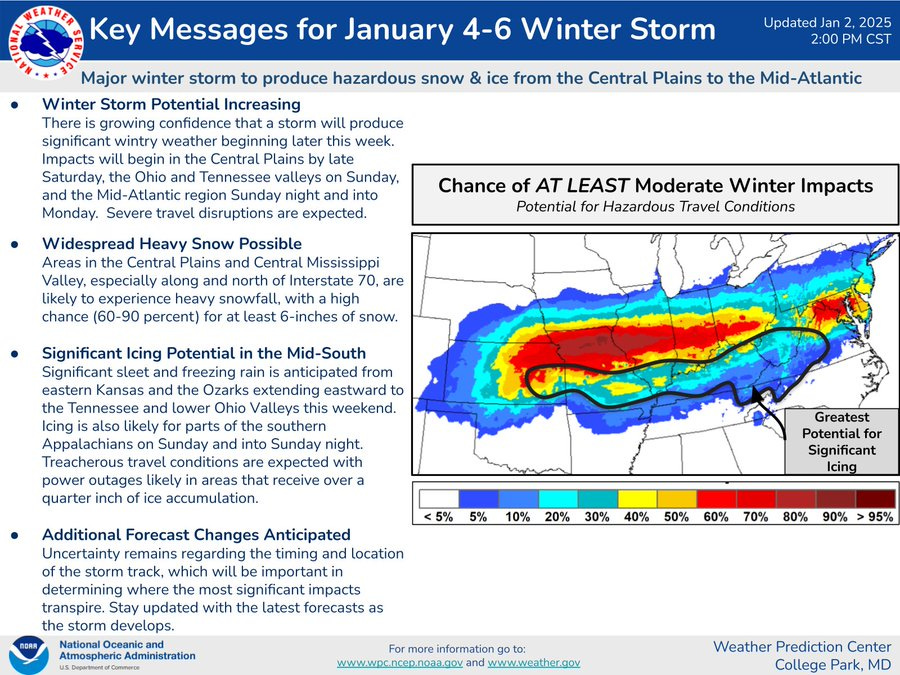
A signficant snow and ice storm will pass south of Michigan early next week with heavy snow from Kansas City to St. Louis to Indianapolis to Dayton to Washington DC. South of the heavy snow there will be a band of significant freezing rain. Anyone traveling toward the Ohio River should be prepared for snow, ice and slow travel.
Here’s current Michigan weather observations, a Michigan weather map and the latest Grand Rapids National Weather Service Forecast Discussion.

Here’s forecast high and low temperatures from the European model. We stay on the cold side of average for the next week, then moderate back to above average for the last couple weeks of January. So…if you like winter, enjoy the next 10 days.

Here’s the latest 8-14 day outlook from the Climate Prediction Center. Michigan is still in the blue (cooler than average). However, this represents an average over 7 days. We may be chilly to start the period, then warm up back to average or even a touch above average by the end of the 7 days. The last 10 days of January look a little warmer than average.
**********************************************************************************************************

*
The moon is in its crescent phase right now with about 13% of the moon illuminated. It’s “waxing”, which means we’re seeing more of rhe moon each evening. Here’s This Week’s Sky at a Glance. This is a good time to view planets if we ever get a clear evening. Venus shines brightly to the southwest in the evening. Jupiter, Saturn and Mars also grace our evening sky.
Interactive map of storm reports from 2024 in West Michigan. Homes collapse in Ethiopean earthquake. Some of the best satellite pics. of 2024.
With the wind today, had the kids been in school, this may have been the first snow day of 2025. Out by the lakeshore we are getting periods of heavy snow and then periods of calm. Typical lake effect bands coming off of the water.
Bill- what is your “Lake Michigan Ice Forecast” for 2025? Rather what % of of the big lake will be covered in nice at peak?
We had a couple bands here (Forest Hills) last night. With the really cold temps the roads are still a bit slick! But with the NW flow, the bands did shift SW again