
Severe Storms Miss West Michigan
Plus today is the 70th anniversary of the Hudsonville-Standale Tornado

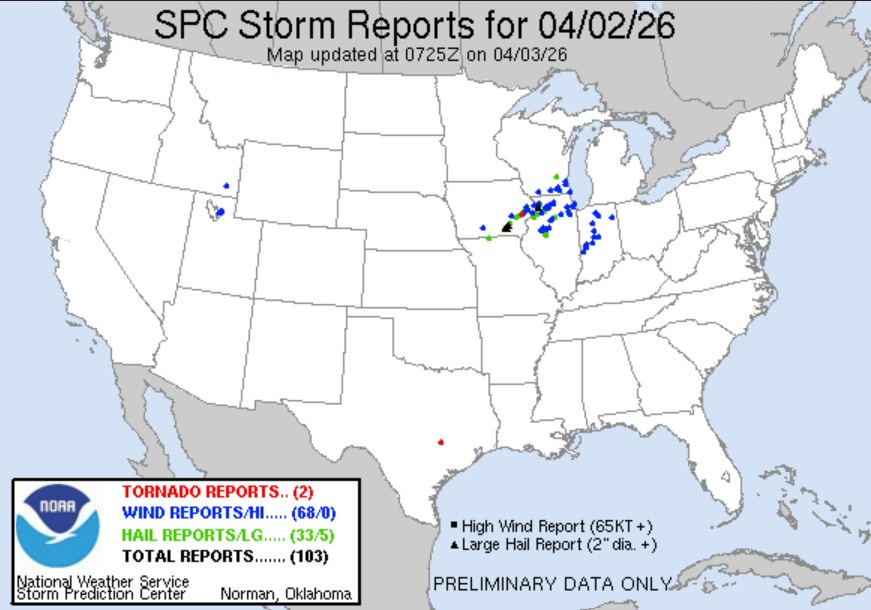
Here’s storm reports for Thursday 4/2 as of early Friday. They were largely in E. Iowa, N. Illinois, S Wisconsin and Indiana…none in Michigan. You can see the severe hail reports (green dots on the map) and wind damage reports (blue dots on the map). There was one small tornado in eastern Iowa. Baseball-sized hail fell near Ottumwa IA.
The warm air pushed north into Michigan. Temperatures rose from the low-mid 30s in the early morning to the 60s to low 70s during afternoon.
Historical note: Today is the 70th anniversary of the Standale-Hudsonville tornado and it’s also the anniversary of the Super Outbreak of tornadoes that occurred in 1974. Here’s a link to a program Storm Team 8 put together on the Hudsonville-Standale tornado twenty years ago in 2006. Here’s the Wikipedia article on the Super Outbreak on April 3, 1974.
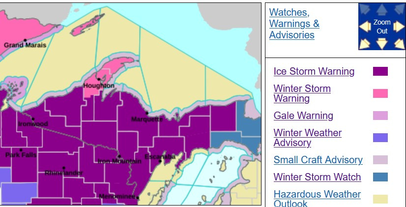
We still have an Ice Storm Warning for eastern Upper Michigan. Watch for icy roads north of the Mackinac Bridge this Friday.
The Mackinac Bridge Authority said Thurs PM: "Motorists are asked to reduce their speed to 20 miles per hour as they approach the bridge and be prepared to stop. Bridge personnel are stationed at both ends of the structure to provide instructions regarding how and when to proceed across the bridge."
I had over an inch of rain (1.17”) at my house on Thursday. I think I heard 2 rumbles of thunder on two occasions.
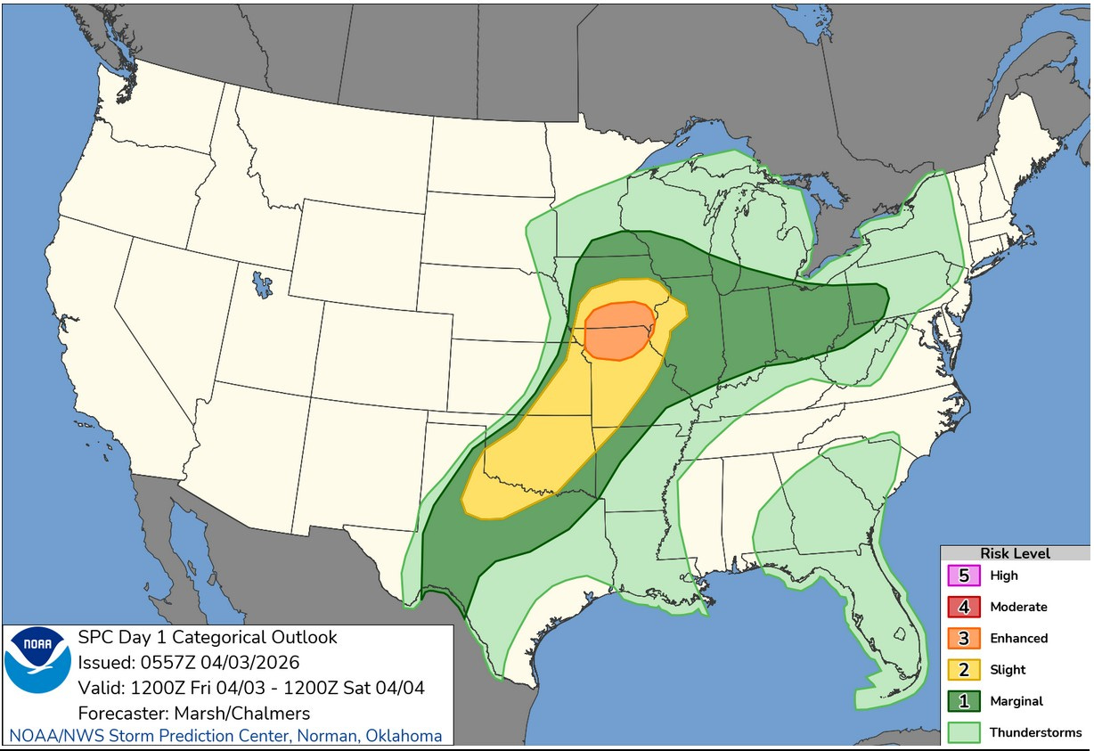
This is the Severe Weather Outlook Map for this Friday. SE Iowa gets another round of storms…back-to-back days of severe weather for them. The Enhanced (level 3) risk area is southern Iowa and northern Missouri, with the Slight Risk (level 2) from central Iowa to N. Texas. A “squall line” of strong to occasionally severe storms may develop in the PM ahead of a fairly strong cold front.
There is Marginal Risk (level 1) that extends east along a front all the way to SW Pennsylvania. It does come into Lower Michigan, generally south of a line from Holland to Monroe. That’s a low risk for hail north of the front in the cool air, where wind damage and tornadoes are not likely.
We’ll also be keeping an eye on area rivers. With another +1/2” of rain coming this Fri. night into Saturday and more rain from Thursday to Saturday of next week, river levels may approach bankfull in a few places. I had 1.17” at my house Thursday. The Ford Airport recorded 0.96” and Muskegon had 1.37” which was a daily record for April 2.
The sirens kept going off here in Marshall. As a retired lineman, I watch the Consumers Energy Outage Map, there were No outages piling up to the west of us so that is always a great indicator that there was very little Wind associated with the Storms.
Thank you for the information! Although Spotter Activation will not be required in Michigan - after what happened a few weeks ago - I'll certainly be keeping my eye out!