
Winter Weather Advisory - Mon. Evening Update
Snow showers continue. It will be breezy with temperatures steady or slowly falling.


The Winter Weather Advisory remains in effect this Monday for the lakeshore counties plus Lake County until 7 am Tuesday.
Here’s the details: *...WINTER WEATHER ADVISORY NOW IN EFFECT UNTIL 7 AM EST TUESDAY... * WHAT...Snow. Additional snow accumulations between 1 and 3 inches. Gusty winds will also lead to drifting snow especially for north/south roads. * WHERE...Portions of southwest and west central Michigan. * WHEN...Until 7 AM EST Tuesday. * IMPACTS...Visibility and road conditions may change rapidly over short distances in lake effect snow. Plan on slippery road conditions. The hazardous conditions could impact the Monday evening activities and the Tuesday morning commute.

Look for cold temperatures in the low-mid teens today with a brisk west wind and wind chills around -5.

The cold air will stick around through the midweek with the cold easing back a bit late in the week. A more substantial warm-up is expected after Feb. 25.
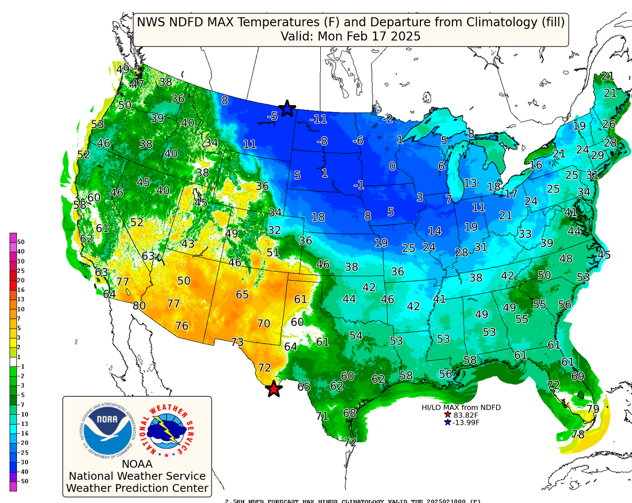
After the snow, arctic air moves into Michigan. Here’s forecast temperatures for Monday afternoon. It’s just 13 in Grand Rapids - that’s about 20 degrees colder than average. The lake warms us a few degrees - it’s just 7 in Chicago…and the cold air will stick around through the middle of next week.
So far, February is running 1 degrees colder than average in Grand Rapids…after January was 2.6 degrees colder than average. In the contiguous U.S., this was the coldest January since 1994.
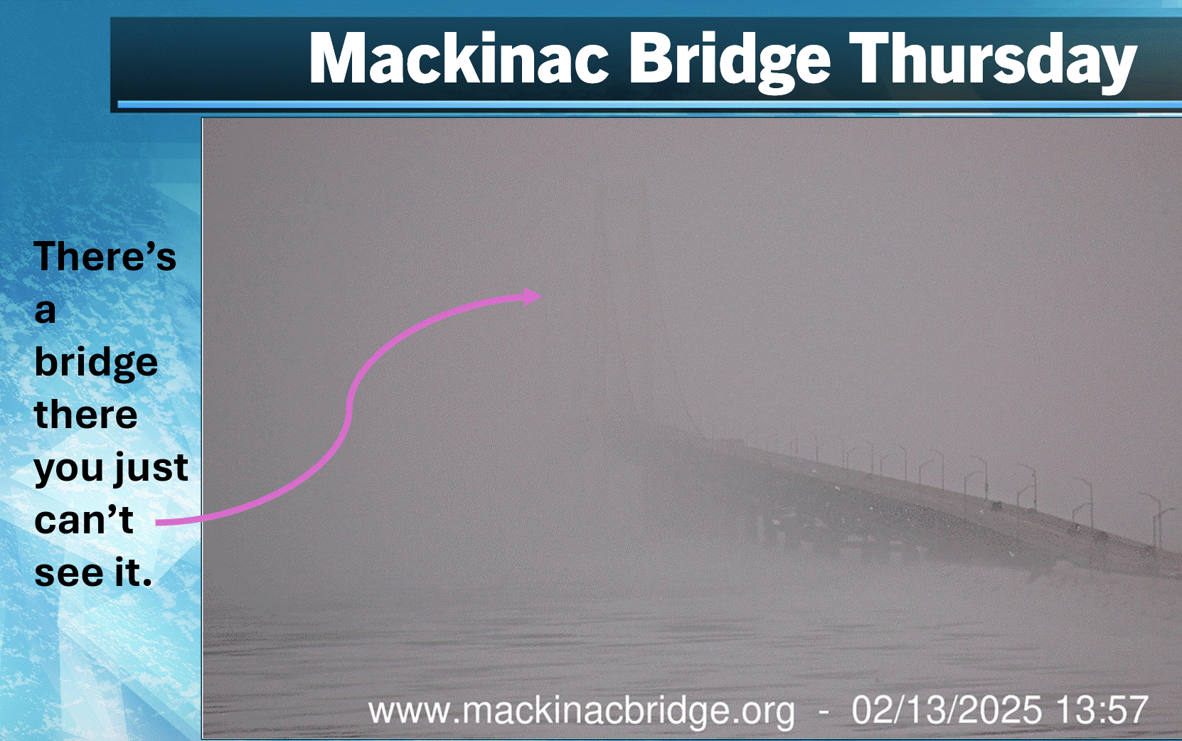
This is a picture from the webcam at the Mackinac Bridge Thursday afternoon. There were times when it has looked like that this weeken. It’s ocasionally snowing hard enough that you can’t see most of the bridge. The Bridge Authority warned that the bridge was icy and slippery. Would you like to drive over the bridge in that kind of weather?
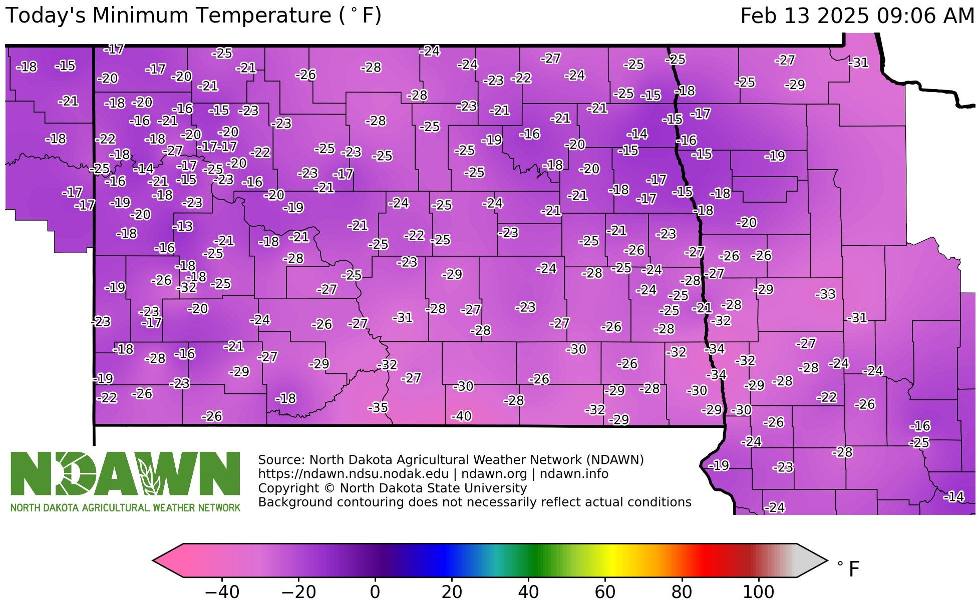
It’s was 40 below zero in Zeeland Thursday morning…that’s Zeeland, North Dakota. This is a map of low temperatures in North Dakota. You can see the -40 in the middle by the bottom of the map. This was the coldest temperature in North Dakota in over 3 years. Cook, Minnesota was also 40 below zero. Early Thursday, Linton ND had a wind chill factor of 62 below zero!

While we got the snow, severe thunderstorms hit the South. This is the severe weather outlook map from the Storm Prediction Center for this Saturday/Saturday night. You can see an Enhanced Outlook Area (in orange on the map above) from Louisiana and southeast Arkansas, across Mississippi and into western Alabama. The Slight Risk Area (in yellow on the map) runs from east Texas to western Georgia. The Storm Prediction Center warns of “Scattered to numerous damaging wind gusts and a few tornadoes.”
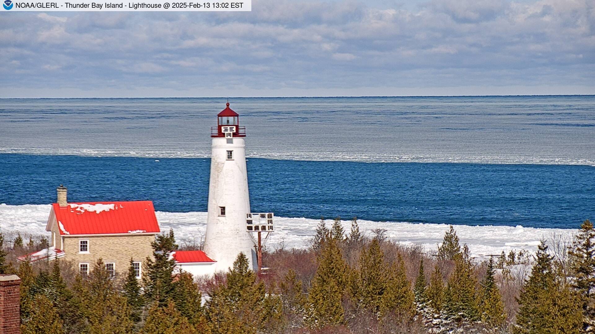
Here’s a pretty pic. of the Thunder Bay Island lighthouse from Thursday PM. There’s ice at the shore, then a stretch of open water, then more ice as you look out over Lake Huron.
Great Lakes ice extent is up to 30% and Lake Michigan now at 22%. Those numbers will increase as the general cold pattern will continue all of next week.

Five locations in the Upper Peninsula have now exceeded 200” of snow for this winter. Last year no one got higher than 173”. S.Ste. Marie has had 163.1” of snow this winter and that’s more than 6 feet above their average snowfall to date.
The most snow on the ground is 43” at Tamarack, with Painesville at 41”. That’s a lot of snow.
Amazing the ice is not higher or at least at average for this point in winter considering the cold January and February. The above average water temps in the fall really made a difference along with some of the wind storms to break up the ice. My guess is we hit 50%-55% ice cover for the Great Lakes for the season.