
Winter Weather Advisory Has Ended
For Oceana County north to the Traverse City Area


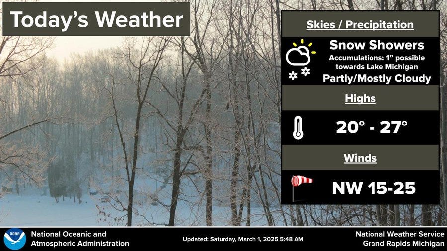
The Winter Weather Advisory has ended. There could be a random flurry during the late afternoon or evening. Roads are mostly dry. Temperatures at mid-afternoon range from the mid 20s along I-94 to the low 20s along I-96 to the upper teens at Cadillac to the single figures at Sault Ste. Marie.

It was quite windy Friday into early Saturday (March 1).

It seems this year that someone has a snow magnet at Sault Ste. Marie, where they had another 9.1” of snow on Friday. That brings their season total to 180.9” nearly double the average winter snowfall through February 28.
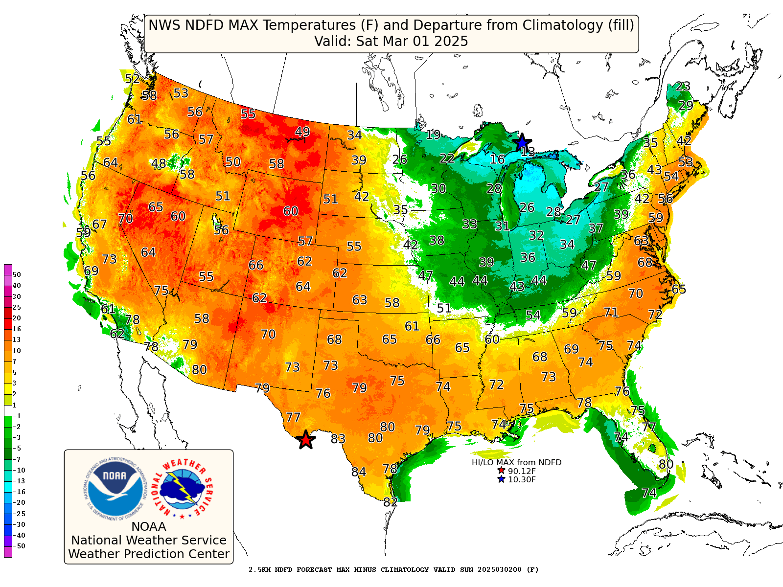
Arctic Air pushes down into Michigan from Canada this Saturday. Temperatures may only be in the mid 20s in the mid-afternoon in West Michigan. The cold air will last into Sunday, then we should be back to the low 40s on Monday. If you don’t mind a cool breeze, it should be a decent weekend to head to the ski resort.
Can we have Winter go away now? I know only the last day of February. Mother Nature always gets the last laugh. Seems like we could still yet get some Arctic Air and SNOW.....
Not looking forward to the howling winds! It could be BLIZZARD conditions right?
You know we will get 1 more snow storm before it is all over! We typically do, but this week sure was a welcome break!