
Strong Winds Hit Michigan 1/27
Wind gusts as high as 74 mph knocked down tree limbs and caused significant blowing snow


Strong winds as high as 74 mph hit the state of Michigan on Monday. The winds knocked down some tree limbs, but caused surprisingly few power outages (approx. 350 customers). It makes a difference that there are no leaves on the trees in winter.
The average wind speed on Monday, midnight-to-midnight, was 20.7 mph. If my records at home here are correct, that makes Monday the windiest calendar day in Grand Rapids since Dec. 23, 2022.
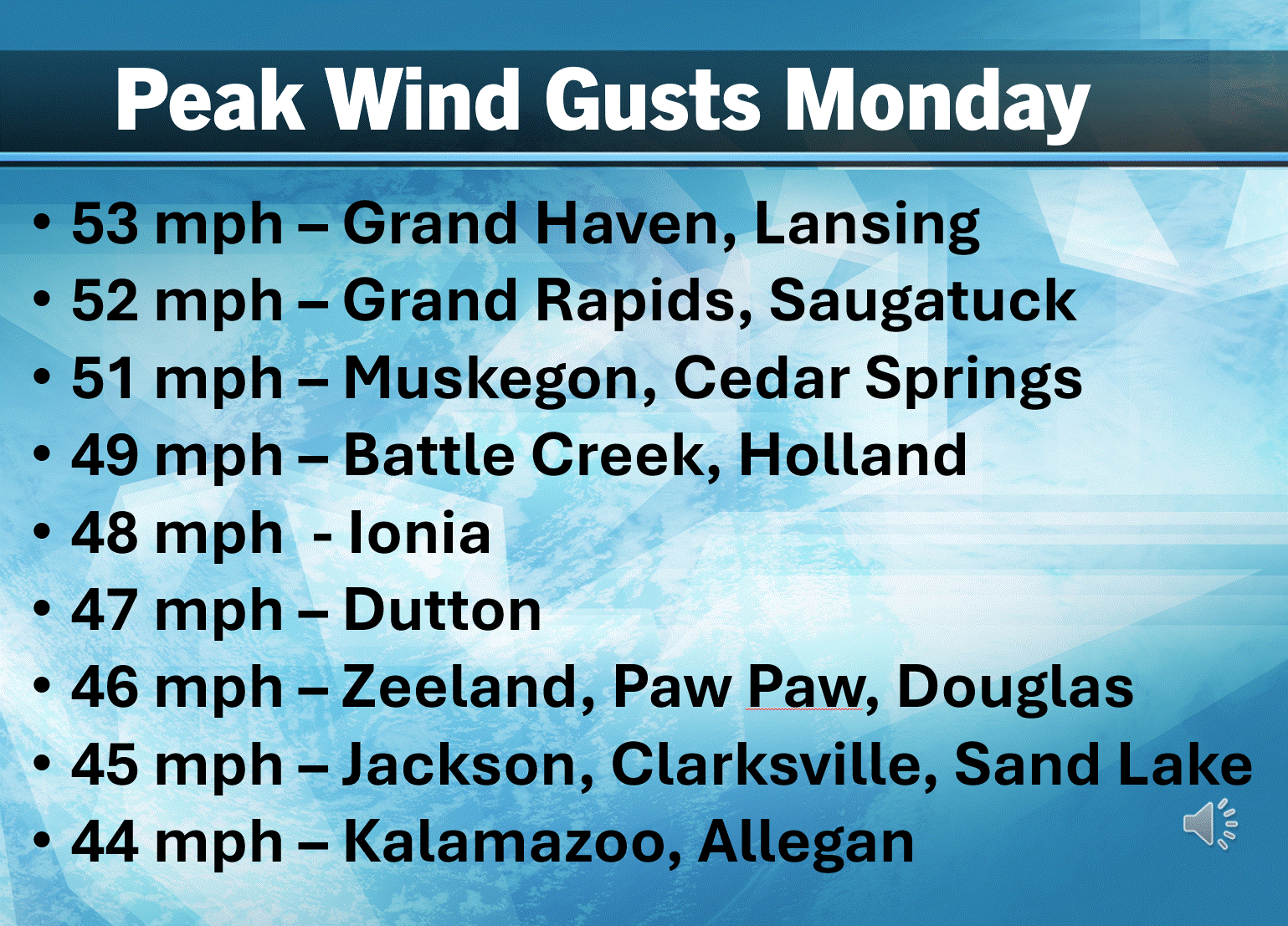
Peak wind gusts in West Michigan were generally between 40-53 mph. Despite the fact that our snow cover was rather hard, there still was some significant blowing and drifting snow.
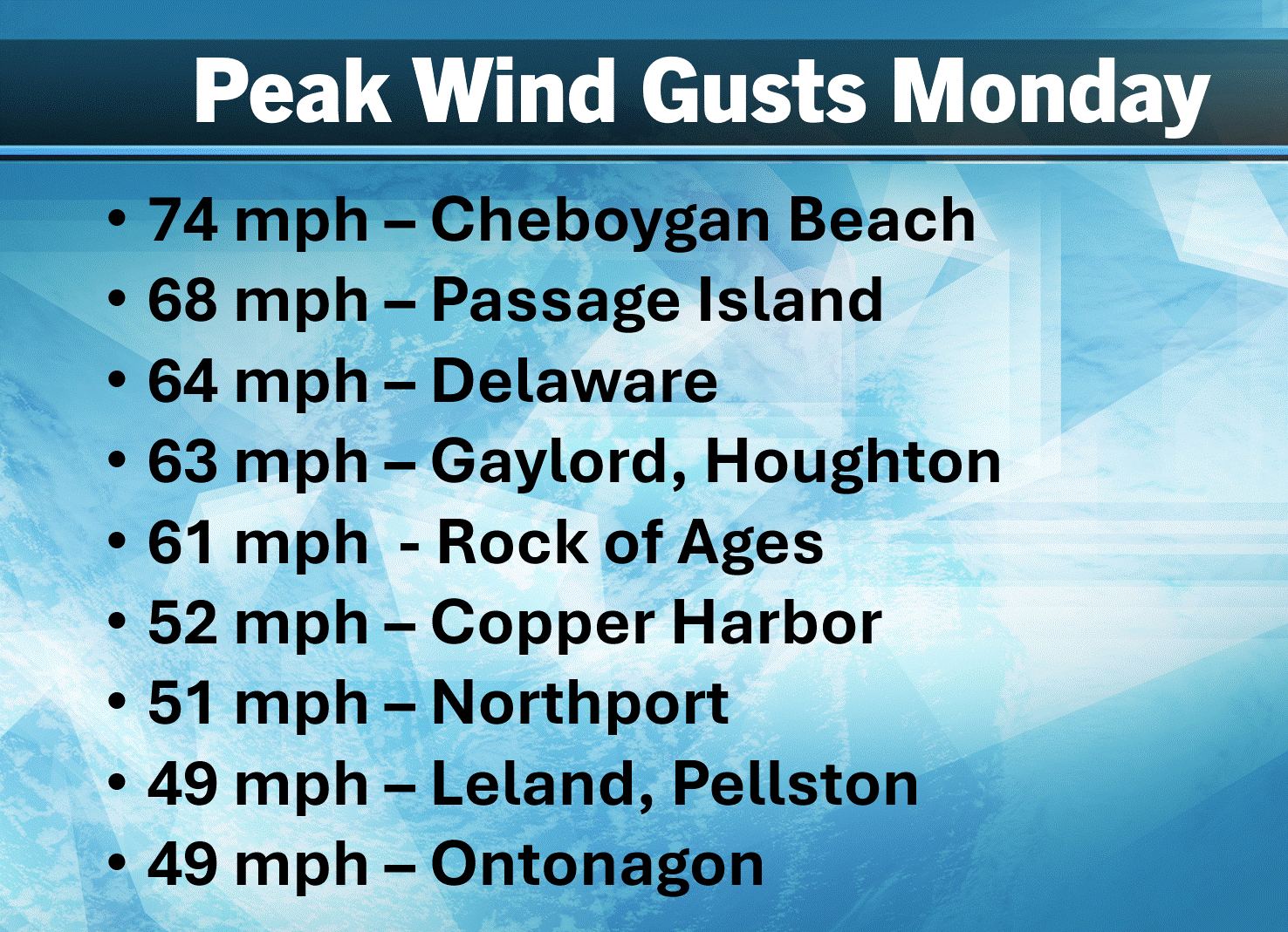
Here’s some peak wind gusts from northern Lower and Upper Michigan. Leading the list was a 74 mph gust on the beach near Cheboygan. That’s hurricane force. Passage Island had the highest gust in the U.P. at 68 mph.
A line of snow showers (squalls) accompanied a front that arrived right around rush hour in the evening. The visibility dropped to 1/8th mile at Big Rapids and 1/4 mile at Cadillac, with the most significant snowfall from 5:15 pm to 7:30 pm.
Storm Warnings were issued for the Lake Superior shore. That’s one step above Gale Warnings.
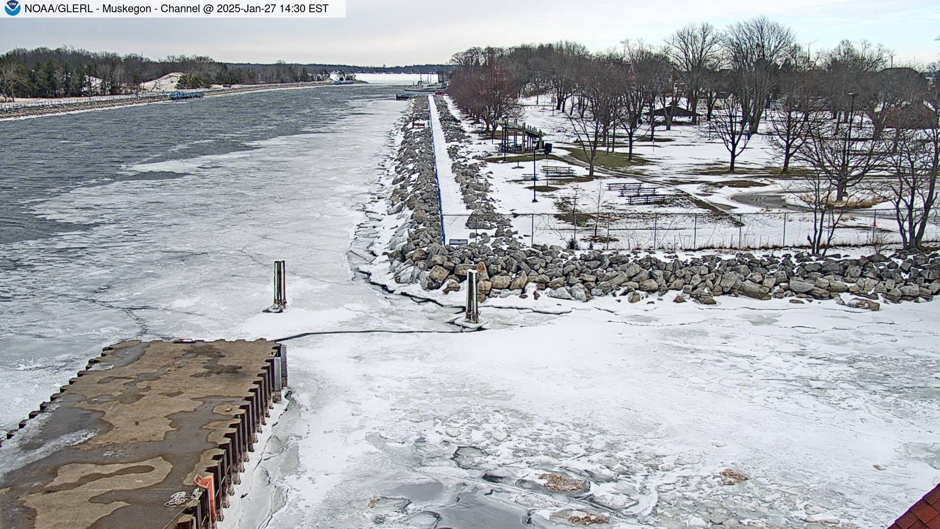
This is the Muskegon Channel Monday afternoon. The strong winds broke up some of the ice in the channel. We had 74% of possible sunshine in Grand Rapids on Monday, making it the sunniest day in nearly a month, since Dec. 30. We had a high temperature of 39 in Grand Rapids, making it the 2nd warmest day of the month. You can see in the picture above the that the snow was starting to melt a little bit in the park in the upper right of the picture. Muskegon and Benton Harbor tied for warmest spots in Michigan on Monday with both cities reaching 40 degrees.