
When could it hit 60 degrees
and, when could we catch a thunderstorm

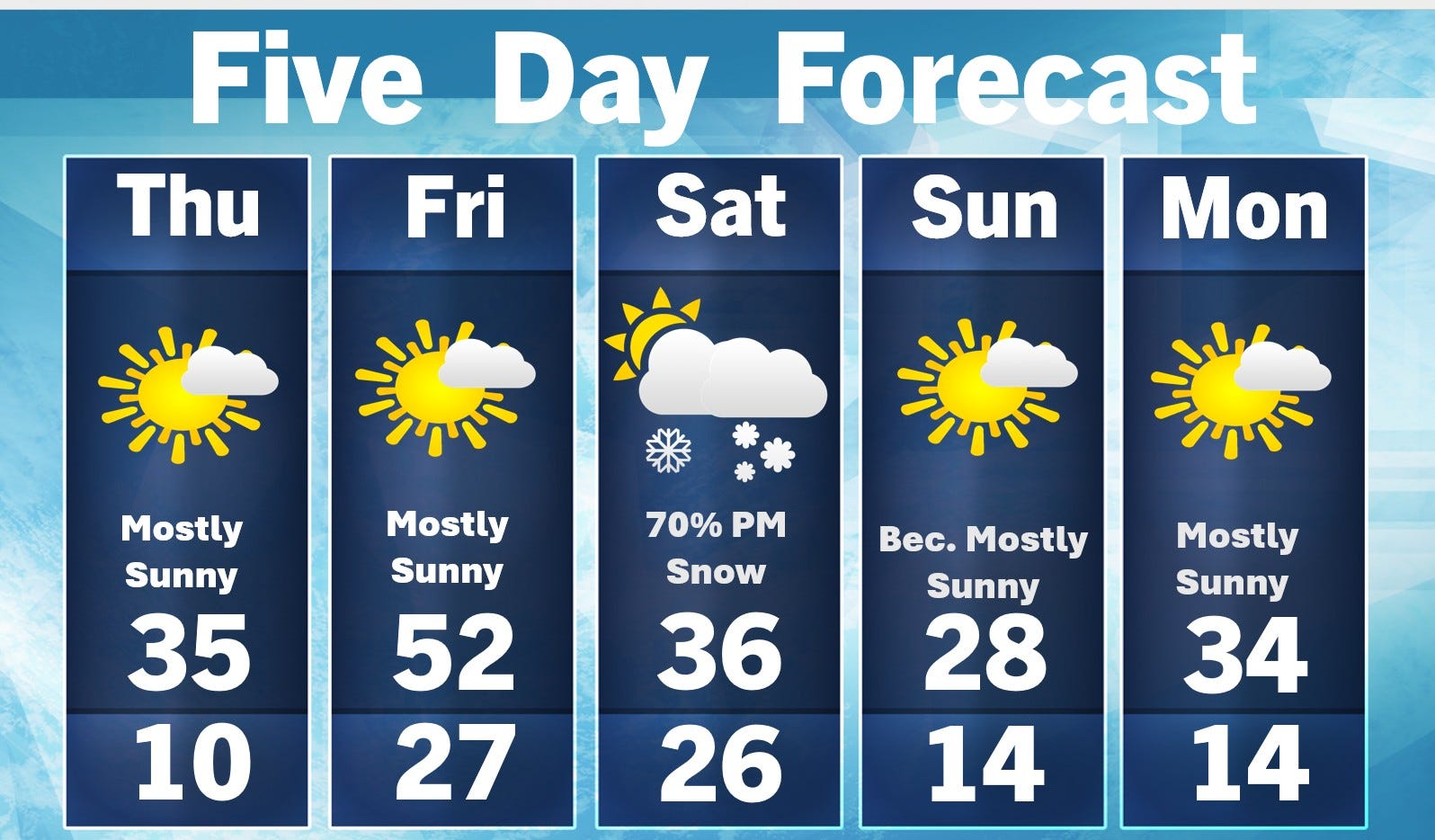
No 60-degree days in the 5-day forecast, but we do have a 50-degree day. That will be tomorrow (Friday). With the help of a brisk south-southwest wind, the temperatures should reach the low 50s inland (low 40s where the wind comes off Lake Michigan).
Today should be a nice day…mostly sunny and a touch above freezing this PM. The snow that’s in the sun will melt and it will feel a bit warmer than the temperature indicates because of the sun and a wind of only 10 mph this afternoon.
Friday the wind could increase to 20 mph in the afternoon. One more shot of Canadian cold air arrives over the weekend.
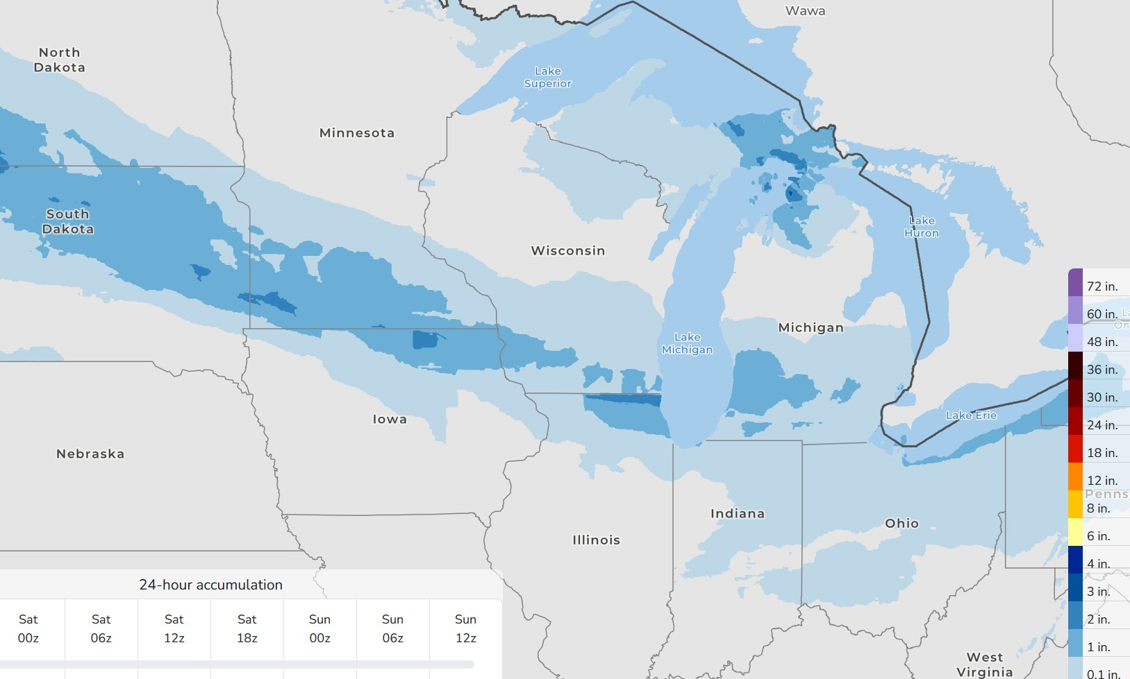
That system will likely bring us some snow Saturday PM/night…nothing major, maybe an inch or two at the most. However that could bring a period of slippery roads. The map above is the 66-Hour Snowfall map. You can see the band of snow from Montana to SW Michigan. This map only goes out 66 hours, so it doesn’t include the snow for Saturday night.
If you like to hit the ski resort one more time, this weekend is the time to do that - or anytime thru the middle of next week. After that it gets warm and wet.
Sunday looks chilly. You may have heard the old folklore that if March come in like a lion, it will go out like a lamb and vice versa. Well, looks like this year, March will come in like a polar bear or maybe a lamb in red flannel.
This shot of cold air will move into New England and New York, we record low temperatures are possible.
BTW, the town of Herman in the U.P. reported a 55” snow cover Tues. evening. That’s more than 4 1/2 feet! They are up to 270” for the winter.
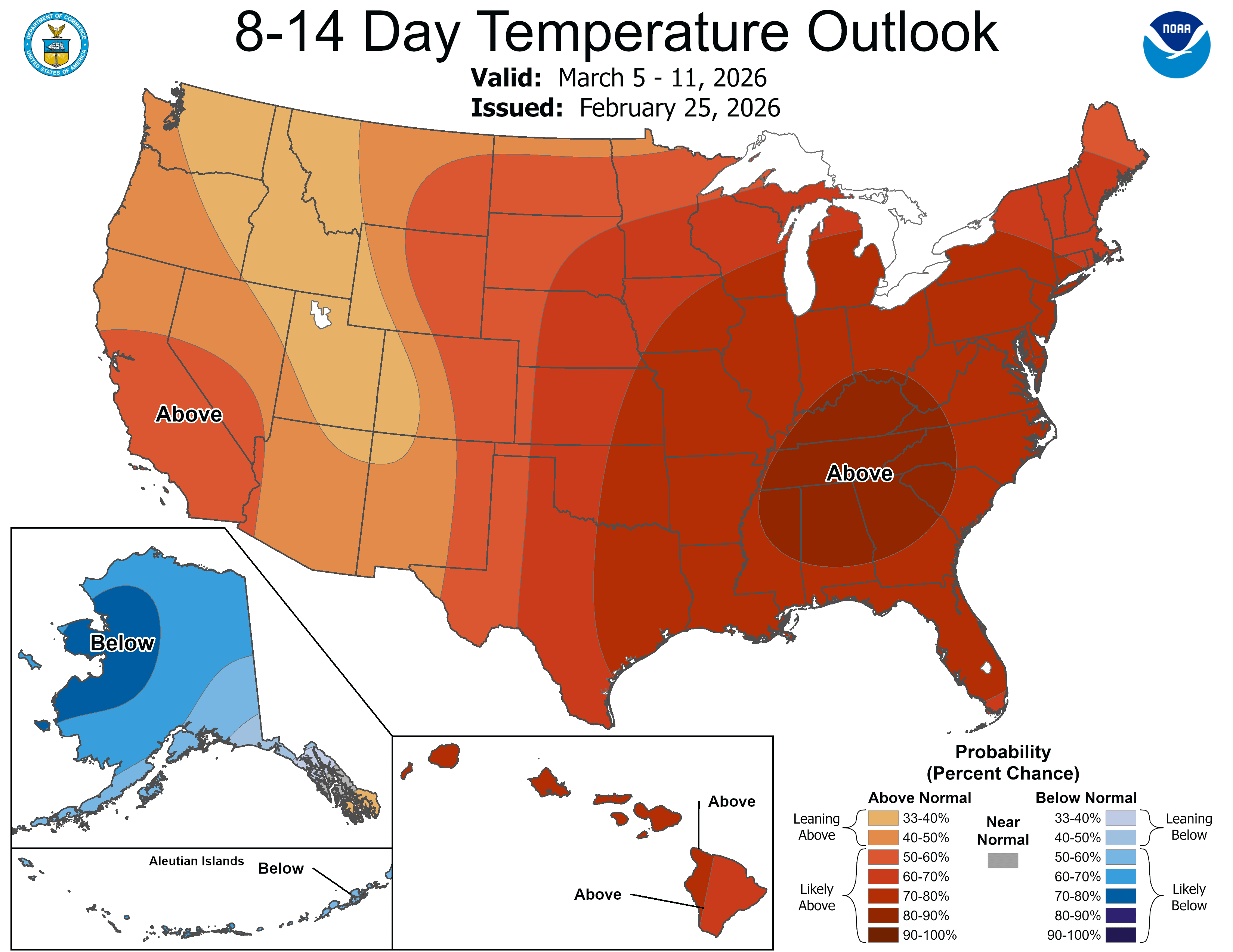
BIG Warm-up coming late next week. This is the 8-14 day temperature outlook from the Climate Prediction Center. Look at the high temperatures the European High Resolution Model predicts for Chicago starting on March 5: 61°, 60°, 66°, 69°, 45°, 58°, 70°
Caution - this may not be spring for good. There will still be a lot of cold air in Alaska and northern Canada and we’ll have to track it to see if any of that can push south into the Lower 48 states in mid-late March.
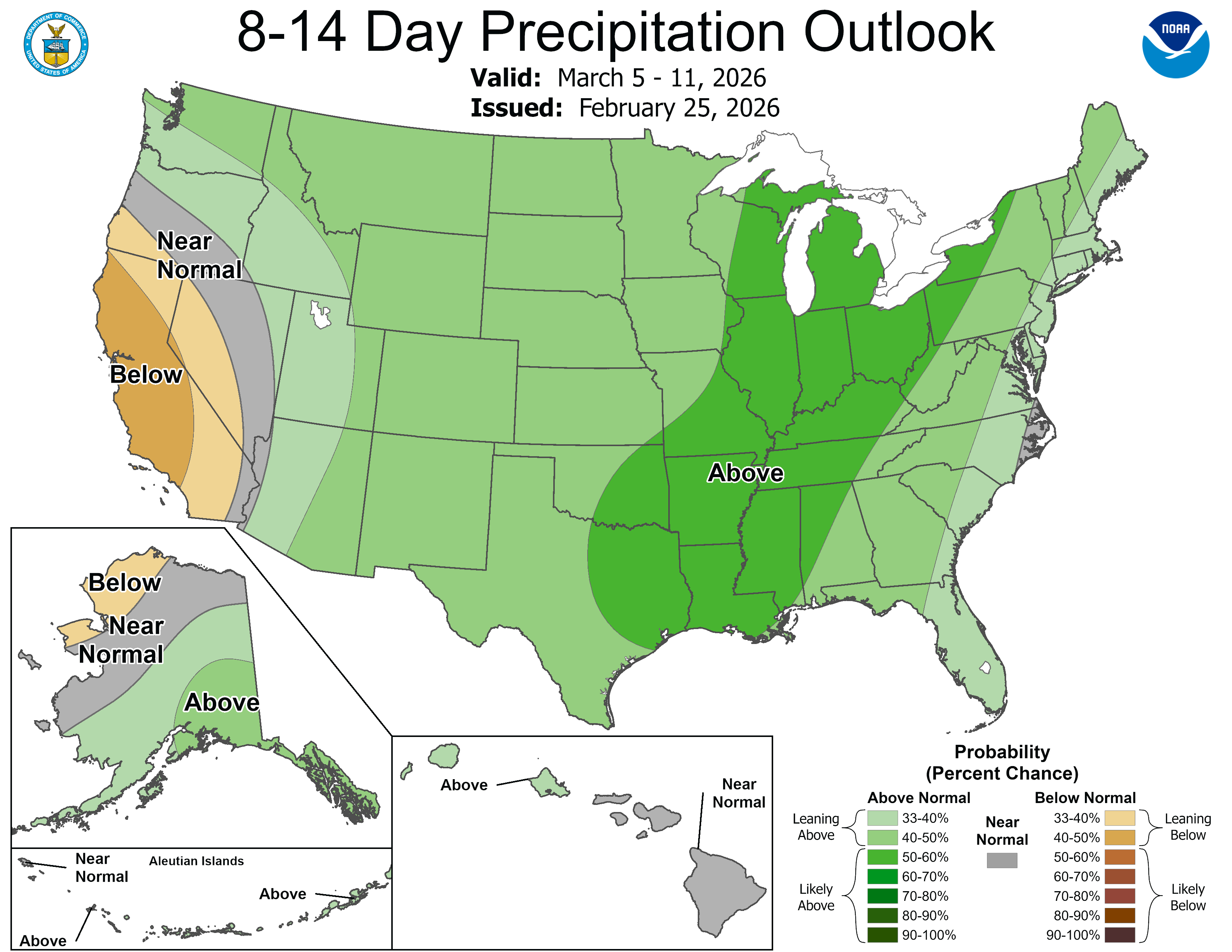
This is the 8-14 day precipitation forecast for March 5-11. Look at the band of wet weather that is forecast to be from the Great Lakes to the Gulf of Mexico/America.
Here’s what the Storm Prediction Center says in their discussion about the potential for severe storms and tornadoes - they are discussing next Wed.,/Thu.: “…pattern recognition suggests thunderstorm (and severe) potential should increase across portions of the central US just beyond this forecast period.
There have been years (1956 for instance) when a cold winter was followed by a spring tornado outbreak in the southern Great Lakes. I’m not seeing that now…but something to keep in the back of my head.
Also…watch two cars fall into a sinkhole in Omaha, Nebraska.
Enjoy the sunshine!
I'm ready for spring
This detailed update is appreciated