
Warmer
A Little Breezy

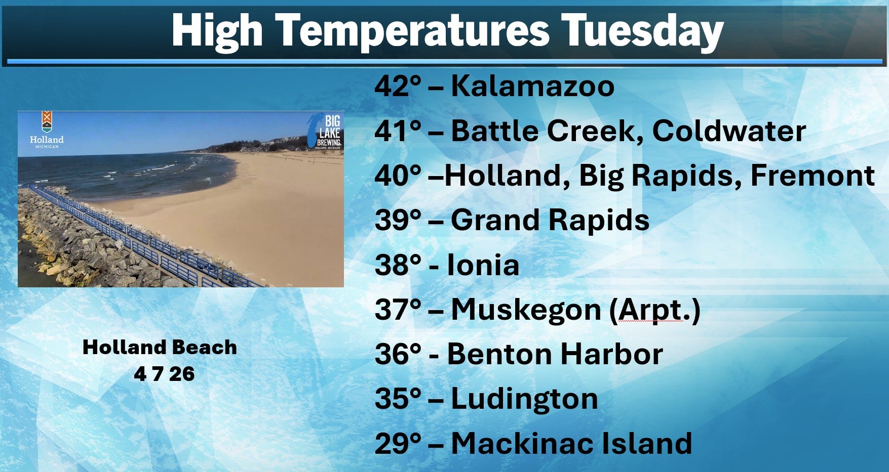
First a look at high temperatures from Tuesday. With an average high of 54, these temperatures were 10-20 degrees cooler than average. That was despite full sunshine and a relatively light wind. Early Tuesday morning, the temperature dipped to 20 in Grand Rapids. It was colder in the U.P. and northern Lower Michigan where there was snow on the ground. Raco crashed to -5 Tue. AM. Other low temperatures: Houghton +1, Marquette and Pickford 2, S. Ste. Marie 5, Pellston 8 and Mackinac Island 10.
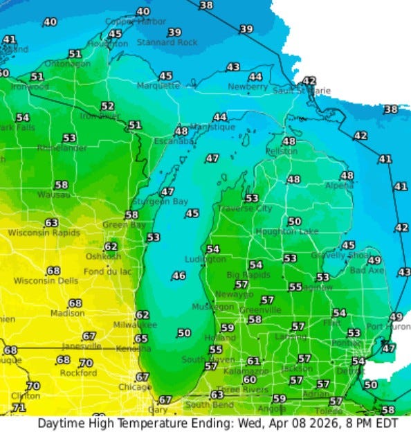
Here’s high temperatures for this Wednesday..upper 50s to near 60, much warmer than PM than yesterday…but…the wind will crank up to 15-20 mph (from the south) and with some cloud cover, it may not feel 20 degrees warmer than yesterday. The Upper Peninsula warms to the 40s and it’ll reach the low 70s over parts of northern Illinois.
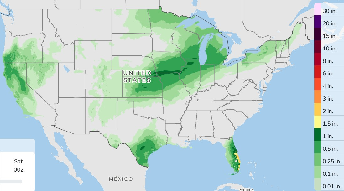
Here’s rainfall for the next 3 days combined. It rains in places that don’t usually get a lot of rain at this time of year…central California, south Texas and the Florida Peninsula. The storm system that will pull the warmer air back up into Michigan will leave a swath of rain from Kansas to Michigan. While thunder isn’t out of the question, most of this will be showers/rain and severe weather is not expected.
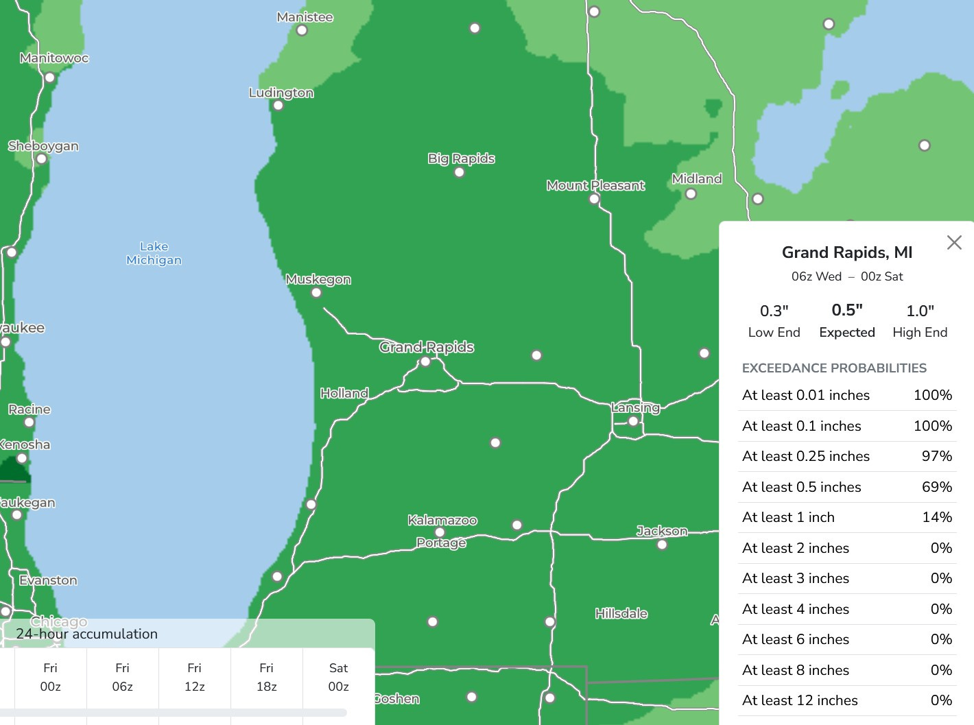
Over the next 3 days, we should get around 1/2” of rain. This model is forecast 1/2” for Grand Rapids…high end an inch. This will slow the fall of area rivers, but not cause any significant bump in levels. The Grand River at Comstock Park is in moderate flood, about 3.3 feet above flood stage.
We were at Roselle Park in Ada Twp. yesterday, and it was completely flooded. That occurred a few years ago also.