
Warm surge Friday/Saturday and Beyond
Increasing threat of severe thunderstorms in the Central U.S.

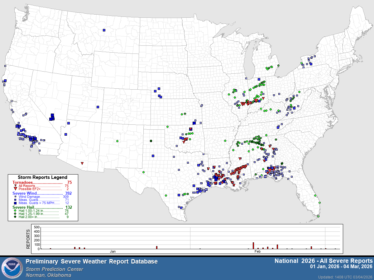
This map shows the severe weather reports so far in 2026. There’s a red dot plotted for each tornado, a blue dot where there was a report of wind damage (or gusts over 58 mph) and a green dot for a severe hail (1” or greater in diameter).
So far this year (through March 4), the U.S. has had 75 tornadoes. The average-to-date is 119 tornadoes. One of the reasons for the low tornado count is the cold pattern we have had for much of the winter in the eastern half of the US. Another interesting note is that the tornadoes we have had have generally been week. Seventy-three of the 75 tornadoes were rated EF0 or EF1.
Note the wind damage reports in California:
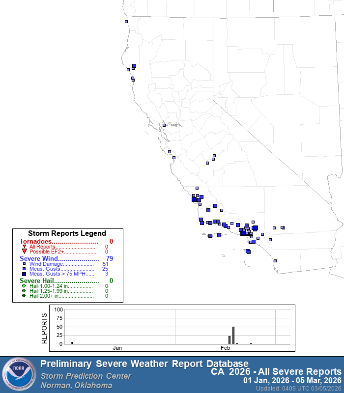
There have been 79 reports of severe criteria winds in California in 2026. That’s the most wind damage reports of any state so far this year!
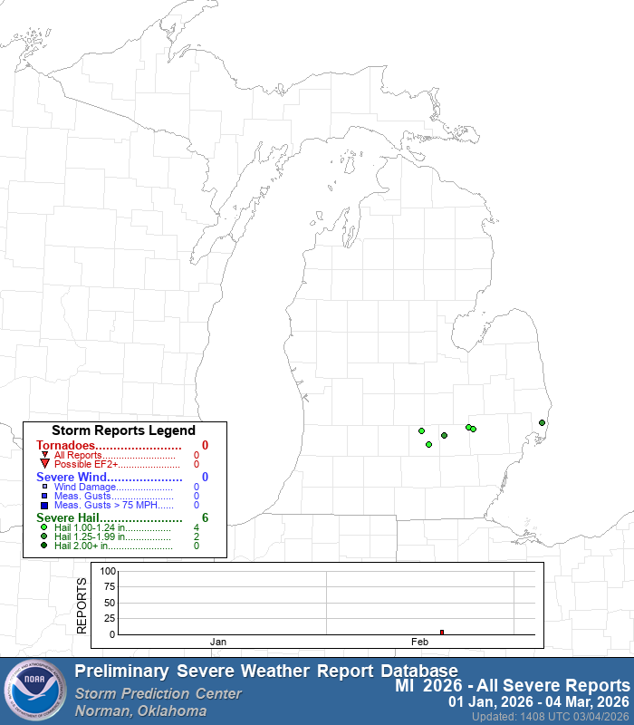
Here’s the severe weather reports in Michigan so far this year…all marginal hail reports (1 to 1 1/4” in diameter). The six reports all occurred on Feb. 18.
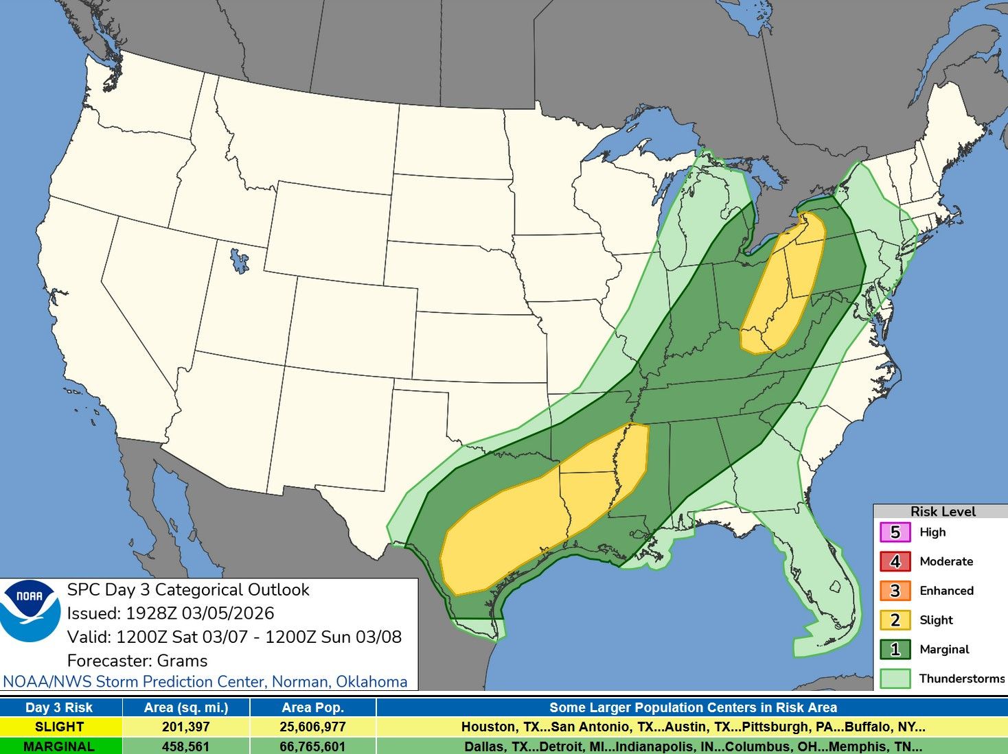
With the warm, moist air surging north into the central U.S., we expect some severe weather today (Fri.) and Saturday.
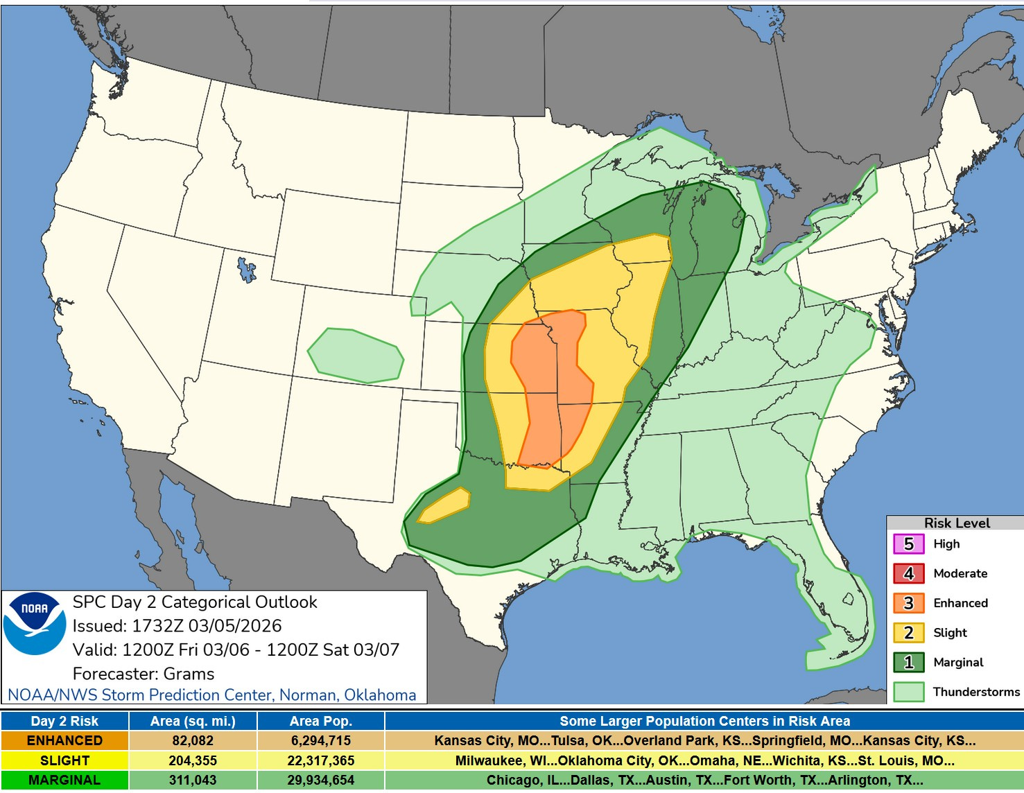
Here’s the severe weather outlook area from the Storm Prediction Center for this Friday/Friday night. There is an Enhance Risk (level 3) from Eastern Oklahoma and northwest Arkansas north to the IA/MO border. The Enhanced Risk (in orange on the map above) is surrounded by a Slight Risk (level 2) from NE Texas to Lake Michigan. SPC says: “One elongated QLCS (Quasi-Linear Convective System) or a pair of QLCSs may evolve during the evening. The lead one should progress east-northeast towards the Lake MI vicinity with a threat for mainly damaging winds and a few embedded tornadoes.”
Here (above) is the severe weather outlook map for Saturday. There is still a Marginal (Level 1) Risk in SE Lower Michigan during the morning. By early afternoon, the storms will move east into Ontario and Ohio and the threat of storms will end for West Michigan during the mid-late afternoon.
Our average temperature is 40, so this is an unseasonably warm 5 days. Thursday evening, the average temperature for the contiguous U.S. was 7.9 degrees warmer than average.
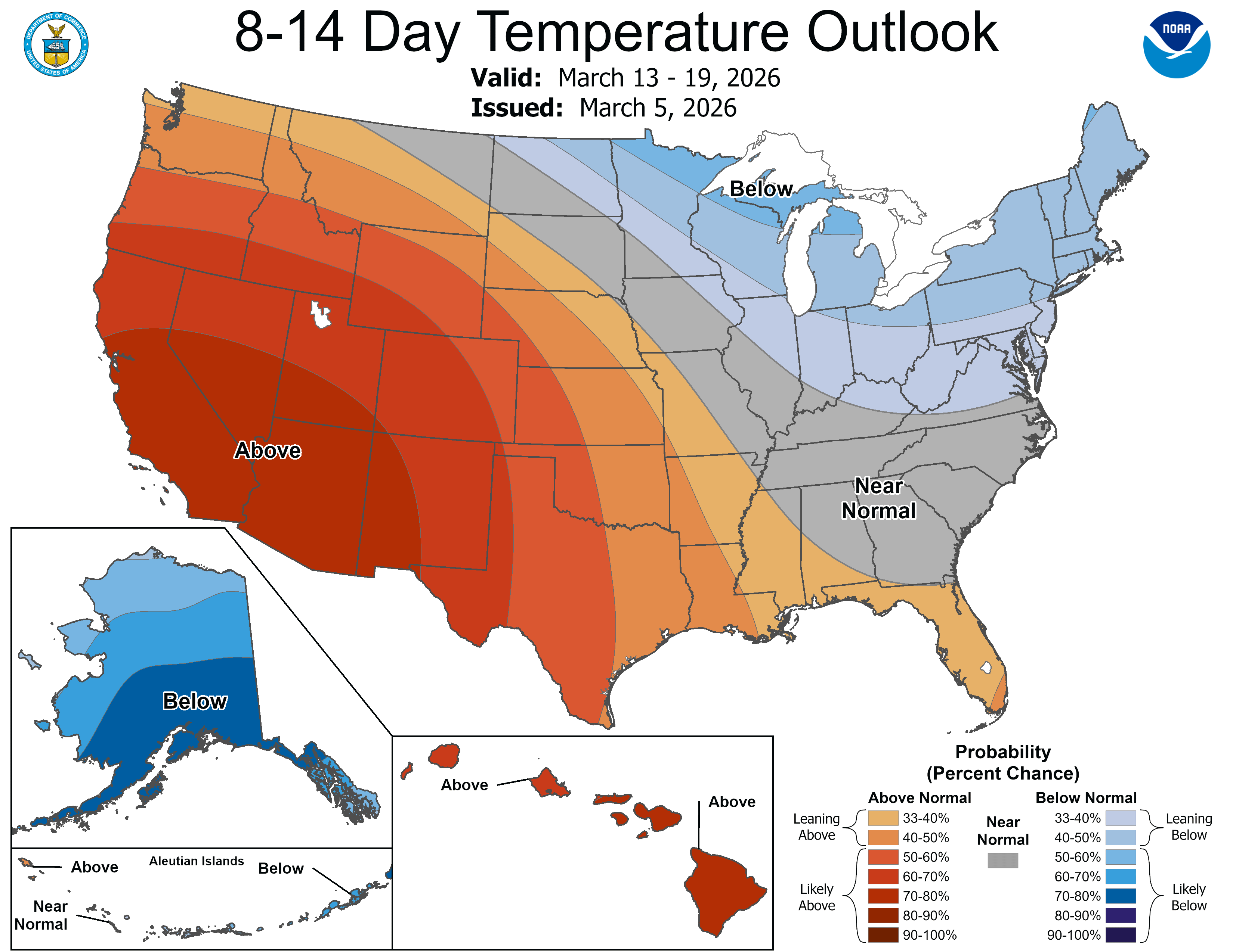
This is the latest 8-14 day temperature outlook for March 13-19. Cooler than average weather is expected for much of the Great Lakes and Northeast. Its isn’t spring for good.
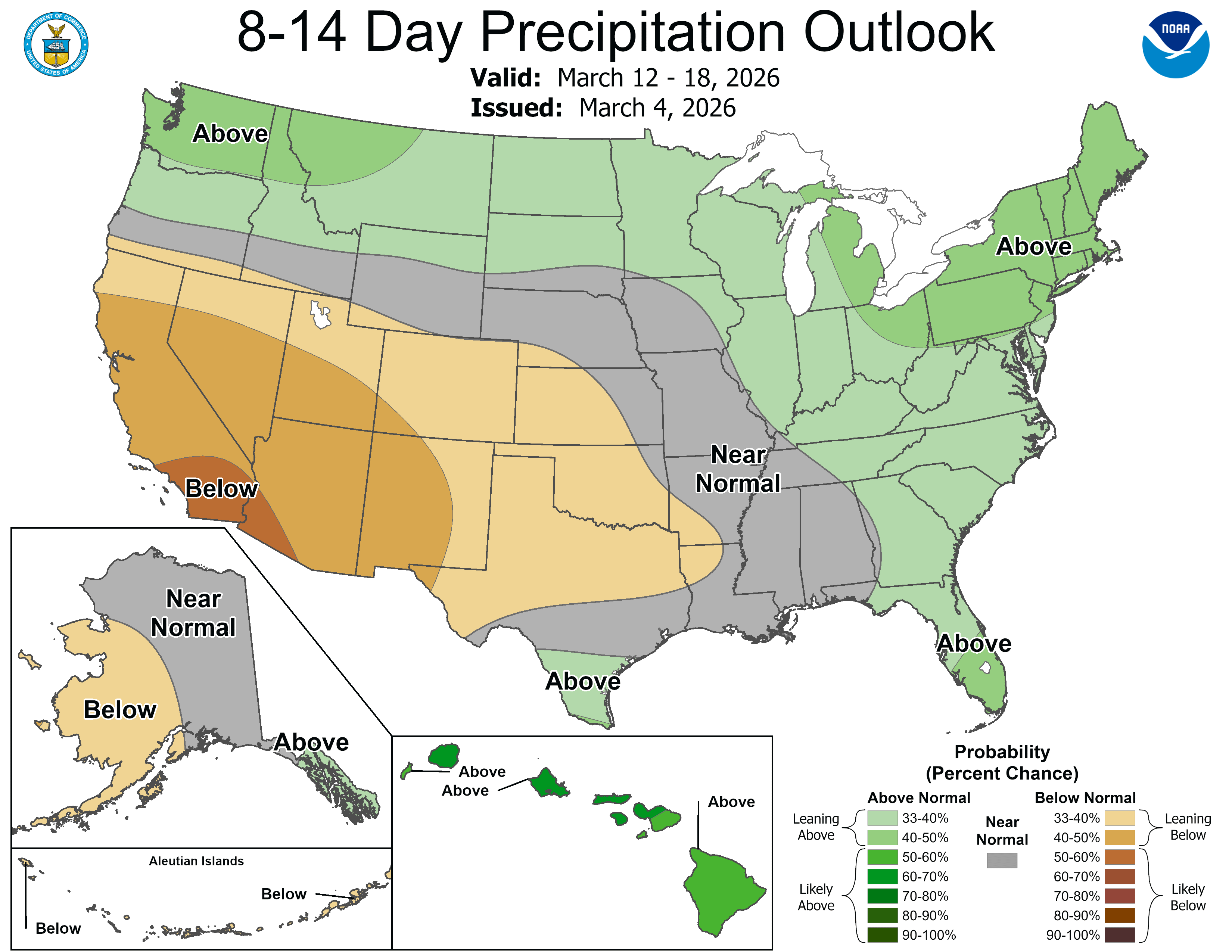
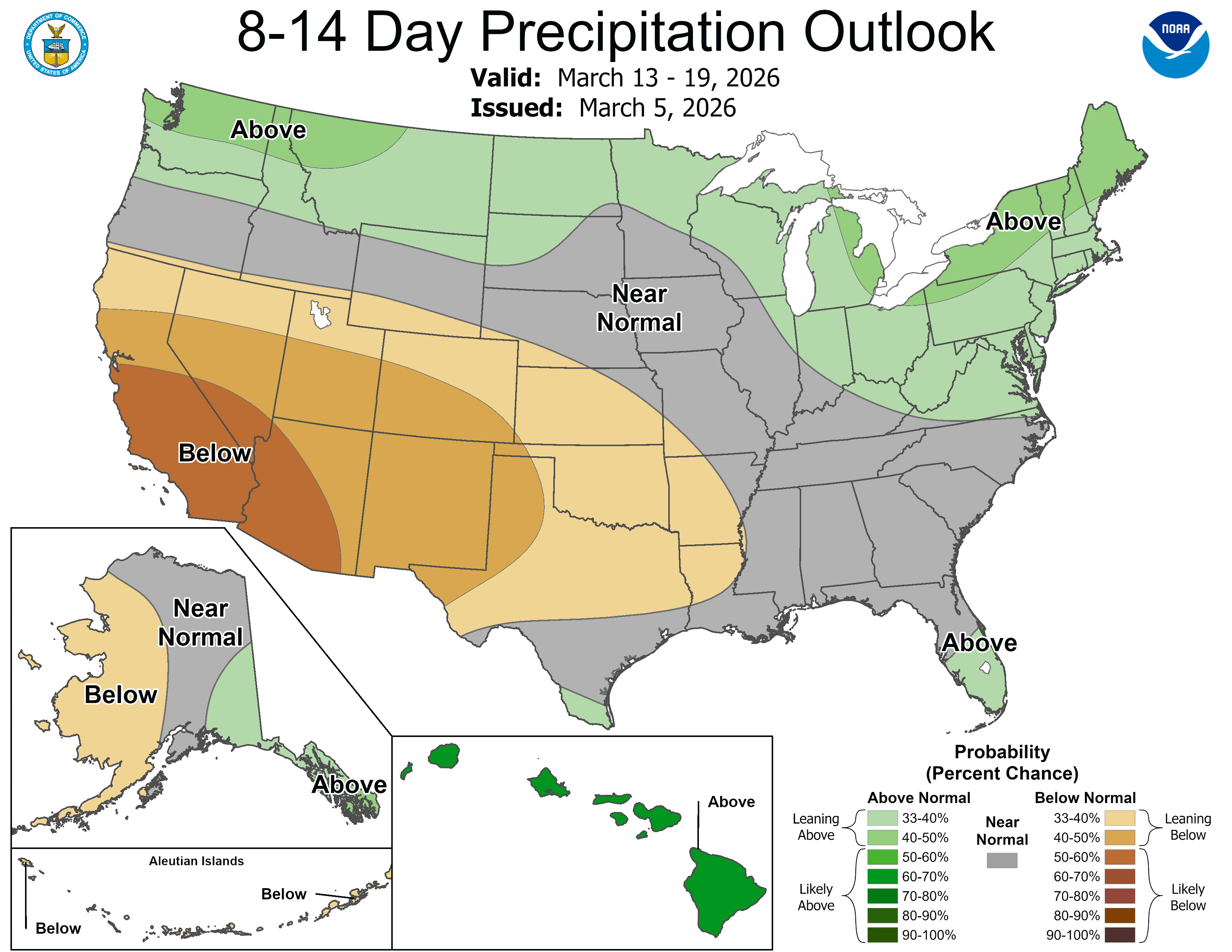
The 8-14 day precipitation outlook shows above average in the Great Lakes and at least a small part of that could be snow. We average about 7” of snow in March and 2” of snow in April
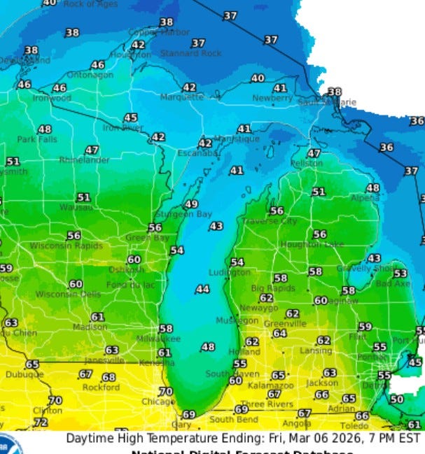
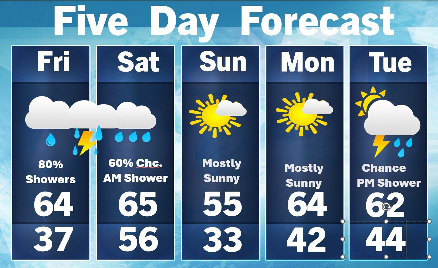
Here’s expected high temperatures today (Fri.). These will occur late in the day if and when I warm front moves through. It could reach 70 in Chicago…just 38 up at Sault Ste. Marie. It may be a touch cooler late in the day at the Lake Michigan shore.
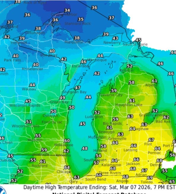
Saturday’s temperatures will be similar to late Friday. A little cooler air will be moving into Wisconsin and the U.P., but still well above average.
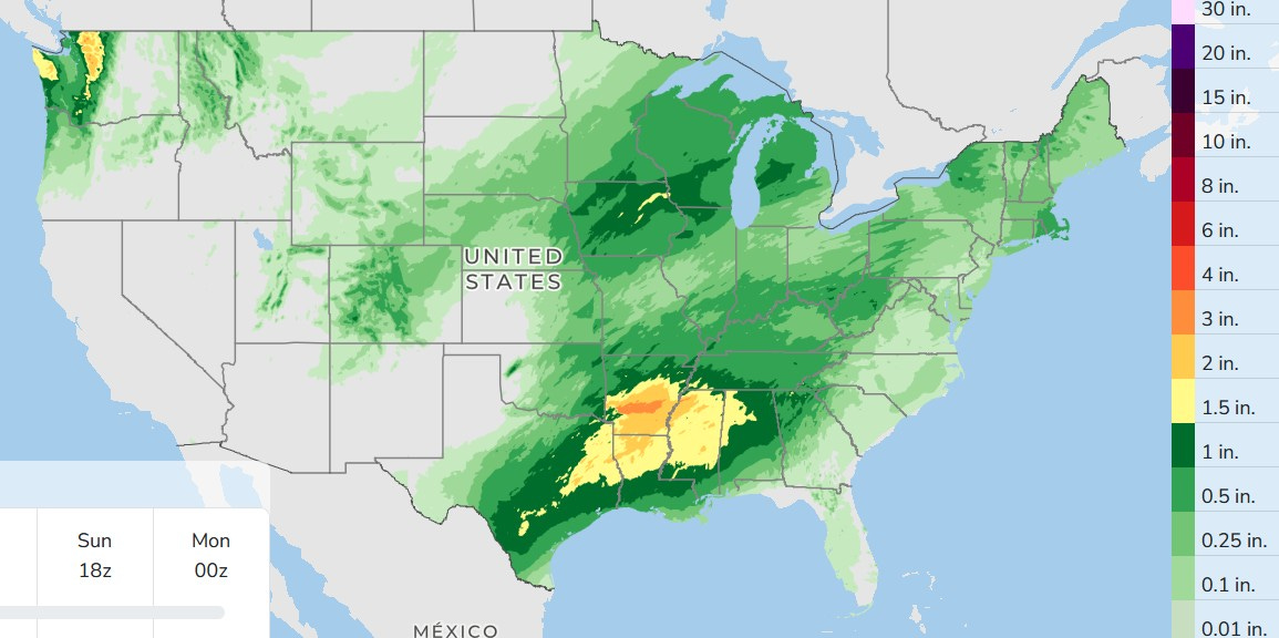
Here’s 3-day rainfall…lots of it in the south. They may need an ark in Arkansas. In West Michigan, we could see amounts range from 1/4” to 1”. The showers should move out about midday Sunday with two nice partly to mostly sunny days for Sunday and Monday.
Also: Super bloom of wildflowers at Death Valley. California.
Thanks for all the Weather info!
Hi Bill, have you ended your daily Vlog??