
Two Very Nice Dry Days
Still a chance of a t-shower along and south of I-94 this PM


First, a quick personal note. Today (April 22, Wednesday) is our 48th wedding anniversary. The first pic. is Gayle and me leaving the wedding. The second pic. is earlier this month at Grand Haven (yes, it was breezy and cold that day). We had dinner at Noto’s at the Bil-Mar and walked up and down the beach. Thanks to Gayle for being such an awesome helper to me all these years. Someone will ask…the weather on our wedding day was awesome…mostly sunny, low 60s. We left the reception in a hot-air balloon. Then we left for Disneyworld (which included a behind-the-scenes tour).
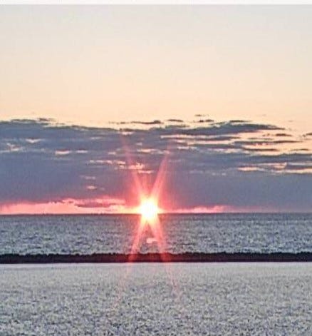
OK - back to weather - This was sunset Tuesday at Muskegon. The scattered showers moved fairly quickly to the south and we’re left with partly cloudy skies and a little scattered fog to start this Wednesday.
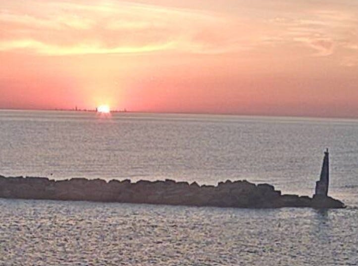
This pic. was taken from the lighthouse at Michigan City, Indiana. Look real close - you can see the sun setting into the skyline of Chicago, which is about 40 miles to the west.
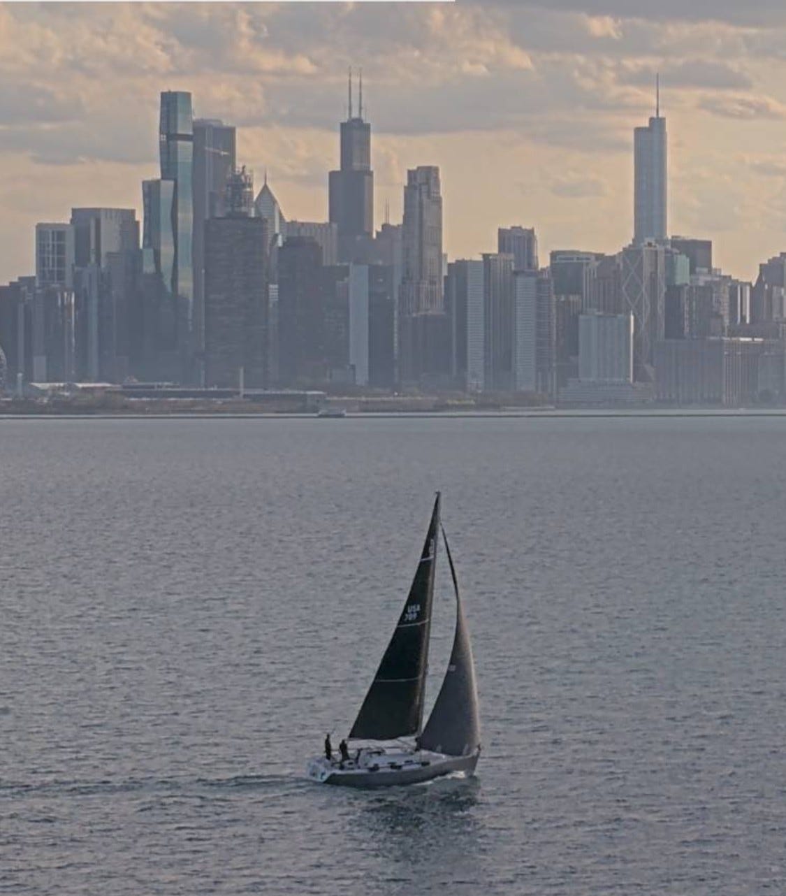
Here’s a pic. of downtown Chicago from the water intake, which is 2.75 miles east of the shore. There’s a beautiful sailboat passing by just before sunset on Tuesday.
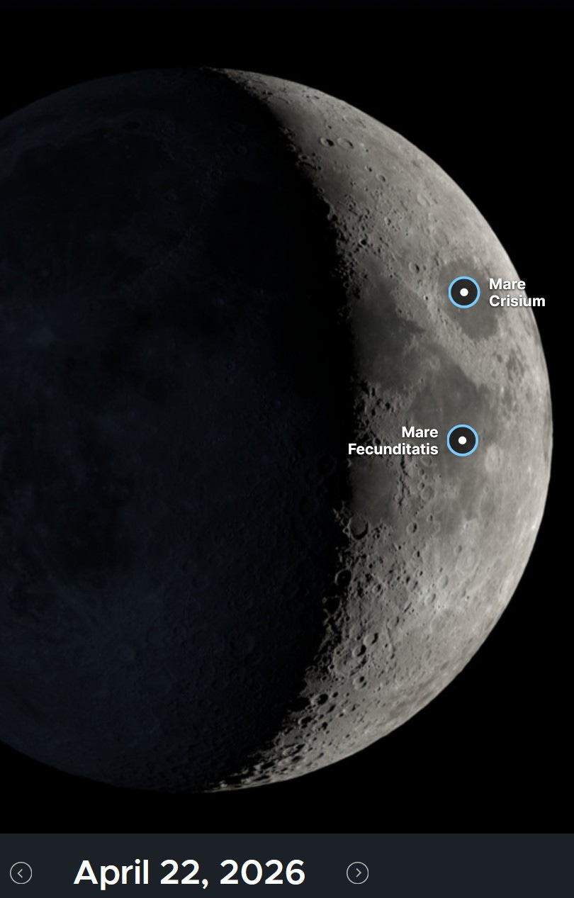
Look for the moon tonight, a crescent moon, up for a couple hours in the west or west before setting. To the right of the moon is the Pleiades and to the left and up a bit is Taurus (the bull). Venus is the bright “star” to the west this evening.
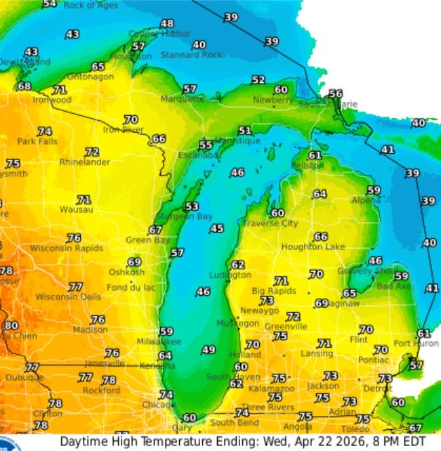
Here’s forecast high temperatures for today. Much of West Michigan reaches the low-mid 70s. The wind should be light, so a lake breeze will develop and cool those areas by the water. You can see S. Haven reaches just 60 today and the Ludington Airport 62. Copper Harbor in the U.P. should hold in the 40s.
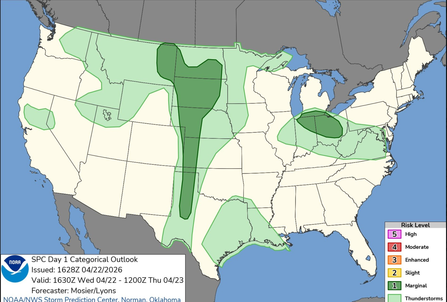
Here’s the Severe Weather Outlook Area for today/tonight (Wed.). There’s a Marginal Risk along and south of I-94. with a General Risk (not severe) south of a line from South Haven to Lansing to Detroit. Most of West Michigan will be dry today. There is another Marginal Risk Area in the High Plains from Texas to South Dakota.
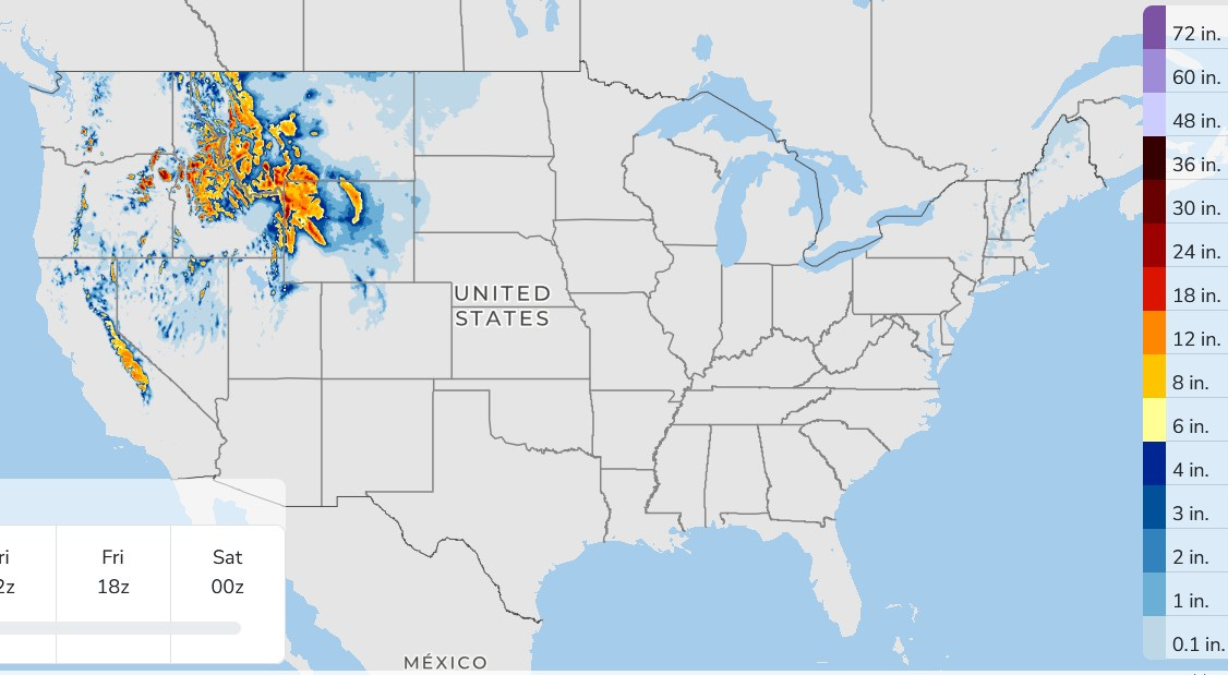
Here’s forecast snowfall over the next 3 days. There will be a few light snowshowers in the higher elevations of northern New England, but the significant snow will be out West. A foot and a half of snow could fall in the mountains of Yellowstone and Grand Teton National Parks.
There is still some snow on the ground in parts of Upper Michigan. Marquette lost 2” of snow yesterday. They are down to 8” of snow on the ground. Tuesday morning, the weather observer at Herman, Michigan still had 17” of snow on the ground. The most they had on the ground this winter was 68” or 5 feet 8 inches…not counting the drifts.
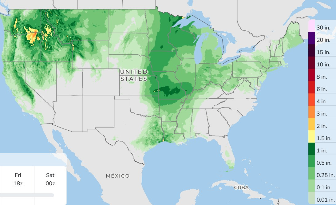
Here’s forecast rainfall for the next 3 days combined. It stays mostly dry in the Southeast, Southwest and southern High Plains. There’s some rain printed out for Michigan. This is a 3-day combined total. We’ll be dry today and tomorrow, so the forecast rain on the map is for Friday, mainly PM and night.
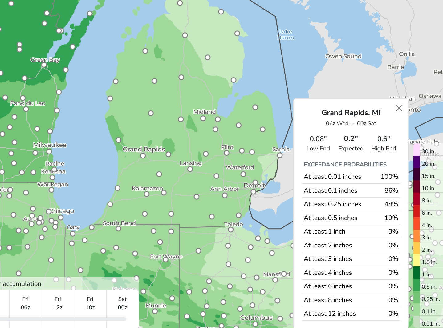
This model is forecasting around 1/4” of rain Friday PM. That’s not enough to affect river levels much and they should continue to slowly fall over the next week.
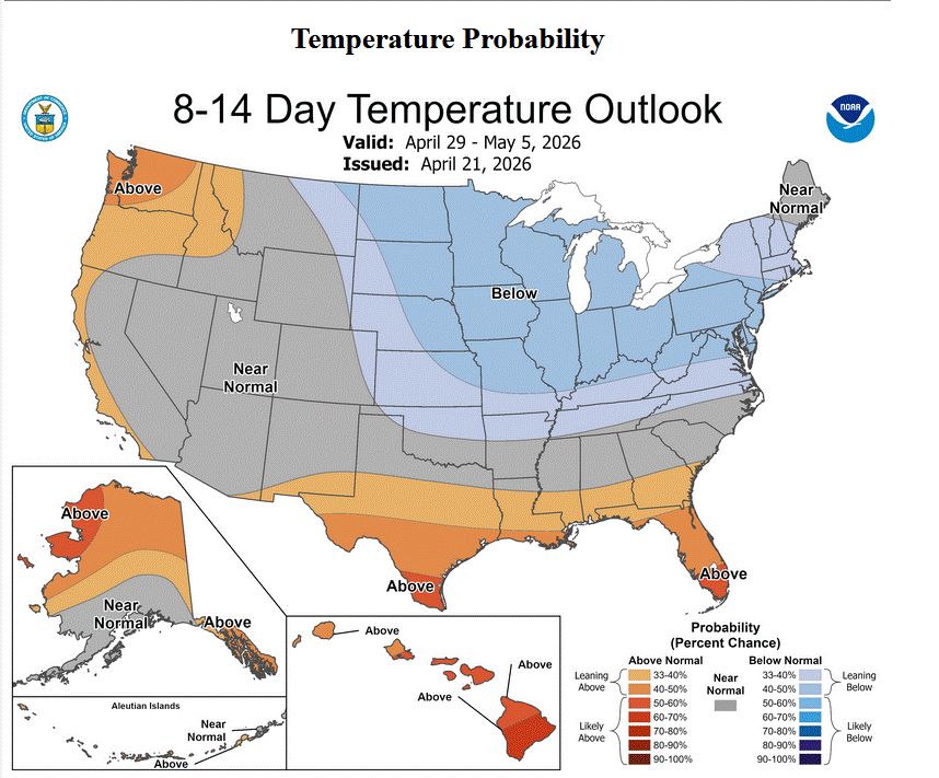
The 8-14 Day Temperature Forecast calls for below average temperatures over the Great Lakes. I would not be surprised if we get a Frost Advisory in early May.
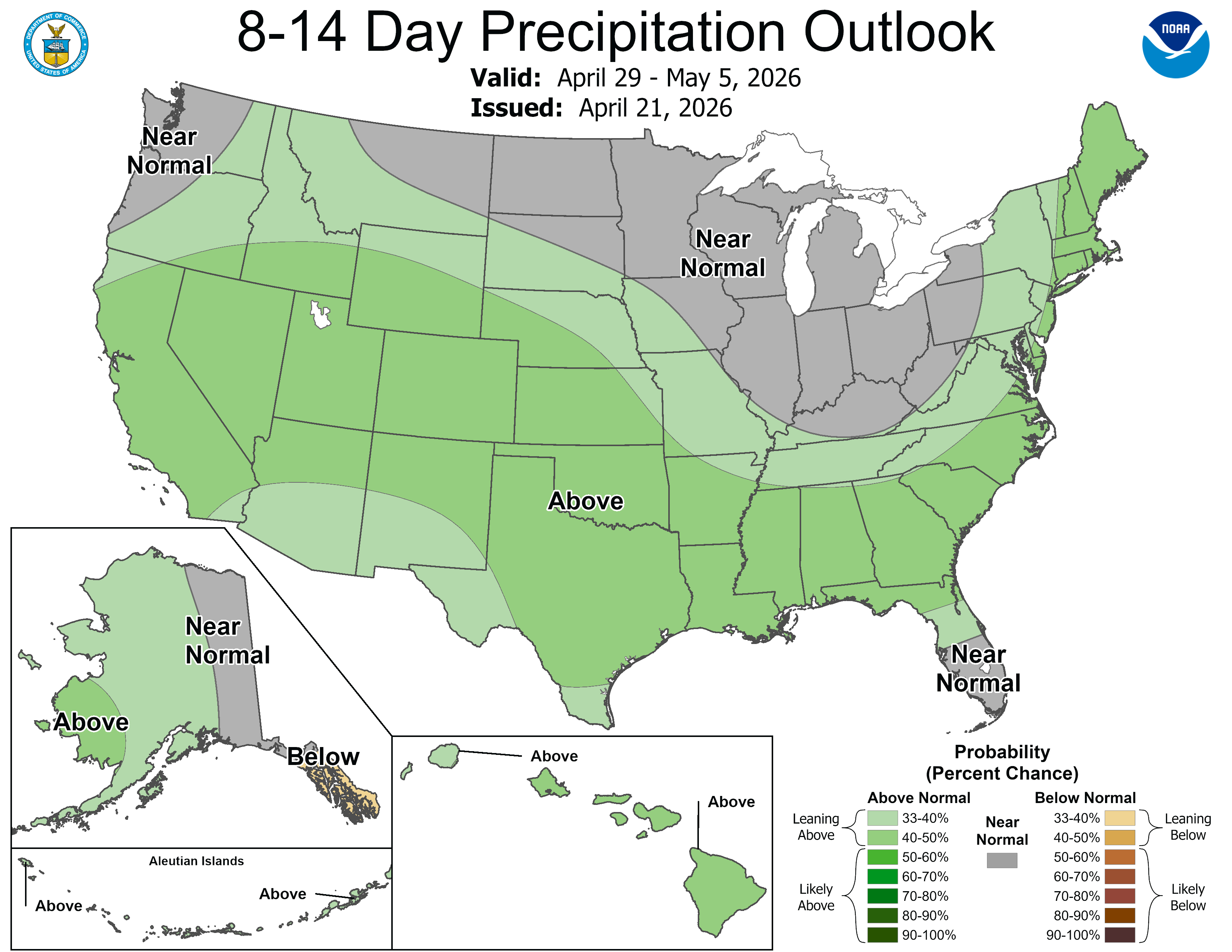
Rainfall for April 29 - May 5 should be close to average. We should continue to see rivers fall to near average flow.
Also: High wind video from Missouri. Cool video of clouds coming off the Rock of Gibraltar. Volcano erupting in Japan. 7.4 magnitude earthquake in Japan. Hailstorm in Spain. Very heavy snow in the Sierra Nevada Mountains of California. Tuesday was the 7th day this year that a tornado warning was issued in California. Incredible mammatus clouds in China (not a current video). Old flash flood videos.
Nice photos; Happy Anniversary: My two Grand-daughters, and my own Grandma have their BIRTHDAY today as well. Super day today.
A side note: I spotted high storm clouds to the south east, and being curious looked them up this evening: Tecumseh, Adrian, and Hillsdale area. They must have been very tall to be seen so far northwest b y the Lake !
Congrats Bill!