
The Blizzard of 1967
Grand Rapids had nearly 20" of snow in 24 hours.

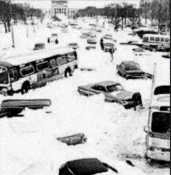
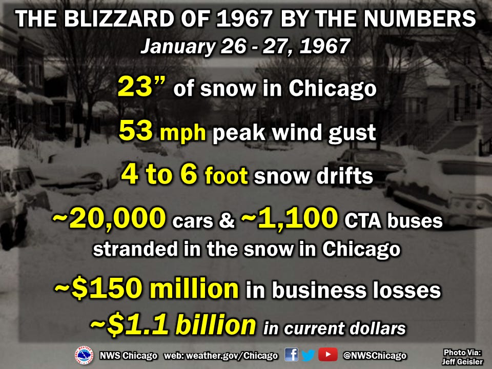
Two of Michigan’s most famous blizzards occurred on January 26. The first was the Blizzard of 1967. The picture above shows Lake Shore Drive in downtown Chicago after the storm. Even the expressways were impassible due to gigantic drifts and buried vehicles. The 23 inches (58.4 cm) of snow that fell on Chicago in 29 hours beginning the morning of January 26, 1967 was a record for a single storm. The 19.8 inches (50.3 cm) that fell in a 24-hour period on January 26–27 was the greatest amount of snow for a 24-hour period.
Pictures from the Blizzard of 1967.
I was a sophomore at New Trier East High School in Winnetka – just north of Chicago. My high school was about a mile from the house where the movie Home Alone was filmed. Winnetka actually had more snow than Chicago, because Winnetka picked up a few extra inches of lake-enhanced snow. The school dismissed us shortly before noon – one of the very few times the school had ever closed. They just turned us loose on the streets.
I remember one guy driving in a circle around the school (we had over 4,000 students – it was like going to high school in the Pentagon) in an old convertible with the top down. Everyone…(well, not everyone, I didn’t do it)…was pelting him with snowballs until the car was totally full of snow.
The next day, we couldn’t open the doors to get out of our house. My brother climbed out of a 2nd story window onto a porch roof and literally walked off the porch roof onto a snowdrift. I spent the day shoveling snow first for our house and then around the neighborhood. I was so tired by the end of the day, but I did earn some decent $$.
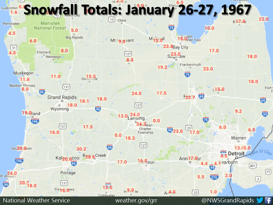
Here’s some snowfall totals in Southern Lower Michigan from the storm. The heaviest snow was in a band from Berrien County to Kalamazoo/Battle Creek to Lansing to the Thumb area.
Unseasonably warm air preceded the blizzard. The high temperature in Grand Rapids on Jan. 24 was a daily record 62°. The temperature was still 57° at midnight. Chicago reached 65° on the 24th and was still 60° at 9 pm. By daybreak, the temperature had fallen to 31°.
Interview with Meteorologist Tom Skilling of WGN about the blizzard of ‘67.
N. Illinois and SW Michigan were under a rare January Severe Thunderstorm Watch during the evening of the 24th. I was at a meeting of the St. Joseph Teen Club and I left the basement meeting to go watch the storm, which had strong winds and frequent lightning.
Then the cold air roared in during the 25th to set the stage for the blizzard on the 26th.
The forecast called for up to 4″ of snow – and the public was unprepared for a blizzard. Snow fell continuously in Chicago from 5:02 am on Thursday, January 26 until 10:10 am Friday the 27th. Winds gusted to 53 mph and the visibility was reduced to near zero in heavy snow and blowing snow. Drifts were measured up to 15 feet high! For the first time in its 112-year history, Michigan State University in East Lansing was closed. The National Guard was called out.
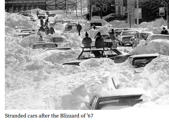
Thousands of people were stranded in offices, in schools, and on buses. An estimated 50,000 cars were abandoned and 800 Chicago Transit Authority buses littered the streets and expressways. People living near main roads took in strangers who had abandoned their vehicles. Snowplows were sent from Iowa and Wisconsin to help Chicago dig out. The airports were closed. There were drifts up to 10 feet on the runways at Midway Airport. The airports didn’t reopen until around midnight the following Monday night. It took 3 weeks before every street in Chicago had been plowed. Some schools reopened on the 31st, five days after the blizzard. Others remained closed.
There were 26 fatalities in Chicago due to the storm…many from heart attacks from shoveling the snow. Helicopters were used for medical transport. Damage from the storm was estimated at 150 million dollars (in 1967 dollars.
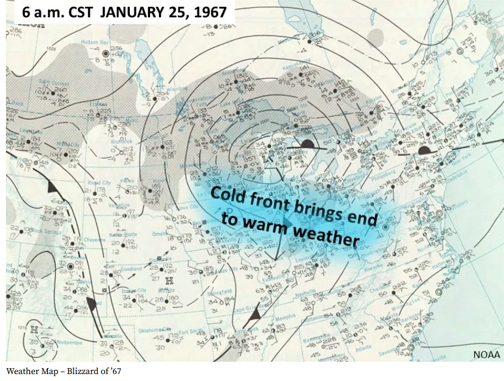
Here’s the weather map from the day before the Blizzard. A strong low pressure area was located over Green Bay WI. That low had pulled up the warm, moist air from the Gulf of Mexico. A sharp cold front swept through before sunrise on the 25th. A second low pressure center formed on the trailing cold front and then moved up toward Ohio, passing southeast of West Michigan.

Chicago got another 4″ of snow on February 1. The following Sunday, February 5, another storm dumped 8.5 inches (21.6 cm) of snow”. Between Jan. 26 and Feb. 5, Chicago got more snow than they normally see all winter. It was hard to find places to put the snow. Snow was dumped in the Chicago River. A train was loaded with snow and sent to Miami where dozens of kids got to play in snow for the very first time.
Media reported that the city of Chicago had nearly 500 snowplows working the storm and 2,500 city workers worked round the clock to clear the snow. It took the city of Chicago three weeks to plow all the streets. Expectant mothers were taken to the hospitals by sled, snow plow and even a bulldozer
!
Also, in April of that year, a strong tornado moved through the Grand Rapids metropolitan area.
Great story Bill, keep em coming.
I really enjoy seeing these articles of West Michigan Weather history. Thank you so much for reporting these.