
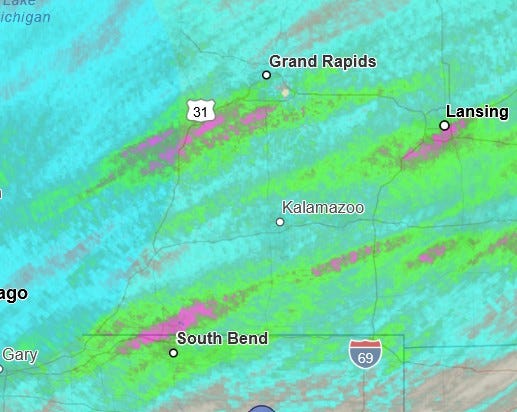
Supercell thunderstorm moved from Niles to Lansing, producing strong tornadoes, wind damage and severe criteria hail
Four fatalities and at least 15 injuries

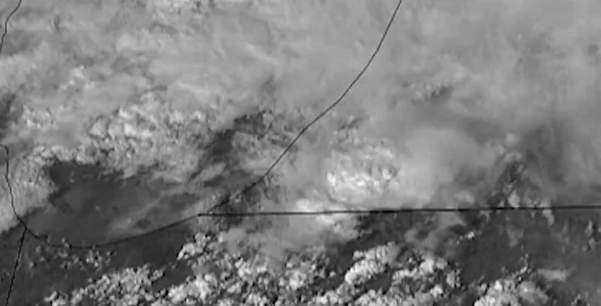
This is a satellite picture from Friday afternoon (3/6). It shows the supercell thunderstorm just north of the Indiana border along the Berrien/Cass County border.
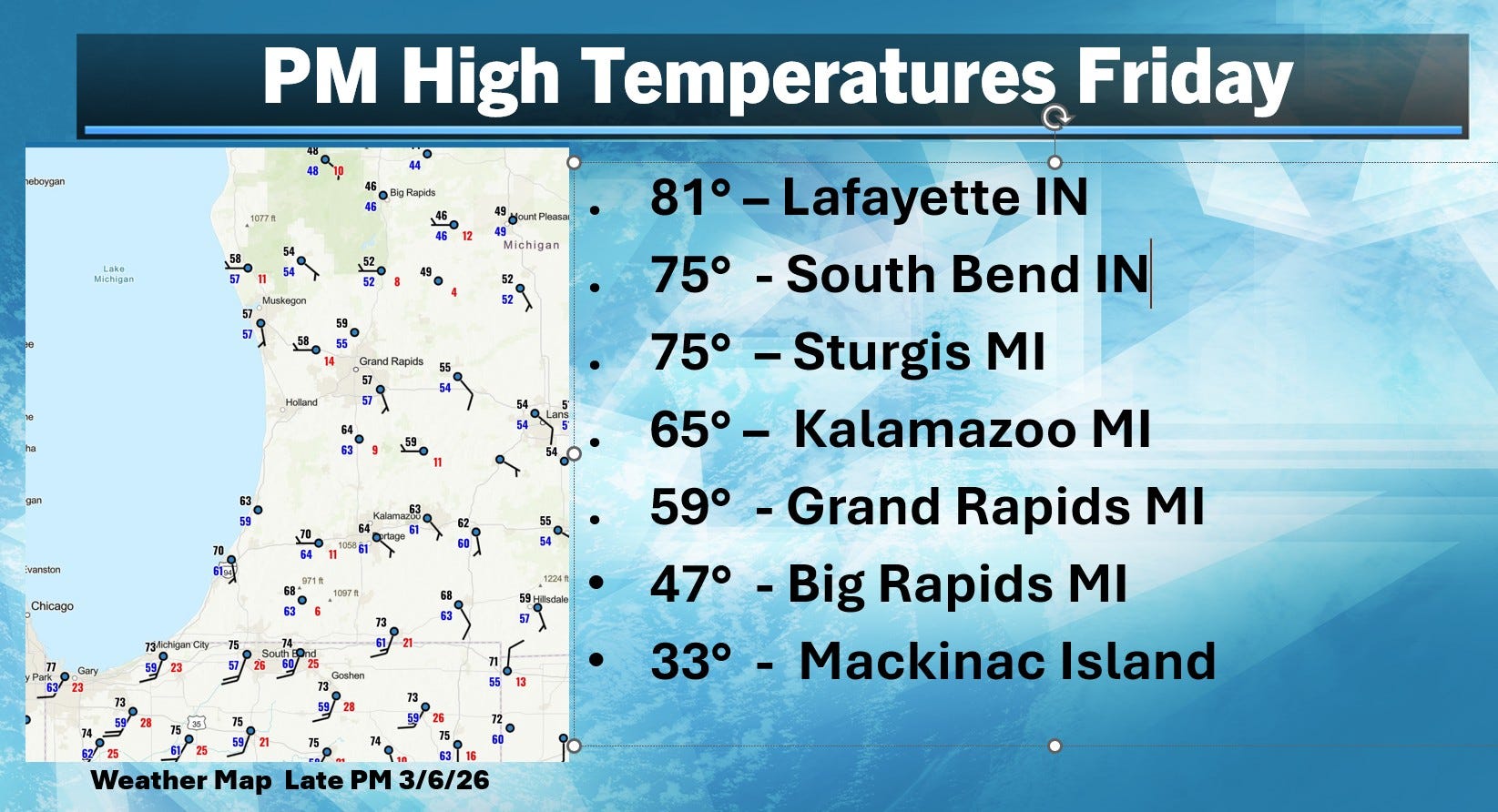
A strong warm front was moving north through southwest Lower Michigan. These are high temperatures through 7 pm Friday. It’s still astronomical winter and temperatures were in the mid 70s to low 80’s in Indiana and far southern Lower Michigan. Dewpoints rose to near 60. This warm, moist air was pushing north into relatively cool air (mid 40s at Big Rapids).
Here’s the Consumers Energy power outage map as of early Saturday. As I write this, there are 8,567 customers without power in Michigan. That includes 4,357 Indiana Michigan Power customers and 3,133 Consumers Energy customers. St. Joseph Co. has the most with 3,992 customers without power.
Note that while a tornado can produce a path of extreme damage, that path is relatively narrow, often less than 1/2 mile wide - as opposed to a big derecho or wind damage event, where damage is widespread. This means that it can take fewer crews to restore damage…but…damage is often snapped utility poles that need to be replaced and significant tree damage, which needs to be cleared in order to get to the downed power lines. Check out this video of spinning debris. Note the wind changes direction.
As I write this, there are four tornado fatalities with three in far northwest Branch County and 15 injuries. The injury total does not contain those who self-treated or who may have been treated at the scene by off-duty or other medical personnel.
There were also storm related injures in KS and MO.
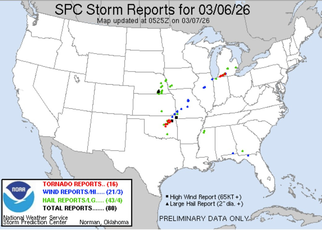
Here’s a map of severe weather reports for Friday. There were 16 reported tornadoes. This number will be reduced when storm surveys confirm that there were multiple sightings of the same tornado (like in Union City). In the U.S. there were 21 reports of wind damage and 43 reports of severe hail )including several in the Lansing area.
Here’s storm total rainfall. Purple areas saw 1-3” of rain. Record daily rainfall was reported at Grand Rapids (1.55” at the Ford Airport), Holland (1.34”), Lansing (1.08” at the airport - there was more on the south end of Lansing) and South Bend (1.19”). The totals at Grand Rapids and Holland were more than double the previous record rainfall record.
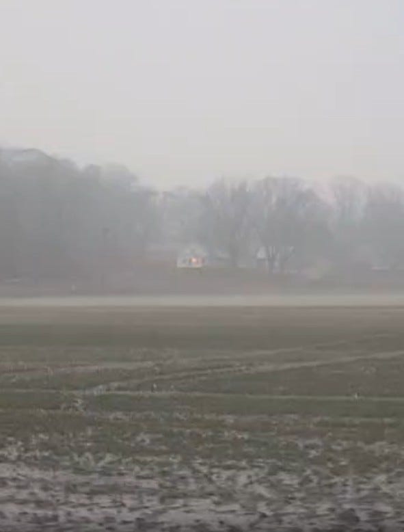
Lots of standing water in some fields (pic. from Caitlin Helen).
I can’t post most videos and pics. on my own blog here, but I can link to them. Check this out: Before and after pictures of tornado damage. It’s eerie with the tornado debris scattered across a frozen lake.
The NWS will be out surveying damage this weekend. This looks like maybe EF3 damage. The last EF3 in Michigan was at Gaylord (5/20/22) and Dexter (March 2012) was an EF3. Many of you will remember the Kalamazoo Tornado of May 13, 1980. That was EF3 and the last F4 tornado I believe was Augusta in April 1977.
Look at this video - showing houses just disintegrating near Union City. Union City damage. Three Rivers tornado. Lots of lightning with this supercell. Three Rivers tornado video (with debris in the air).
Just south of me. Pouring rain here in BC with lightning.
Thanks for your prediction yesterday prior to this actual damage.