
Sunday, March 22
No big storms in the next week. Average high temperatures reach the upper 40s.

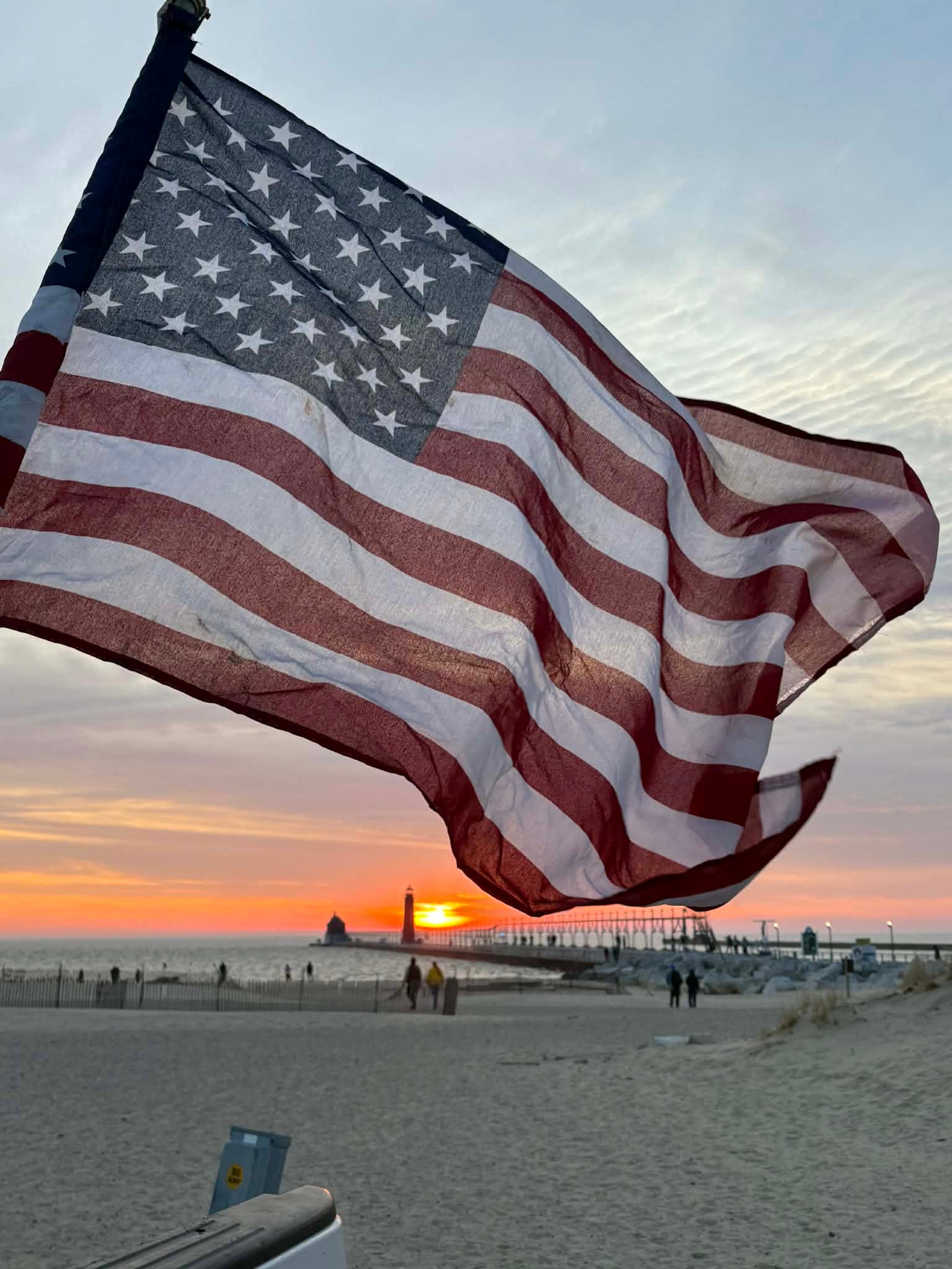
My daughter #2 (Marie Steffen) went to Lake Michigan to see the sunset Saturday evening. I’ll share several pictures here. Quite a few people on the beach and walking the pier.
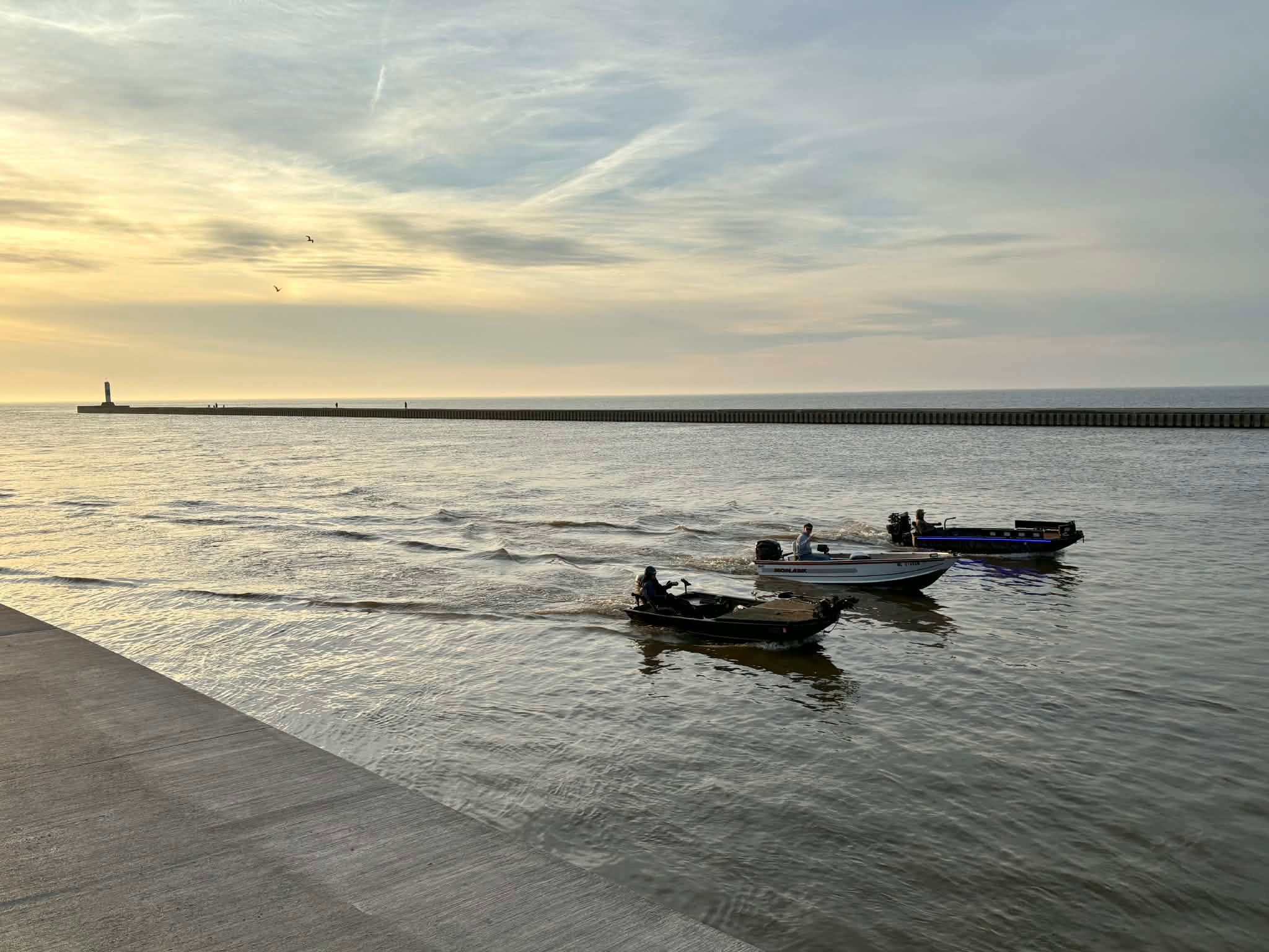
Marie caught these 3 boats coming down the channel - I’d guess they were guys fishing. The lake will be a little choppier today (Sun.) as north winds pic. up to 15-25 knots and waves increase to 3-7 feet.
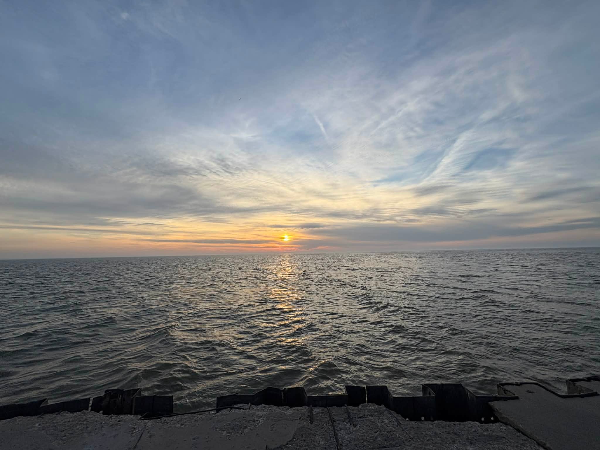
Another of Marie’s pics. This is sunset from the end of the Grand Haven pier. You can see some cirrus clouds and a few jet contrails.
The days are getting longer at the rate of nearly 3 minutes per day. Sunrise today in Grand Rapids will be at 7:57 am and the sunset at 7:42 pm. The average high/low temperature for today (Sun.) is 47°/29° and these numbers are going up at the rate of nearly a degree every 3 days.
The record high temperature for today is 85° set in 2012, when we had a historic heat wave in March. I remember swimming in Gun Lake on March 19, 2012 - the water temperature at the beach was 64° (I measured it) and I kayaked around the lake for most of the afternoon. The blossoms came out too soon and later frost wiped them out and we had virtually no fruit crop that year. We haven’t had a bad year like that since 2012. In fact, we’ve had bumper fruit crops in West Michigan for the past 3 years.
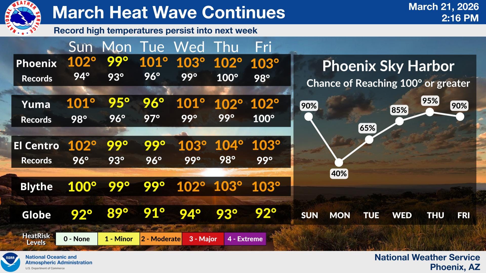
A couple of big weather stories: The record setting heat wave continues from the Desert Southwest into the Plains. Here’s forecast highs for Phoenix AZ. Omaha reached 96° on Saturday. Lincoln NE had a high temp. of 97°and Des Moines IA reached 90°. It was in the mid-upper 70s as close as Chicago. At one point Saturday afternoon, the combined temperature of the Lower 48 states was 20 degrees warmer than average! Seventeen percent of the Lower 48 states had a temperature of at least 0 and 47% had a temperature of at least 80°.
We were in the warmest air last night. A cold front coming through this AM will turn our winds to the north and temperatures will likely fall a few degrees during the daytime, down to 40 by sunset.
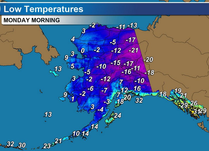
There is plenty of cold air left in Alaska and across most of Canada. The polar vortex is almost as strong as mid-winter. Here’s forecast low temperatures for early Monday in Alaska. Saturday AM, the town of Eagle AK reached -37. Fairbanks was -24.
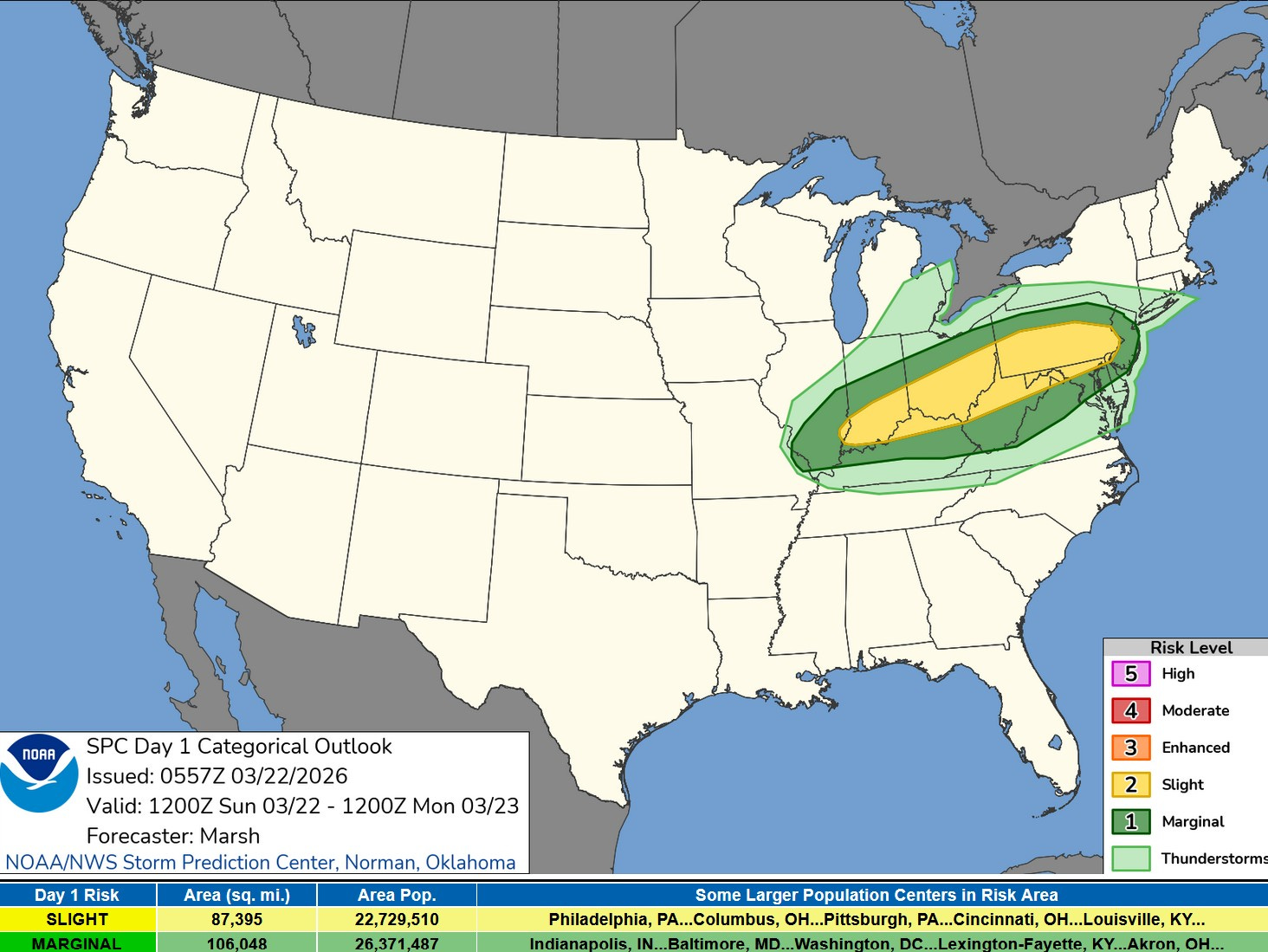
There was only one report of severe weather in the U.S. on Saturday. That was 1” diameter hail at Grainger, Tennessee. Today we do expect isolated severe weather from southern Indiana to Pennsylvania. While a tornado is not impossible, the main threat will be a few reports of strong winds and marginally severe hail.
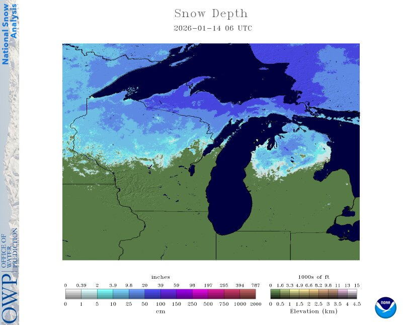
Here’s how much snow there is on the ground in the Western Great Lakes. As of this Sunday AM, Sault Ste. Marie has 32” of snow cover and Marquette reports 44” on the ground. Herman MI is up to 351” of snow for the winter. They had a snow depth of 68” on March 16th. Marquette has had 265” of snow this winter - that’s 95” more than average-to-date.
So far, the month of March is averaging 4.5 degrees warmer than average in Grand Rapids. If you’re keeping track, February was 1.2 warmer than average, January was 4.6 colder than average, December was 4.4 degrees colder than average and November was 1.3 degrees colder than average.
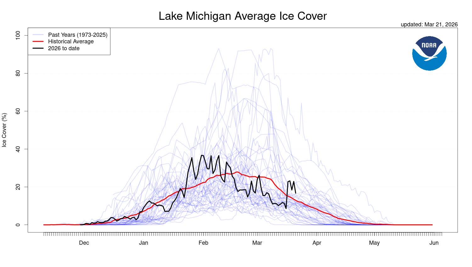
Here’s a graph of Lake Michigan ice cover this winter. The red line is average ice cover and the darker line is ice this year. It peaked in February. The dark line bounces up and down with the wind. A strong wind breaks up the ice and it refreezes when it’s calm (and cold).
We do have a about a 60% chance of a shower today. It would be relatively light, less than 1/4”. Many of us will see less than 1/10th inch. After today, the next chance of (mainly light) rain showers will be Wed. night into Thursday. It may be cool enough for a period of snow showers next weekend…no big storms this week. No really warm air or really cold air this coming week in West Michigan…fairly average late March weather. Here’s radar.
Thanks Bill for all this information. Is the much warmer than normal weather a part of La Nina weather pattern development?
Lots of good info as always. Thank you. Especially appreciate those G H pics. The one at the end of the pier-both sky and lake-reminds me of the kids' phrase "Criss-Cross Applesauce'. So many interces!