
Storm Chasers Head To...Yellowstone?
Best Chance of a Severe Storm Today is in the Northern Rockies

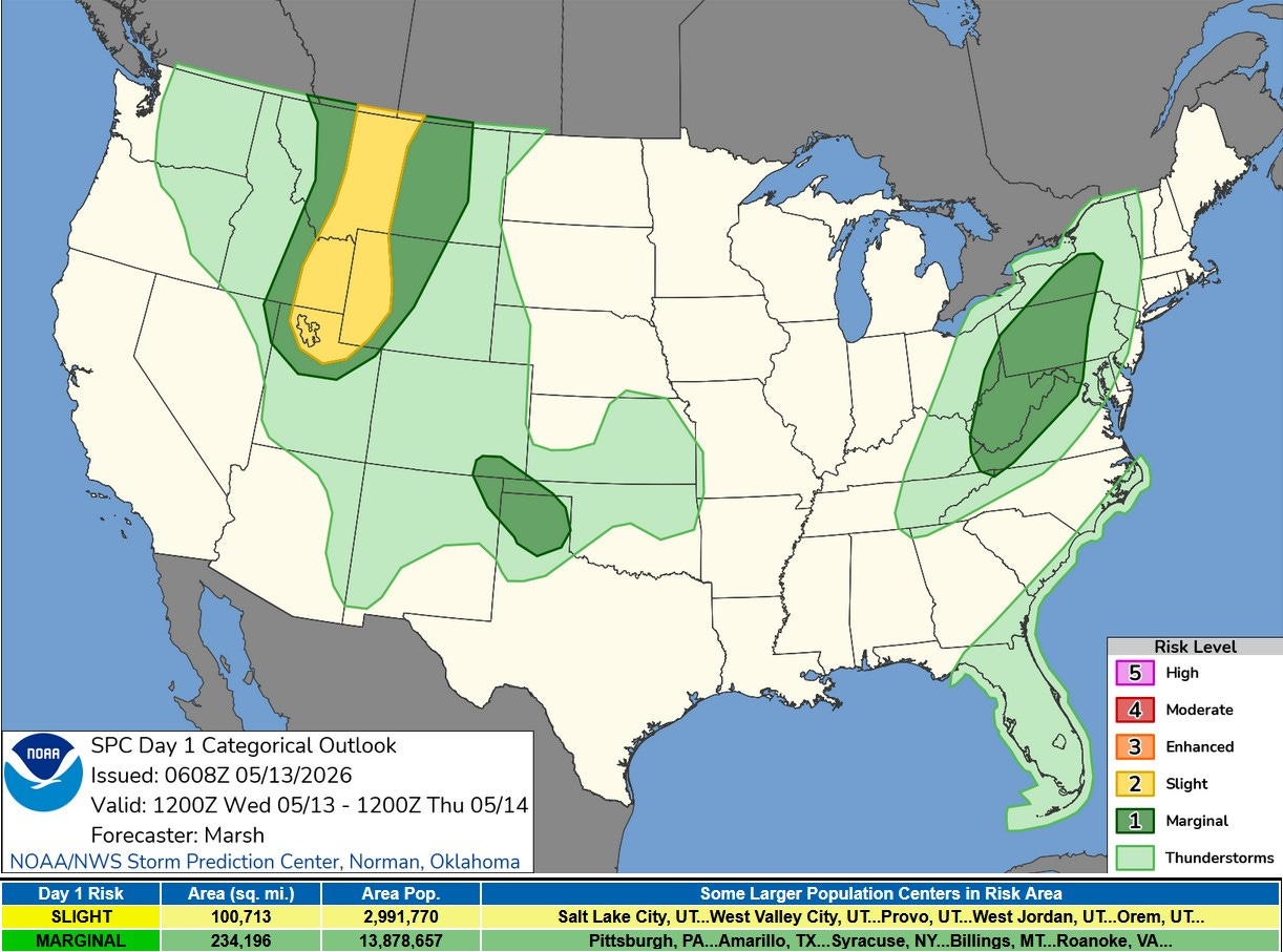
This is the Severe Weather Outlook Map for this Wednesday (5/13). There is a level 2 Slight Risk of a severe storm from northern Utah north through eastern Idaho and western Wyoming, across Montana and up into Canada. The threat there is isolated wind damage. So Yogi Bear better make sure that picnic basket doesn’t blow away.
There are two other areas with a Marginal Risk (level 1) from south-central New York to western Virginia and in the Texas and Oklahoma Panhandles.
Here in Michigan, we’ll probably be storm free until the weekend.
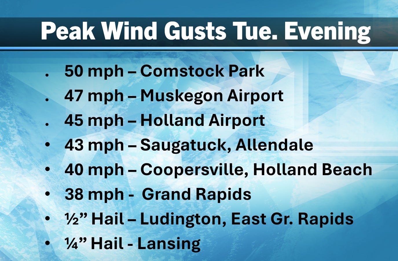
We had some showers and thunderstorms move through the area Tuesday evening. Here’s some peak wind gusts with the storms. There were several hail reports.
Nationally, there was virtually no severe weather on Tuesday. There were two marginal 1” diameter hail reports and one possible small tornado, all in central Florida.
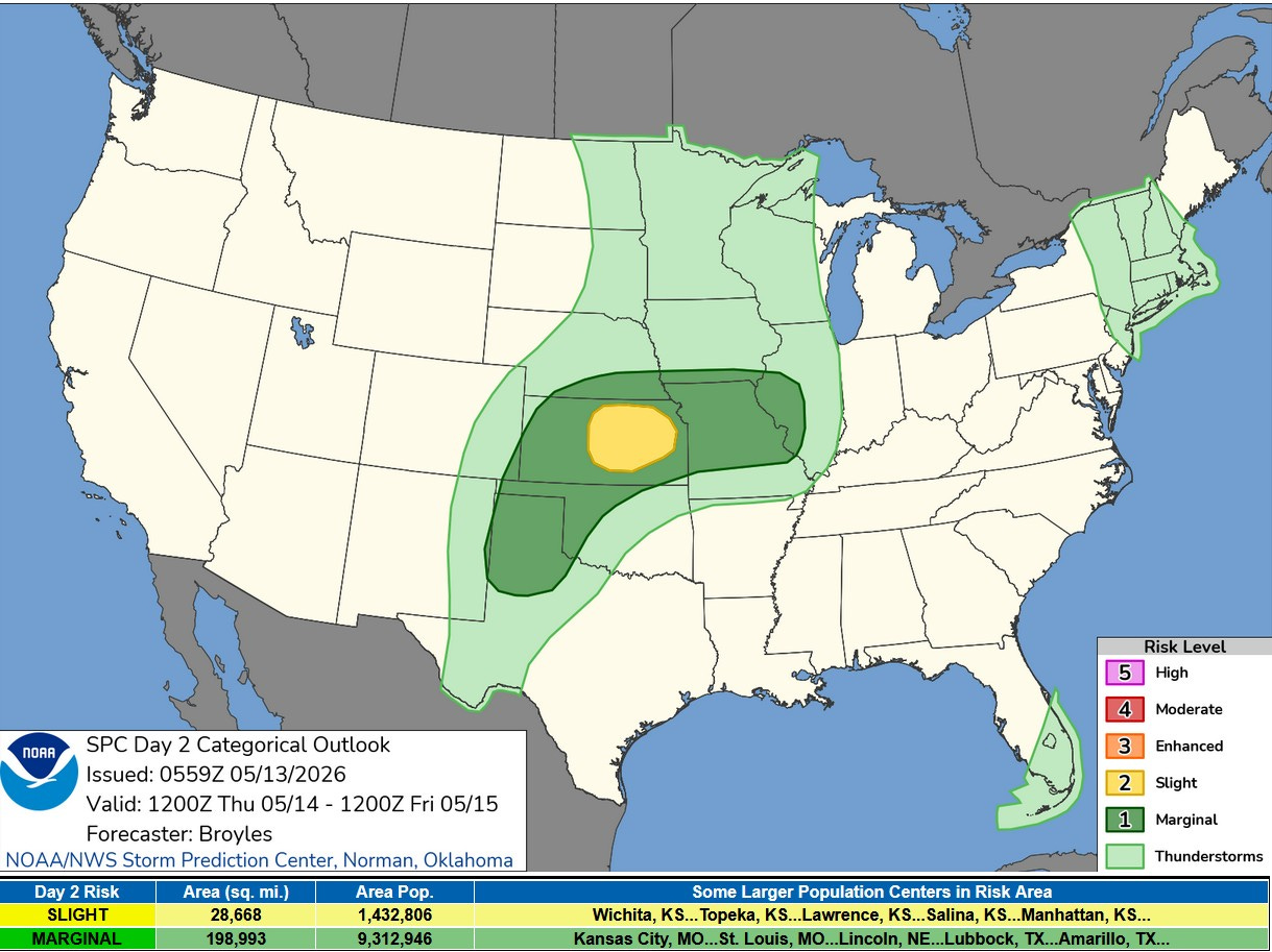
Here’s the Severe Weather Outlook Map for Thursday. No storms in Lower Michigan. There’s a Slight Risk (level 2) in Kansas and a Marginal Risk (level 1) from the Texas Panhandle to western Illinois.
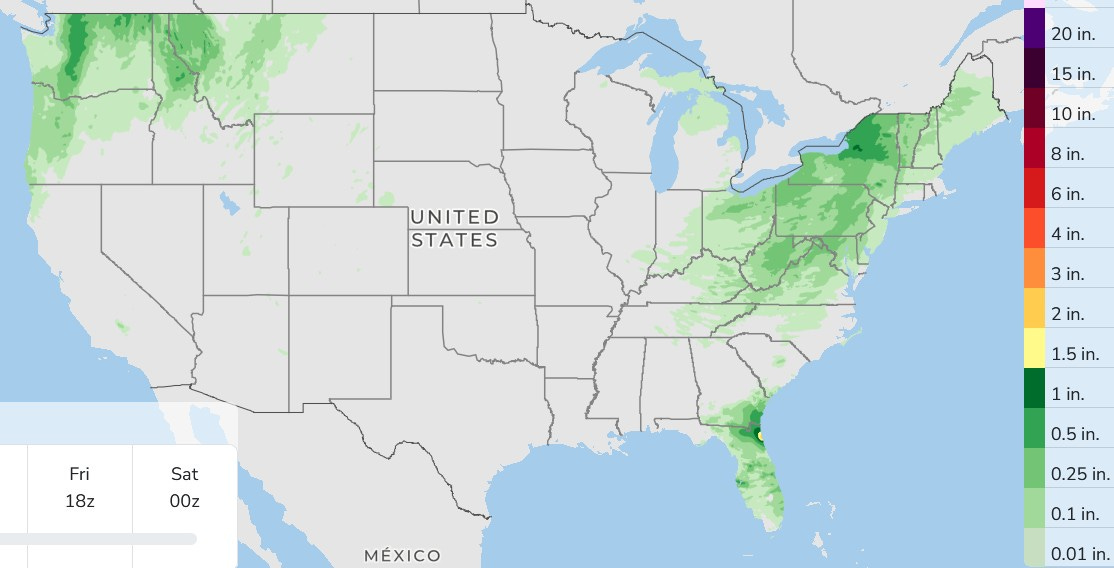
This is 3-day total rainfall. Much of southern Lower Michigan will be dry. There could be a few scattered light showers in northern Lower and eastern Upper Michigan.
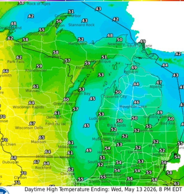
Here’s Forecast High Temperatures for today. Low to mid 50s inland and near 50 at Lake Michigan. With a brisk northwest wind at 15-25 mph, it’ll feel more like March than May. The average high temperature for today in Grand Rapids is 69.
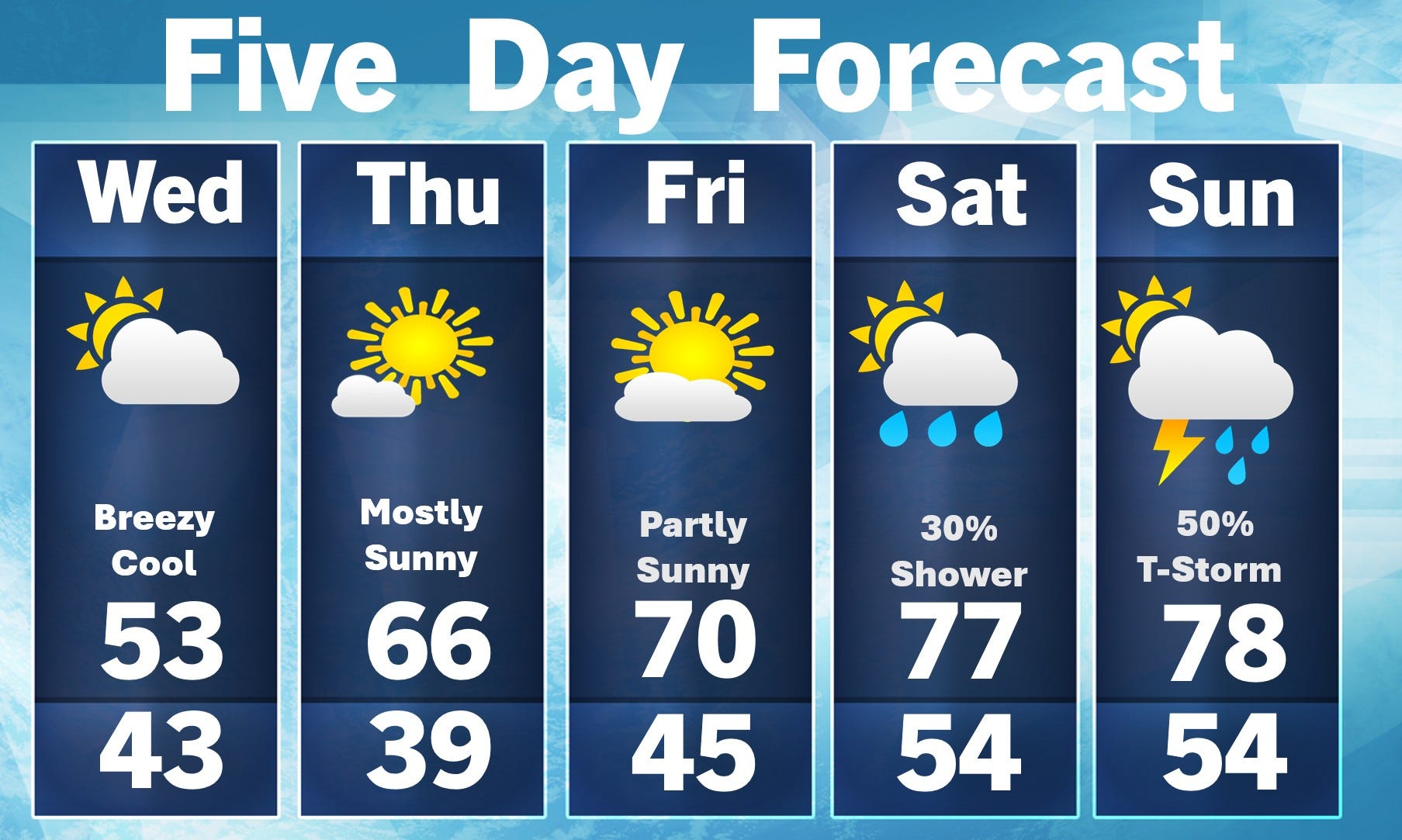
We’ll be mostly sunny and warmer on Thursday. I can’t rule out a little frost in low spots that get cold on a clear night (Leota, Baldwin). After that, I think we’re done with frost/freeze forecasts and you’re free to plant the garden. Most of the weekend will be dry. There will be a small chance of a shower or t-storm on Saturday with a little better chance either Sunday or Monday.
Nice few days ahead. A bit windy still. Yah, Yogi in Jelly Stone park! Mr Ranger oughta get his sharp stick with a nail on the end and pick up all those crumpled papers. My fav. cartoon song as kid was when he danced, cleaned up the park, and threw his generous backend into it: " Pick'n up the trash-bump bump; Put it in the bag-bump bump". The only time we saw Mr Ranger having some fun, haha.