
Still A Chance of Isolated Frost
Cool Pattern Forces Severe Storms South of Michigan

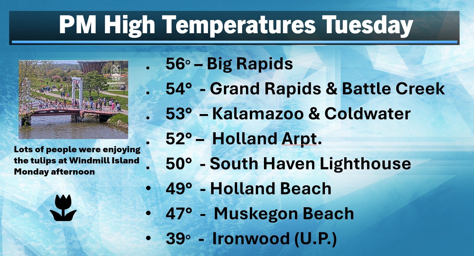
Here’s Tuesday afternoon high temperatures. Big Rapids topped the list. They got the most sunshine. Grand Rapids midnight-to-midnight high temperature was 60 at 12:01 am…the afternoon high temperature was just 54. The average daily high temperature for Grand Rapids is now 66.
It was cooler near Lake Michigan. The afternoon high temperature was just 47 at Muskegon. It was cold in the U.P. Several places had a little light snow, including Ironwood and Marquette.
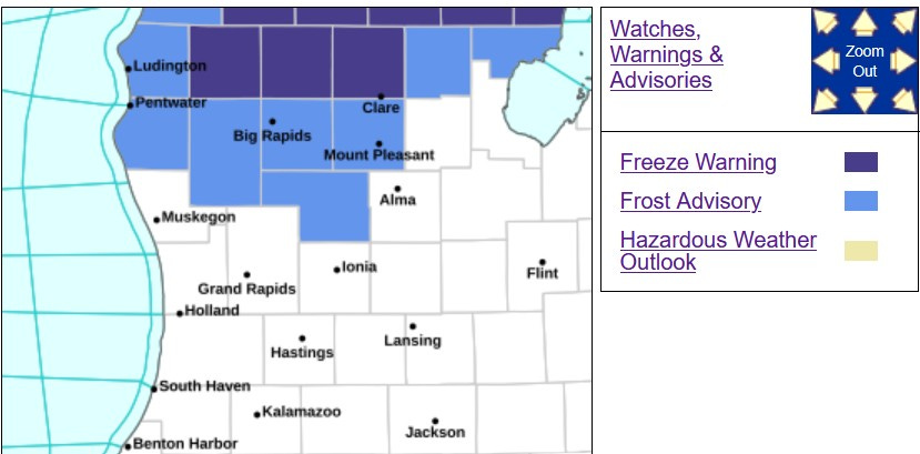
We start this Wednesday with a Freeze Warning along US 10 away from the lake and a Frost Advisory for the counties above in the lighter blue - including Oceana, Newaygo and Montcalm Counties.
This map from the G.R. National Weather Service shows where a freeze and frost is possible early this Wednesday morning.
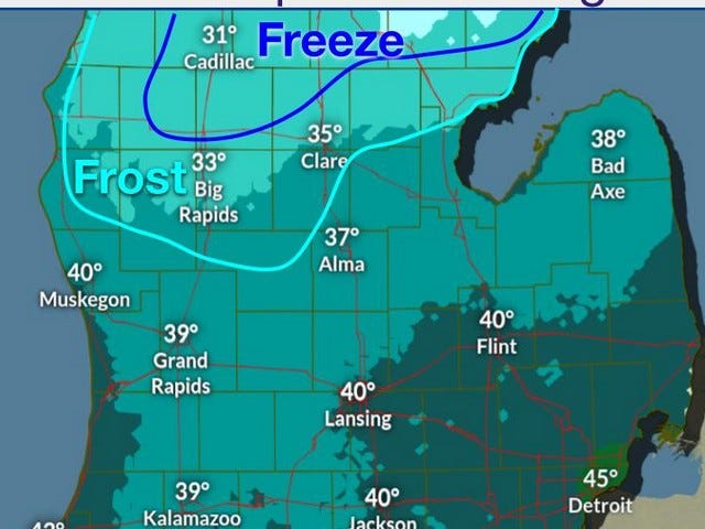
And here’s a map showing low temperatures and frost/freeze areas early Thursday morning. This is cool, but not nearly as cold as the 26-degree reading we had in Grand Rapids on 4/20.
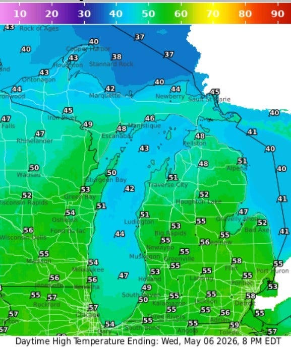
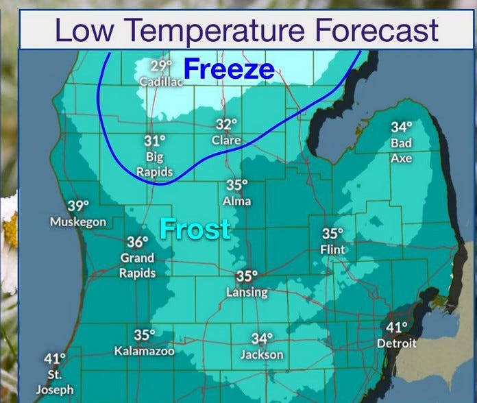
Here’s forecast high temperatures for this Wednesday…mid 50s inland and near 50 at Lake Michigan. Most of these temperatures are about 10 degrees cooler than average.
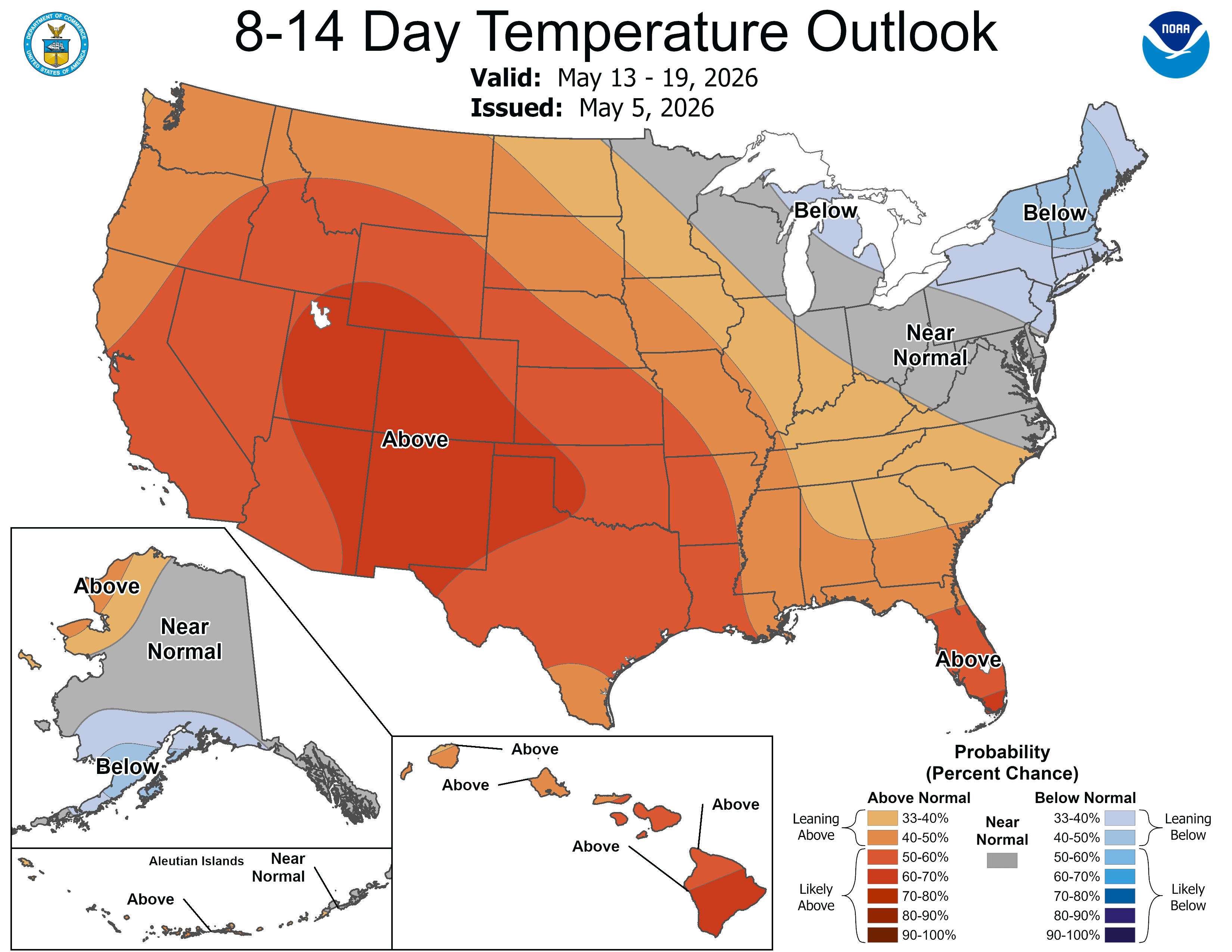
The 8-14 day outlook finally has west Michigan back to average. Keep in mind this is the average over 7 days…so the first 3 or 4 days may be cooler than average and the last 3 or 4 days may be a little warmer than average…balancing out to average. I’ve said before I expect a little warmer pattern after mid-May (15th) and maybe then I can give the go ahead to plant frost sensitive plants and vegetables.
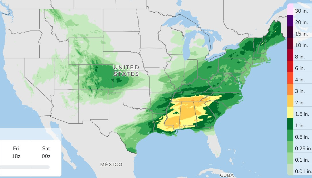
Here’s 3-day total precipitation. That’s a lot of rain (thunderstorms) falling across much of the South. They need the rain and they’re going to get it.
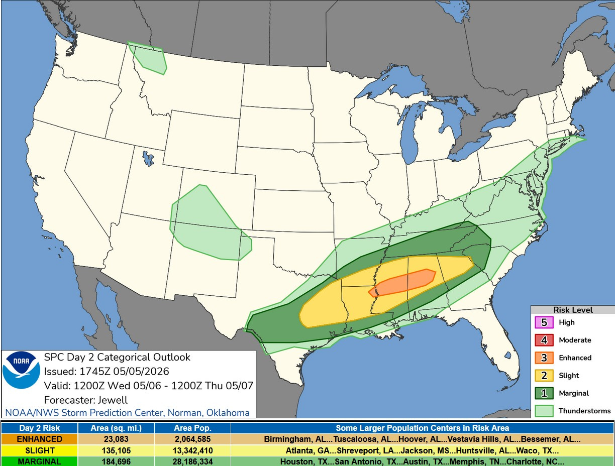
Here’s the Severe Weather Outlook Map for this Wednesday. That’s a level 3 Enhanced Risk from northeast Louisiana across Mississippi into Alabama. Birmingham is the first city listed in the Enhanced Area (stay safe daughter #3). The Storm Prediction Center says: “Supercells capable of all hazards will be possible across portions of central Mississippi and Alabama before a shift to a more widespread damaging wind risk into the late evening/overnight.”
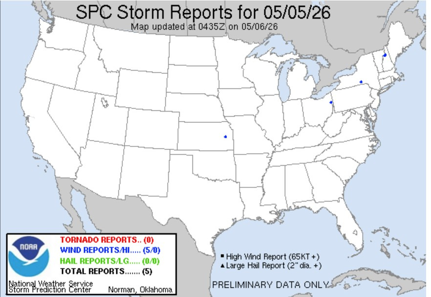
There were only 5 reports of severe weather on Tuesday…a very “quiet” day.
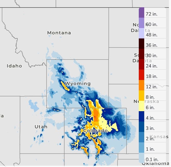
The precipitation out west is falling mainly as snow. This area had well below average snowfall this past winter and they need the moisture.
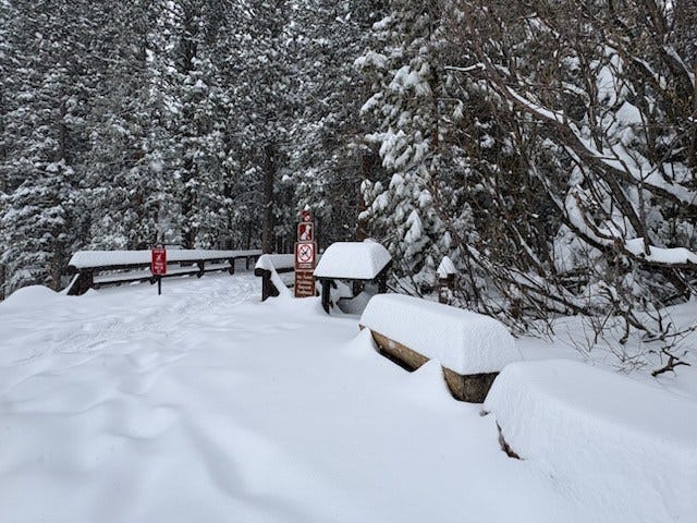
This is the snowfall in Rocky Mt. National Park, where an isolated 30” total is possible. I noted that today’s bird watcher’s walk has been postponed.
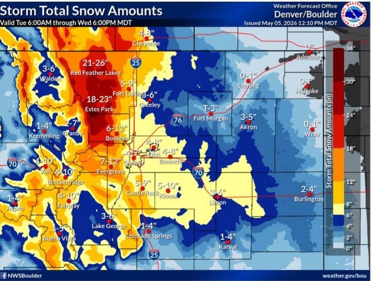
Here’s the snowfall forecast in Colorado. Note the highest snow totals could be mover 2 feet. It’s a snowstorm for the city of Denver where 4-9” is likely. Snow falls, albeit lighter out in the plains of far west Kansas.
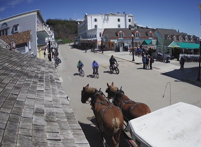
The sun was shining Tuesday up on Mackinac Island. The snow piles have melted and the island is coming alive. Note the horses and bicycles.
Also: The Florida Peninsula is hot - highs in the low-mid 90s. Spectacular eruption of Kilauea on the big island of Hawaii.
Good/ fun information. Nice variety. With relatives in TX, Denver, FL, CA, NC, TN, and eastern seaboard it's nice to see what each of them can expect. Your thorough coverage is appreciated.
Thank you