
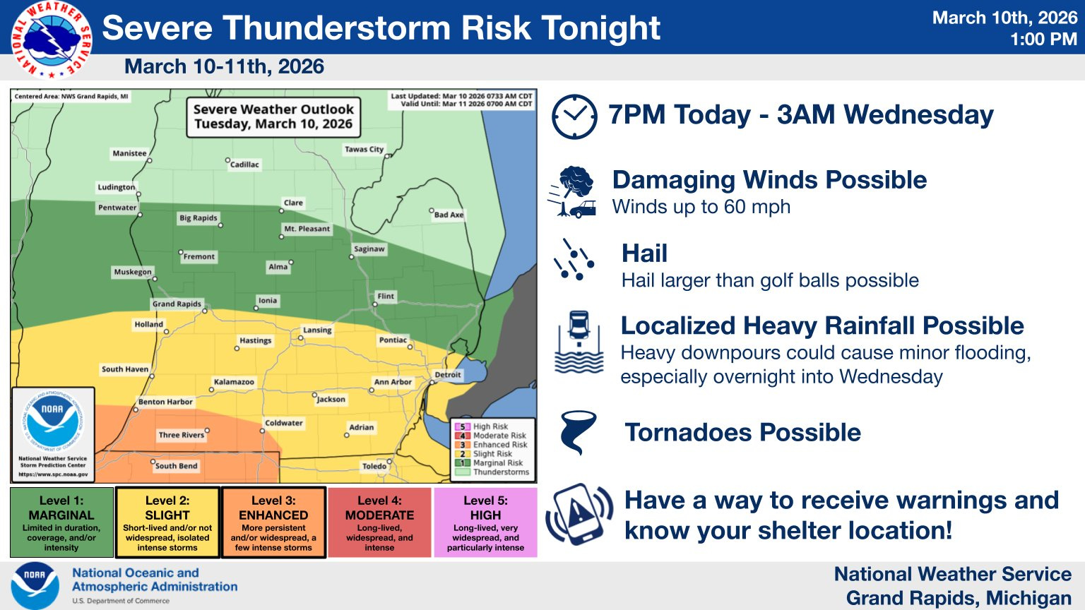
Severe Thunderstorm Watch for West Michigan
Best chance of a tornado is in N. Illinois and NW Indiana, grapefruit-sized hail reported southwest of Chicago.

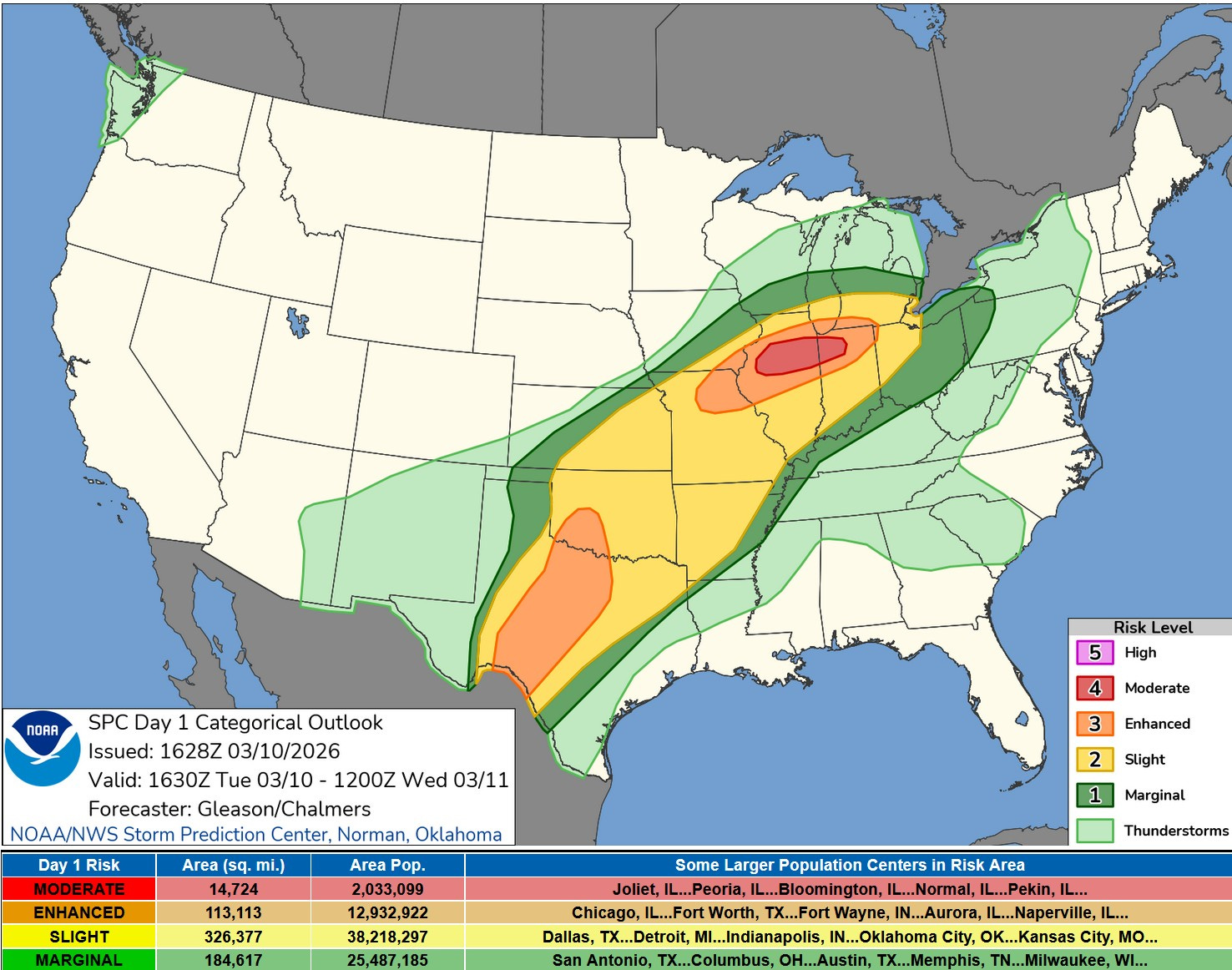
This is the afternoon/evening updated Severe Weather Outlook Map from the Storm Prediction Center. SPC upgraded parts of N. Illinois and NW Indiana to a level 4 or Moderate Outlook.
Hail up to FIVE INCHES in diameter has fallen in Illinois, where at least 3 tornadoes have touched down. Multiple reports of hail in Ottawa and Kent Co., including in Grand Rapids.
SPC says: “Scattered to numerous severe thunderstorms are expected tonight from the southern Plains to the southern Great Lakes vicinity. All severe hazards are likely, including the risk for multiple strong to intense tornadoes, damaging winds, and very large hail.”
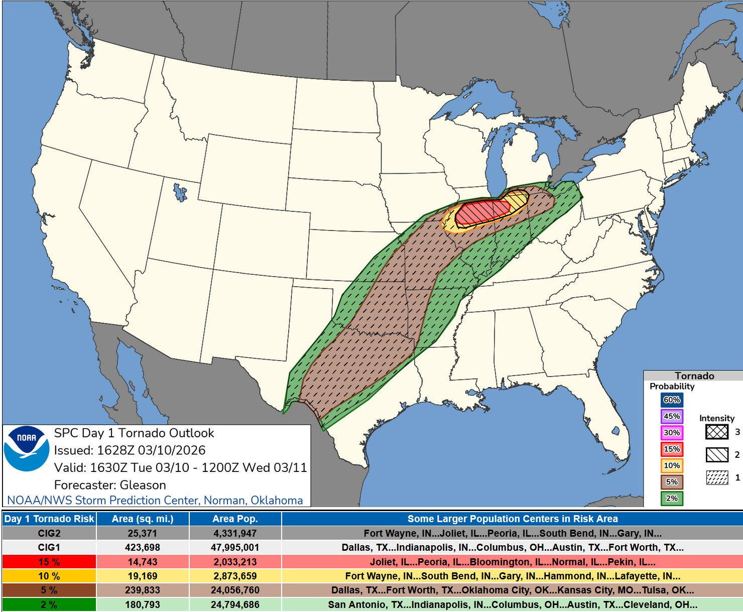
Here’s the Tornado Forecast Map from SPC for Tue. PM/night. Note that the best chance of tornadoes will be in north Illinois into northwest Indiana. There is a lower chance of a tornado in southern Lower Michigan and that chance is generally along and south of I-94.
The first tornado occurred just north of Pontiac IL. Grapefruit sized hail with that storm. New Watch coming for SW Michigan.
More from SPC: “Moderate to locally strong instability, steep mid-level lapse rates, and strong deep-layer shear will all contribute to a very favorable environment for significant severe potential. Very large hail (2+ inches in diameter) will be possible with initial supercells. Effective SRH (Storm Related Helicity - basically, the more SRH, the easier it is for a thunderstorm updraft to rotate) and related low-level shear will marked increase around 8 PM and later in tandem with the strengthening low-level jet. The supercellular tornado threat is likewise expected to quickly increase through the late afternoon/evening, as enlarged/curved low-level hodographs will easily support intense low-level rotation. A focused corridor along and just south of the front will have the best potential for multiple strong to intense tornadoes (EF2-3+). Accordingly, greater tornado probabilities (15%) and a categorical Moderate Risk have been included across parts of northern/central IL into northwest IN with this update.”
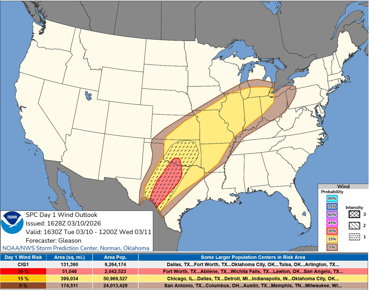
This is the Severe Wind Forecast Map. SPC has a large Slight Risk area (in yellow on the map above) from southern Michigan to Mexico with a 30% Enhanced Outlook in Texas. This area comes north to include Ottawa, Kent and Ionia counties. I think the best chance of severe winds will be across N Illinois and N. Indiana and south of I-94 in southern Lower Michigan in the warm sector.
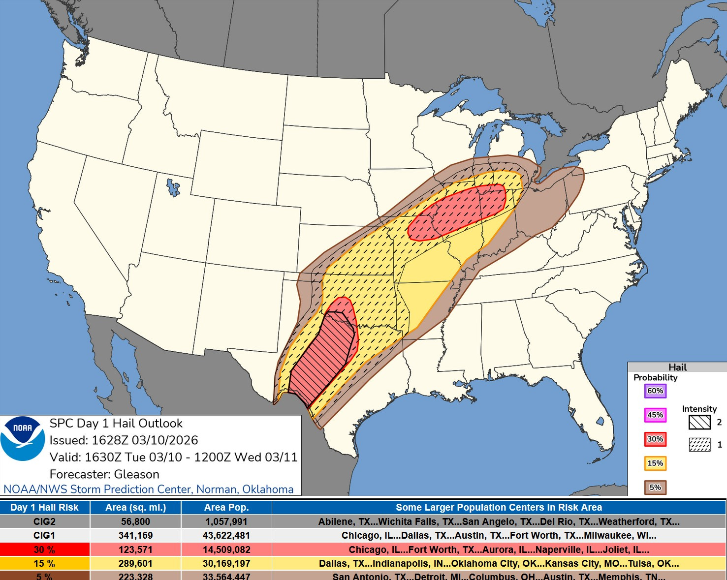
This is the Severe Hail Forecast Map. Hail is also a concern and the highest risk area comes up into southwest Lower Michigan. Again, areas from Kent Co. to the south are in the yellow (15% risk of a severe report within 25 miles of a given point). The red colored area includes areas south of I-94. The area most likely to see severe hail would be south of the warm front.
OK, where’s the front. These are weather observations at 3 pm. The numbers are current temperatures. It was 43 at Ionia with a northeast wind and 70 at Marshall with a southwest wind. In Illinois the temperature at Jacksonville (just west of Springfield) is 83, while the Chicago water intake, just a couple miles east of downtown shows an air temperature of 36 with a north wind at 15 mph (doesn’t south like a tornado day there, does it?
Graphic from the Grand Rapids National Weather Service. Areas in orange south of a line from Benton Harbor to Coldwater have the highest risk for a tornado or severe criteria hail
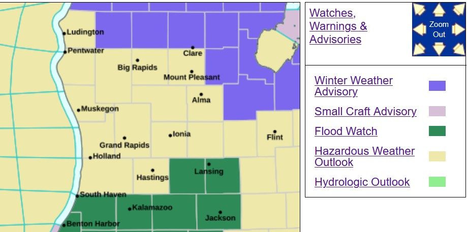
Flooding is also possible. A Flood Watch has been posted for areas south of a line from South Haven to just north of Lansing. 1-2” of rain is possible on generally wet ground. Up north there is a chance of a little freezing rain and for the U.P., snow is likely. A Winter Weather Advisory is in effect north of a line from Ludington to Flint.
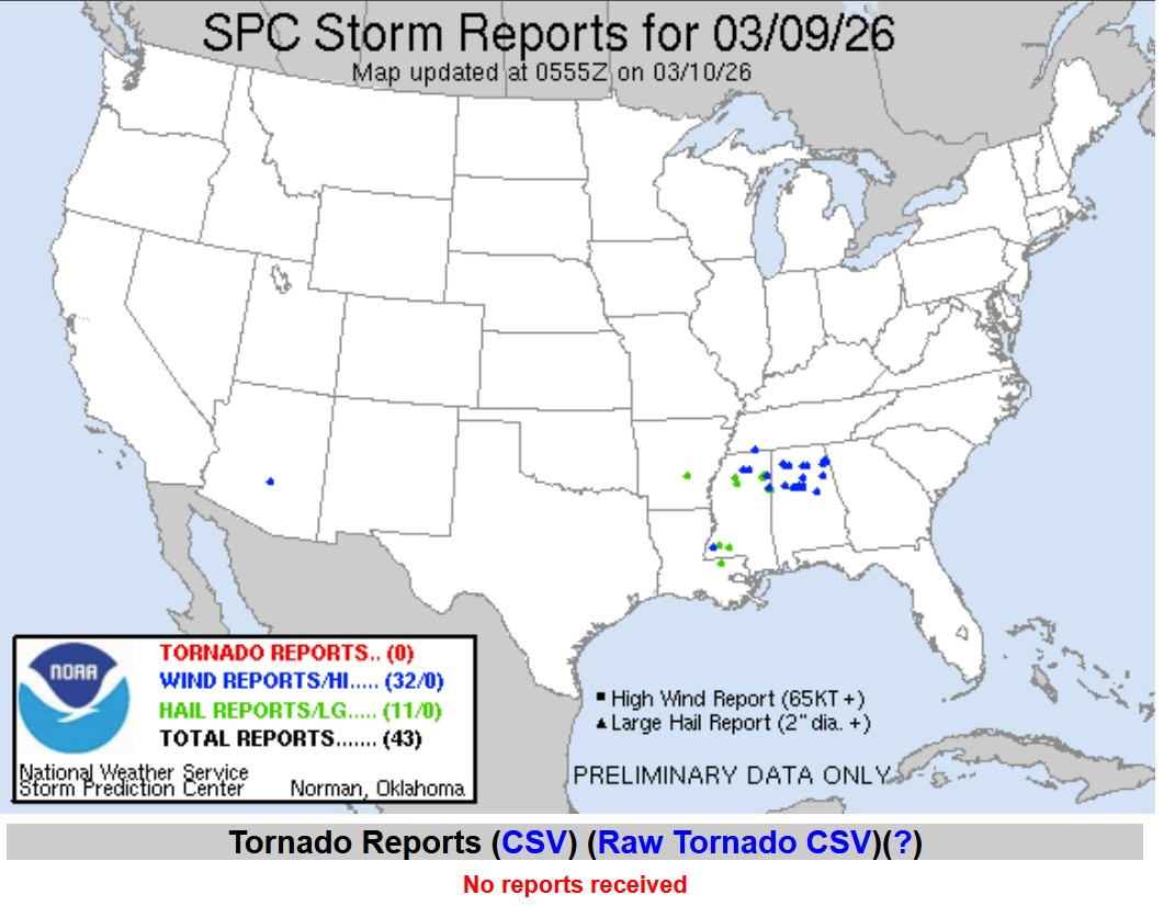
Here’s the severe storm reports from Monday/Monday night. Each blue dot is a severe wind report and each green dot is a severe hail report. There were no tornadoes, but there were 32 severe wind reports and 11 severe hail reports. I did not see any reports of injuries. The Birmingham AL airport had two gusts to 37 mph and 1.2” of rain.
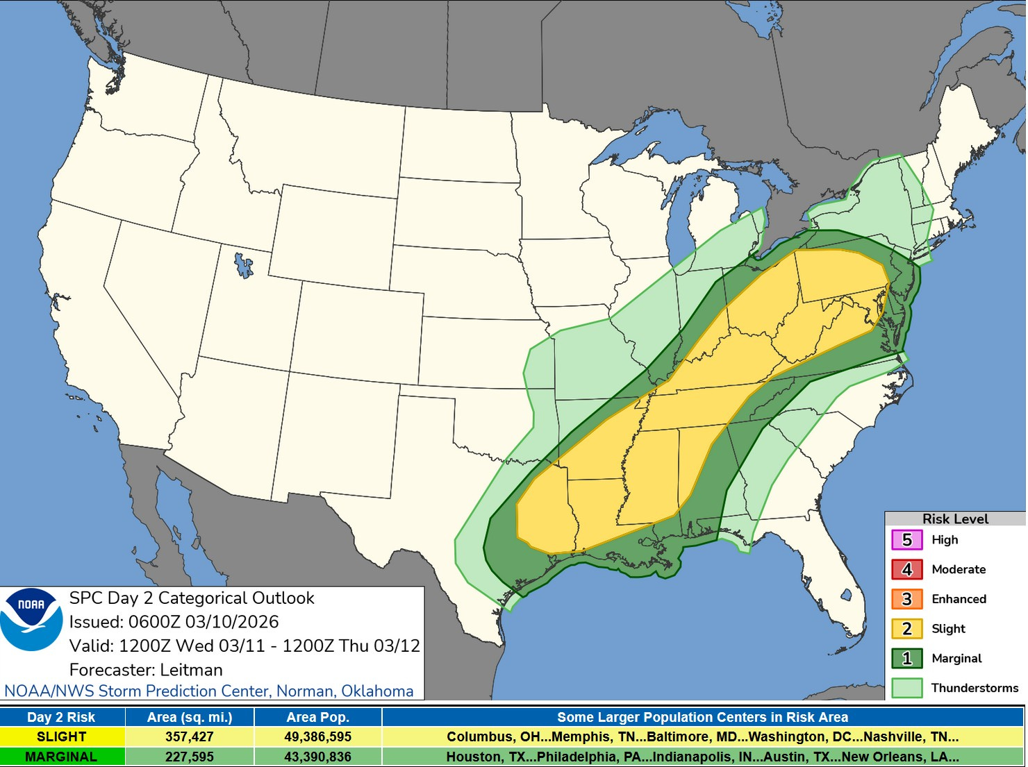
Here’s the Severe Weather Outlook Map for Wednesday. There is a large Slight Risk (level 2) Outlook from Pennsylvania to east Texas. The light green in Lower Michigan is a chance of a General (not severe) storm. We’ll be solidly in the cool air Wed. in West Michigan.
This is the 66 hour total precipitation map from the Weather Prediction Center. The yellow indicates +1.5” and the dark green +1”. In southern Michigan this rain will fall mainly Tue. night thru Wed. Some rivers are on the high side and this rain could push them to bankfull.
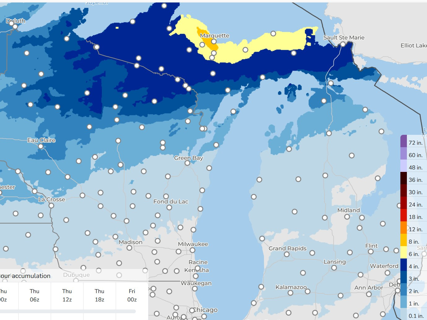
This is the 66 Hour snowfall forecast from WPC. Yup, another snowstorm for Upper Michigan. The orange is 8” and the yellow is 6”. Look for trace amounts (almost all rain) Wed. night north of Grand Rapids…maybe an inch around Traverse City and Gaylord. It’s still astronomical winter and we’re not completely done with snow yet.
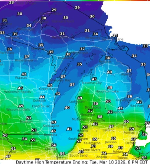
Here’s forecast high temperatures today (Tue). There will be a big temperature difference south to north. Three Rivers reaches 70. Most of the day it’ll be in the 50s in the G.R. area…only mid 40s for Gaylord and Traverse City…and just low-mid 30s for the U.P. Marquette still has 29” of snow on the ground and S. Ste. Marie has 26”.
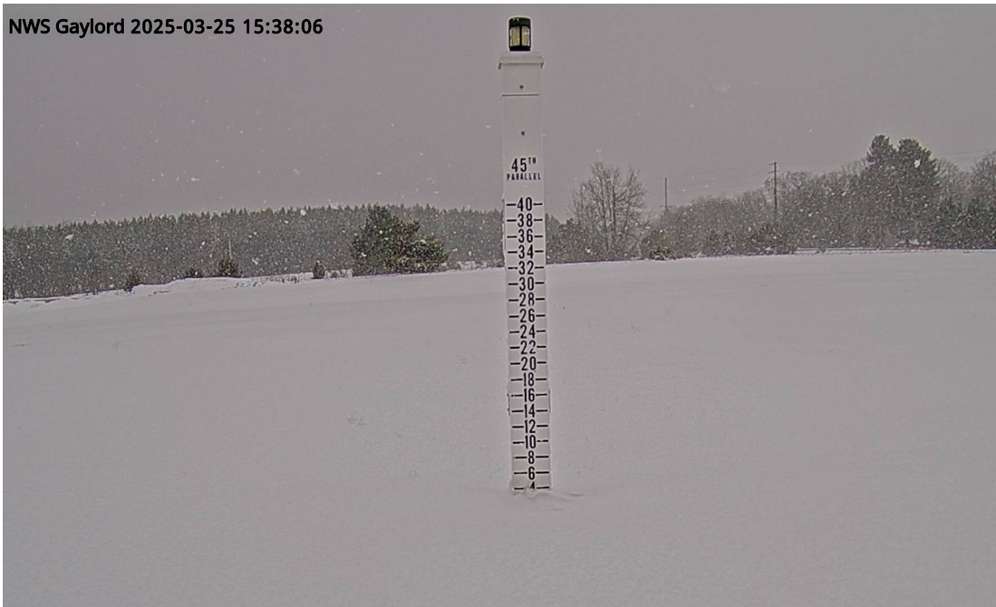
This is the Gaylord snow stake early Monday morning
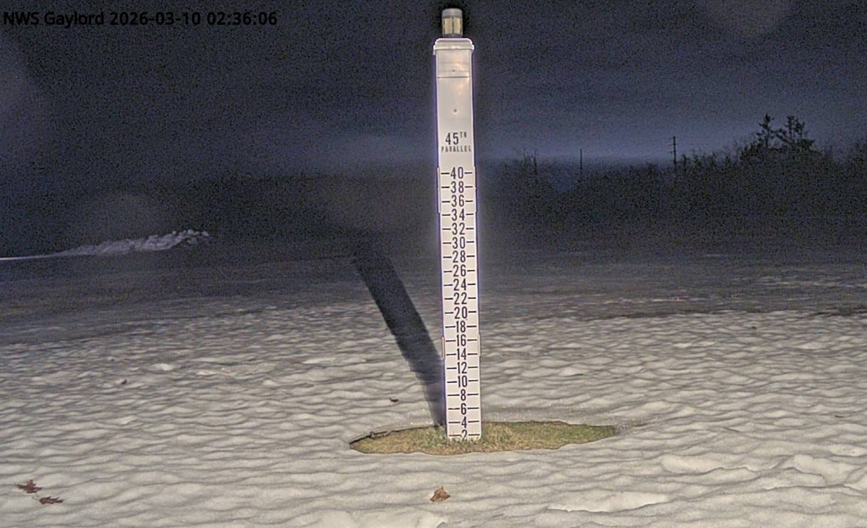
This is the stake early Tuesday AM. Note it was mostly sunny and warm Monday. Much of the snow melted. The sun warmed the stake and the snow around the stack melted
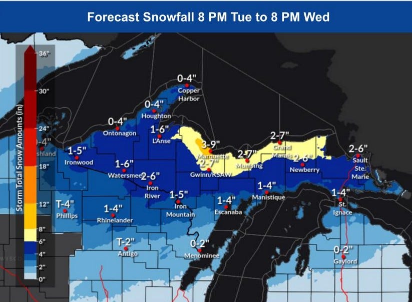
Here’s the expected snowfall totals with up to 9” expected in the Marquette area and up to 6” possible along the shoreline east to Sault Ste. Marie.
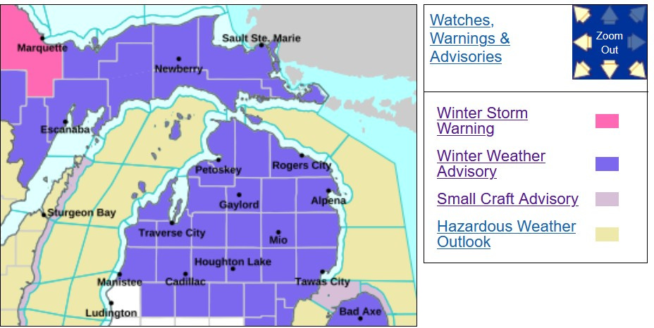
There’s a Winter Storm Warning out for Marquette Co. and a Winter Weather Advisory for the rest of the U.P. and for northern Lower Michigan, where a small amount of freezing rain or freezing drizzle may mix in with the snow.
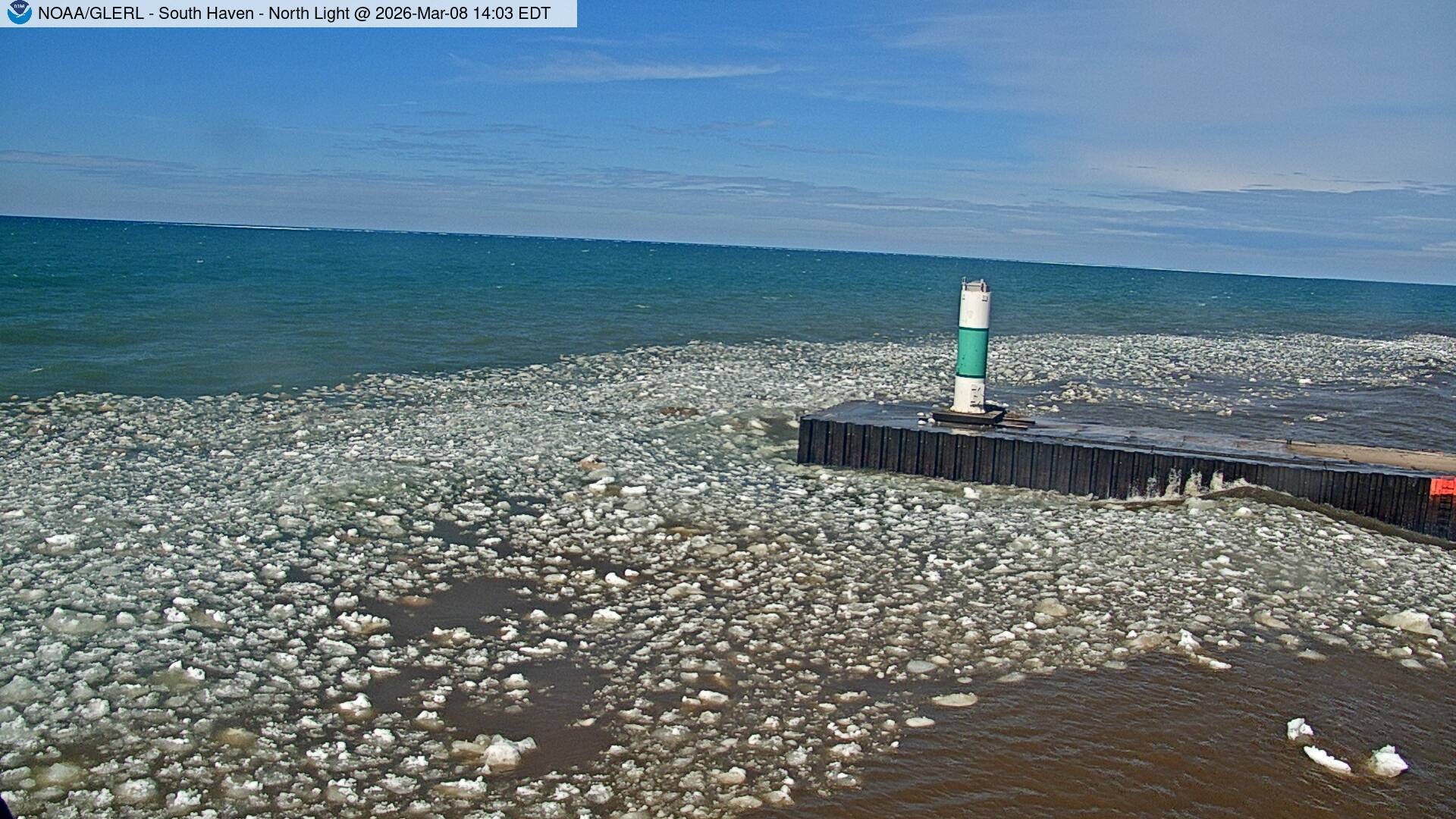
This is what it looked like Sunday when the sun came out around midday. We still have floating ice along the shore. It’ll was breezy Monday…not quite as windy as Sunday. Wind gusts Sunday: Saginaw 49 mph, 47 mph Grand Rapids, 45 mph Muskegon, 44 mph Big Rapids, 43 mph East Grand Rapids.
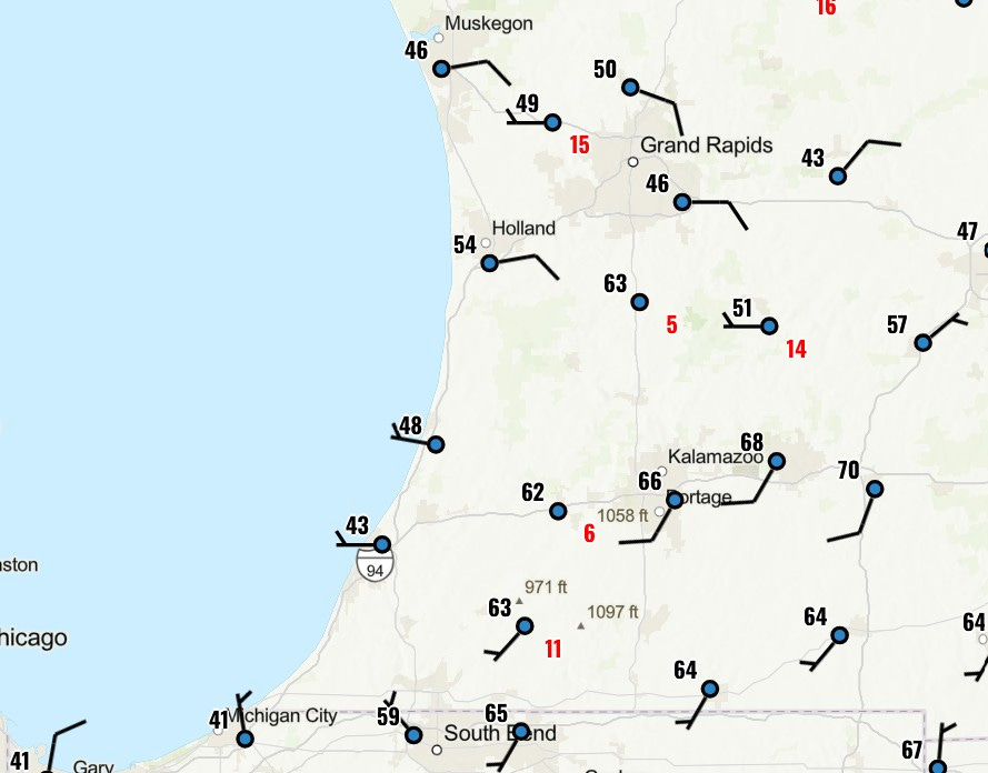
Winds today (Tue.) will be mostly from the east at around 10 mph. Winds will be out of the south in the warm sector down toward the Indiana border.
Enjoy the sun and warm temperatures…we have a pattern change on the way. Cooler air will move back into Michigan this Wed.,/Thu. and it’s going to stick around. It won’t be real cold - it’s mid March, not mid-January, but we’ll be back to the pattern we had for much of the winter with relatively cool temperatures in the Great Lakes, Northeast and mid'-Atlantic.
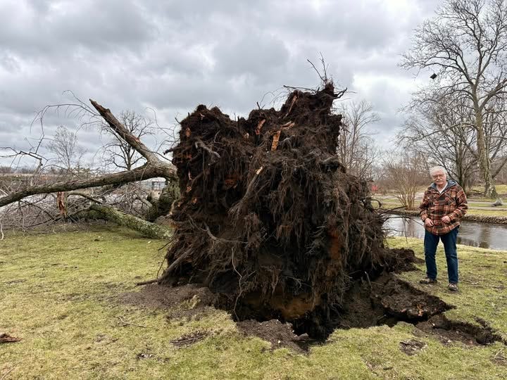
Check out my pics. from Three Rivers on Saturday: https://www.facebook.com/bsteffen8/posts/. That facebook post has had over 9,500 likes, over 1,000 shares and 439 comments. People are interested in weather. This is worth another look - the Union City Tornado when it was EF3 with peak winds of 160 mph.
I was really impressed with the response of Three Rivers. There were more than a dozen power company crews, lots of people helping to clear downed trees and debris. We saw a Meijer’s truck giving out free water, the Salvation Army, the United Way and Samaritan’s Purse had trucks there. The St. Joseph Co. mobile van was there. It was a little windy and there were some light showers in the afternoon. By Sunday evening there were only 437 customers without power in the whole state of Michigan.
Ugh
Great information! Thank you!!