
Severe Weather Next Tuesday
A Warm Start to Next Week - Temperatures in the 70s.

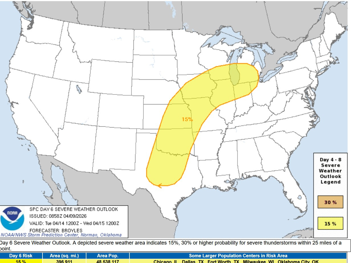
This is the Severe Weather Outlook Area for next Tuesday PM. This is 5 days out and they are already highlighting a large area from Texas to Michigan for strong thunderstorms.
The Storm Prediction Center says: “…A moderately unstable airmass will likely be in place by afternoon from the southern Plains northeastward into mid to upper Mississippi Valley and southern Great Lakes. Supercells with large hail, wind damage and tornadoes are expected Tuesday afternoon and evening. An upgrade will be possible across parts of the threat area.”
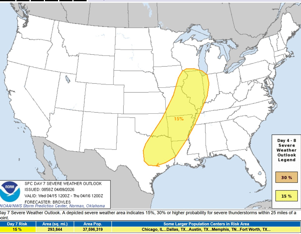
A fairly long stretch of severe weather is likely in the central U.S. starting this weekend and continuing through the middle of next week. This is the Severe Weather Outlook Area for next Wednesday. Again, a large area from Texas to Lake Michigan is expected to see severe weather. There will be a front wobbling back forth aiding in storm development.
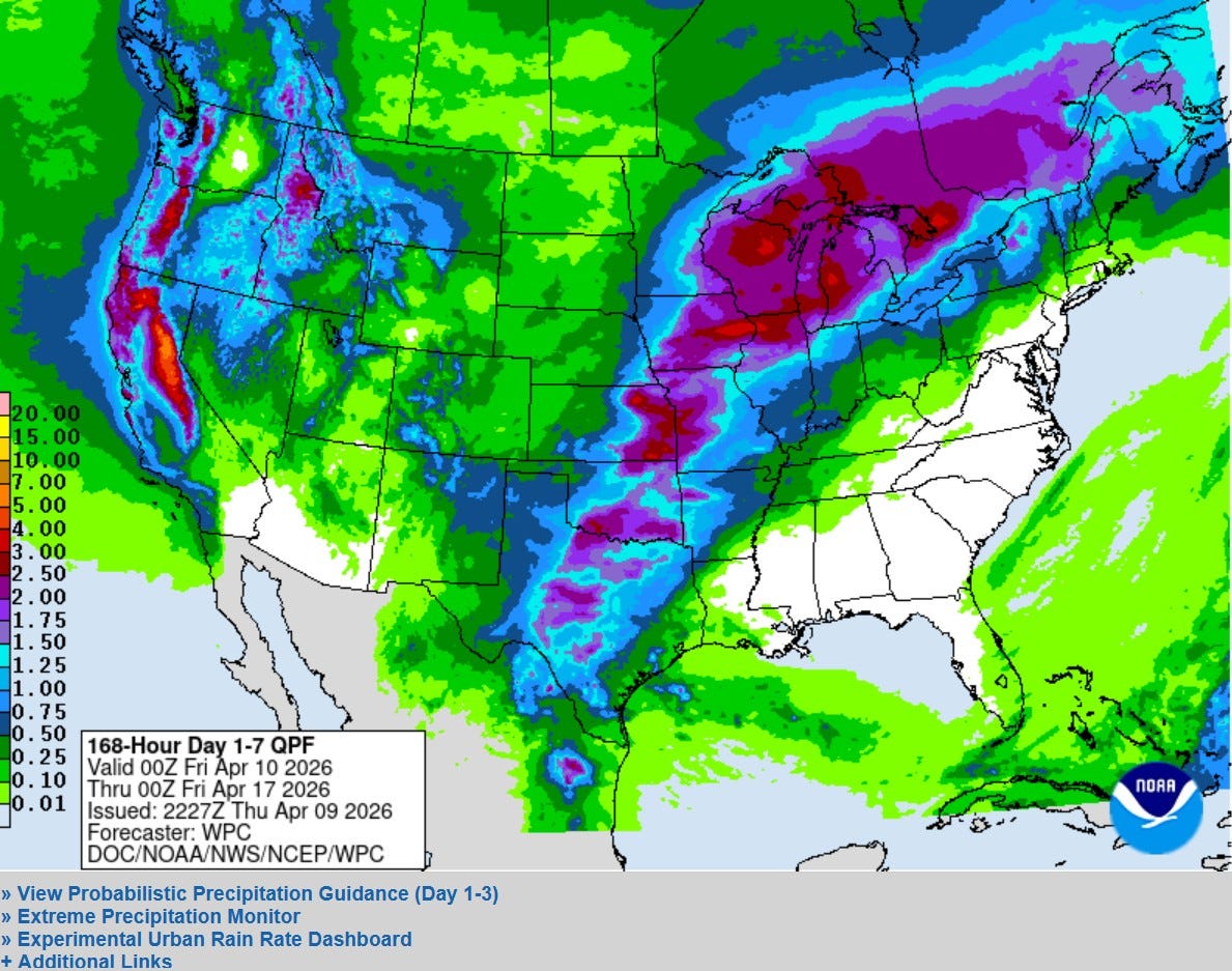
Here’s the latest 7-day rainfall outlook from the Weather Prediction Center. There’s a large area of 1.5 - 3” of rain from Texas to Michigan. This would keep river levels high and might even produce new flooding.
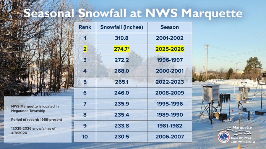
Of particular concern is parts of Upper Michigan, where there is still a significant snow cover. Here’s some snow depths Thursday in Upper Michigan: Mohawk 37”, Marquette 36”, S. Ste. Marie 24”, Pickford 22”. Herman has at least 3 feet on the ground and they report 365” of the winter. Mohawk (Keweenaw Peninsula) is up to 360” for the winter. Mt. Bohemia Ski Resort plans to be open weekends through Mother’s Day (May 10). Snowriver Mt. Resort, Marquette Mountain and Boyne Mt. are also still open for skiing.
Note on the 7-day precipitation map…it’ll be mostly sunny, dry and warm for the Master’s Golf Tournament in Augusta, Georgia…near 80 today, then mid 80s over the weekend. There will be rain and high mountain snow along the West Coast.
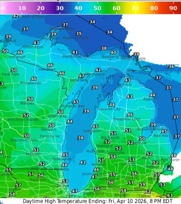
Here’s high temperatures for today (Fri.) in Michigan…in general a few degrees cooler than yesterday with mid 50s inland the mid-upper 40s at Lake Michigan. The U.P. will see upper 30s to mid 40s.
Showers should clear by early afternoon and by late in the day, the sun may return. Saturday should be a nice day, mostly sunny and mild with several rounds of showers and t-storms in the early-mid part of next week.
Also: The Polar Vortex is still there, north of Hudson Bay. Much of Canada is still experience mid-winter temperatures. One car escapes landslide. Kilauea’s still erupting in Hawaii. Severe thunderstorm in China. Volcano in Indonesia. 7.4 magnitude earthquake in Taiwan - dangerous boulders crash across highway. Spotted lake in Canada. Lightning hits electric fence.
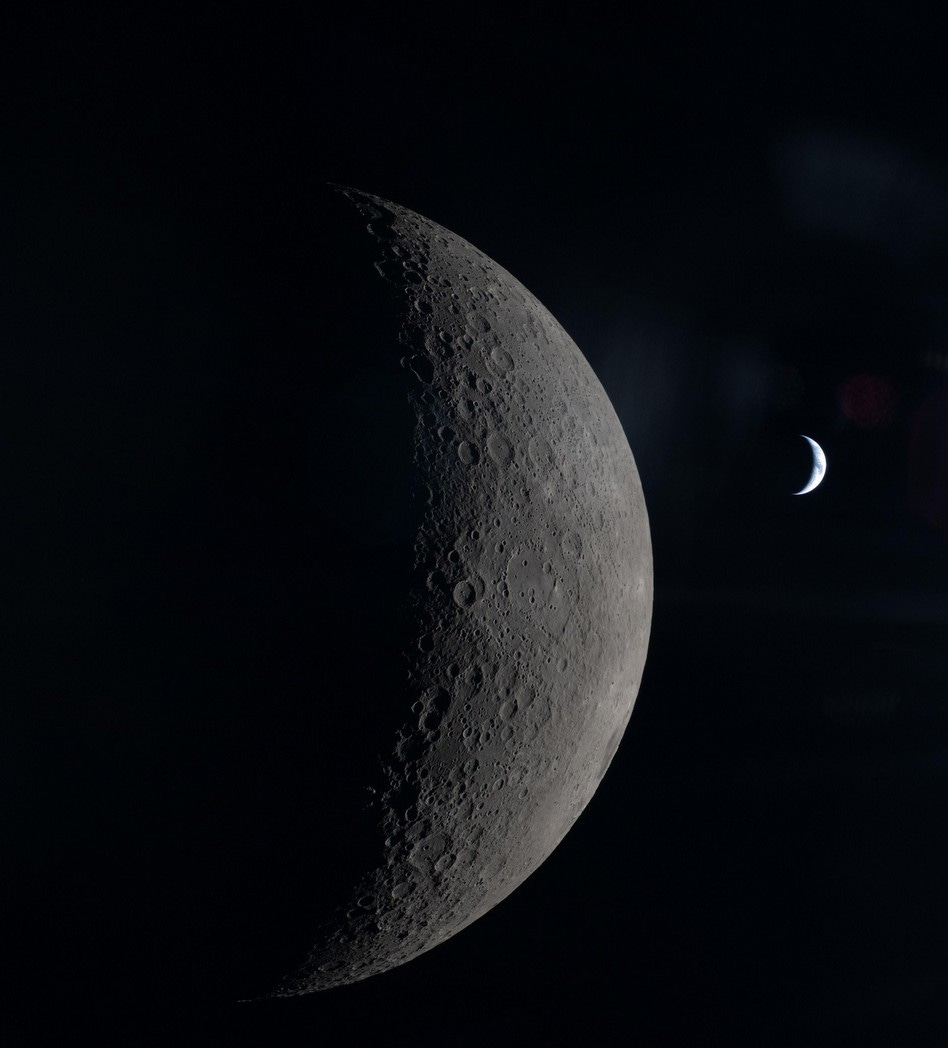
Here’s a pic. from the Artemis spacecraft, showing the larger moon and in the distance a crescent Earth (from NASA).
BTW - So far this year, the U.S. has had 313 tornadoes. The most in any state is 59 in Illinois. Michigan has had 11 twisters. None in Nebraska and only 4 in Kansas so far this year. Michigan is drought free for the first time in 3 years.
Thanks Bill for all the information