
Potential for a Severe Thunderstorm
Locally heavy rain will cause additional flooding

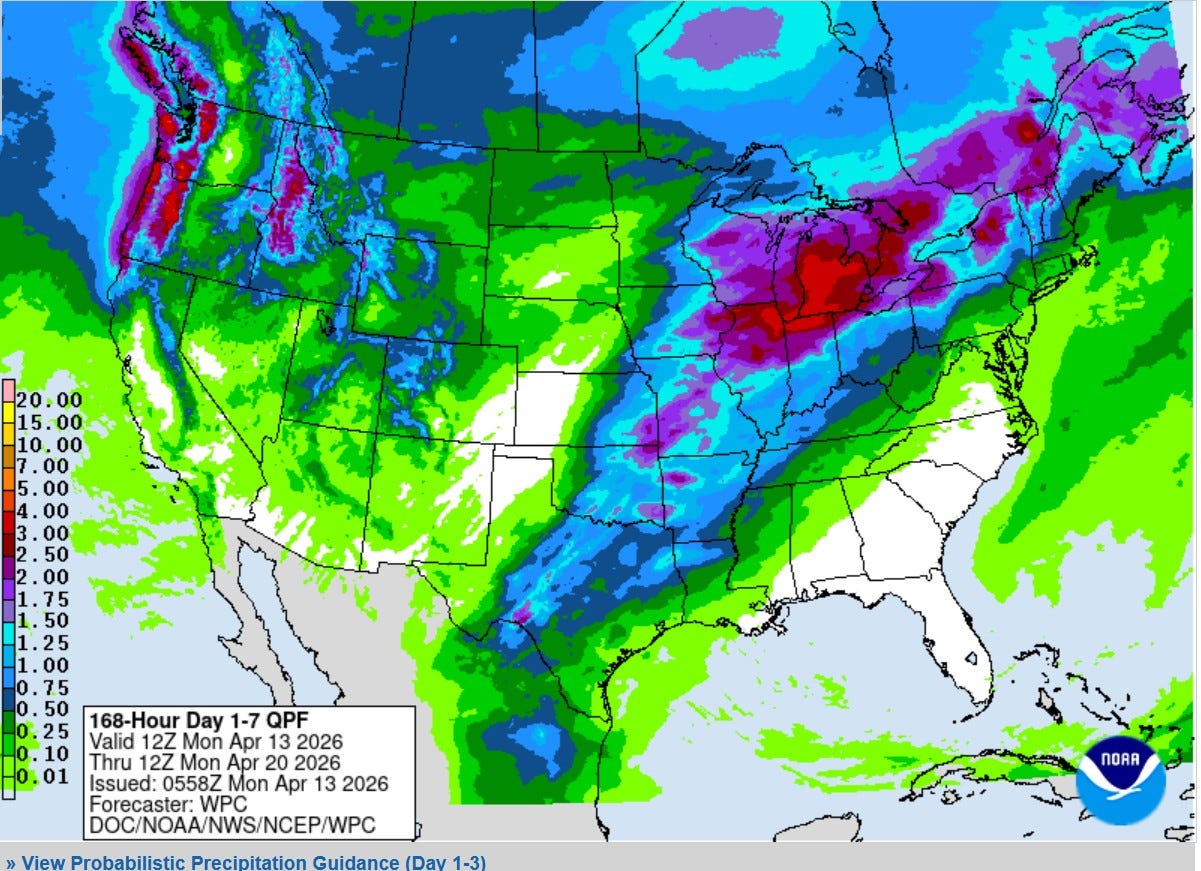
Here’s the latest (as I type this) 7 day combined rainfall forecast from the Weather Prediction Center. The heaviest rain is forecast to be in Lower Michigan, northeast Illinois and northwest Indiana. The bright red is 2-3”. That’s on top of already wet ground, that would certainly produce more flooding. Fortunately, most rivers (including the Grand River in Kent Co.) have crested and have been falling over the last 24 hours. I picked up another 1/2” last night.
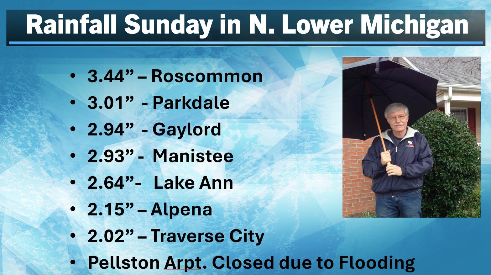
Look at the rainfall across N. Lower Michigan. Significant flooding was noted on the Crooked River and the water from Black Lake was approaching homes along the lake.
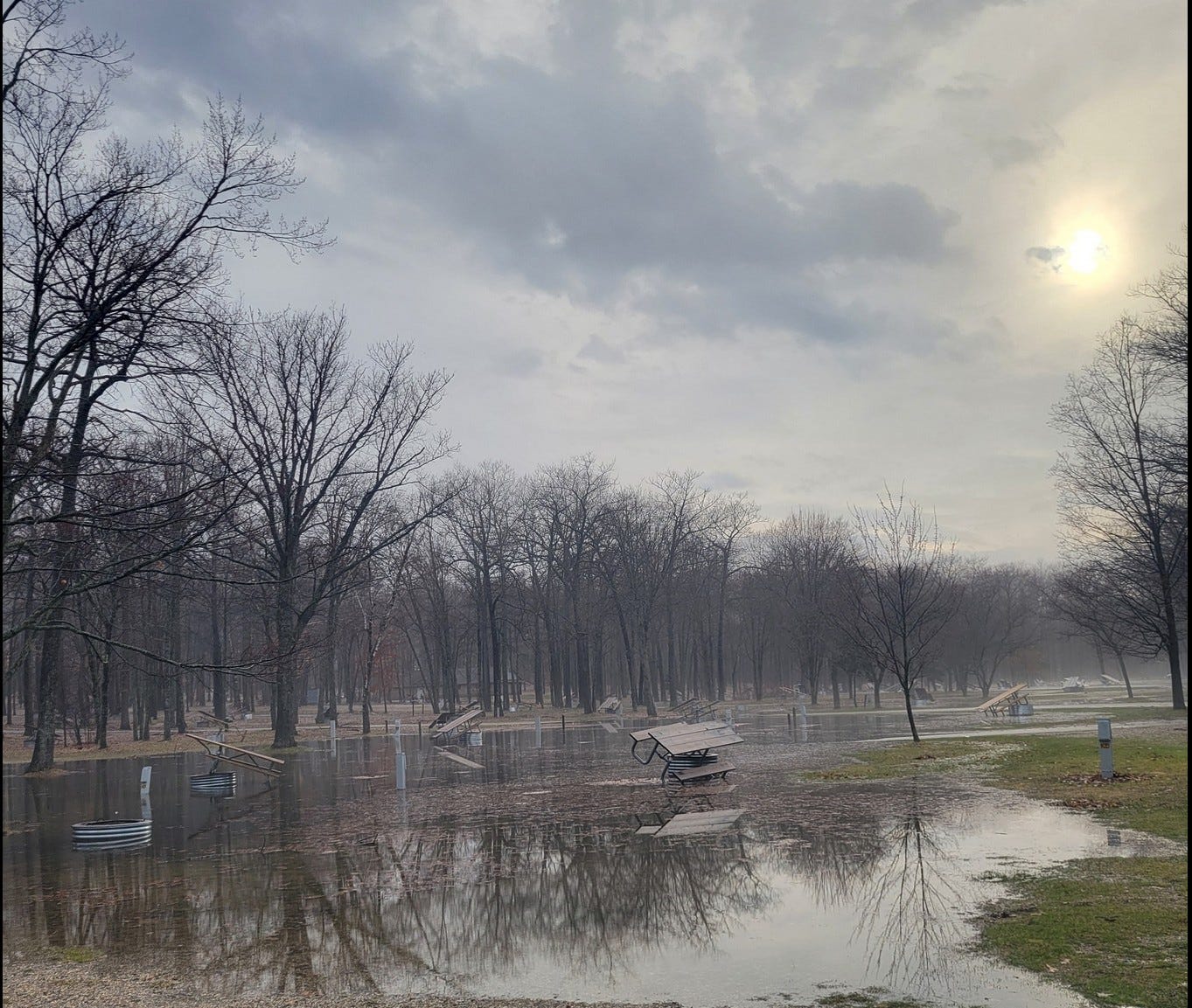
This is flooding at South Higgins Lake State Park (from their facebook page). This is going to get worse before it gets better unfortunately.
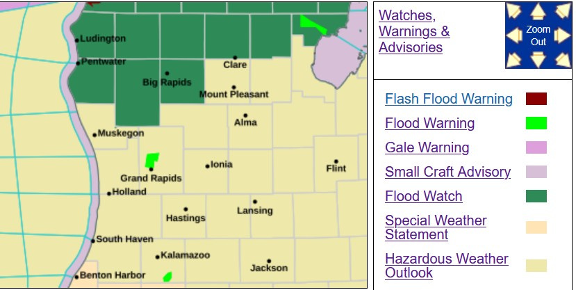
There’s a Flood Watch in effect for Oceana, Newaygo and Mecosta Counties to the north.
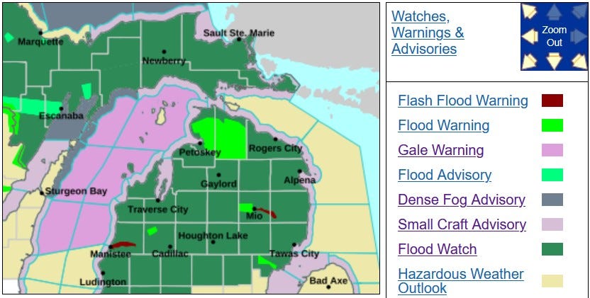
The Flood Watch covers all of northern Lower Michigan with a Flood Warning for most of Cheboygan and much of Emmet Counties. Here’s flooding in Cheboygan Co.
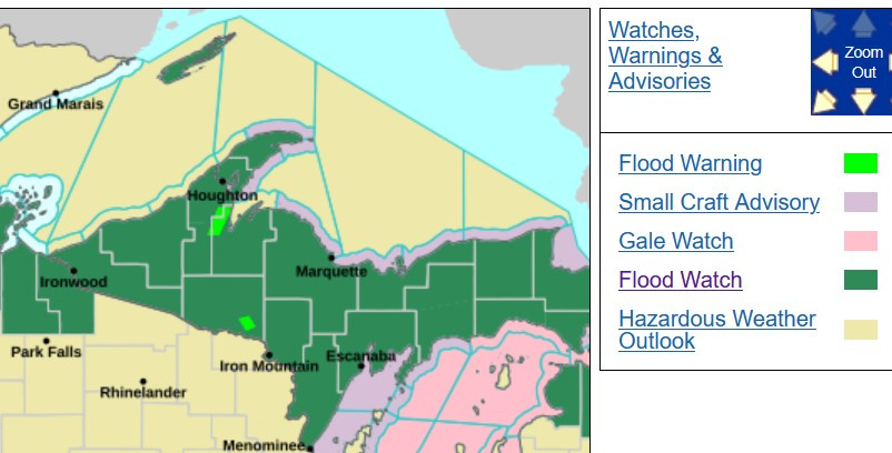
All of Upper Michigan is under a Flood Watch. At midnight, the Marquette Airport still had 33” of snow on the ground.
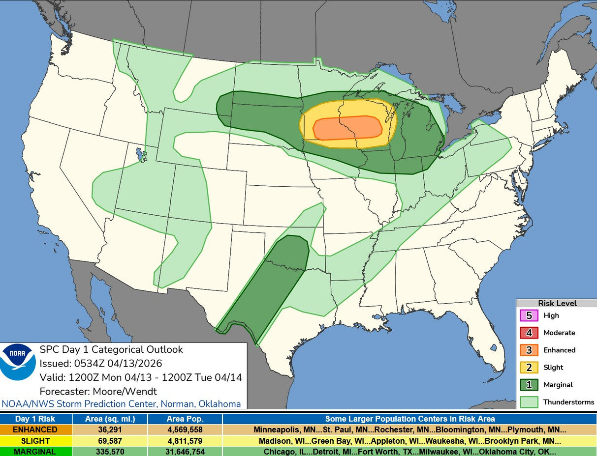
Here’s the Severe Weather Outlook from the Storm Prediction Center. Lower Michigan is in the dark green Marginal Risk Area. SPC says: “Severe thunderstorms are likely across the Upper Mississippi Valley and Great Lakes region with potential for large to very large hail, damaging wind, and tornadoes.”
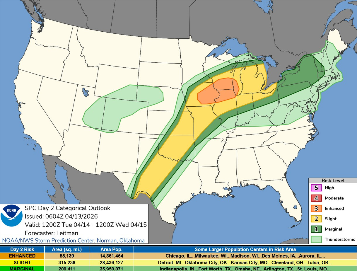
Tuesday PM, most of West Michigan is in the level 2 or Slight Risk Area (yellow on the map above) SPC says: “With time, and as the low-level jet increases during the evening, convection may consolidate/grow upscale into one or most bowing segments and progress eastward into Lower MI/IN/OH, posing a continued risk for hail and an increasing risk for damaging wind gusts.”
Winds will die down a little bit today. Peak gusts Sunday included 51 mph in Grand Rapids, 49 mph at Muskegon, 48 mph at Holland, 47 mph at Norton Shores and 46 mph at Battle Creek. I was at Manhattan Park in East Grand Rapids. I saw at least 3 kids/parents trying to get kites to stay in the air - lots of people in the park.
High temperatures Sunday included 82 in Detroit, 80 at Kalamazoo, Benton Harbor and Allegan, 79 in Grand Rapids, Battle Creek, Ionia, Marshall and Coldwater, 78 aet the Holland Airport, 73 in Fremont, 66 at Ludington and just 37 at Sault Ste. Marie.
Check out the snow in the Sierra Nevada Mountains of California. Flash flood in Saudi Arabia.
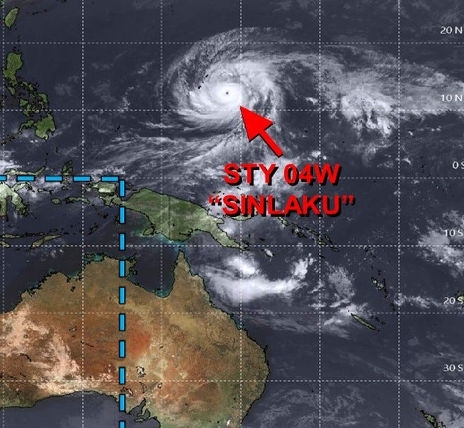
One final note. There is a very large hurricane with a well-developed eye in the western Pacific Ocean. It’s been given the name “Sinlaku” and it’s packing winds of 170 mph. The worst of the storm is missing Guam (but they do get wind and rain), but it looks like the island of Tinian in the Mariana Island took a direct hit. The island has just a few thousand people living on it. The storm will weaken as it moves to the north over open water.
Lots of chatter online about the Dam in Cheboygan. The Cheboygan County Sheriff's Office warned residents on Monday that the dam's water levels have reached the "READY" mark as rain continued to be in the forecast for the next few days and the National Weather Service declared a flood watch until 8 a.m., Wednesday, April 15. Under the "READY, SET, GO"safety system that the Michigan Department of Natural Resources is using to address the swelling waterway, the READY mark means water is 12 inches below the top of the dam, with levels rising 3 inches a day or more. That's when residents in the area should plan or pack in case an evacuation is ordered.