
Severe Storms Produce Tornadoes, Hail and Significant Wind Damage
Survey crews will be out to view the damage to see if it was tornadoes or thunderstorm winds

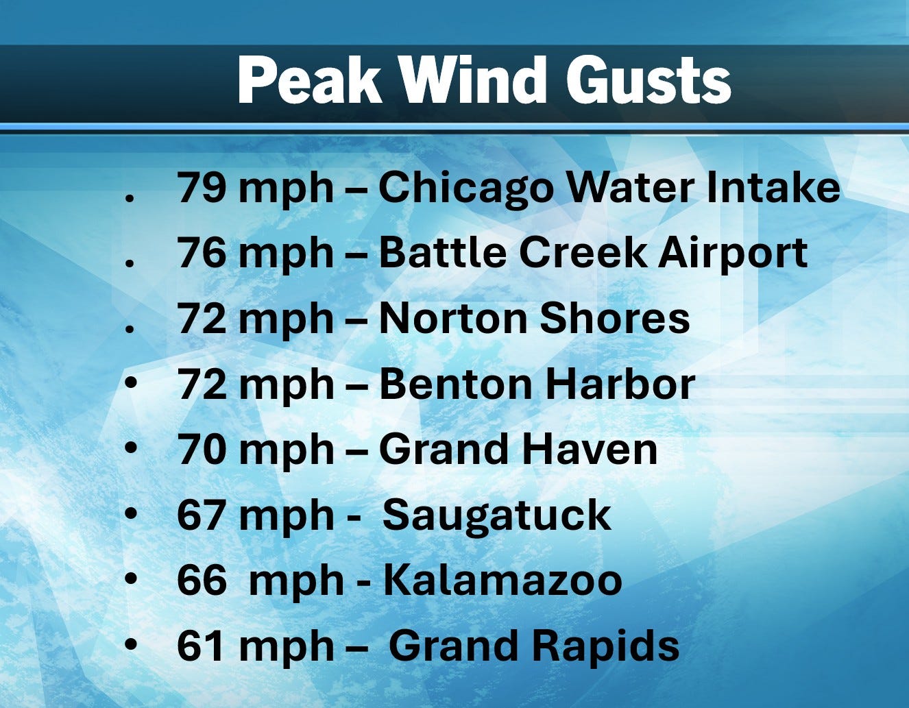
Here’s some peak wind gusts from the Thursday evening storms. At Battle Creek the wind hit 76 mph before the power went out, so it could have been stronger than that. Same thing happened at Milwaukee, where they got to 61 mph before a power outage.
There were general wind gusts of 40-80 mph across the area. There were also reports of hail and at least half a dozen places where small tornadoes may have touched down.
National Weather Service meteorologists will conduct damage surveys to determine if the damage was caused by a tornado or straight line thunderstorm winds. They view damage on site and then look at radar images. There were several places where you could see debris balls, an indication that ground level debris (much bigger than raindrops) was being lofted above ground by a tornado.
Here’s video of the Mayville WI tornado.
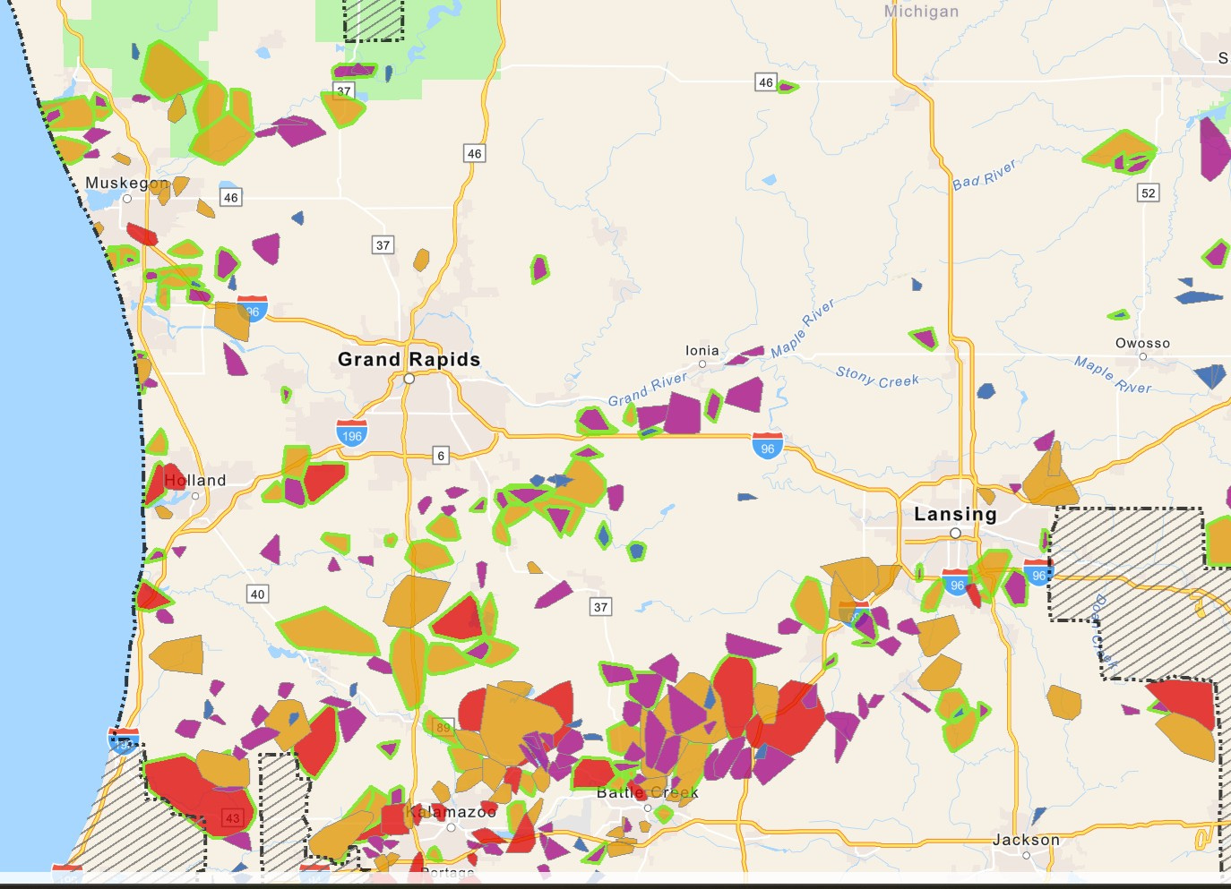
Here’s the Consumers Energy Power Outage Map as of 1:30 pm Friday. As of 1:30 pm, we have 234,434 customers without power in the state of Michigan, by far the most of any state (IN 60,888, IL 18,499). This includes 178,982 Consumers Energy customers.
The counties with the highest % of customers without power early Fri. PM are Van Buren (48%), Kalamazoo (37%), Calhoun (31%) and Barry (27%).
Another shower/storm is possible this evening/tonight with a Marginal to Slight (level 1-2) risk of additional severe weather.
It will be a breezy afternoon (Friday) and that may be a factor in restoring power in certain areas.
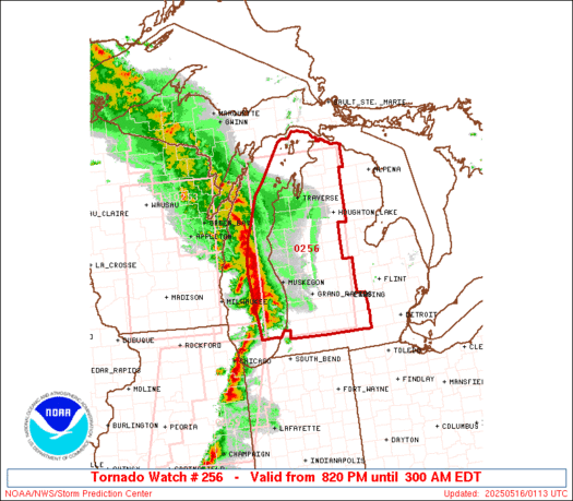
This was the tornado watch that was issued (outlined in red) and the rather solid line of storms that pushed across the Midwest and Western Great Lakes.
Sometimes the cooler air over Lake Michigan causes storms to weaken. That’ was not the case Thursday evening. This line of storms were truckin’ over Lake Michigan like it wasn’t there. A feed of warm, moist air was feeding into the storms. In the early evening, Gary, Indiana was showing a temperature of 91 and a dew point of 70 ahead of the storms.
http://billsteffen.com

Useful Links: The latest Severe Weather Outlook Maps from the Storm Prediction Center, current Tornado and Severe Thunderstorm Watches, current Meso-discussions, current weather observations in Michigan, Wisconsin, Illinois and Indiana, a Michigan weather map, a Wisconsin weather map, and the latest Grand Rapids National Weather Service discussion, WOOD TV8 radar, WOOD TV8 homepage (possible live coverage this evening) and the latest from meteorologist Bill Marino.
Check out the message above from Ace Hardware Handyman
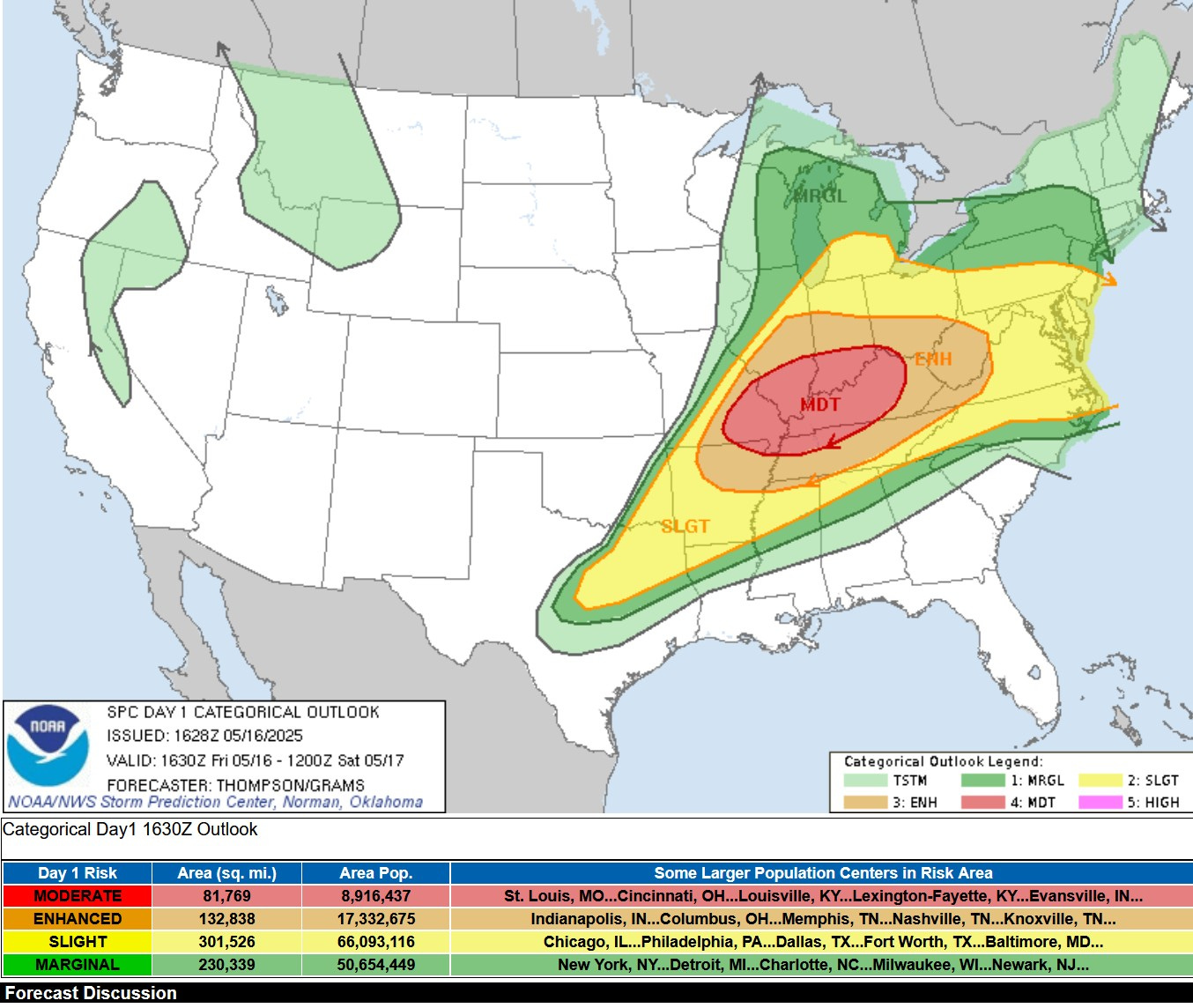
This afternoon/night (Friday) we’ll likely see another big severe weather day, with tornadoes, large hail and a long swath of significant wind damage from SE Missouri and northeast Arkansas to West Virginia and may all the way to the Atlantic Ocean.
Above is the Severe Weather Outlook Map for Friday PM/night. You can see that there is also a Marginal or Level 1 risk of a severe storm in Lower Michigan.
For Michigan, SPC says: “Favorable shear will support organized convection capable of isolated damaging gusts and hail.
I’ll update this thread again later today - so come back to the blog later today for the latest. If you’re inclined, you can hit the subscribe button below.