
No Big Storms, Near Average Temperatures
Also - hurricane hits Australia, Record Southwest Heat,

Happy Weekend. Partly sunny and relatively warm this Saturday, a chance of showers and a bit cooler on Sunday, dry Monday and Tuesday.
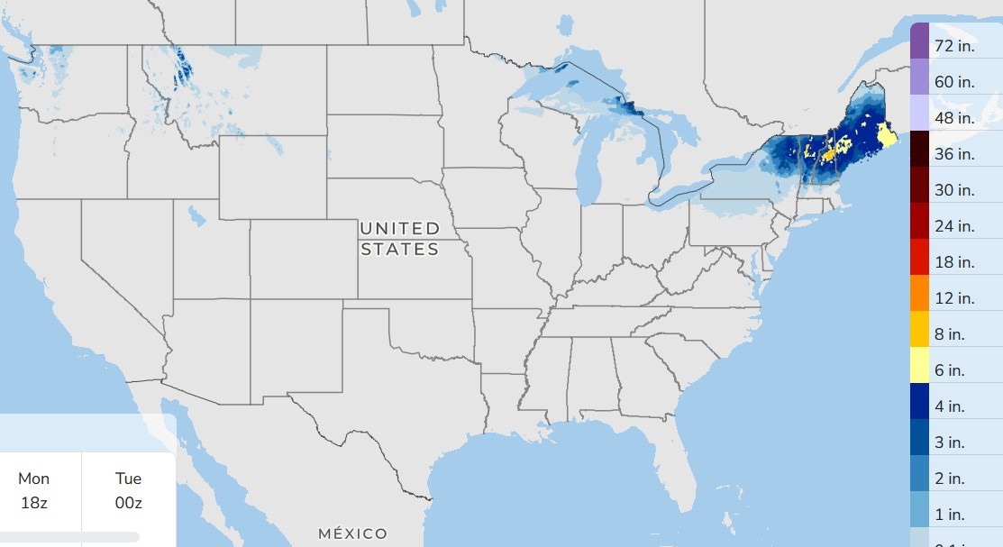
Here’s forecast snow in the U.S. through Monday. There will be an area of snow across northern New England. The yellow indicates 6” of new snow.
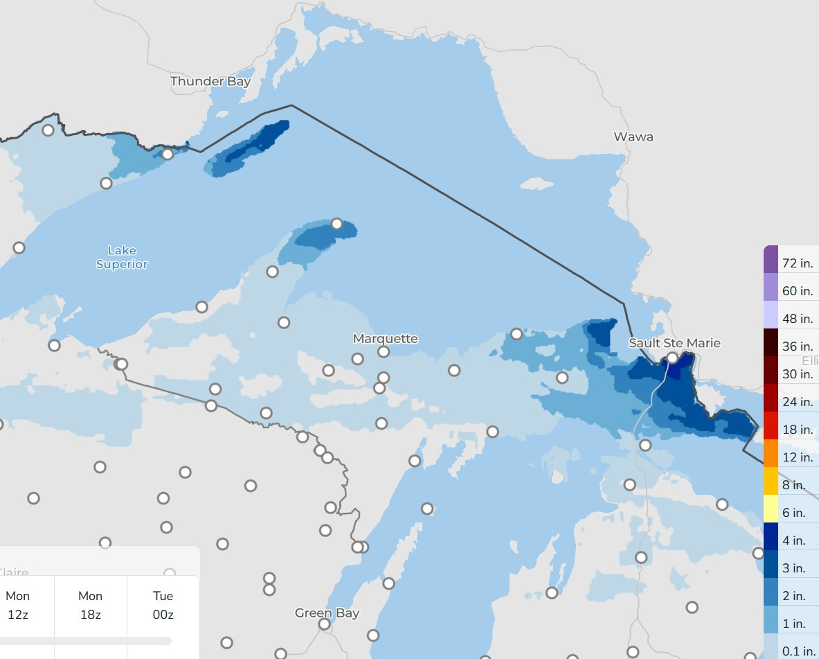
Here’s snowfall in Michigan…most of the U.P. and northern Lower Michigan gets a dusting or nothing at all. A band of snow moves from Isle Royale, across the Keweenaw Peninsula and over toward S. Ste. Marie. This looks like only 1-4”, not much by U.P. standards.
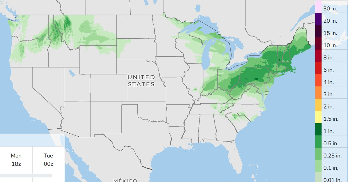
Here’s precipitation (rain, plus melted snow) for the next 3 days. There will be some showers in Lower Michigan Sunday (less than 1/4” - may even be less than 1/10th inch.
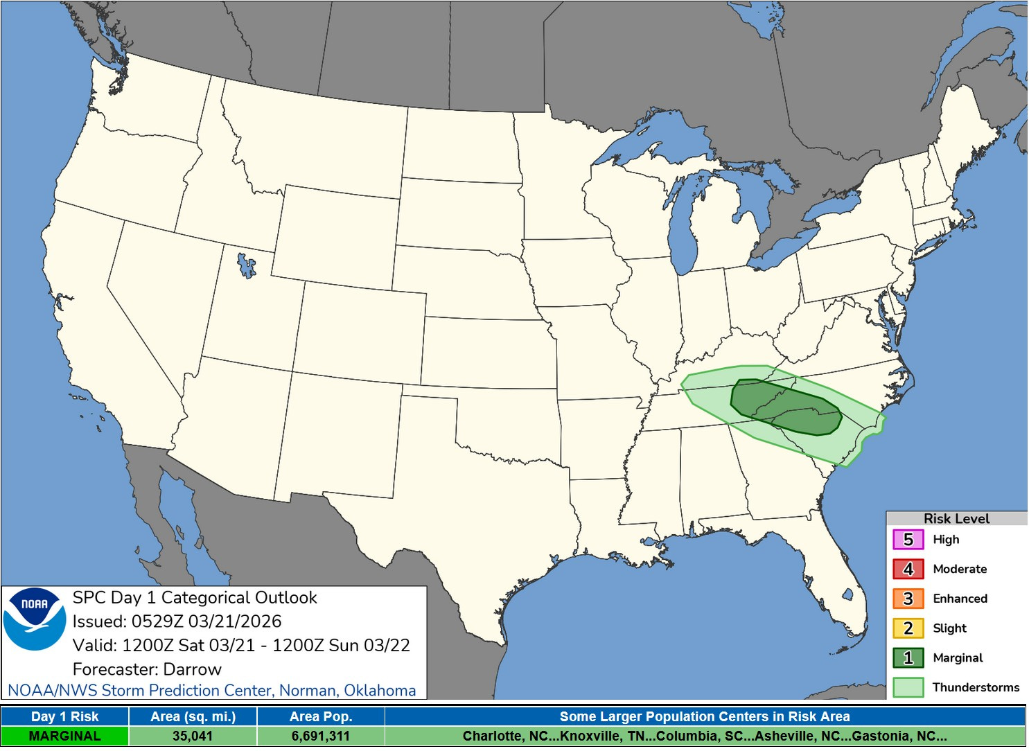
Here’s the Severe Weather Outlook for this Saturday PM/night. There is a level 1 Marginal Risk from eastern Tennessee into the West Carolinas…could be most mostly small hail in the Smoky Mountains.
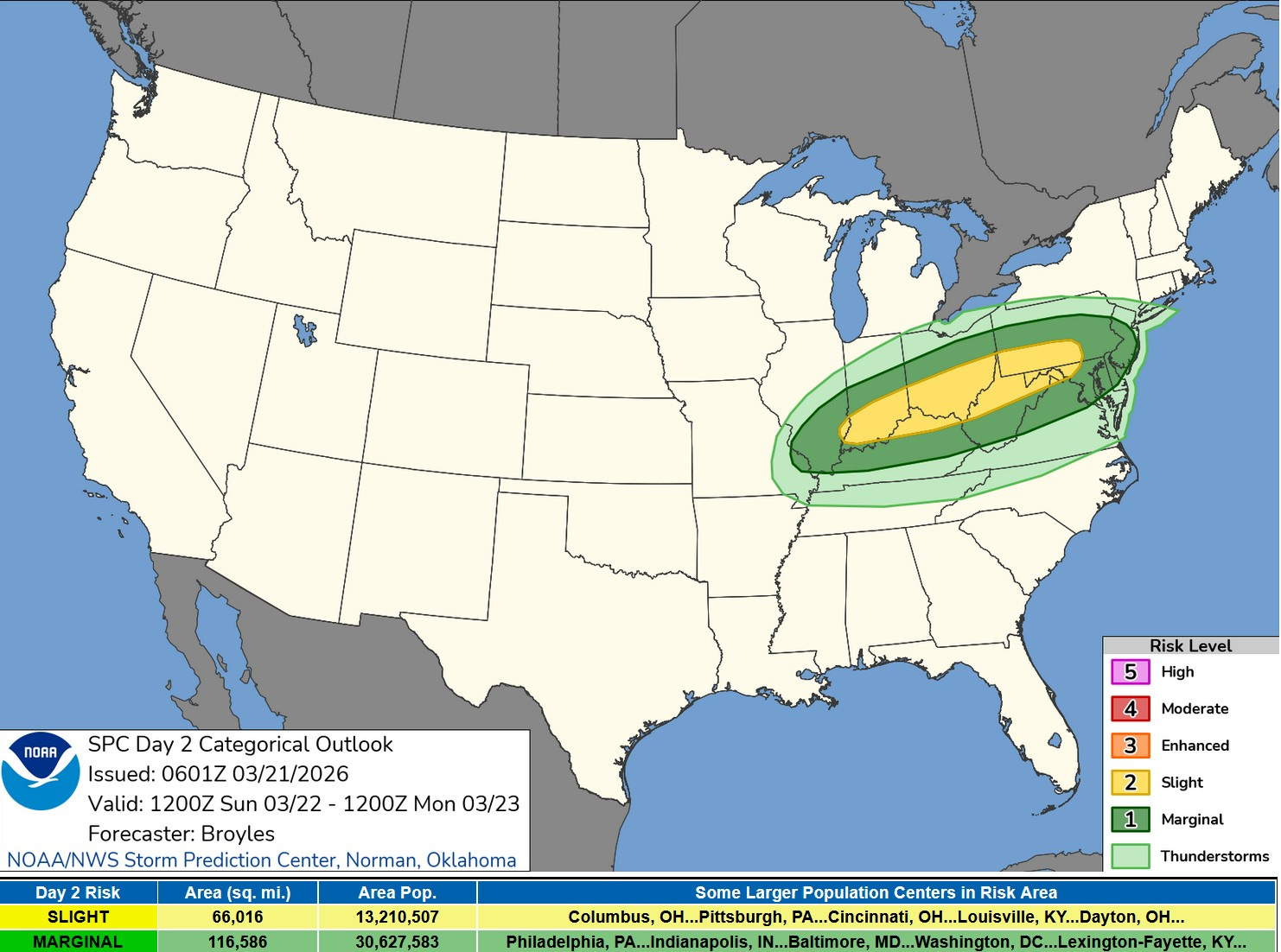
There’s a bigger area in the outlook for Sunday PM/Night, with a level 2 Slight Risk (in yellow on the map above) from southern Indiana to western Maryland and southwest Pennsylvania.
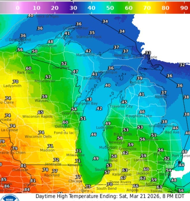
Here’s high temperatures. Quite a contrast - from low 30s up by Sault Ste. Marie to low-mid 80s in Iowa and western Illinois. Kansas city reached 90 degrees on Friday, so these temperatures could be a touch underdone. Note the 77 for Chicago and 70 at the Indiana border. Grand Rapids gets 62, but again, that may be touch underdone. Note it will be cooler near Lake Michigan…just 49 at the Ludington Airport (and probably 45 at the beach.
The wind coming off Lake Michigan can make a big difference in temperature. Friday morning, the temperature at the South Haven Lighthouse fell from 54 to 42 in one house when the wind shifted and started coming off the lake.
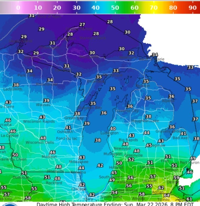
Here’s high temperatures for Sunday…a little cooler (especially in Chicago). We could still touch the low 50s in Grand Rapids, but just 36 in Traverse City and 35 in Gaylord
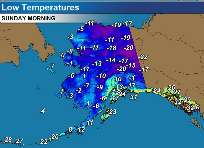
It’s cold in Alaska. Here’s low temperatures for Sunday AM. Friday AM, the town of Deadhorse reached -39F. The cold air is pretty much statewide, with the chill extending south into the Panhandle and the Aleutian Islands.
There’s a tropical cyclone (same as a hurricane) moving across northern Australia. Named “Narelle”, it will weaken to a tropical storm over land, then regain hurricane strength when it’s back over the open water off the northwest coast.
Also: They sure got a lot of snow in the U.P. The Grand River has fallen below flood stage at Comstock Park. Flooding in Hawaii. Wind gusts to 135 mph and up to 44” of rain in five days.
Some of this [weather] is so treacherous while ours is looking to become a bit milder. THNX
Thanks for the spring-like forecast, Bill. Finally, an opportunity to start some needed yard work.
Have a good weekend.