
Monday - Warmest Day of the Week
Not Much Rain This Week

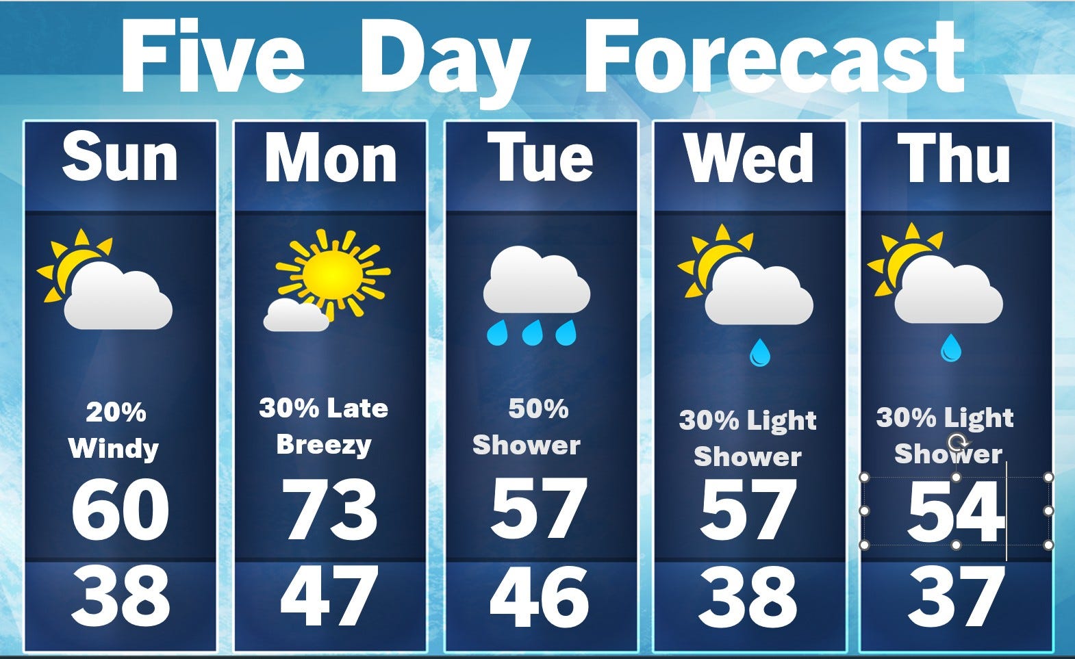
Sunday morning update: Let’s start by going through the forecast. Inland, today will be nearly 10 degrees warmer than Saturday. However, it’ll be on the windy side - southwest winds at 15-25 mph with gusts to around 30-35 mph. It’ll also be about 10 degrees cooler at Lake Michigan. The chance of a light shower/sprinkle is not 0%, but most areas will stay dry.
Monday will be the warmest day of the week, with highs inland in the low 70s. Once again it will be on the windy side (winds stay southwest). It’ll be a good 10 degrees cooler at Lake Michigan. A shower or isolated thunderstorm is possible Monday night.
Tuesday will be cooler with a chance of a shower (mainly early). Look for highs in the mid-upper 50s Tuesday, Wednesday and Thursday. Average high temperatures are now in the mid 60s. There will be a small chance of a light shower Wednesday and Thursday.
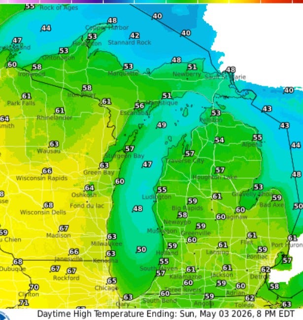
Here’s forecast high temperatures for this Sunday PM…low 60s inland and low-mid 50s at Lake Michigan. It’ll be in 50s in northern Lower Michigan and most of Upper Michigan. You can see the warmer air (highs near 70 this PM) out along the Mississippi River.
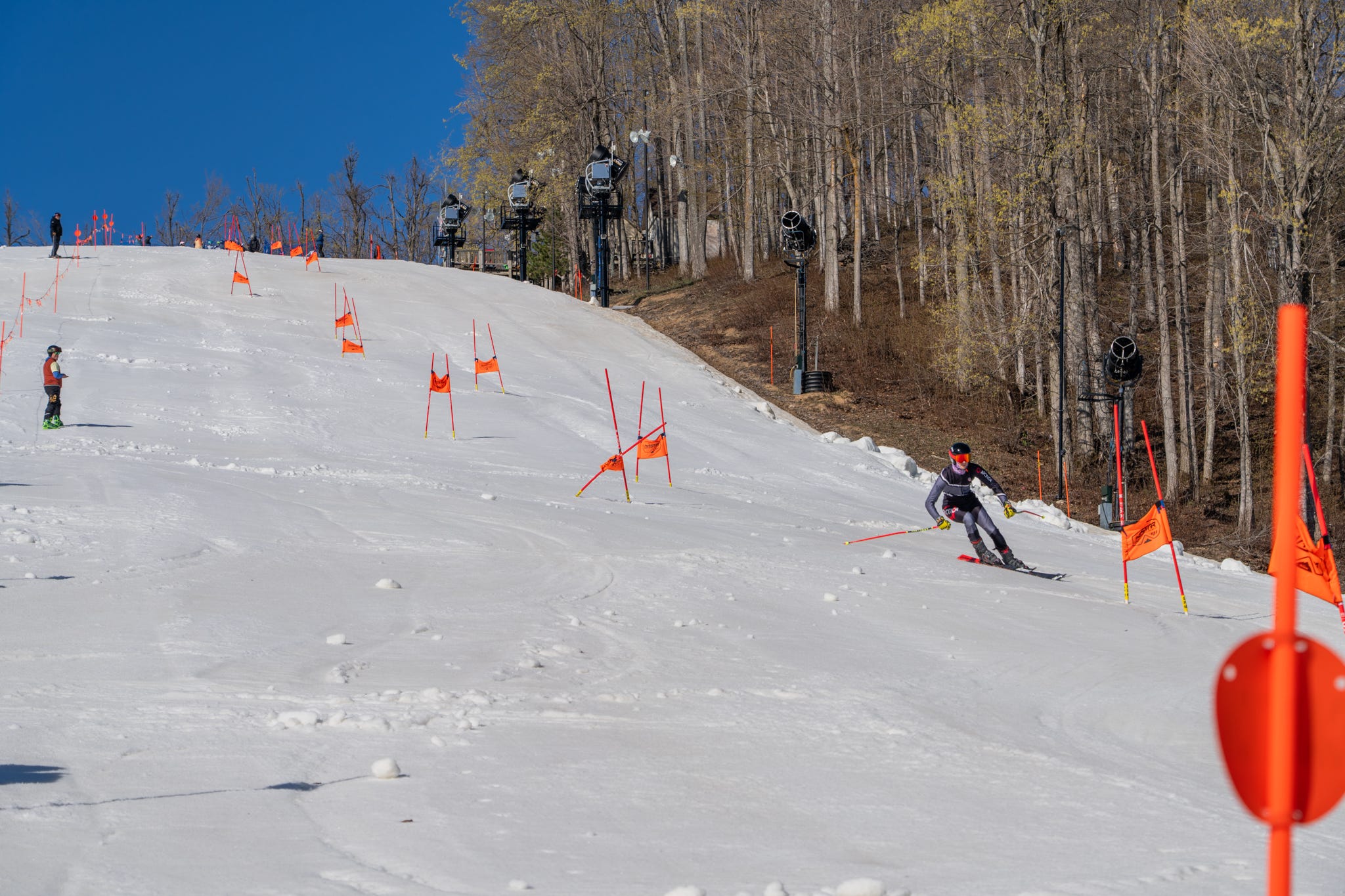
Did you know that you can go snow skiing in Michigan today - Sunday, May 3rd? This pic. is from the Boyne Mt. facebook page and they write:
Helloooooo Boyne Mountain! It's Kyler, with your snow report.
”We are open for weekend skiing Sunday from 9am-1pm with Victor Glacier.
The park crew is working to have a setup with some features at the bottom of the glacier for as long as we can. They're putting in work to keep the fun going.
Victor Glacier is about 10 feet deep, and still going strong. Weekend riding in May is looking good.
Victor Glacier: Michigan's Longest Season
Mount Bohemia is officially closed for the season, which means Victor remains the winner as the longest season in Michigan. We're not stopping until Mother Nature makes us.
And don't forget about the Boho Bash on Saturday, May 16, our late-season celebration to close out the winter in style.
This Week's Weather
The weather is looking more like normal spring this week, so temps are looking good at preserving more snow for riding this weekend.”
The U.P. and northern Lower Michigan did see a few flurries as the colder air came in. Herman is up to 366” of snow for the winter, with Mt. Bohemia right behind at 360”.
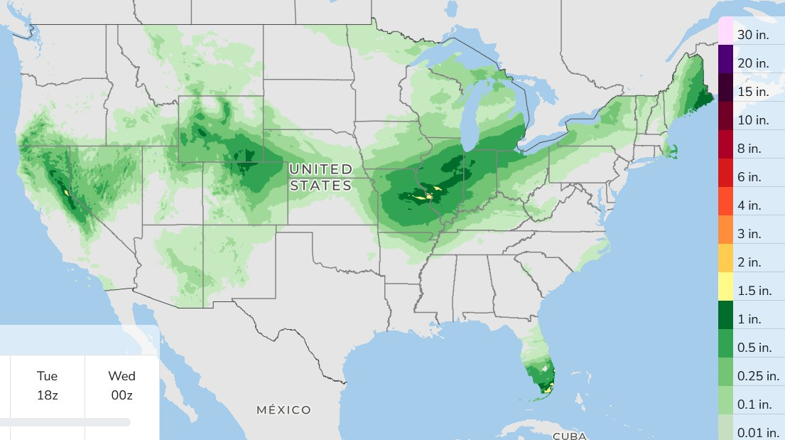
Here’s 3-day rainfall for the contiguous U.S. The best bet for showers in southern Lower Michigan will be Monday night into Tuesday AM.
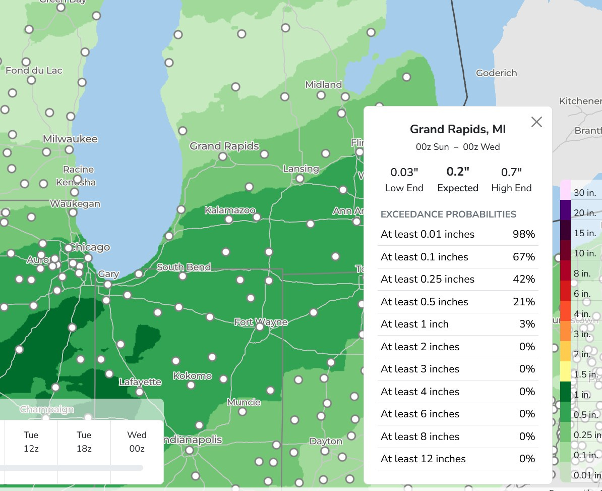
There may be a little more rain south and less rain to the north. The Query for Grand Rapids is less than 1/4” with a low end of just 0.03”. Around 1/2” is possible along and south of i-94. River levels will continue to fall in most areas.
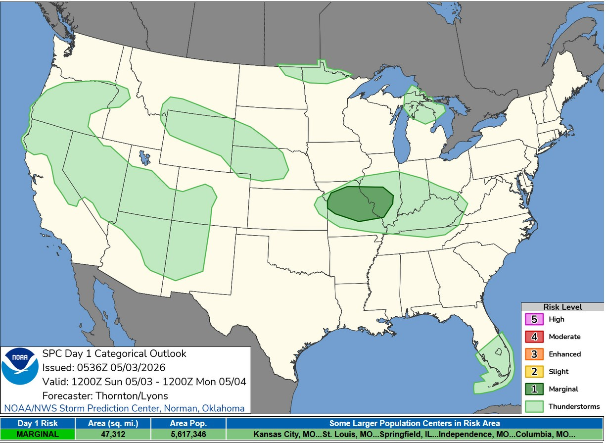
This is the Severe Weather Outlook for this Sunday. There’s only one Marginal Risk area from Missouri into Illinois, mainly for very isolated strong wind and hail. Tornadoes are unlikely. A non-severe thundershower is possible in eastern Upper Michigan and northern Lower Michigan.
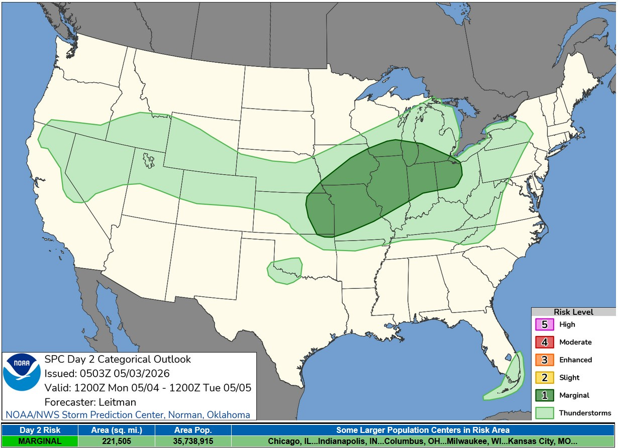
Here’s the Severe Weather Outlook for Monday/Monday night. There is a level 1 Marginal Risk from eastern Kansas to southern Lower Michigan. SPC says: “…strong storms are possible during the afternoon…near the surface front from eastern IA toward Lake Michigan. However, boundary layer moisture will likely be even more limited across this area, leading to weaker instability. Nevertheless, a well mixed boundary layer could support strong wind gusts.” So, to answer the question, will I see a severe storm at my residence Monday evening…probably no.
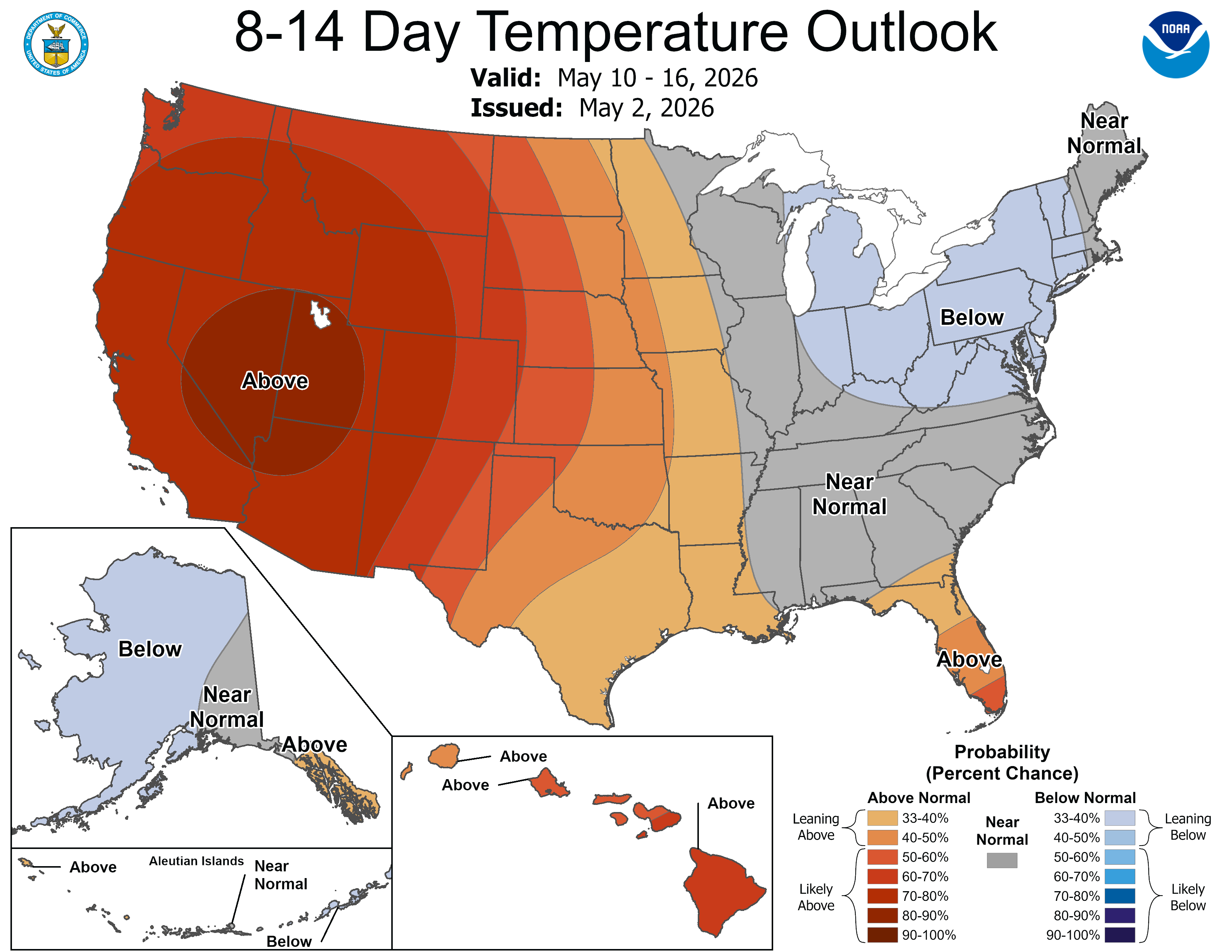
The latest 8-14 day temperature outlook has above average temperatures west of the Mississippi River with cooler than average over the Great Lakes and Northeast. This is for May 10-16. I think the overall cooler than average pattern that we are in now will end around the middle of the month and we’ll flip to warm, with lots of days in the 70s in the 2nd half of May (and maybe a few in the 80s).