
May Starts Cool and Dry
Warmer Pattern for the Coming Weekend.

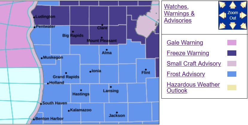
Here’s a look at the Frost Advisory (medium blue counties) and the Freeze Warning (darker blue counties) that’s in effect this morning. With clouds coming in many areas won’t see frost, but scattered areas will (low spots with sandy soil are most susceptible). This should be the last morning with a general Frost Advisory that covers all of West Michigan. I can’t rule out a frosty morning in places like Baldwin, Leota, Gaylord and Grayling.
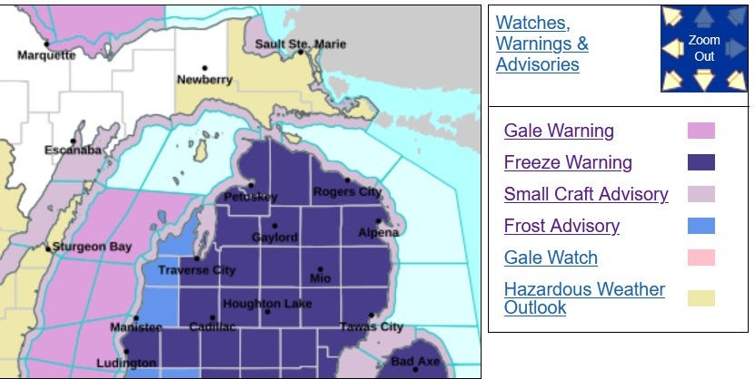
There is a Freeze Warning early this (Tue.) for most of Northern Lower Michigan. It’s a Frost Advisory for Manistee, Benzie and Leelanau Counties.
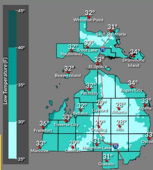
Here’s forecast low temperatures for this morning across northern Lower Michigan. Inland areas may rich the upper 20s, while lakeshore areas may stay a degree or two above freezing.
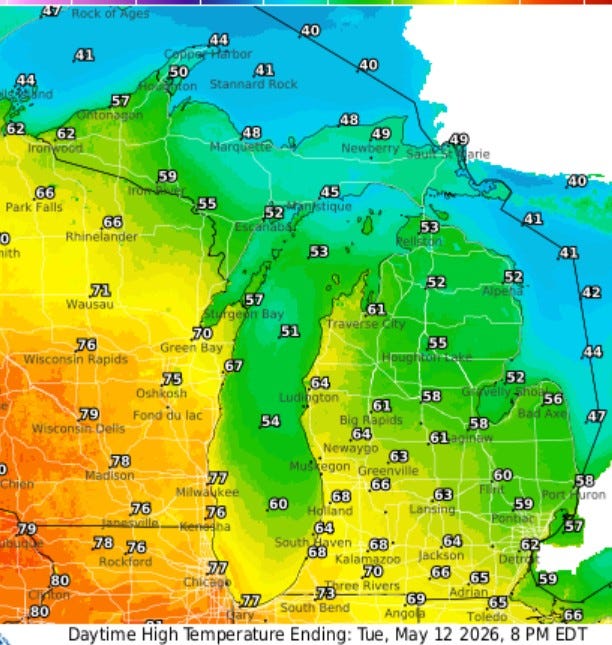
We should be a few degrees warmer today. High temperatures will generally be in the mid-upper 60s. It’ll be in the low-mid 70s at the Indiana border and near 60 along the lakeshore north of Muskegon. It’ll hit 80 out along the Mississippi River, but once again the cool air will move in and we’ll be stuck in the low-mid 50s on Wednesday.
Since April 29 (13 days), the temperature has been 6.7 degrees cooler than average and since April 30 (12 days), Grand Rapids has had just 0.03” of rain.
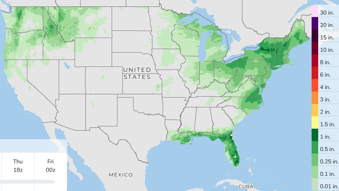
Here’s forecast 3-day rainfall totals. First, some welcome rain for Florida. They’ve been fighting wildfires. Fortunately, the biggest one in the Everglades is more than 50% contained.
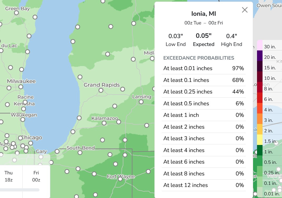
Here’s rainfall (mainly today/this evening) for West Michigan. Everyone gets a little rain. I did a query on Ionia, where 0.05 is expected…though the high end is 0.4”, so generally less than 1/10th inch in the light green area, with isolated totals up to near half an inch. The darker green is 1/4 to 1/2”.
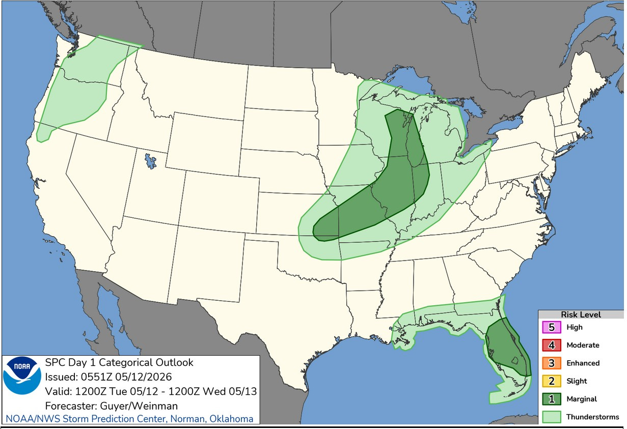
Here’s the Severe Weather Outlook Map for this Tuesday. There’s a Marginal Risk (in dark green on the map above) for eastern Wisconsin, Lake Michigan and a small part of southwest Lower Michigan. That area extends southwest to southeast Kansas. There’s also a Marginal Risk Area in the Florida Peninsula.
There could be an isolated strong wind gust with any storms the develop. Yesterday (Mon.), there were only 8 severe weather reports, mainly isolated trees and wires down in the eastern Carolina. One semi was blown over at Forestbrook, South Carolina.
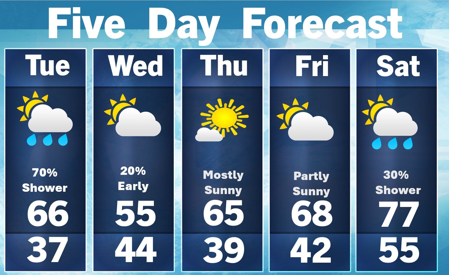
Here’s a 5-day forecast. A touch warmer today with a 70% chance of a shower or thunderstorm. It’ll become breezy with a south wind at 15-20 mph. The coolest place will be from Muskegon north along the lake, where the south wind comes off the water. The water temperatures at Holland St. Park is 52 and it’s 58 at Reeds Lake (inland).
Wednesday will feel more like early April than mid-May with a brisk northwest wind. Any leftover showers will clear out early. Thursday looks nice, lots of sunshine…mid 60s…a touch cooler near the lake. Thursday should be an OK day. We’ll head up into the 70s (inland) over the weekend with just a small chance of a shower or storm on Saturday.
Have a great day!
Thanks Bill for all your insight on the upcoming weather.