
Marginal Risk of Severe Weather
Best bet for a stronger storm will be south of Grand Rapids this evening

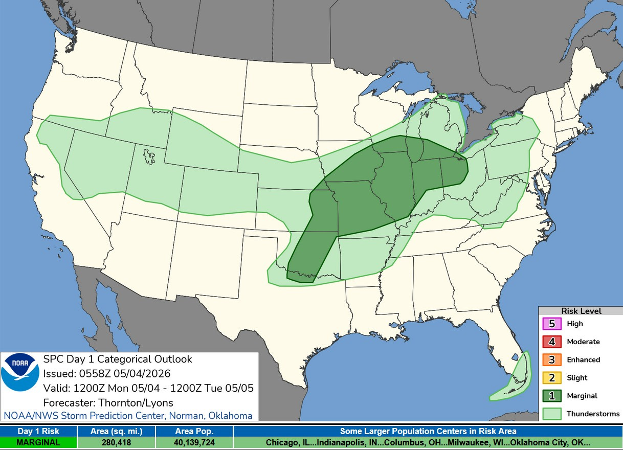
Areas along and south of I-96 (generally south of a line from Montague to Detroit) will have a Marginal Risk (level 1) of a severe thunderstorm this evening. The Storm Prediction Center says: “Lower Great Lakes Vicinity...Scattered thunderstorm development will continue further north into the Great Lakes region along the cold front. Moisture becomes more limited with northern extent which may limit the severe threat. However, strong flow aloft and steep lapse rates may still support downward mixing and swaths of strong to severe wind.”
This looks like the only chance we’ll have for severe weather this week.
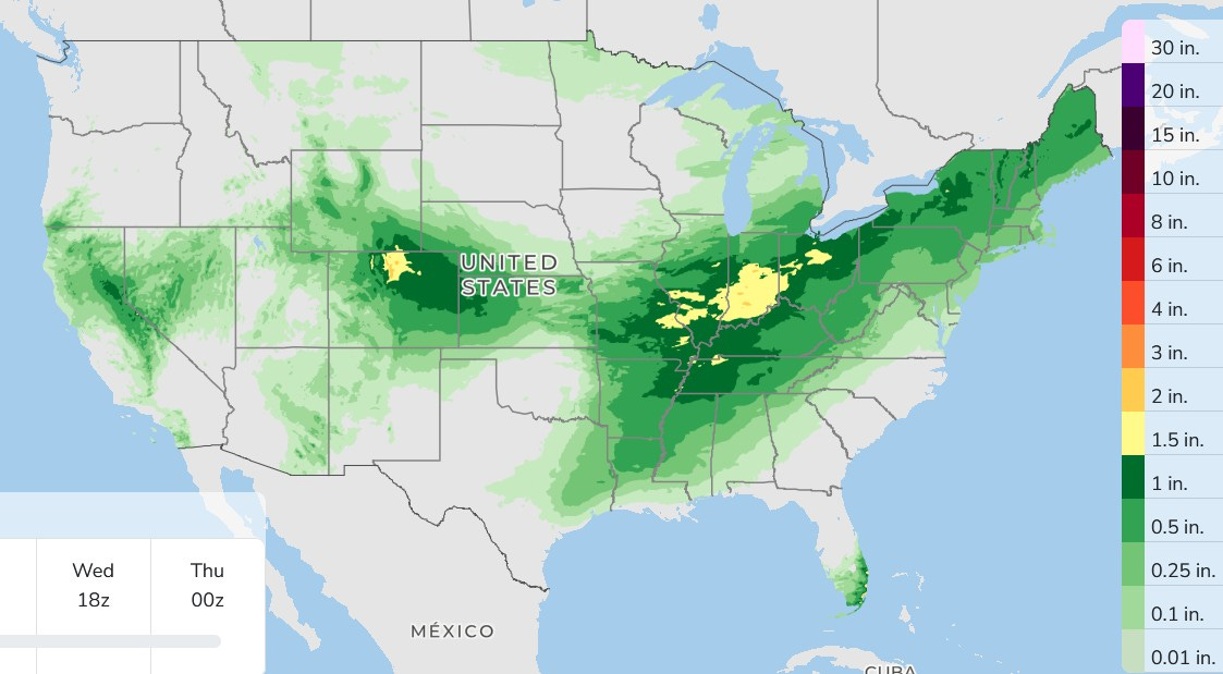
Here’s forecast rainfall over the next 3 days combined. Lots of rain down in Indiana…more rain for parts of the Southwest.
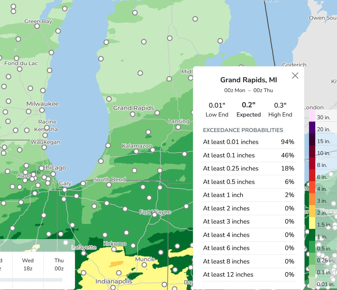
Here’s a closer view. Our rain will come this evening/tonight. We expect a touch under a quarter inch north of Grand Rapids and about half an inch south of I-94.
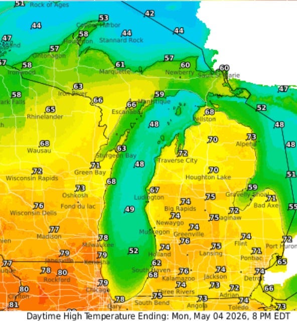
Today will be the warmest day of the week, with high temperatures inland reaching the mid 70s. It’ll be 10 degrees cooler near Lake Michigan (South Haven gets a high of 62. It’ll be another breezy day. Peak winds Sunday included 50 mph at the Ford Airport in Grand Rapids, 45 mph in Holland, 42 mph in East Gr. Rapids and 41 mph at Pentwater and Ionia.
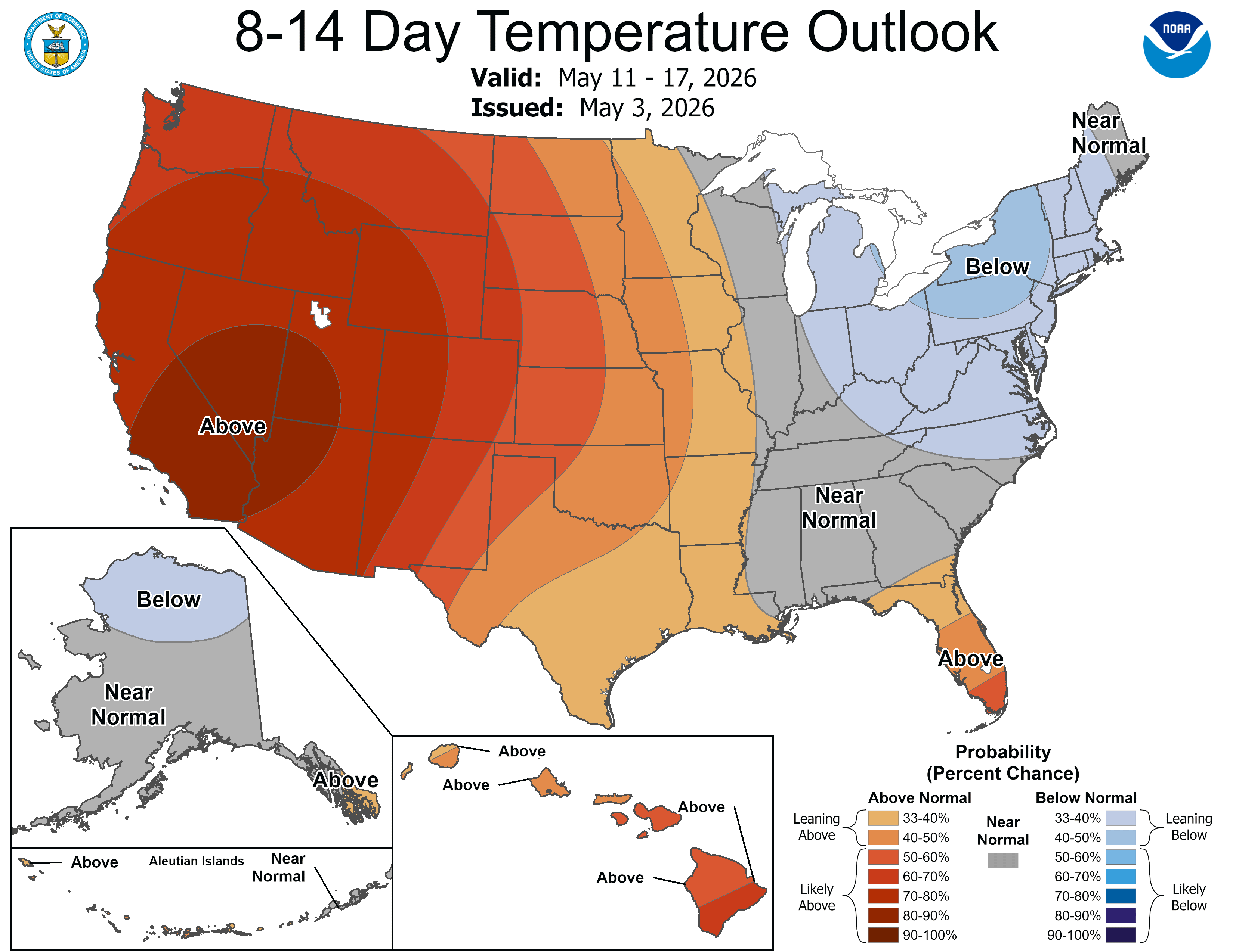
The latest 8-14 Day Outlook calls for a continuation of our cool weather pattern into the middle of the month. I don’t see a general frost/freeze at this point, but with a cool trough hanging around the Great Lakes, we can expect some cool nights if and when we clear out at night.
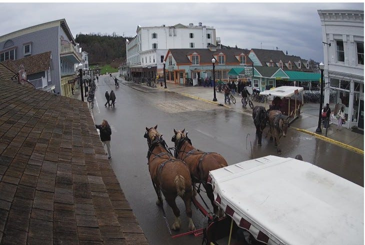
This was Mackinac Island at midday Sunday. The island is getting ready for the tourists. Note the horses. They had a light shower, which dampened Lake Shore Drive. The temperature was a cool 39°. The warmest temperature so far this year on the island has been 61°. They have had only 10 days since Nov. 4 when the temperature has climbed above 50°. (pic. from Horn’s Bar webcam).
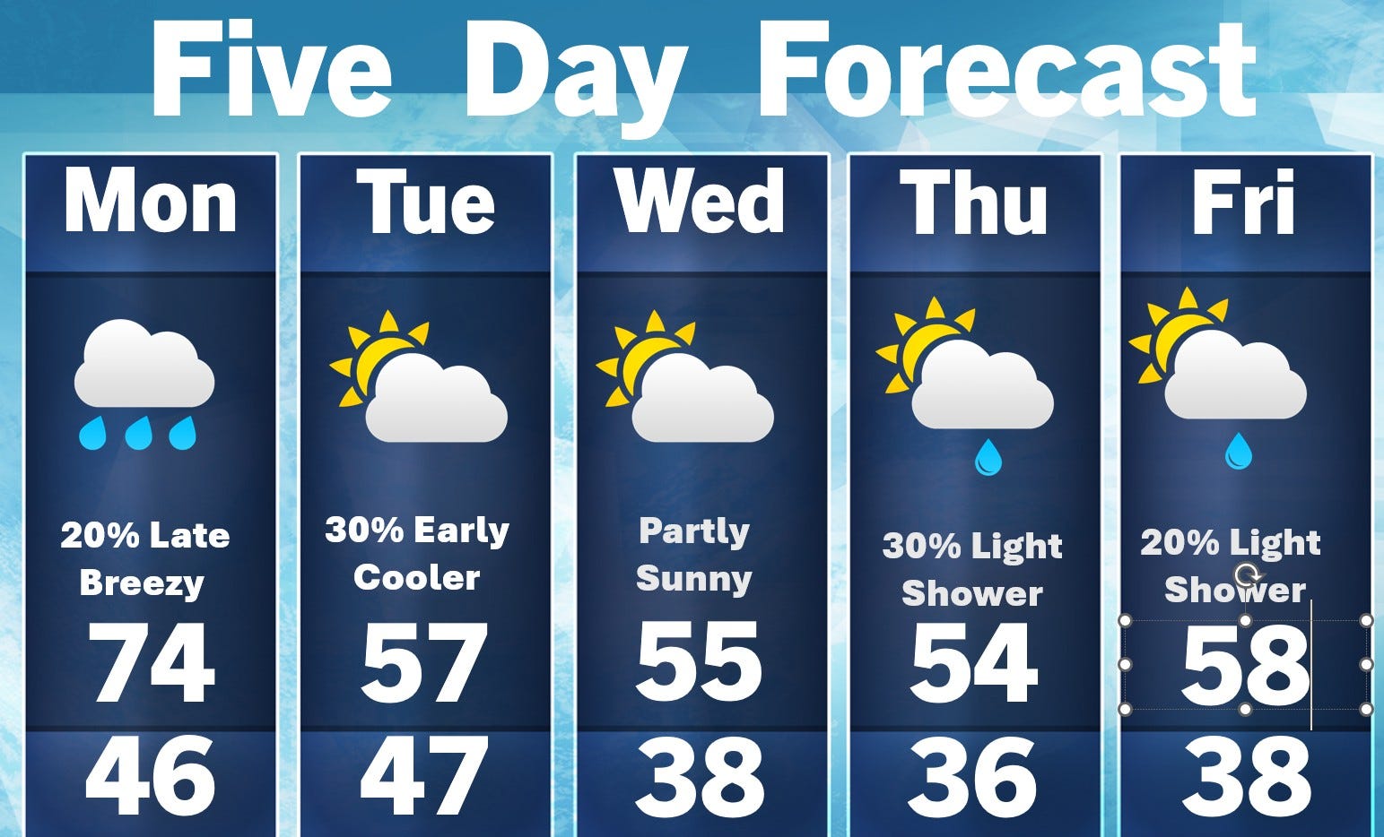
Today is the one warm day. We’re back in the 50s tomorrow. We’ll continue Small Craft Advisories for Lake Michigan today. Winds will be southwest at 15-25 mph with gust in the 30-35 range.
Thanks Bill for all the good information.