
Lots of Snow in Northern Michigan
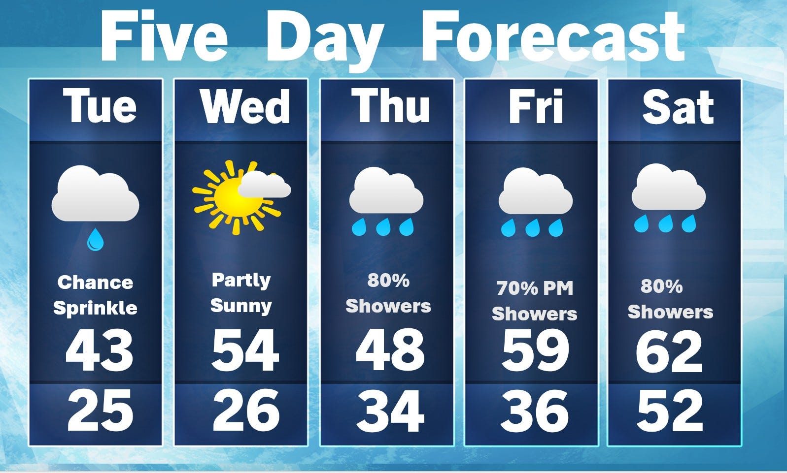
Week-Long Warm Spell on the Way.

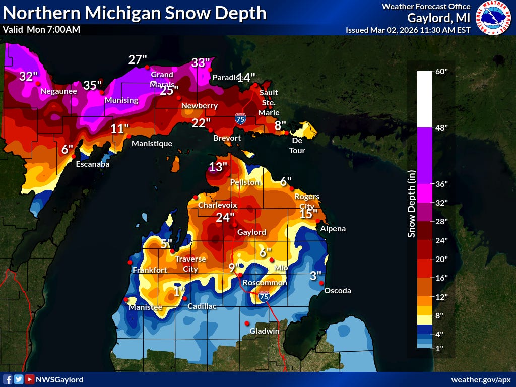
While the snow has melted (except for the piles) in southern Lower Michigan, there’s still a lot of snow in northern Lower Michigan. Here’s the Gaylord NWS snow depth map for Monday, March 2. The snow depth is the number to the upper left of each city. Munising had 35” on the ground and the Marquette Airport had 39” on the ground. The greatest snow cover I could find was at the town of Herman, west of Marquette with 49” on the ground (that’s over 4 feet!).
Other snow depths: 19” Harbor Springs, 13” Alpena and Charlevoix, 2” at Lake City and Houghton Lake.
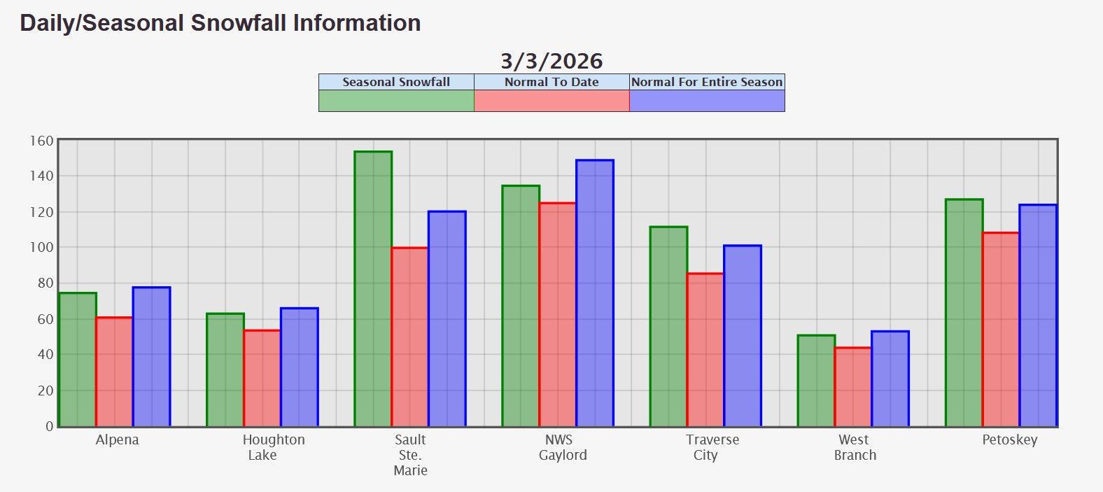
Here’s season snowfall for this winter (green bar), compared to average snowfall-to-date (red bar) and average season snowfall (blue bar).
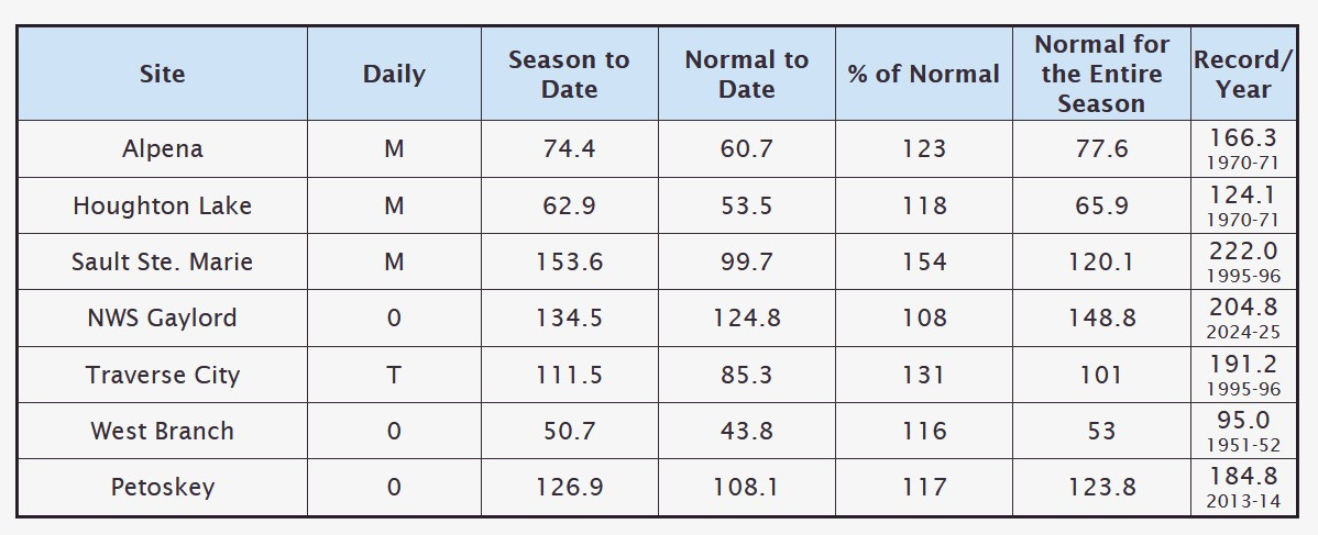
Here’s season snowfall for this winter, compared to average snowfall-to-date, the percent of average-to-date and normal of the entire season. Note that S. Ste. Marie is already 33.5” above their average season snowfall total.
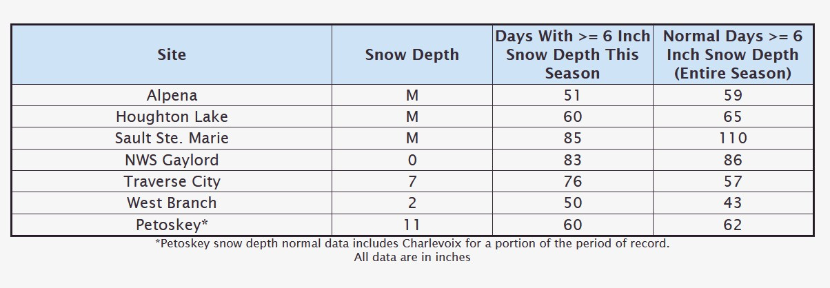
Here’s some snow depths (Gaylord does have snow on the ground). Traverse City has had 19 more days with 6” or more of snow on the ground than in an average winter.
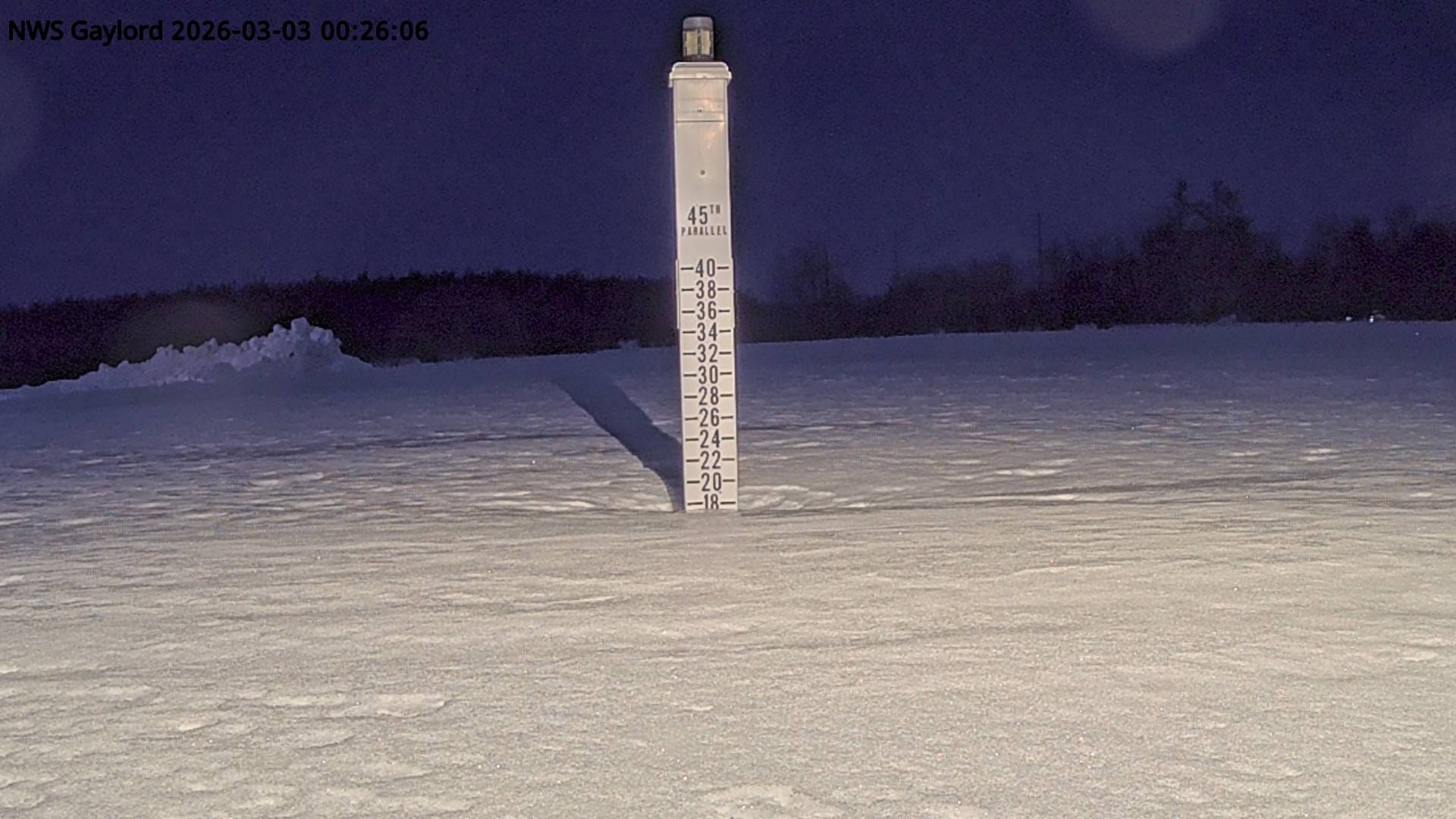
This is the Gaylord NWS snow stick…showing nearly 18” of snow on the ground early Tuesday morning
.
While an extended warm spell in on the way for the Great Lakes into the weekend, it looks like the cool air will return during the 2nd week of March.
With the warmer air pushing northward from the Gulf, look for a chance of thunderstorms (the storms will mostly be south of I-94). There could be some severe weather in the southern Plains and Ohio River Valley.
Also: Sunset on Mackinac Island. Remembering the Great Blizzard of March 1966. Landslide in Peru.
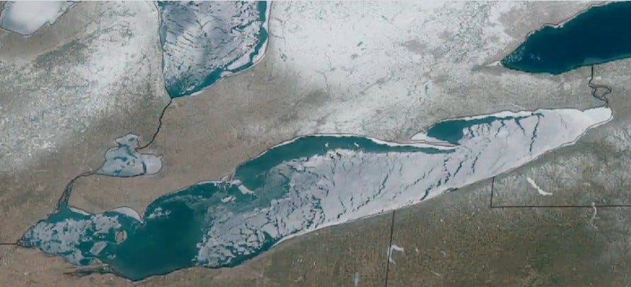
Here’s current ice cover on Lake Erie. Erie is the shallowest of the Great Lakes and often has the highest percent of ice cover in the winter, despite the fact that Lake Erie is the Great Lake that is farthest south.
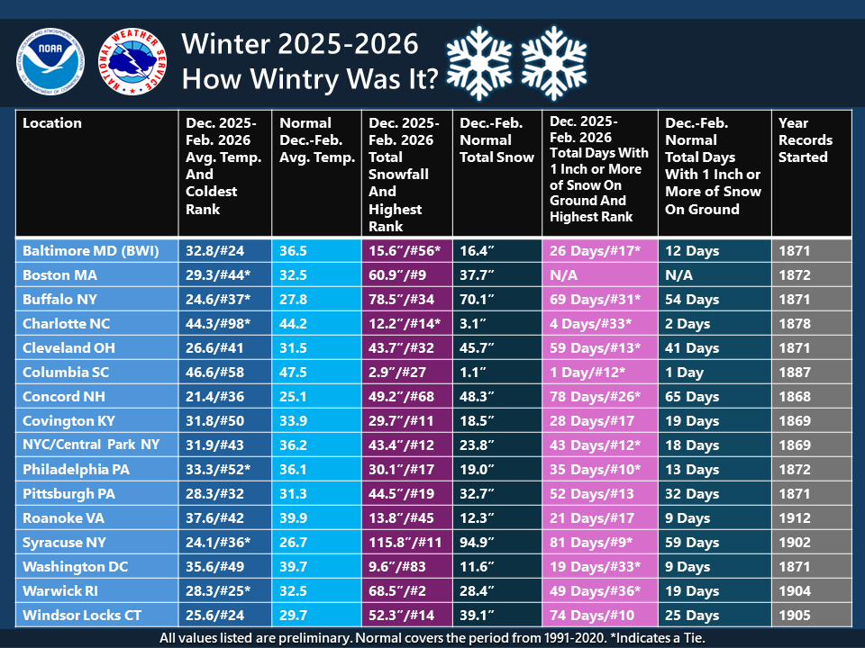
It was generally a colder and snowier winter in the eastern U.S.
Thanks, Bill!
Thanks! I prefer reading vs watching a video, so I liked this one very much.