
Friday 4 17 Was a Big Severe Weather Day
790 Reports of Severe Weather in the Contiguous U.S. - the most of any day so far in 2026

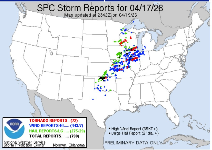
The map above from the Storm Prediction Center shows where severe thunderstorms hit Friday/Friday night (4/17/26). There’s a red dot plotted where there was a tornado reported, a blue dot for a severe wind report and a green dot for a severe weather report (1” in diameter or greater).
There were 72 reports of tornadoes, 443 reports of wind damage (7 reports of winds over 75 mph) and 275 reports of severe hail (with 29 reports of hail 2” in diameter or greater). That’s a total of 790 severe reports, the most severe weather reports of any day in 2026 so far. In fact, there was only one day last year (5/16/25) that exceeded 745 severe reports in a single day.
The NWS issued 311 Severe Thunderstorm Warnings Friday/Friday night and 150 tornado warnings.
Keep in mind that the final tornado count may be a bit lower, as duplicate reports of the same tornado are eliminated. I only found one tornado injury, that was in Saratoga, Iowa.
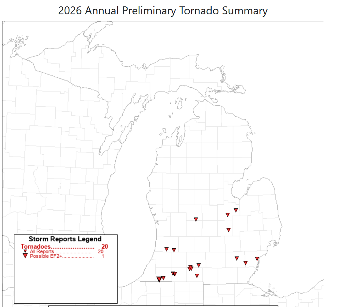
According to SPC, Michigan has recorded 20 tornadoes so far in 2026. That’s already more than the annual average (16). All of the tornadoes have been south of a line from Grand Haven to Saginaw. There was one possible EF2, but the rest were all EF0 or EF1 (relatively weak tornadoes).
Lightning caused a significant fire at the York Creek Apartments in Comstock Park Friday night (4/17). I live about a mile away and I jumped when I saw the bright flash and heard the very loud thunder that followed a few seconds after the flash.
It looked like every acre of southwest Lower Michigan had a thunderstorm Friday evening/night. The gust front, usually on the leading edge of a thunderstorm, passed through with a peak gust of around 35-40 mph.
Rainfall in Grand Rapids has totaled 11.92” since March 1. That’s 7.19” above average or 2 1/2 times average rainfall (252%). The period from Jan. 1 - April 18 has been the wettest ever for that 108-day period
This week (April 19-25) should be mostly dry - giving flood waters a chance to recede. The best chance of rain isn’t until Thursday night into Friday.
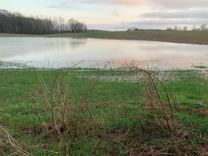
This lake is in the soybean field just south of the Alpine Athletic Field. Usually, this lake isn’t there, but when there is a heavy rain or rapid snowmelt in spring, a temporary lake forms.
I’ve been walking here for years and this pic. (taken Thursday 4 16 26) is the biggest I have ever seen it. I’d say it covered more than an acre and was probably 2 feet deep in the middle. It’s become the home for numerous ducks and geese. This is the largest of several temporary ponds in the fields south and east of the athletic field. Creeks in the area were bankfull.
Hey Bill! Will all this rain and flooding lead to a rise in the Great Lakes water level? Wondering how much our flooding will raise it.
hopefully it doesn't advance east for Saturday? Not sure how much more MI can take!!