
Narrow Line of Showers/T-Showers Moving Through
Dry weather returns for tonight, tomorrow and Thursday

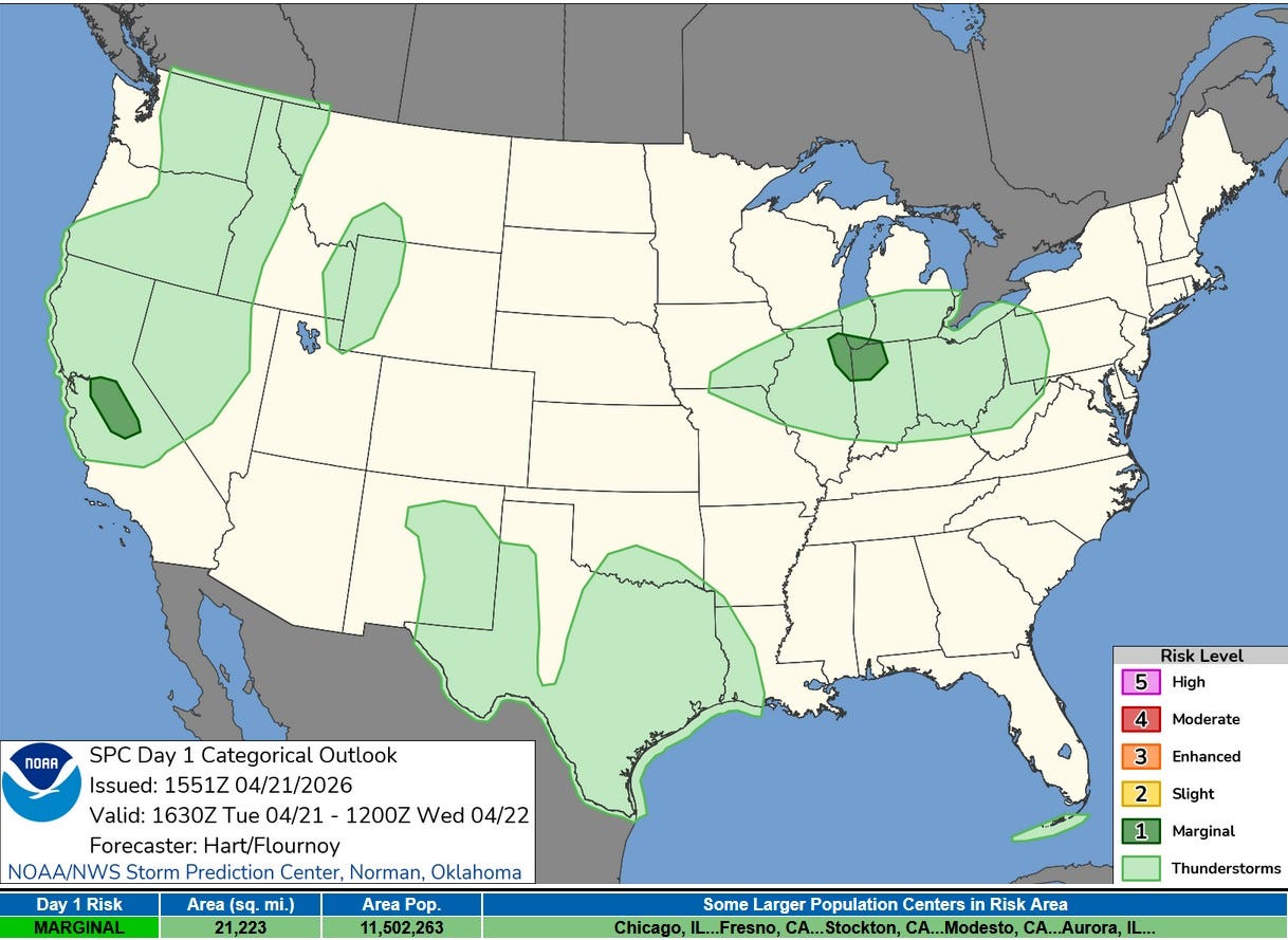
This is the Severe Weather Outlook Map for this (Tue.) afternoon/evening from the Storm Prediction Center. Southern Lower Michigan is in the light green General Thunderstorm Outlook. There is a small level 1 or Marginal Risk for NE Illinois and NW Indiana.
They say: “Visible satellite and radar imagery show a line of high-based showers and thunderstorms developing ahead of the trough over southern WI. As these storms track into northern IL/IN, continued heating/weak destabilization will increase the risk of gusty/locally damaging wind gusts and small hail in the strongest cores this afternoon.”
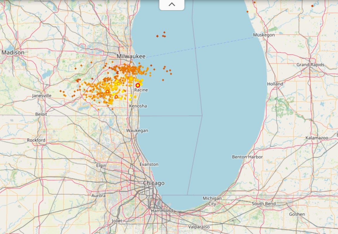
Here's lightning data as of around 1:30 pm...virtually none in Michigan and a lot south of Milwaukee. The storms are moving NW to SE, so the best chance of storms will be in NE. Illinois, NW Indiana and the southwest corner of Lower Michigan down toward Berrien County.
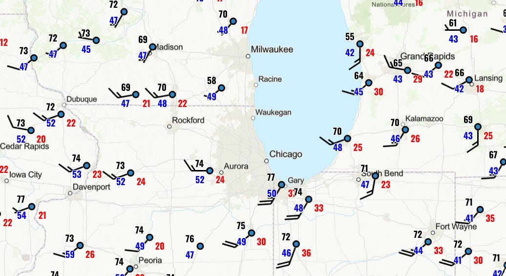
Here’s a plotted weather map from 2 pm today (Tue.). The black number to the upper left in each station plot is the temperature. In Grand Rapids, it was 65. The number in the lower left of each station plot is the dewpoint, a measure of the amount of moisture in the air. In Grand Rapids that was 43. The number in red in the lower right of each station plot is the peak gust of wind in the last hour. In Grand Rapids, that was 29.
Note how temperatures and dewpoints are higher across the lake in Illinois and northwest Indiana. Grand Rapids has a dewpoint of 43, while Gary, Indiana is 50. Grand Rapids has a temperature of 65, while the Chicago area has temperatures in the mid 70s. So, that’s why the Storm Prediction Center has a Marginal Risk of a severe storm in northeast IL and northwest IN and not here in Grand Rapids.
Bottom line…The showers and storms would be along the trough, so if you do get a shower or storm, it won’t last very long. There’s also a little better chance of a shower or storm south of I-94 than there is up along US 10 (Ludington to Reed City to Bay City).
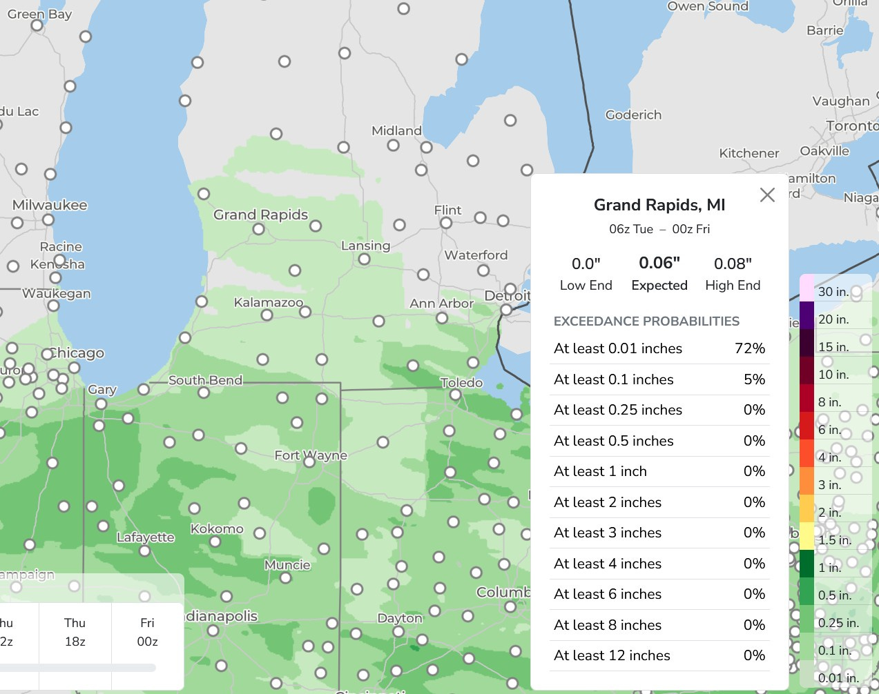
Here’s the 66-hour rainfall forecast. The light green color is for 1/10th of an inch of rain or less. I queried Grand Rapids and it gives us just 0.06” with a Low End of nothing. Rainfall may be a touch higher toward in the Indiana border in the evening and IL, IN and OH could see a shower develop Wed. PM.
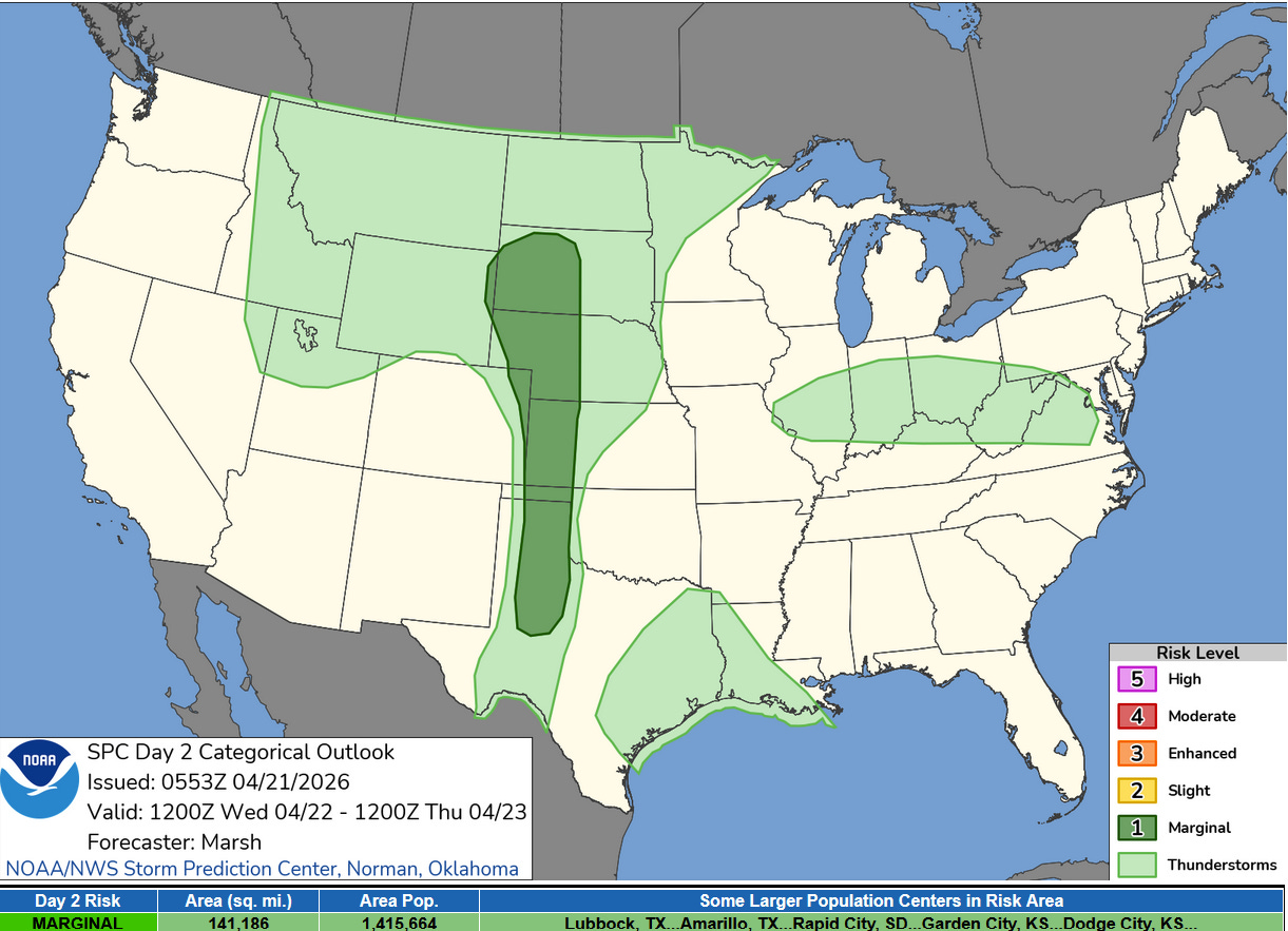
Here’s the Severe Weather Outlook Area for Wednesday. Michigan is not in it…it should be a dry day statewide. The trough I mentioned earlier will sink south, giving a chance of an isolated shower or storm from central Illinois to northern Virginia.
There is a level 1 Marginal Outlook in the Plains from South Dakota to Texas. There could be isolated storms with hail and strong winds there. The High Plains had a very dry winter, so they could use any rain they get on Wednesday.
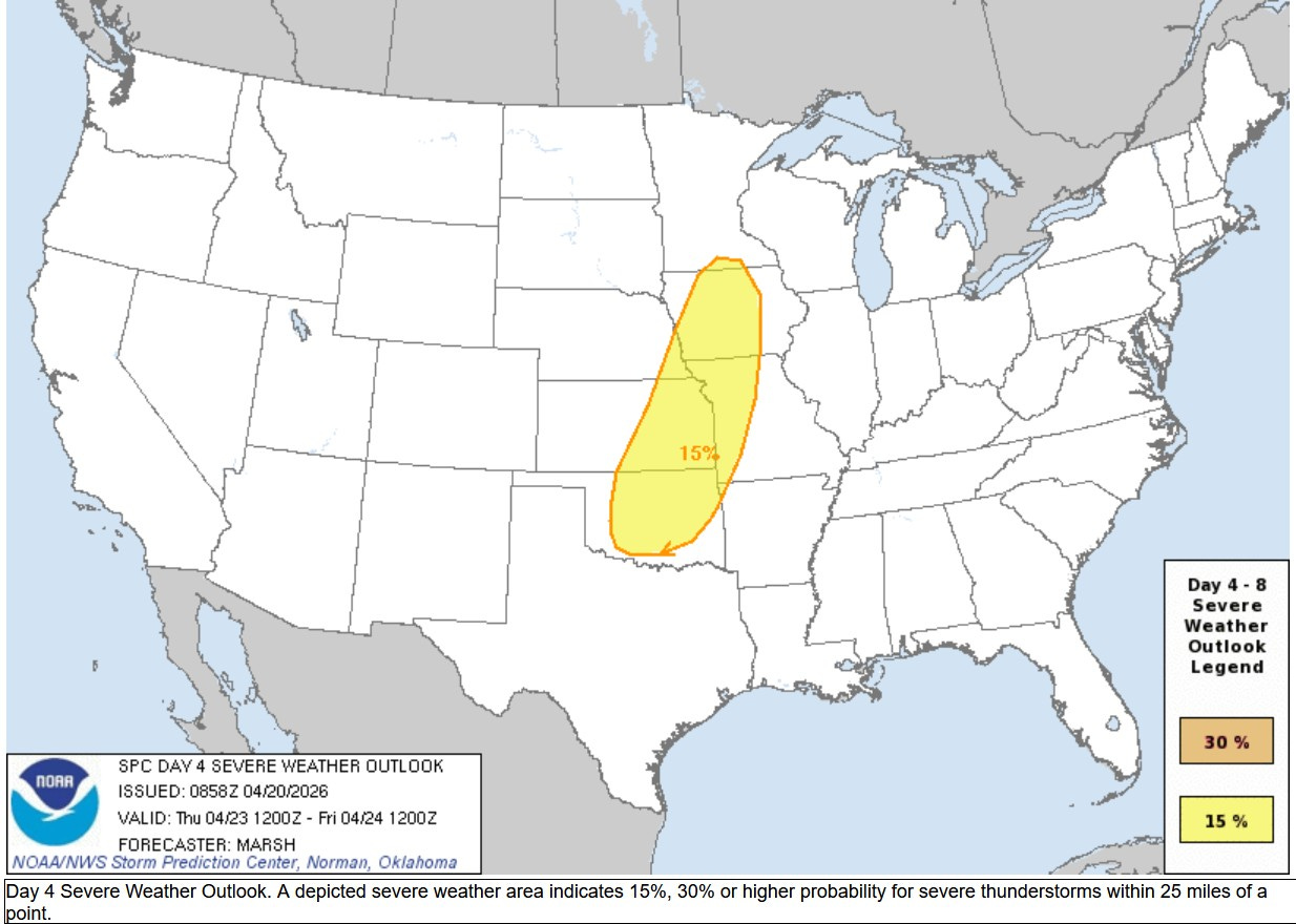
Here’s the Severe Weather Outlook Area for Thursday PM/night. Once again, it does not include Michigan. We should have another dry day here. Severe Weather is likely from Iowa to Oklahoma.
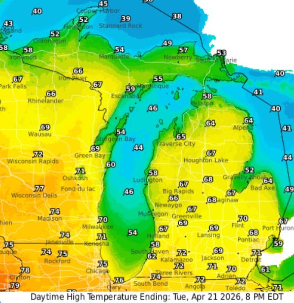
Here’s high temperatures for this Tuesday. It’ll be significantly warmer this afternoon than it was Sunday and Monday with highs inland in the mid-upper 60s to low 70s along and south of I-94. It will be cooler near Lake Michigan with a high in the upper 50s at South Haven. The wind has picked up and there are small craft advisories in effect for Lake Michigan.
Also: The Rapid River in the U.P. is certainly living up to its name. There is still snow in parts of Upper Michigan. Marquette still had 10” of snow on the ground at midnight. However, S. Ste. Marie melted their last inch of snow on Monday and they report just a trace of snow on the ground this morning. They had at least 1 inch of snow on the ground for 144 days.