
Heavy Rain Possible Next Week
Rivers levels stay high through mid-April

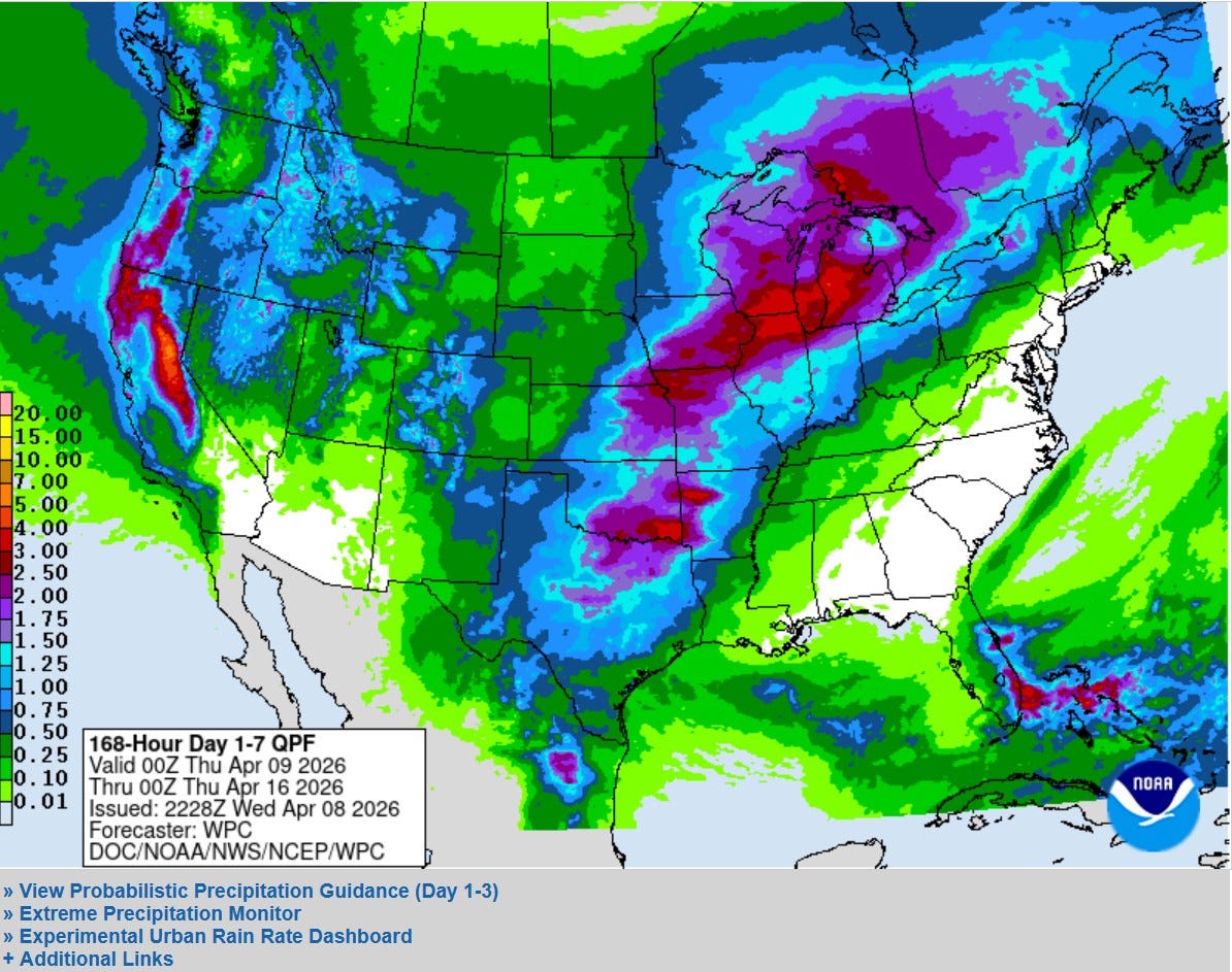
This is the 7-Day Combined Total Rainfall Outlook from the Weather Prediction Center through next Wednesday. They are forecasting a band heavy rainfall along a front that wobbles back and forth from Texas to the southern Great Lakes. The heaviest rain may come in the Monday - Wednesday period next week. The Grand Rapids NWS forecast discussion said: “NCAR medium-range guidance points toward the potential for strong to severe storms Monday and Tuesday.” There will definitely be multiple chances for rain over the next week to 10 days.
On the pic. above, check out the rain (and snow in the Sierra Nevada Mountains.) in California. The weather looks great for the Masters Golf Tournament in Augusta GA. Four partly to mostly sunny days with a warming trend. Mid 70s today rising to the mid 80s Saturday and Sunday.
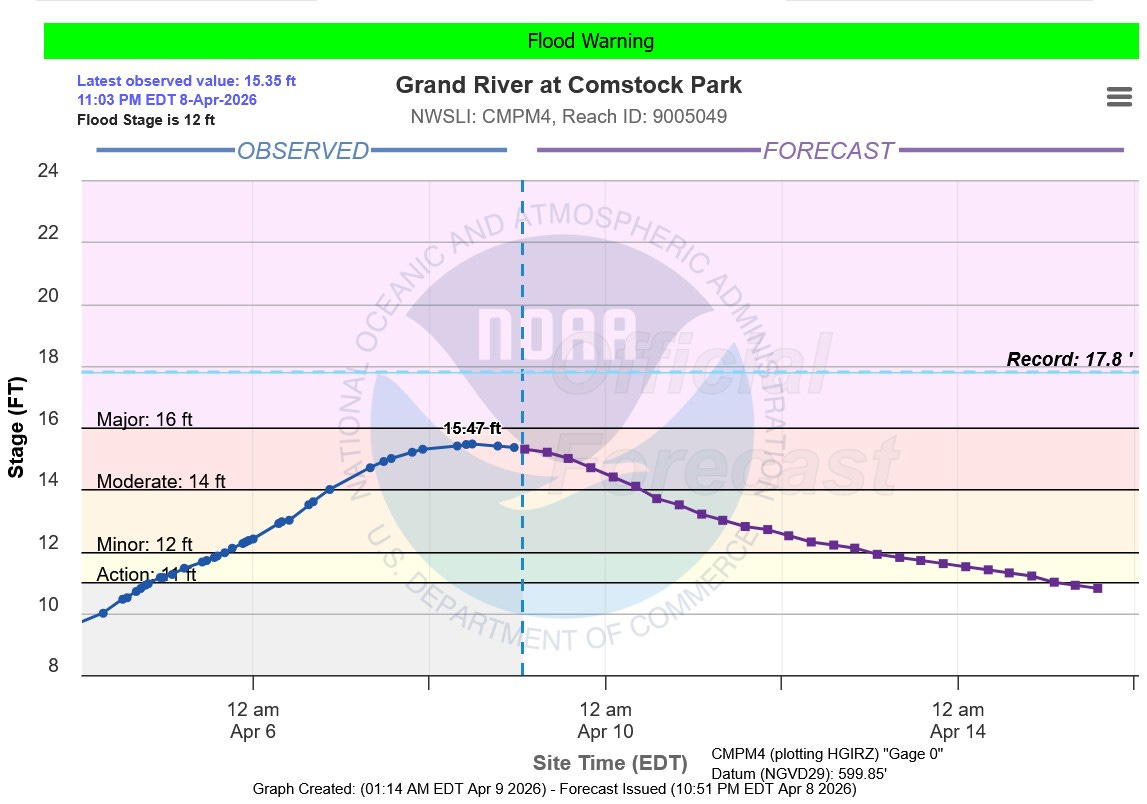
Moderate flooding is occurring in Comstock Park (Kent Co.). The river is about at flood stage (it’s crested at Ada. The river is 3.47 feet above flood stage. The flood won’t affect the Whitecaps, but there is some residential flooding along Abrigador Trail, Konkle Dr., Willow Dr. and Riverbank. The additional rain this AM and early Friday should have much effect on the rivers. They will slowly fall.
The record crest on the Grand River at Comstock Park is 17.8 feet in April 2013. The river reached 16.85 feet in 2018.

Here’s flooding at Roselle Park in Ada, where the trail is closed. Note how the grass has greened up and the willow tree in the middle of the pic. starting to turn green.

Here’s local radar courtesy of the NWS. The rain should clear out to give us a dry afternoon. Then more rain Thu. night/Friday. No severe weather over the next 3 days.
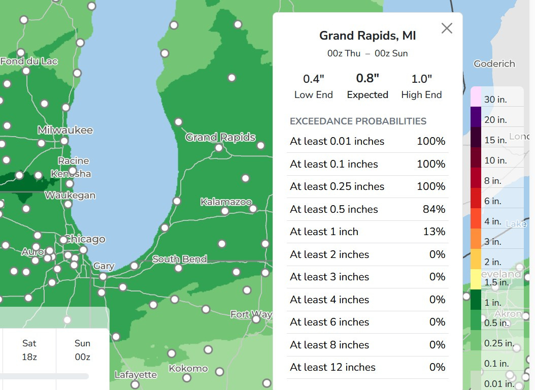
Over the next 3 days, Grand Rapids is expected to get around 3/4” of rain (including the rain that fell overnight) with a 100% chance of 1/4 inch. Most of the midday and afternoon today will be dry. Most of the Friday midday and afternoon will be dry and most of Saturday will be dry. There will be more rain overnight into the early-mid morning time frame.
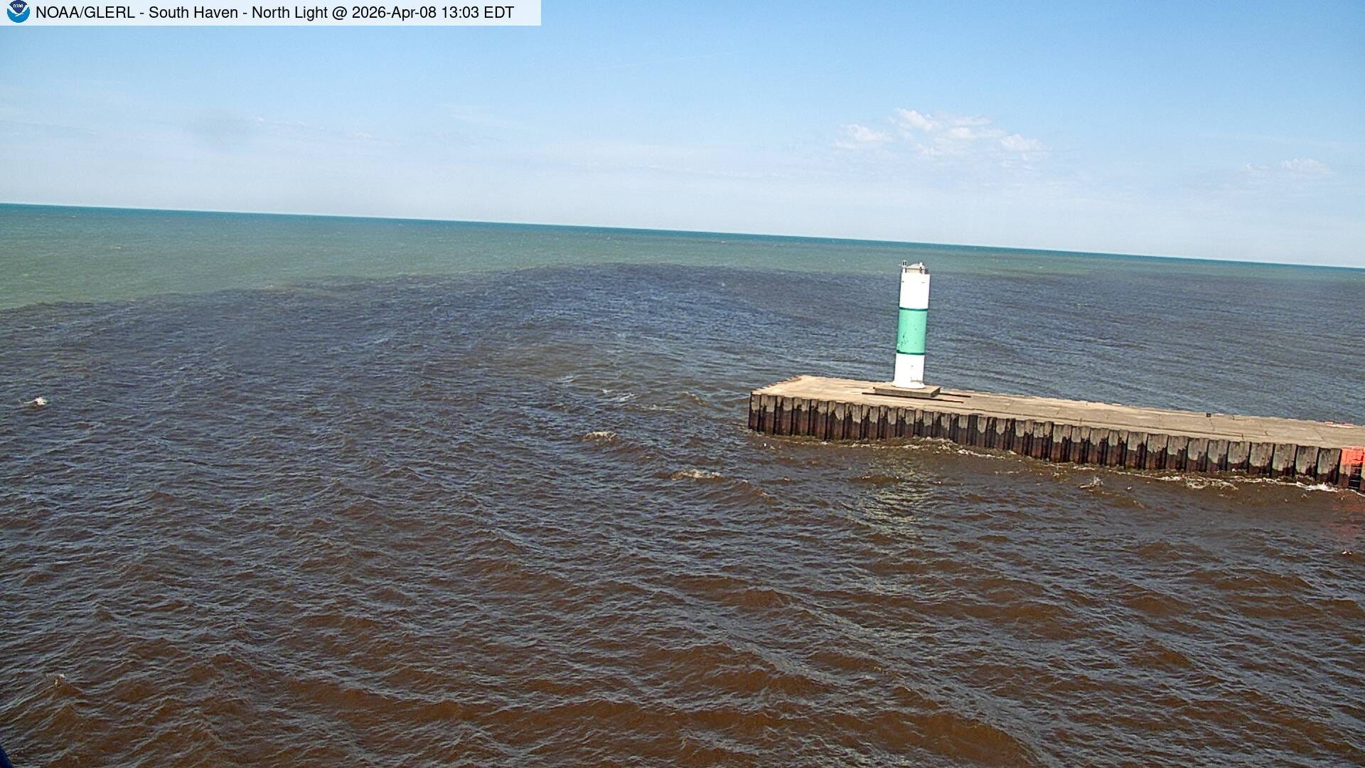
This is the South Haven Channel Wed. PM. Note the darker color of the Channel water (Black River) next to the brighter colored water of Lake Michigan.
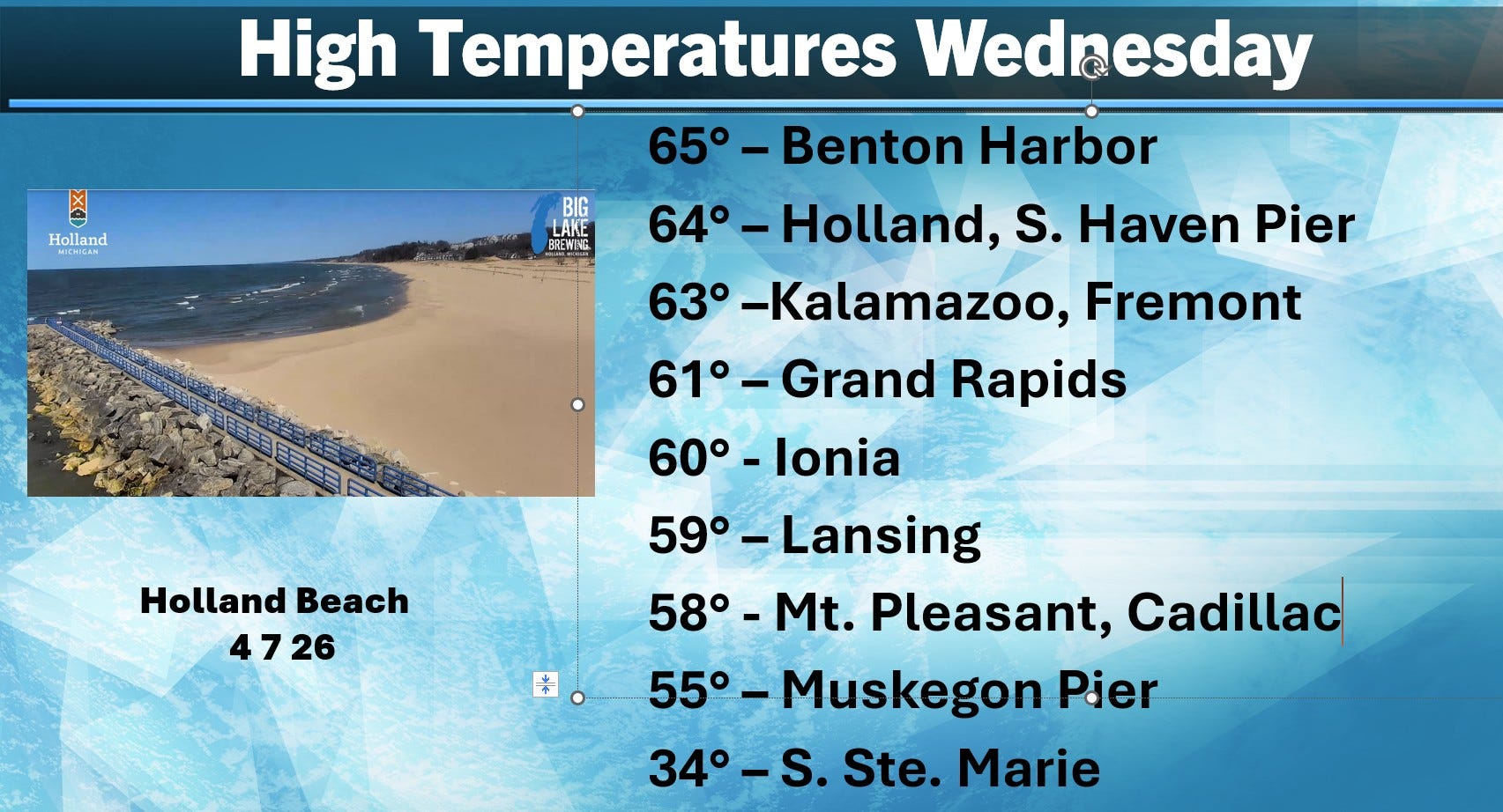
Here’s high temperatures from Wednesday. Grand Rapids was 22 deg. warmer than on Tuesday. Benton Harbor was 29 deg. warmer on Wed. than on Thu.
Also, looks like another round of general rain headed toward Hawaii…and a strong hurricane is going to be headed toward Guam. Residents and the military on Guam should start making hurricane preparations. Marquette picked up another 0.8” of snow yesterday. They have 36” of snow on the ground at the airport and they are up to 274.7” for the winter season.
Thanks again Bill, and Florida is the worse is many tears
Thanks Bill, I take its too far out for the severe weather predictions?