
Freeze Warning, Frost Advisory
At least several chances for frost over the next 8-10 days

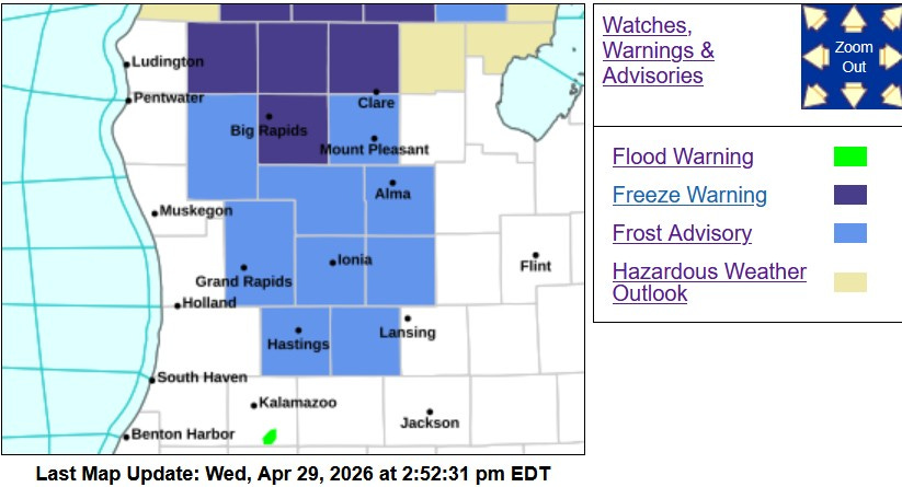
A Freeze Warning (in dark blue on the map above) and a Frost Advisory (in lighter blue on the map above) will be in effect from 2 am until 9 am Thursday morning (4/30). This does include Grand Rapids, but does not include the lakeshore counties or the I-94 counties.
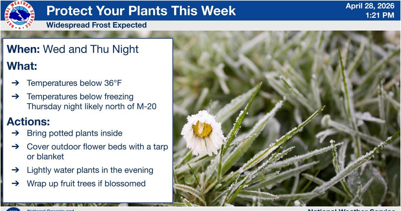
Measures should be taken to protect any frost sensitive plants. Many trees are in blossom, including fruit trees. Don’t worry about bulb flowers like tulips. They will wilt when it gets below freezing, but then they’ll pop back up when it warms back up above freezing.
Freeze Warnings and Frost Advisories will most likely be in effect for Thursday night/Friday morning as well.
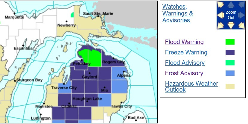
Freeze Warnings and Frost Advisories are in effect for much of Northern Lower Michigan. The only reason they are not in effect for Upper Michigan is that vegetation has not progresses enough for frost to cause damage. However, it will be just as cold tonight in the U.P.
The green on the map is a Flood Advisory for Emmet and Cheboygan Counties for another week (until May 7). There is a Flood Advisory in effect for the Tahquamenon River, which is a few inches above flood stage. There is a Flood Warning for the Michigamme River in the U.P.
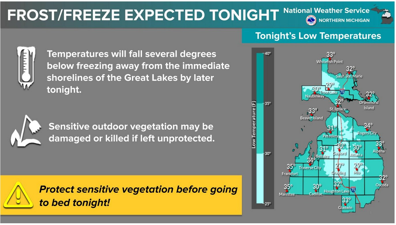
Here’s a look at some forecast low temperatures for this Thursday night. Inland areas could drop to the upper 20s, while readings at the Lake Michigan shore should hold in the mid 30s (above freezing.
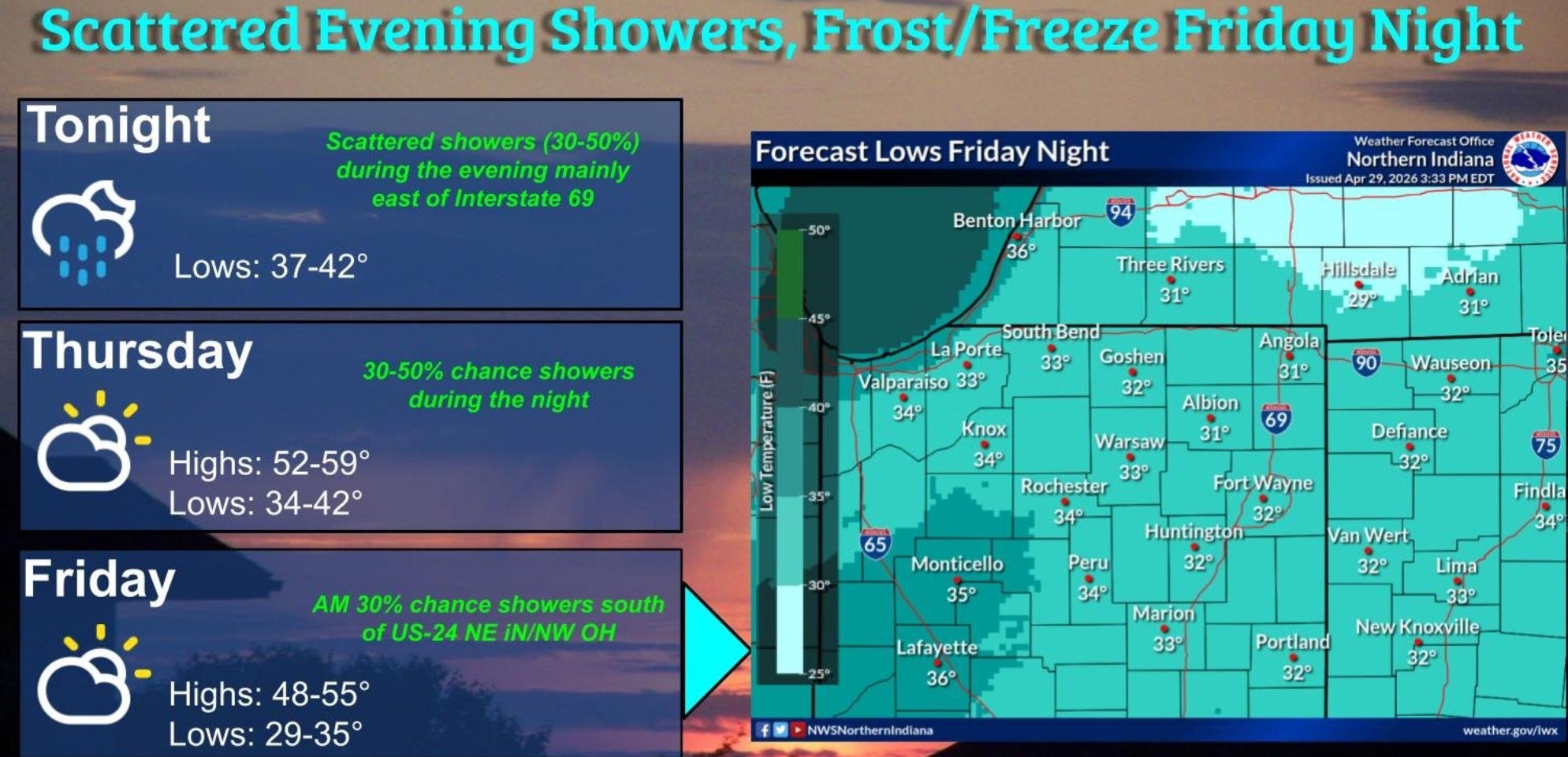
This graphic is from the National Weather Service in northern Indiana. This includes the Michigan counties that border Indiana. This area should not see frost tonight, but there will be a chance of frost/freeze tomorrow night (early Friday). In fact, we may have a little better chance of frost Friday AM.
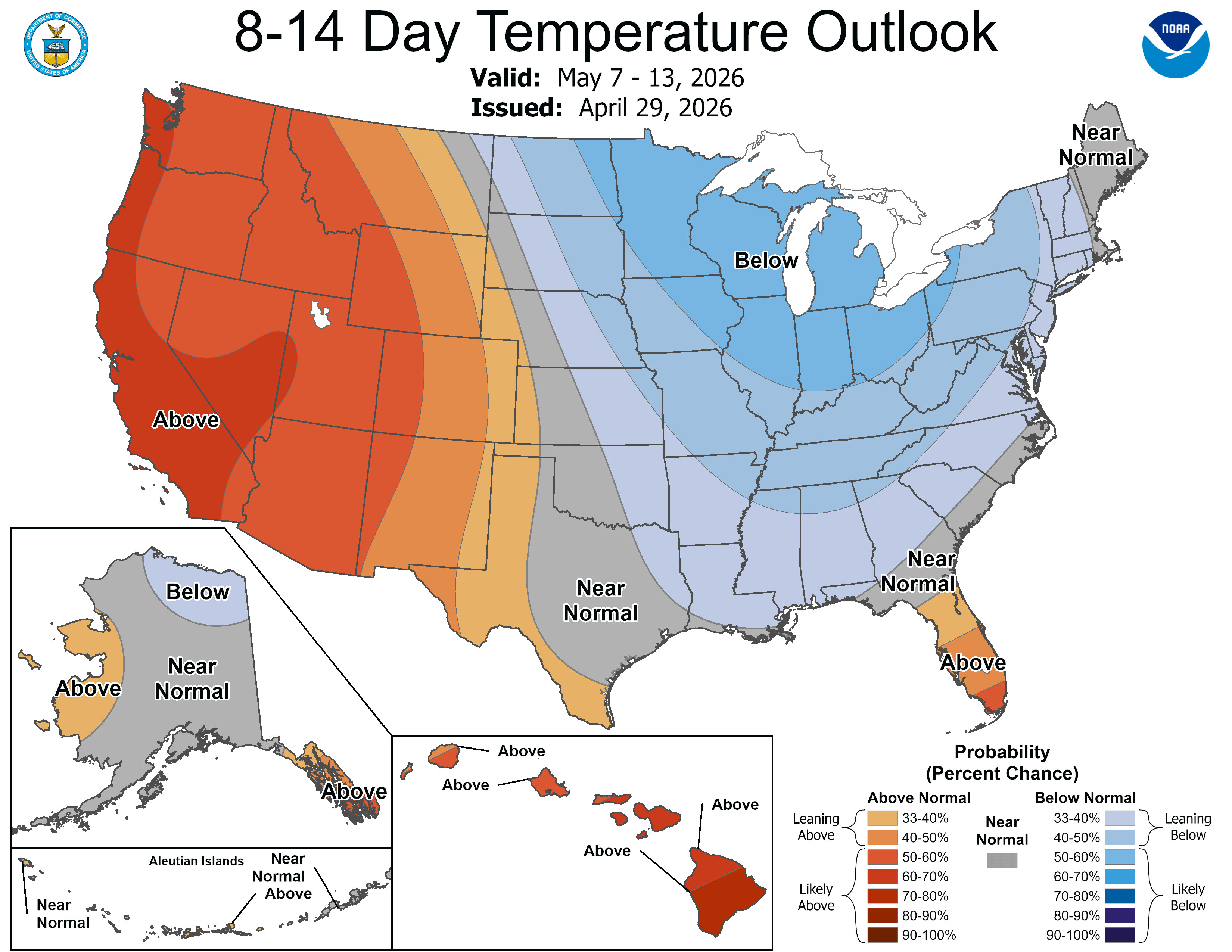
The overall cool pattern should continue through much of the first half of May. There will be an upper level ridge over the Western U.S. and a trough over the Great Lakes. While this can be a cool and occasionally showery pattern, it should reduce the threat of severe weather in the Great Lakes for the first half of May.
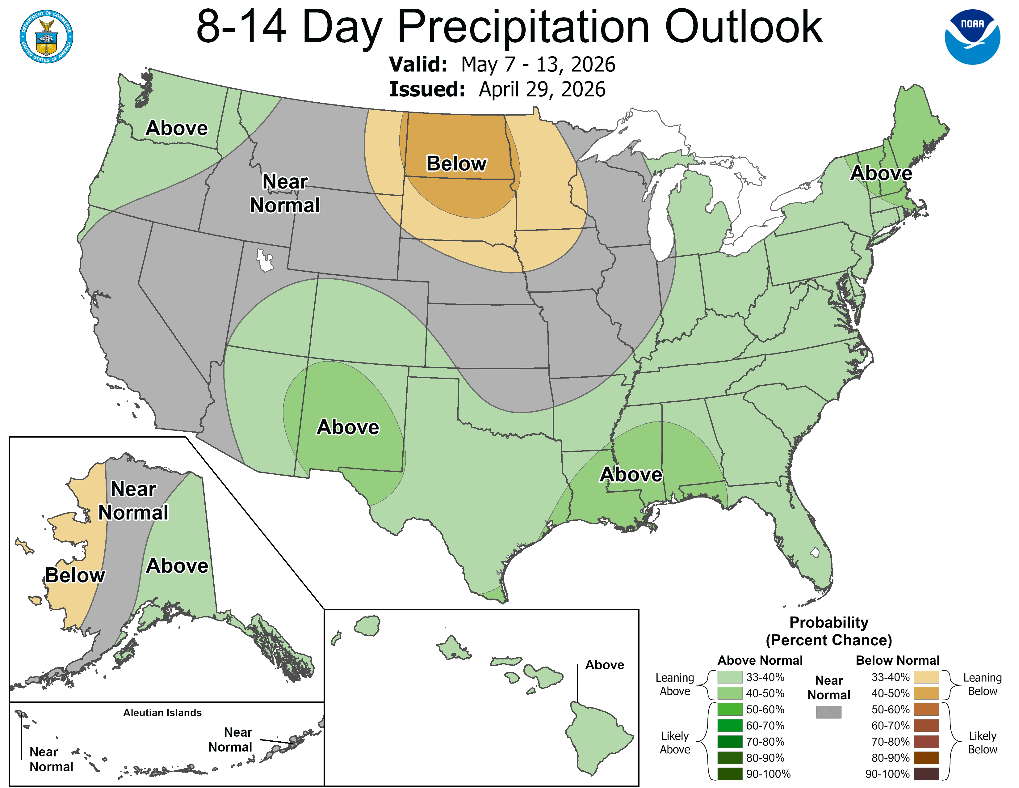
Here’s the 8-14 Day Precipitation Outlook. Lower Michigan may be slightly above average, but without a lot of Gulf moisture, we shouldn’t see the rainfall amounts that we’ve had in April.
This pattern should give some much needed rain to the southern and southeastern U.S.
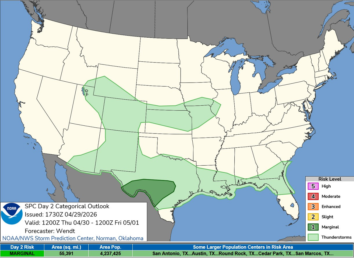
We’ve had a lot of severe weather in the U.S. during March and April. We should see less severe weather over the next week. Here’s the Severe Weather Outlook Map for Thursday. There is a Marginal Risk (level 1) over portions of Texas, including San Antonio and Austin.
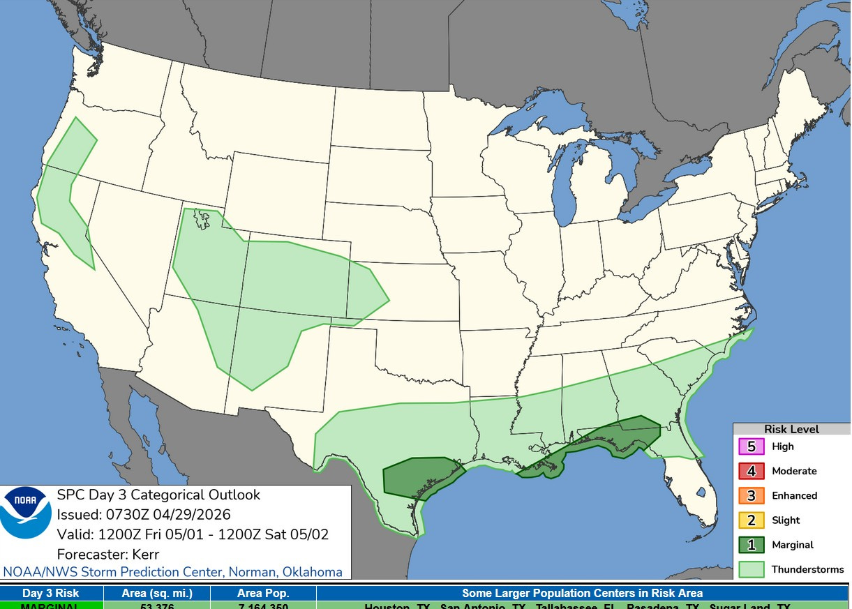
The Severe Weather Outlook Area for Friday/Friday night shows two Marginal Risk areas from Texas to the Florida Panhandle. Again, hopefully we’ll get some much needed rain in these areas and little severe weather. Again, no storms in the Great Lakes.
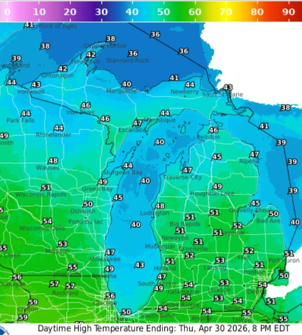
Here’s forecast high temperatures for Thursday…low-mid 50s inland, upper 40s near Lake Michigan and in northern Lower Michigan. Much of Upper Michigan will see high temperatures in the low 40s with Copper Harbor expected to see a high of just 38.
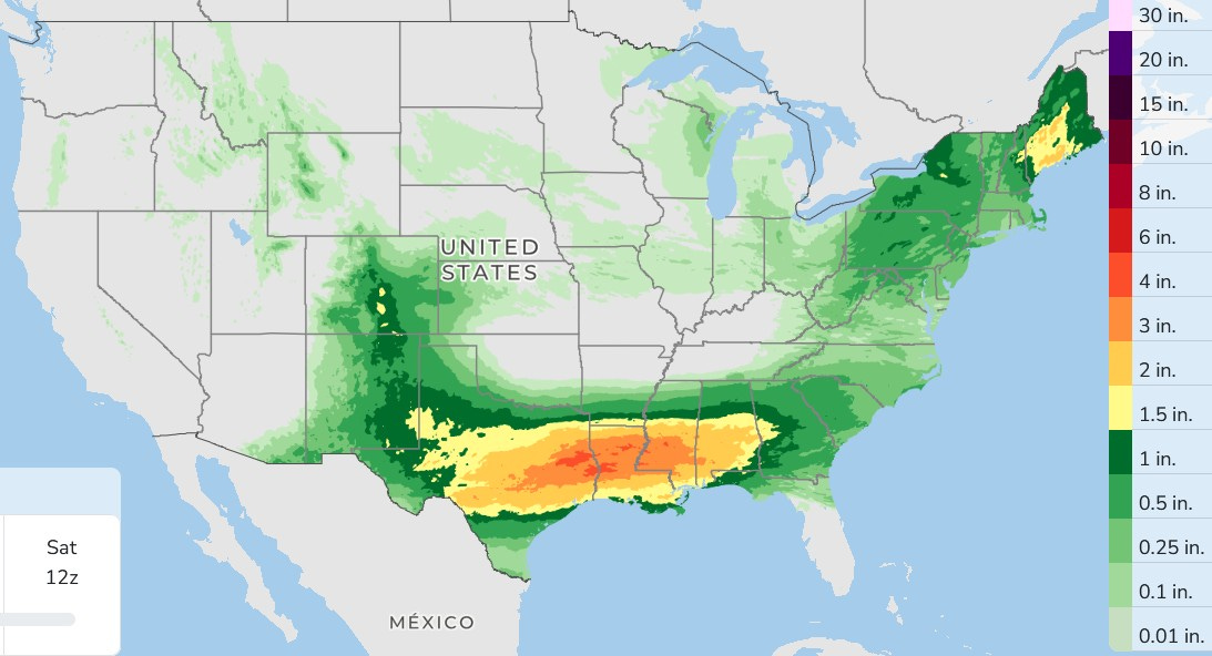
Here’s rainfall over the next 3 days. Lots of thunderstorms are expected from New Mexico to Georgia. There will be some significant rain in the state of Maine.
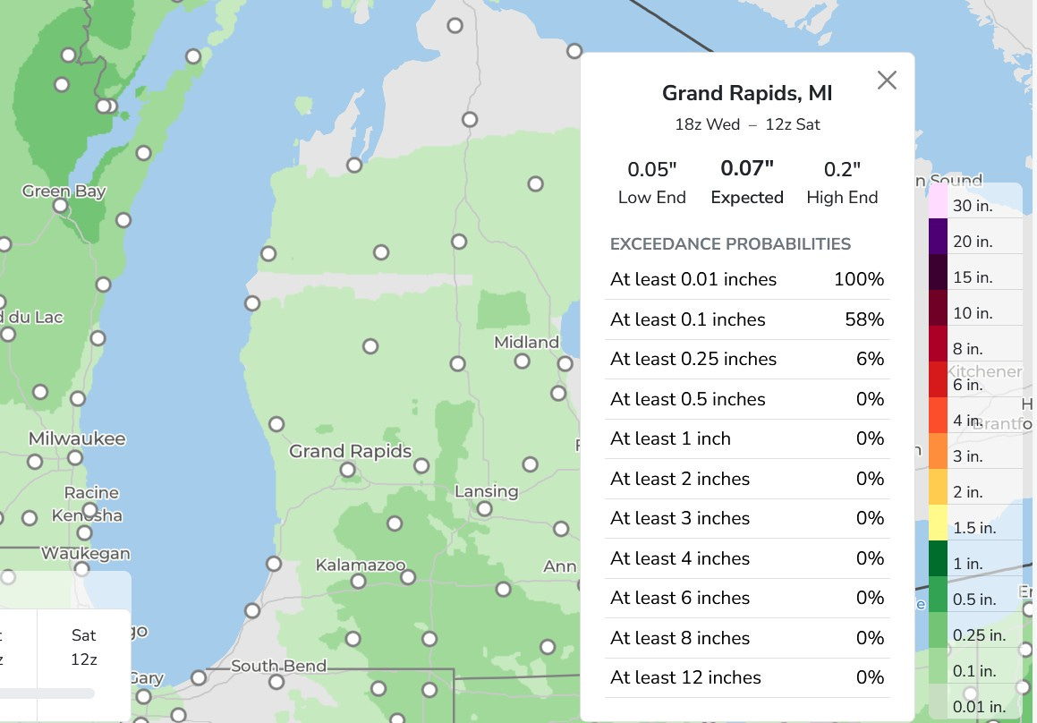
Over the next 3 days, much of West Michigan will see light amounts of rain with Grand Rapids expecting less than a tenth of an inch.
The lake does a LOT for the shoreline counties (one reason for all our orchards, vineyards, etc.) Lake Effect snow is the tradeoff, but in exchange we spend much of the year almost as though we were a USDA zone or two south. I'm in Ottawa County and we love it. Thanks for your great info, Bill.