
Easter Weekend and Beyond
Wet start to the weekend, chilly - could be a snow shower Easter morning

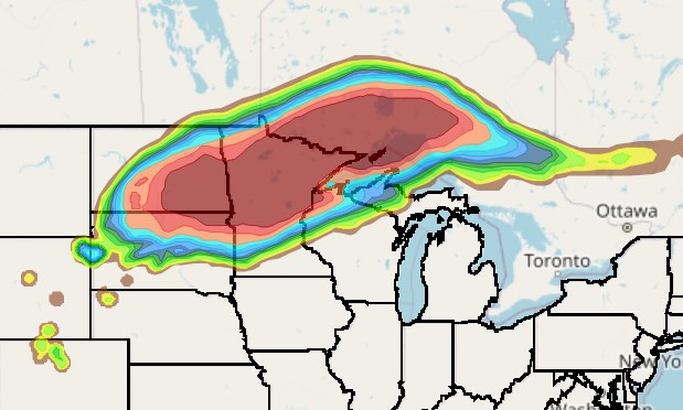
First, we’re missing an Easter snowstorm/icestorm. The map above shows where the shovelable snow will fall, with the heaviest snow from NorthDakota across Minnesota and up into Southwest Ontario. There will be some 8-12” totals there.
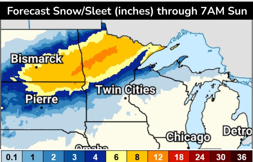
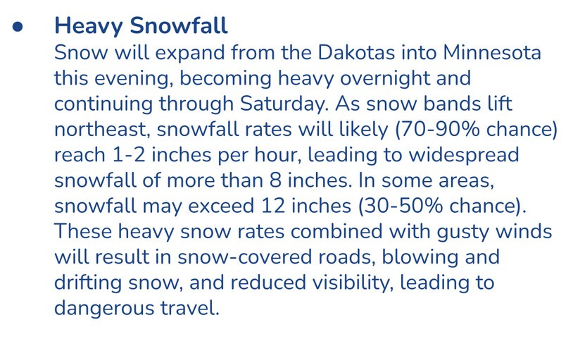
This is the snowfall forecast from the Weather Prediction Center. The orange band is 12” of snow. Snow amounts will be lower as you head southeast, where some of the precipitation will fall as rain/freezing rain. WPC says:
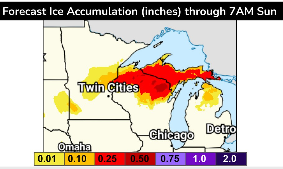
Here’s the forecast ice accumulation, centered on northern Wisconsin and Upper Michigan. There could be a period of freezing rain in northern Lower Michigan, north of Houghton Lake. WPC says:
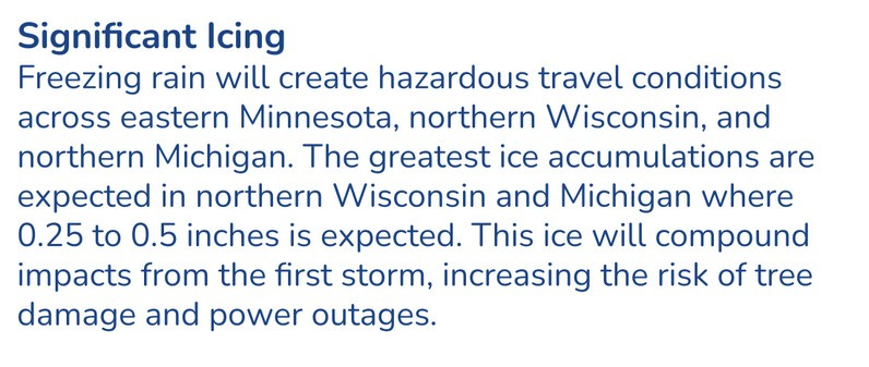
The Mackinac Bridge was closed Friday due to ice falling off the bridge.
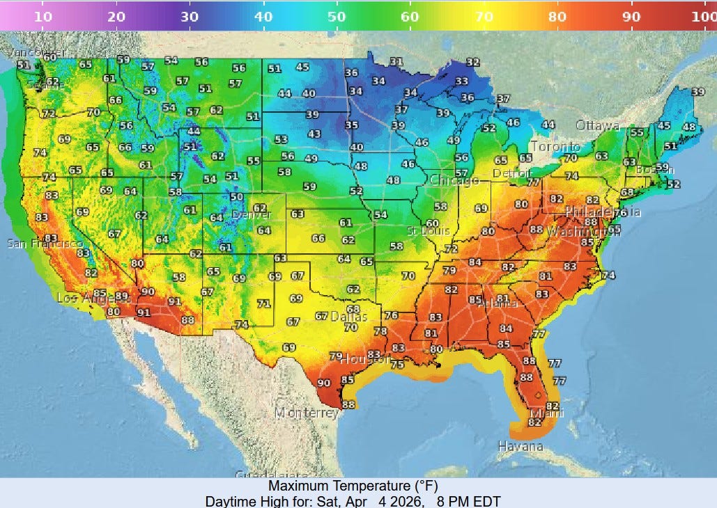
Here’s U.S. high temperatures for this Saturday. Look at the 80s up into Pennsylvania. It’ll be in the 80’s from Florida across the Gulf states to southern Texas with a few low 90s in the Desert Southwest. Cool air will dominate the Upper Midwest.
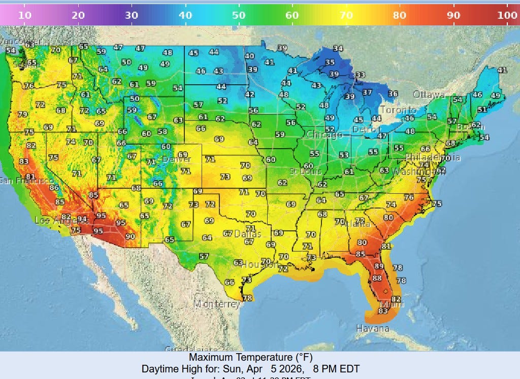
Here’s high temperatures for Easter Sunday. It’ll be another warm day in Florida and the Desert Southwest, with generally cool weather from North Dakota to Michigan.
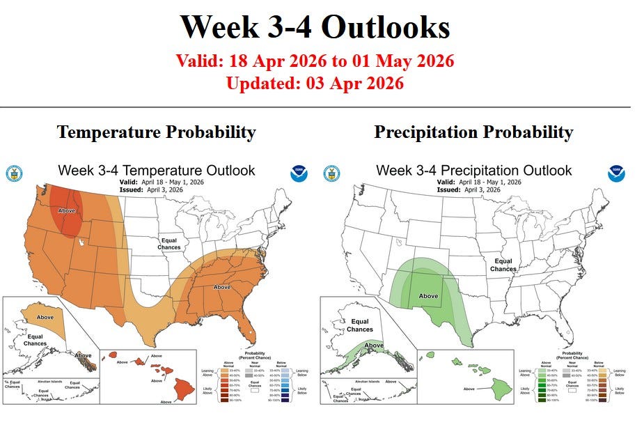
Here’s the 3-4 week forecast from the Climate Prediction Center. They have Michigan with an equal chance of above and below average temperatures and rainfall. I’d be inclined to continue the pattern of a little above average rainfall for the Ohio Valley up into S. Michigan. There is still a lot of cold air in Canada and the contrast between the warm, moist air from the Gulf and the cold air from Canada should result in an ample number of thunderstorms.
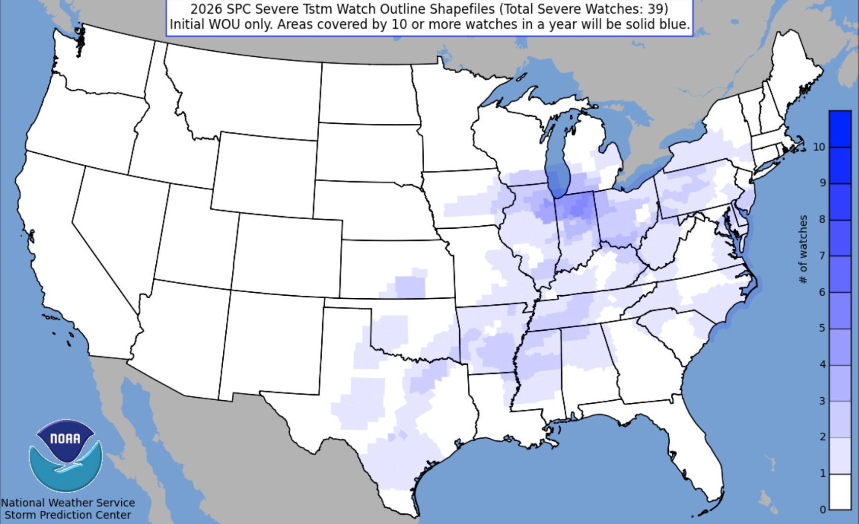
One final note - this is interesting…a plot of all the Severe Thunderstorm Watches (not Tornado Watches) in the U.S. so far in 2026. The greatest number of watches has been in Northern Indiana (darkest purple on the map), with a high concentration in northeast Illinois and southwest Michigan. Since the U.S. gets more tornadoes/severe storms than any other place on Earth…it looks like globally THE place to watch storms so far this year has been northern Indiana!