

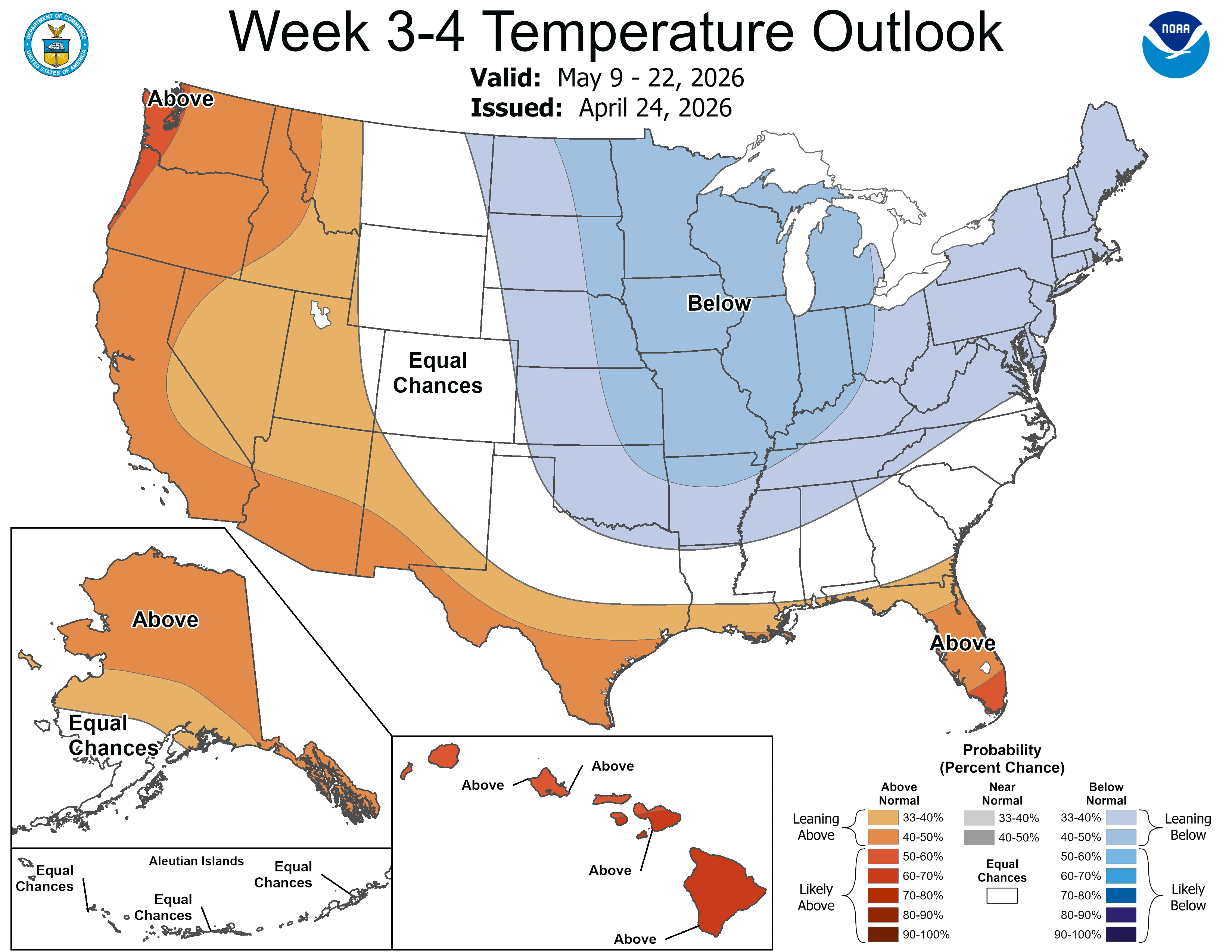
Here’s the 3-4 week forecast for May 9-22 from the Climate Prediction Center. Below average temperatures are likely over the Midwest, Great Lakes and Northeast. It’s likely temperatures will be a touch cooler than average over the next 10 days and maybe beyond that. So far, this month of April is running 5.1 degrees warmer than average. We’ve had 7.6” of rain this month, but only a trace of snow.
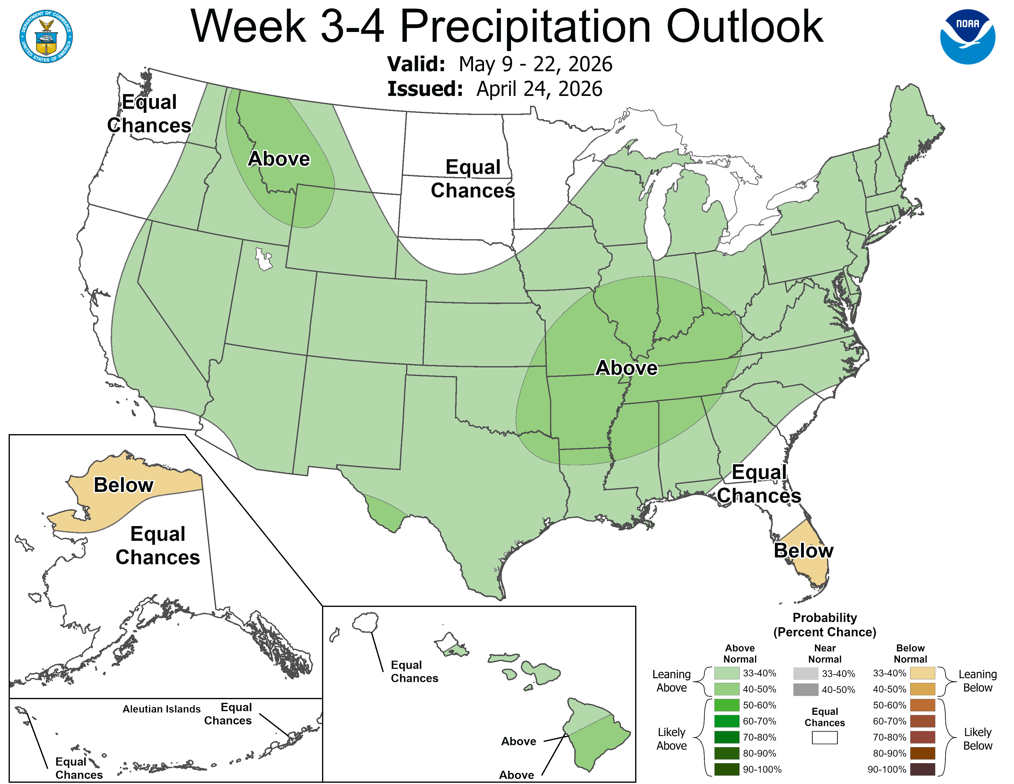
Rainfall is expected to be a touch above average over much of the country, including Michigan.
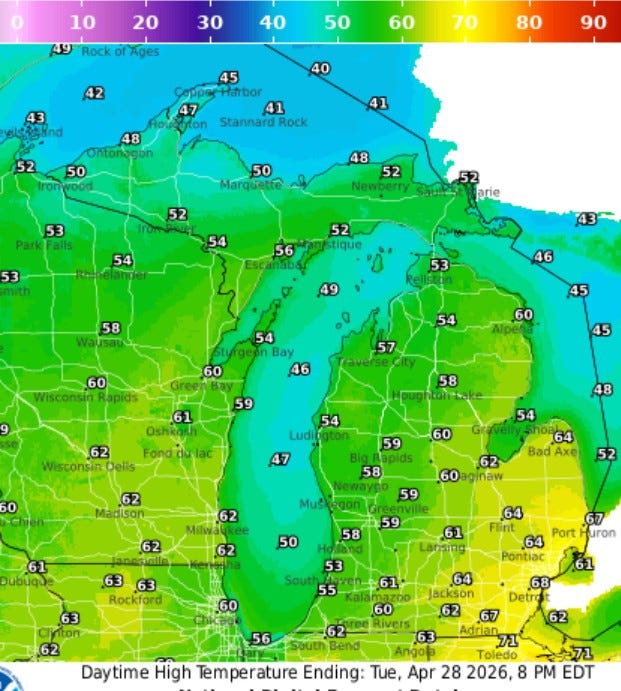
Here’s forecast high temperatures for today (Tue.). We’ll reach the upper 50s to near 60 inland, and low-mid 50s at the Lake Michigan shore. It’ll be a touch warmer - upper 60s - over in Detroit.
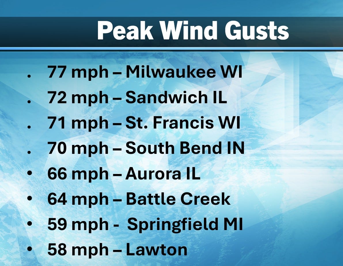
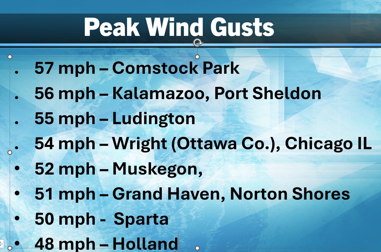
It got pretty windy for a while Monday PM. Here are some peak wind gusts. Approximately 60,000 customers lost power. There were many trees, wire and limbs downed by the wind and a couple of semi-trucks tipped over.
April has been warm and wet. We’re currently 5.1 degrees warmer than average and we’ve had 7.60” of rain in Grand Rapids this month. Blossoms are 1-2 weeks ahead of schedule. Toward the end of this week, we may see a bit of frost in a few spots. We can get a frost all the way into mid-May.
Ugh, I'm ready for some warm sunshine
Thanks Bill for all the information as always. Quick question, yesterday when the storms went through here in Schoolcraft, afterwards the wind really picked up and was blowing from the ESE about 40-55 MPH. Never seen it blowing from that direction after a storm goes through.