
Cool Pattern Through Early Wed.
Warmer Wednesday PM - Friday

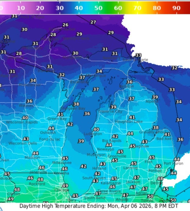
Here’s high temperatures for this Monday…the average high for April 6 is 54 and we’ll be around 10 cooler that today and tomorrow. We have about a 50/50 chance of a period of light to very light rain or snow today, but roads stay mostly clear.
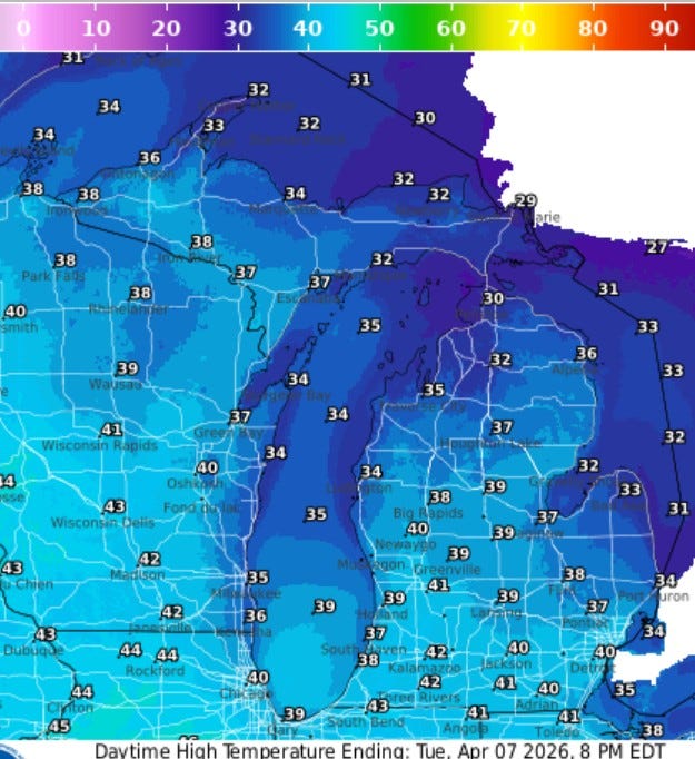
Here’s high temperatures for Tuesday. Look for partly to mostly sunny skies with highs in the low 40s. Cooler to the north, just 32 at Gaylord and 29 at Sault Ste. Marie. It’ll be a cool home opener for the Whitecaps in the evening. After a chilly start to Wednesday (below freezing), we’ll be back in the mid-upper 50s Wednesday afternoon.
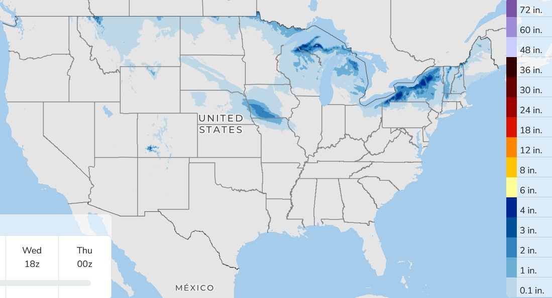
Here’s total snowfall for the next 3 days. Look for another 1-3” in parts of Upper Michigan and an inch in northeast Lower Michigan.
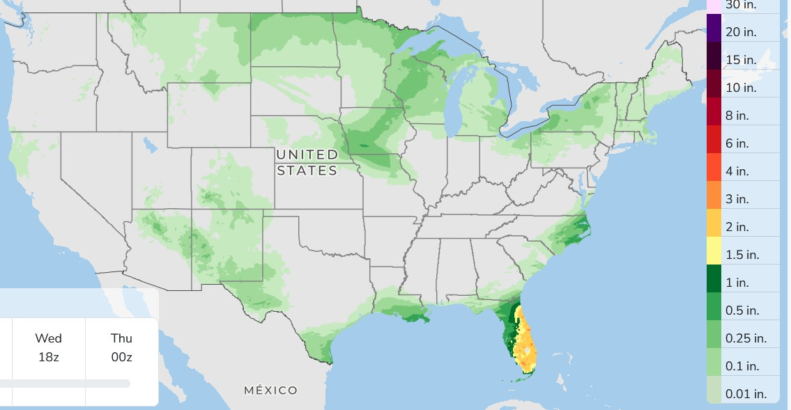
The heaviest rain in the U.S. over the next 3 days may be over the Florida Peninsula with some 1-2” totals. Anything in West Michigan today would be very light. There’s a better chance of some more significant rain on Thursday. Very little severe weather is expected in the U.S. over the next 3 days.
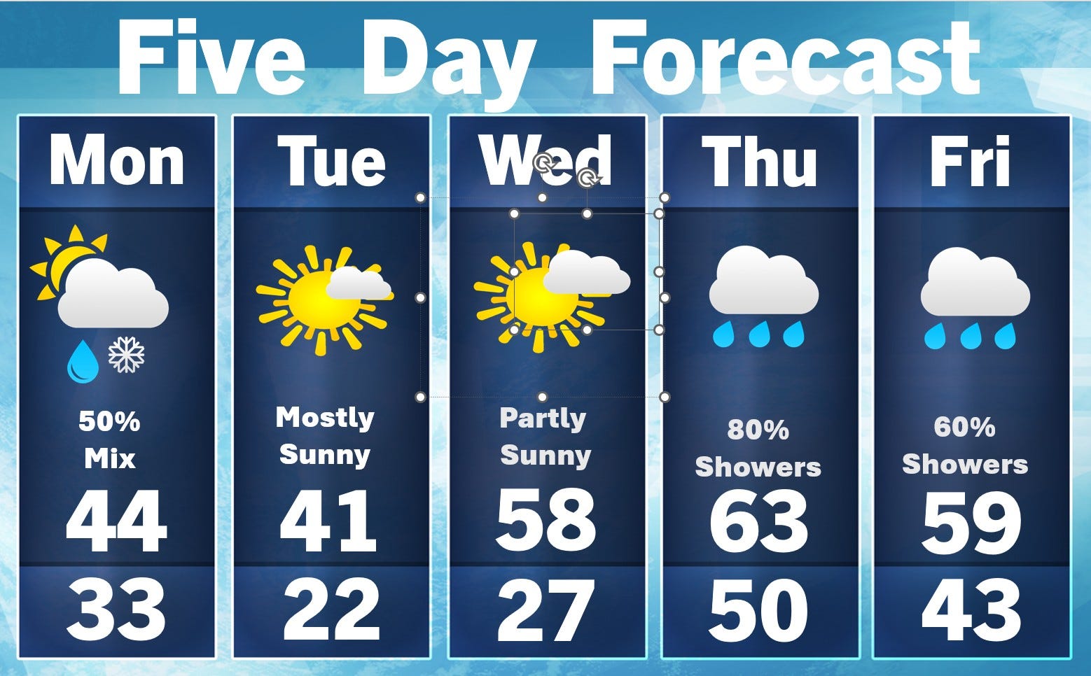
The average high temperature for today is 54. It’ll be breezy today with a northwest wind at 15-20 mph this PM. Sunrise is now at 7:15 am and sunset at 8:14 pm. This is the time of year where you are looking into a bright sun driving east in the early morning and looking west in the evening. The days continue to lengthen at the rate of over 2 1/2 minutes per day.
The water temperature of Reeds Lake is a chilly 44 and at the Holland Channel the water temperature is 46. A number of rivers are bankfull this Monday morning. We’re tracking the rain that’s coming our way later this week Thursday to Saturday.s
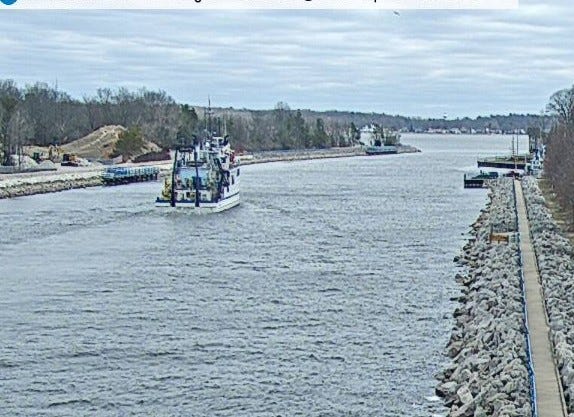
This pic. shows a fairly big boat moving through the Muskegon Channel Sunday. They went out beyond the breakwalls where it was a little choppy.
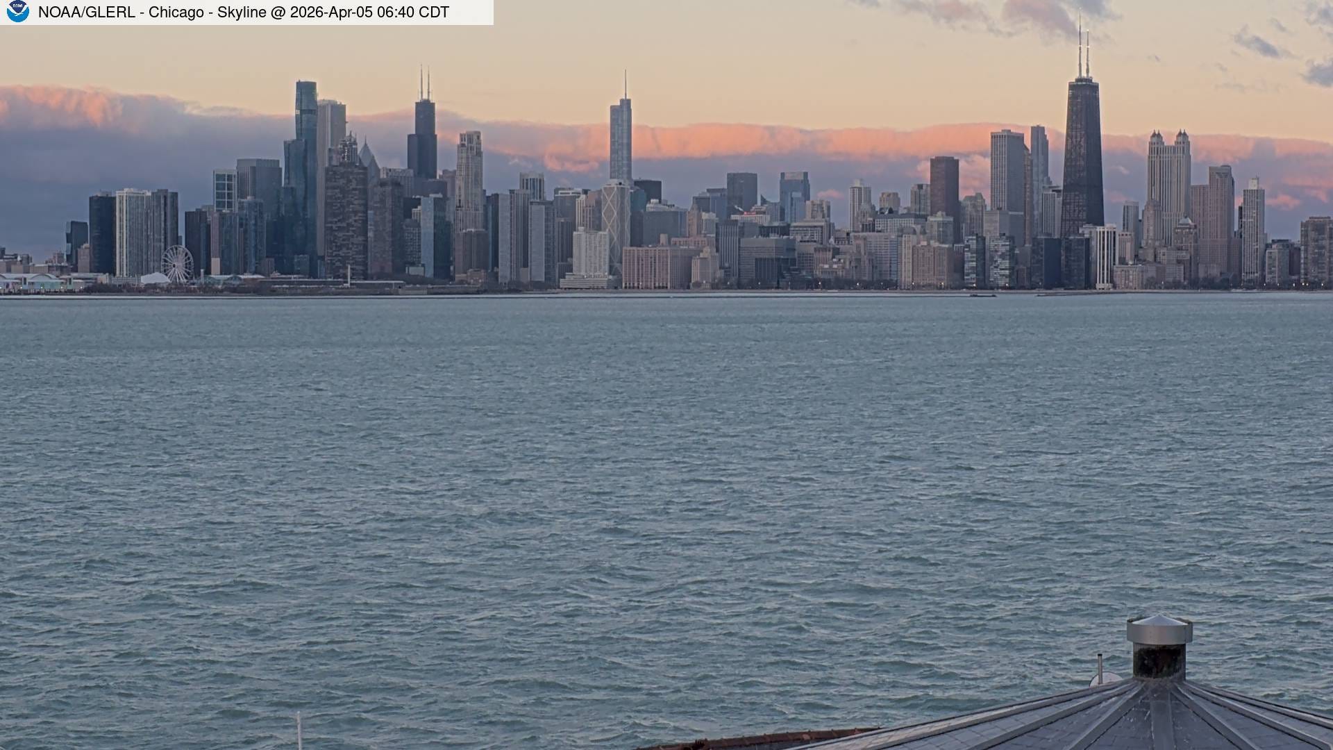
This pic. was Sunday morning from the Chicago water intake looking back to the WSW toward downtown. The clouds in the distance look like a mountain range.
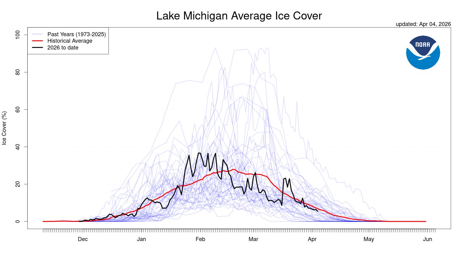
Here’s a record of Lake Michigan ice cover this winter. Here’s the percent of surface ice cover Sunday (4/5) on the Great Lakes: Superior 7.2%, Michigan 4.9%, Huron 15.2%, Erie 0.1%, Ontario 0%, Great Lakes combined 7.4%.
Sure do look like mountains...Fun to see when you live in a flat state. Also, Sometimes the temp Maps are prettier to look at than the temps themselves...all those aquas, shades of blue, and deep navy!
Thanks Bill