
Cool Pattern Into Next Week
Rainfall amounts will be light the rest of this week

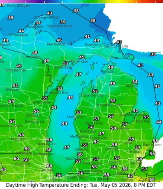
Here’s forecast afternoon temperatures for today (May 5). We’ll be in the mid 50s this afternoon - jacket weather. While it’s not impossible that a light shower or sprinkle will occur, most all of the day will be dry. A west wind will keep temperatures cooler near Lake Michigan. The weather should be good for the Tulip Festival much of the rest of this week.
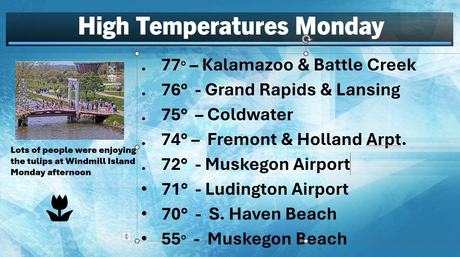
Here’s high temperatures from Monday. It was the warmest day of the week with inland areas in the 70s. Note the 17-degree difference between the Muskegon Airport and the Muskegon Beach. At the South Haven Beach, the temperature climbed to 70, then the wind shifted off the cold water and the temperature quickly fell into the upper 50s.
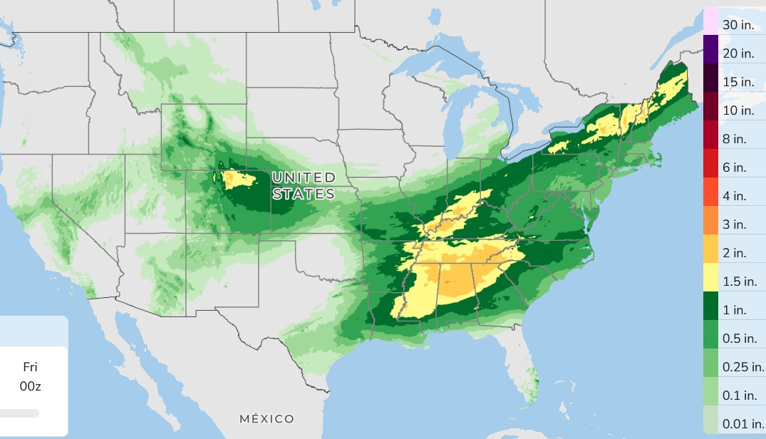
Here’s precipitation over the next 3 days combined. That’s a big area to see 1.5 - 2.5” rains. New England gets some significant rain. The precipitation in Colorado will be mostly snow. There could be 3-6” in Denver with 1-3 feet of snow in the high mountains.
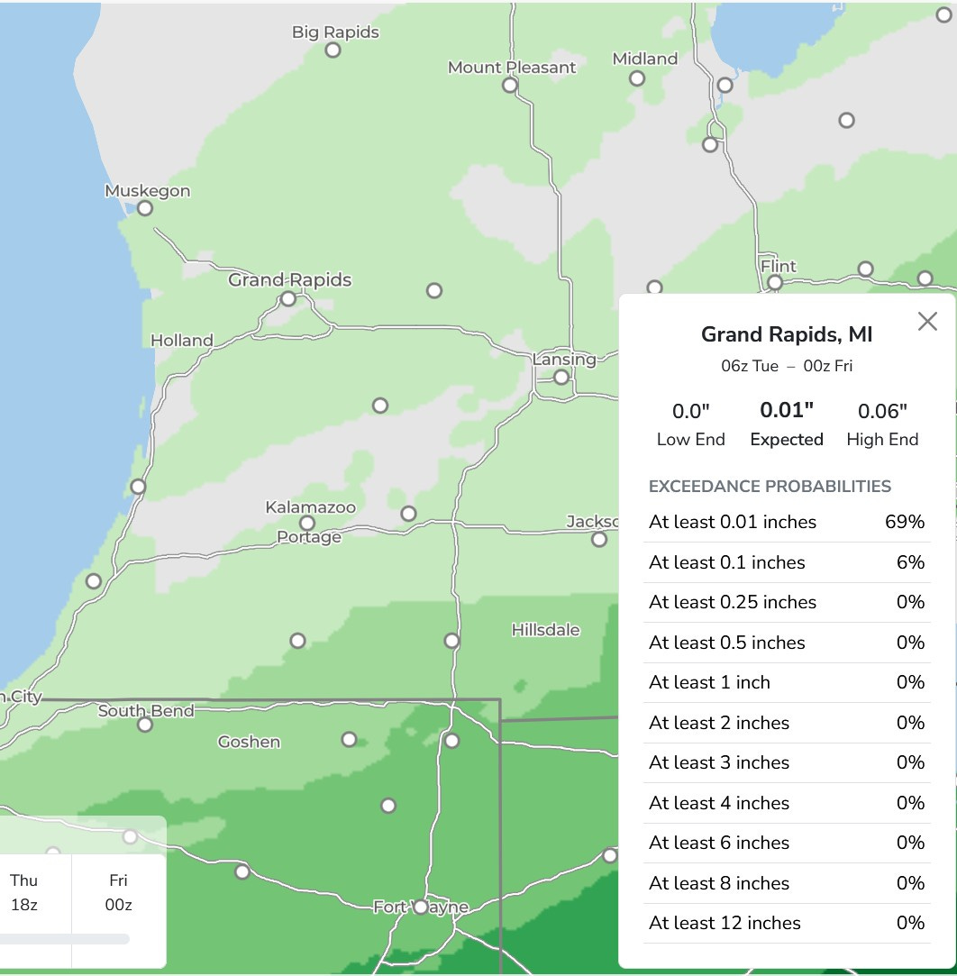
An isolated light shower or sprinkle isn’t impossible, but if that were to occur it would be brief and light. A query on Grand Rapids yields only 0.01” of rain - save for Kalamazoo.
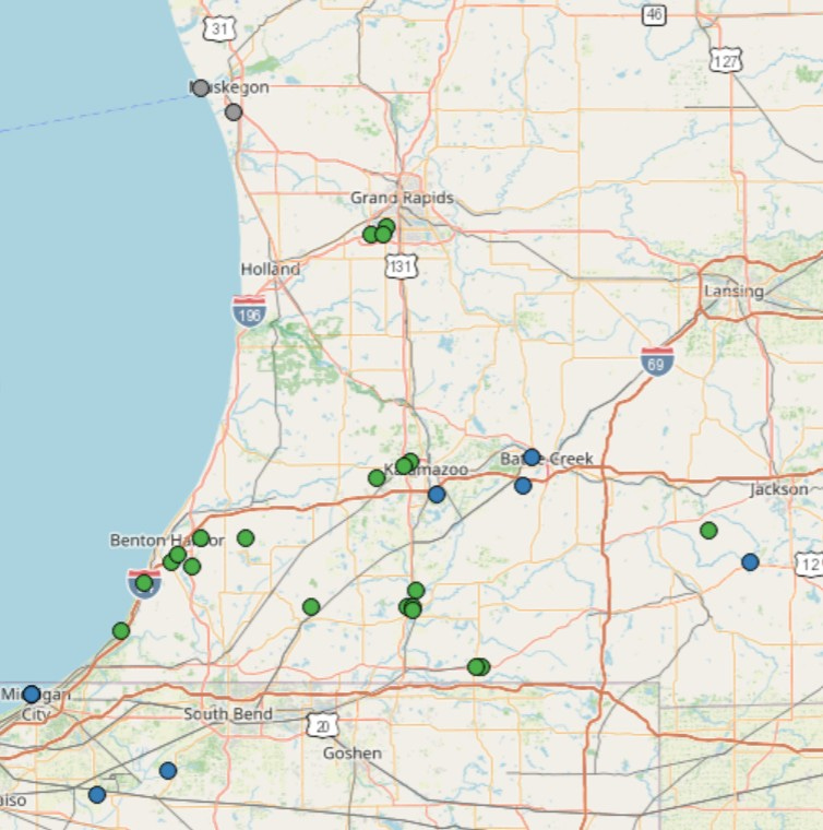
All the green dots are places that reported hail with the thunderstorms Monday PM. It was generally under an inch in diameter. Three locations in Berrien Co. had 1” diameter hail. Three locations in Indiana had severe criteria winds.
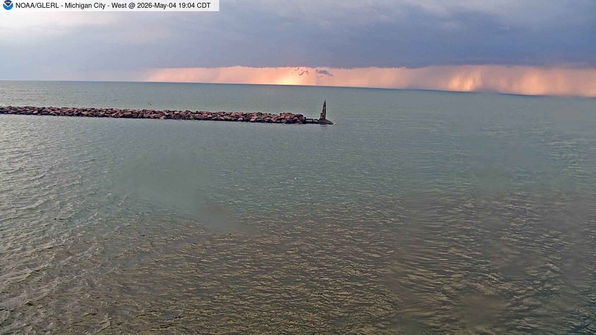
This pic. was taken at the lighthouse at Michigan City IN. The sun had just set. A gust to 58 mph was recorded at the lighthouse. You can see the streaks of rain in the distance.
Also: Four of the five Great Lakes are total ice free. Lake Superior has 0.9% ice cover, just a small amount of ice left in the bays on the northwest side of the lake.
The heat is on for central Florida, where temperatures could reach the mid 90s. The Arizona desert will see temperatures soar to 100 degrees and it’ll be warm in the Pacific Northwest.
I have to water my new grass since I've gotten almost zero rain in the past week to 10 days.