
Cool Pattern for the First Two Weeks of May
Can't rule out another morning with at least scattered frost

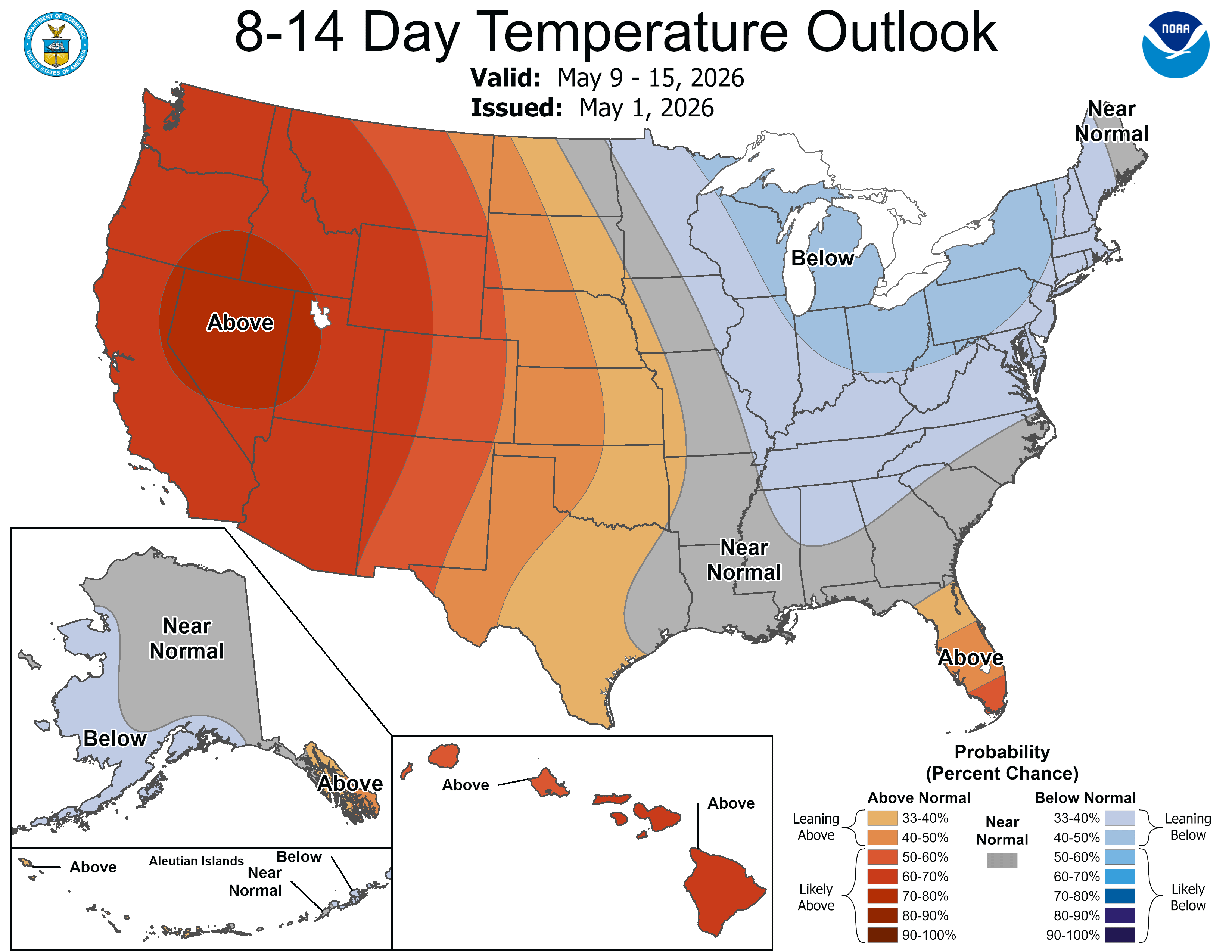
This is the 8-14 day temperature outlook from the Climate Prediction Center for May 9-15. This forecast comes out once a day in the mid-late afternoon.
The forecast has been consistently cool for the first two weeks of May, recognizing the pattern chance with the upper level trough that has formed over the Great Lakes and Northeast and the upper level ridge in the West (Rockies).
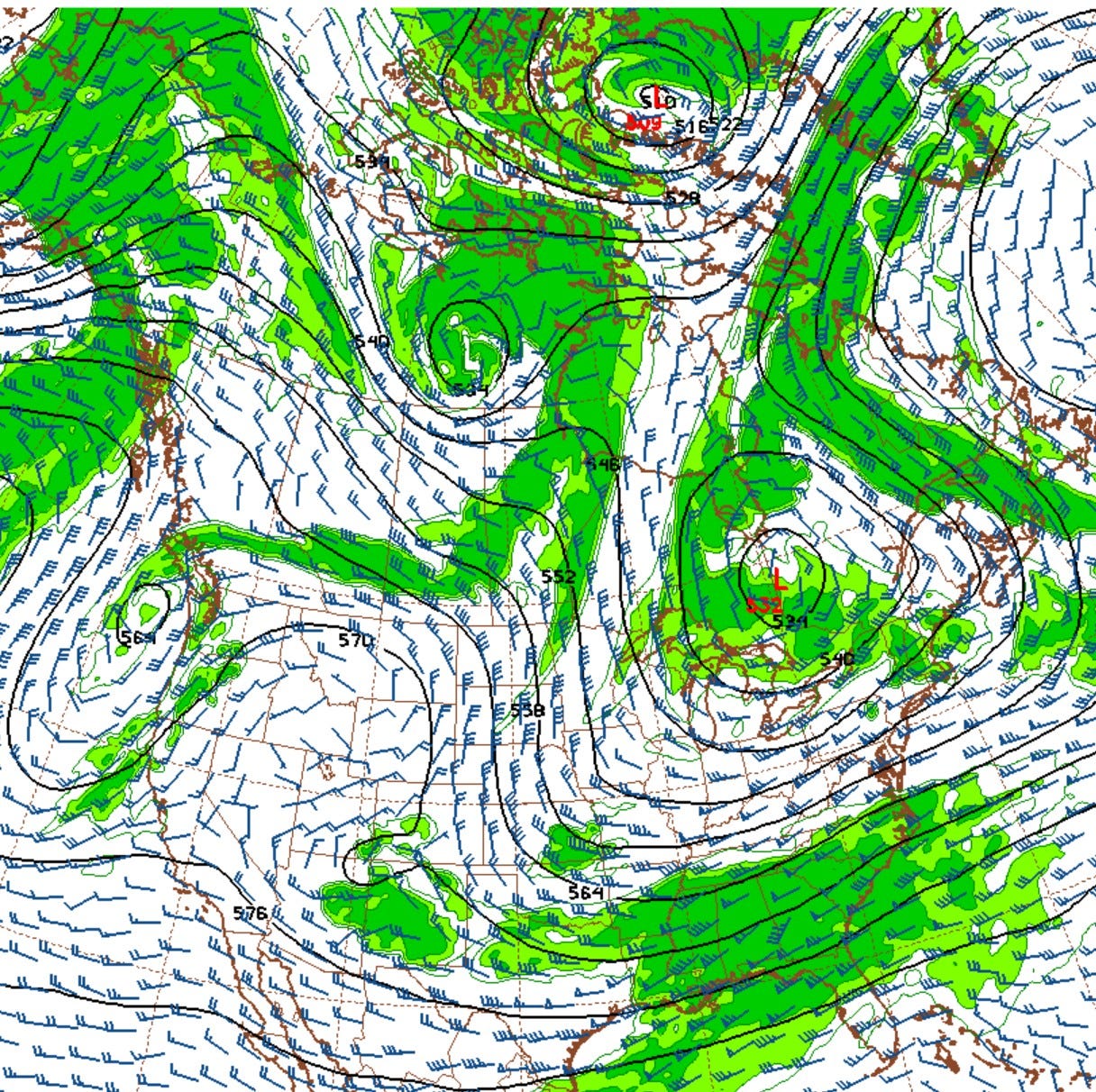
Here’s a map of the upper level wind flow. Our air at this level (500mb pressure surface) is coming south from Hudson Bay.
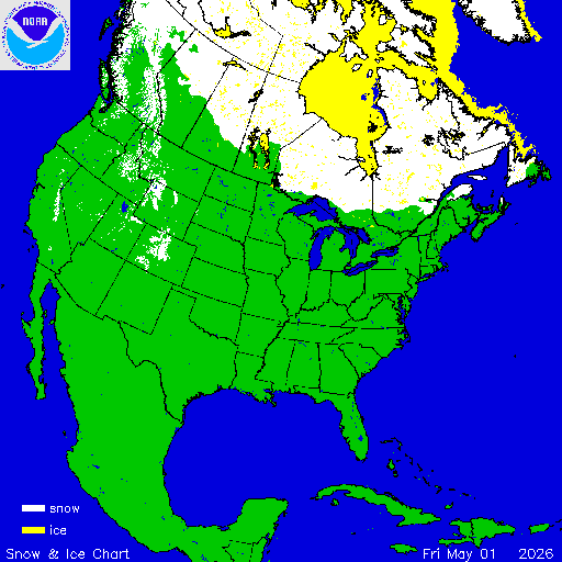
This map shows snow (in white) and ice (in yellow) cover as of Friday May 1. You can see the solid ice cover on Hudson Bay and there is still snow on he ground north of Minnesota and Lake Superior. When we get a north or northwest flow, cold air that has been sitting over that snow is going to move in. Plus, when it’s cloudy and the air passes over the cold water of the Great Lakes, it just doesn’t have a lot of time to warm up.
Friday’s high temperature in Grand Rapids was 46 and that was 18 degrees colder than the average high for the day which is 64. It was the coldest day since April 7.
April was 4.1 degrees warmer than average. We had 20 days that were warmer than average and just 9 days that were colder than average. Two days were exactly average. The warmest temperature was 80 on the 23rd and the coolest was 20 on the 7th.
Rainfall totaled 7.85” and that was 3.86” above average. We had two days when we set daily rainfall records: 1.53” on the 4th and 1.92” on the 14th. We had 15 days with measurable rain and another 4 days with a trace of rain.
It was a windy month with an average wind speed of 11.4 mph. On the 14th, Grand Rapids (Ford Airport) set an all-time record peak gust of 81 mph.
We had 9 days with thunderstorms and only a trace of snowfall.
Now, the first two weeks of May will overall be cool. Some of you may want to consider delaying the planting of any frost sensitive flowers and vegetables. That’s especially true if you live in a place that is prone to a late frost. A late frost is more common in rural valleys with sandy soil.
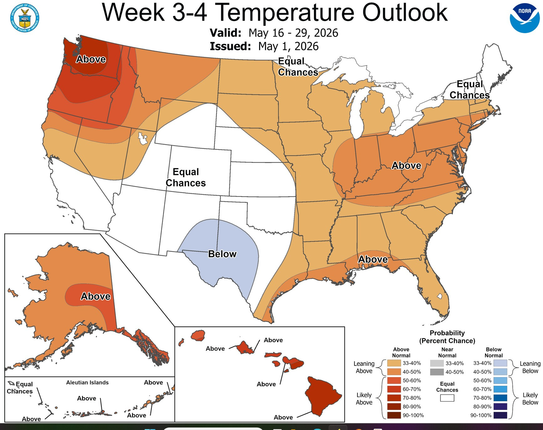
Here’s the 3 to 4 week temperature forecast. The Climate Prediction Center expects a pattern shift around the 15th that will bring back a warmer pattern and with it more thunderstorms.
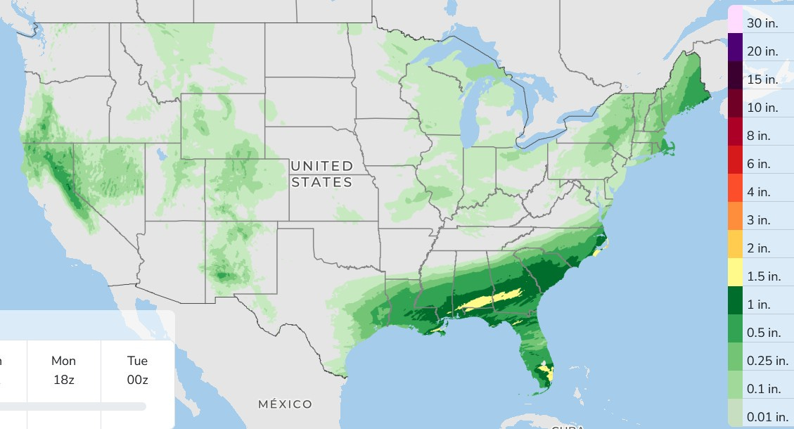
Here’s total rainfall over the next 3 days. Much-needed rain will fall in the Southeast with only a few scattered light showers and sprinkles in West Michigan on Sunday.
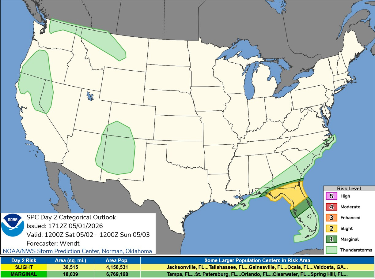
Here’s the Severe Weather Outlook Map for this Saturday. There is a Slight Risk (level 2) across much of northern Florida and extreme southern Georgia.
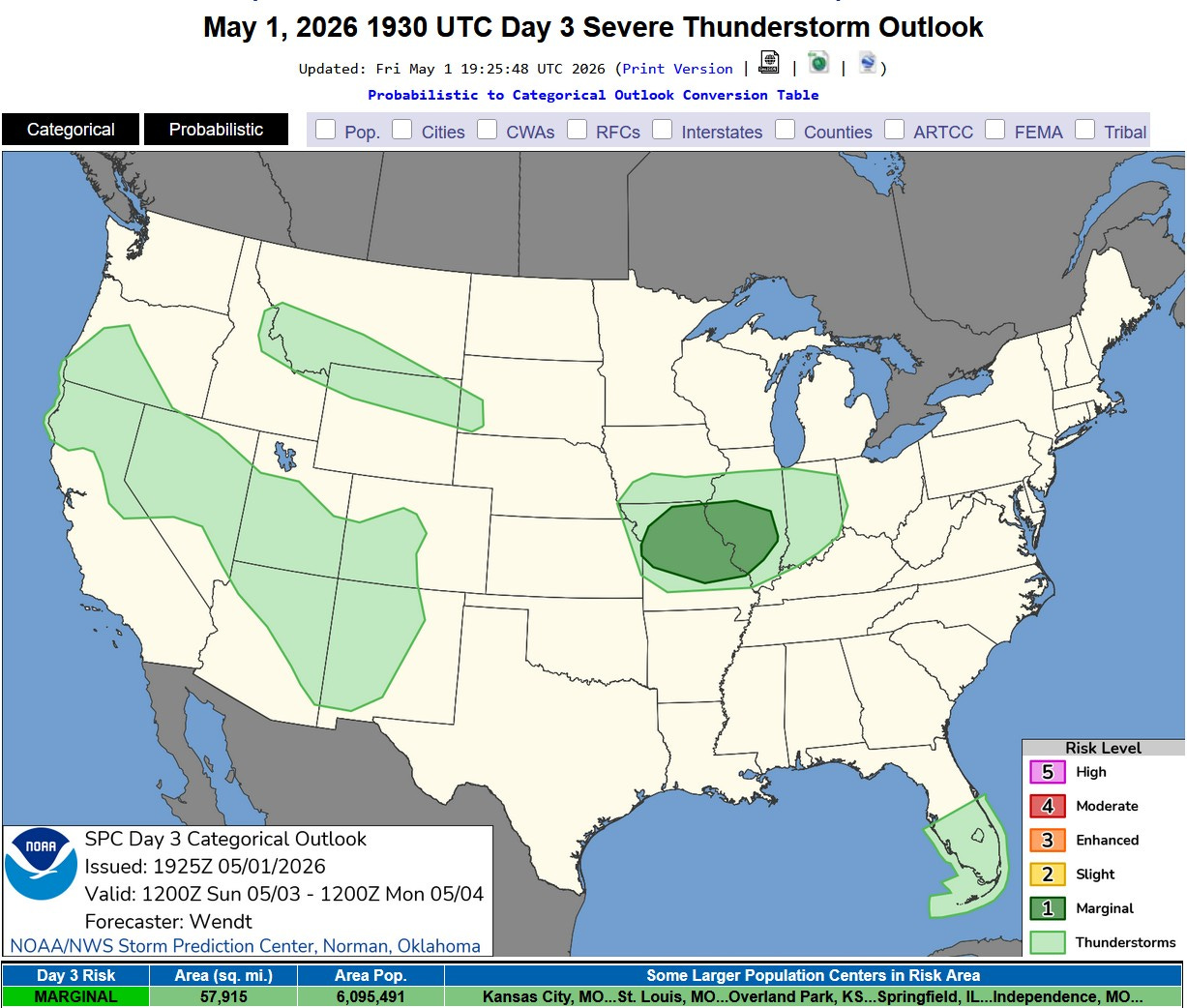
Here’s the Severe Weather Outlook map for Sunday. There’s a Marginal Risk (level 1) for large sections of Missouri and Illinois. Thunderstorms are not expected in Michigan on Sunday, though a storm is possible on Monday.
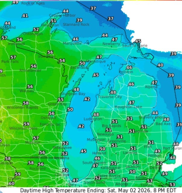
Here’s forecast high temperatures for today (Sat.). We’ll be a touch warmer than yesterday, but still well below average. Look for highs in the low 50s in inland areas and mid-upper 40s at Lake Michigan.
Also: Half dollar-sized hail in Houston. Gaining daylight in the month of May. Fresh snow on the mountaintops on Colorado. Significant flooding in San Antonio. Significant flooding in Brazil. Cool iridescent cloud in India. Side note…my uncle spent two years in India. He was in the Army and they needed someone who could fix motorcycles in India and Uncle Felix was the best motorcycle mechanic in Chicago.