
Cool Pattern Continues
The last 8 days have been 7.4 degrees cooler than average

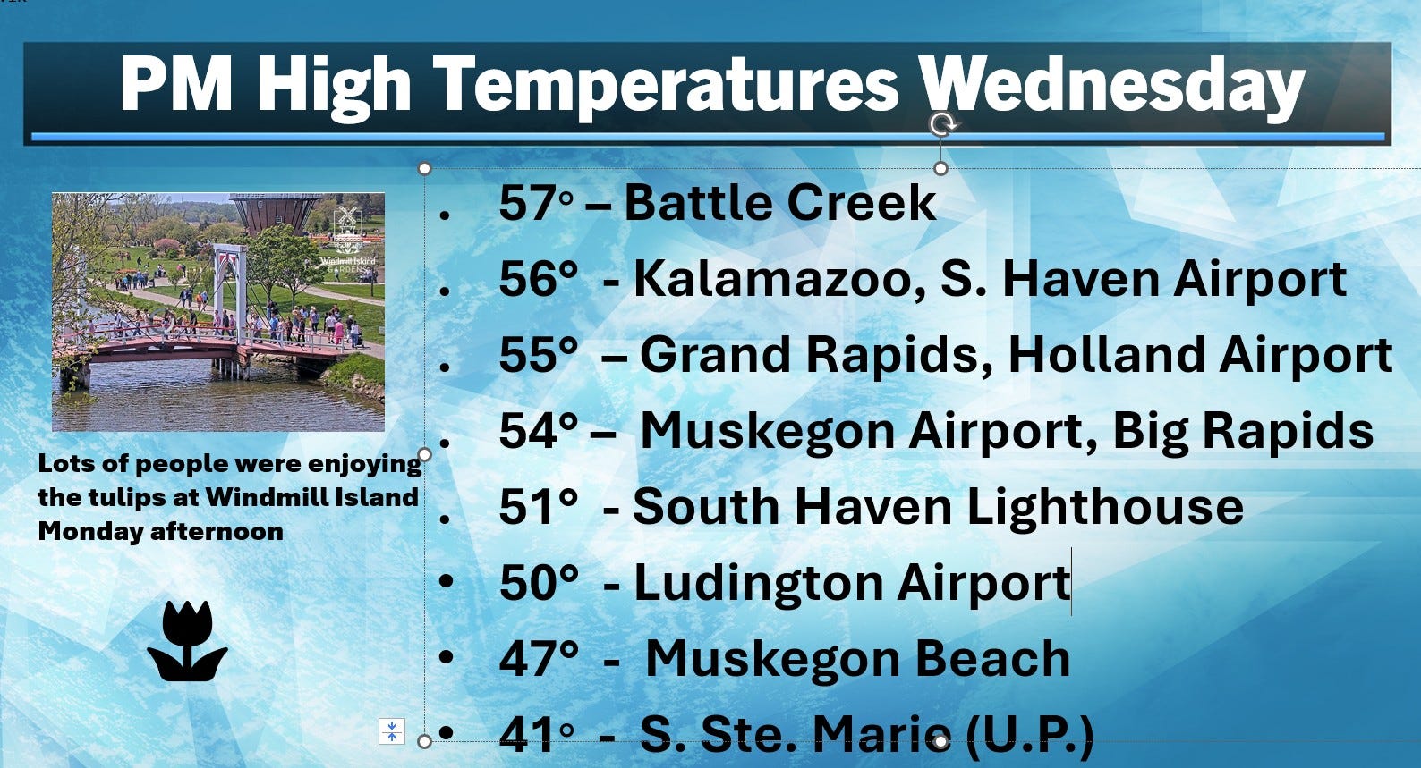
Here’s a look at high temperatures Wednesday. The 55 in Grand Rapids was 11 cooler than average. It was cooler near the lake, a chilly 47 at the Muskegon Beach. Mackinac Island had a high of 43 and S. Ste. Marie struggled to 41.
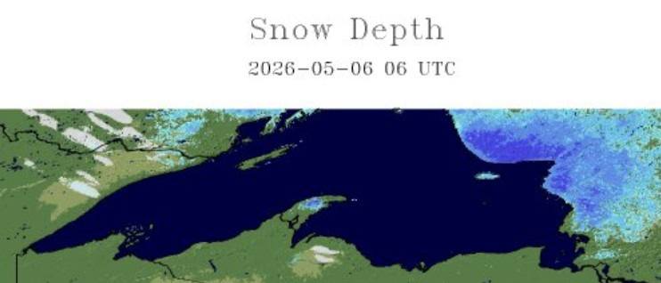
This map shows snow cover Wednesday morning. There’s still a little snow in the higher elevations of the Keweenaw Peninsula and just west of Marquette. There’s still a lot of snow on the ground in Canada as you go north of S. Ste. Marie.
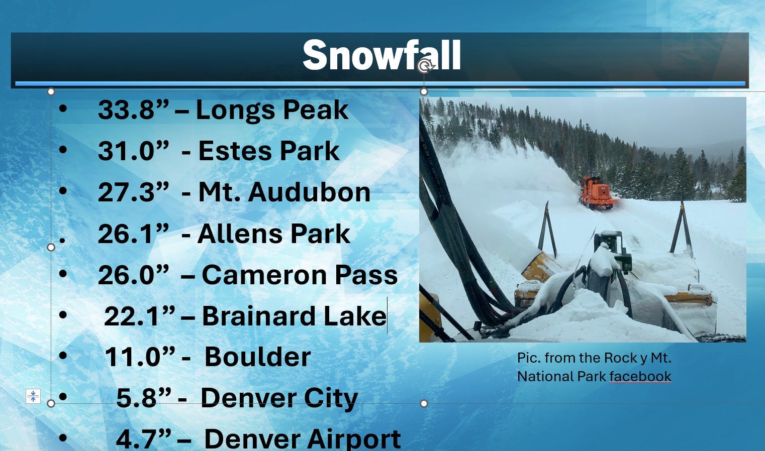
Wow! Check out the snow they had in Colorado…and it wasn’t just in the mountains. The Denver Airport had nearly 5” of snow. Over 2 1/2 feet of snow fell in parts of Rocky Mt. National Park.
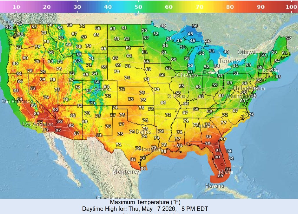
Here’s expected high temperatures in the U.S. today. We’ll reach only the low-mid 50s and just the 40s up near Lake Superior. It’ll stay hot in Florida and the desert Southwest. Denver soars back into the 60s.
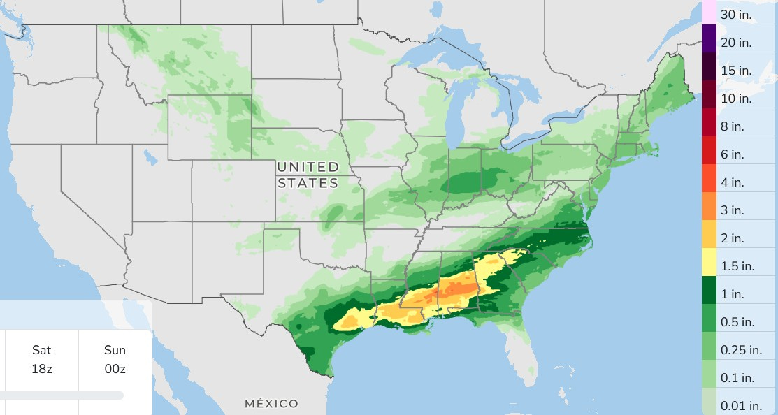
Here’s the 3-day total rainfall forecast. Heavy rain is expected from southeast Texas to the Carolinas. Probably no rain or just a few sprinkles for much of Grand Rapids, with a chance of a shower or t-shower basically limited to areas along and south of I-04.
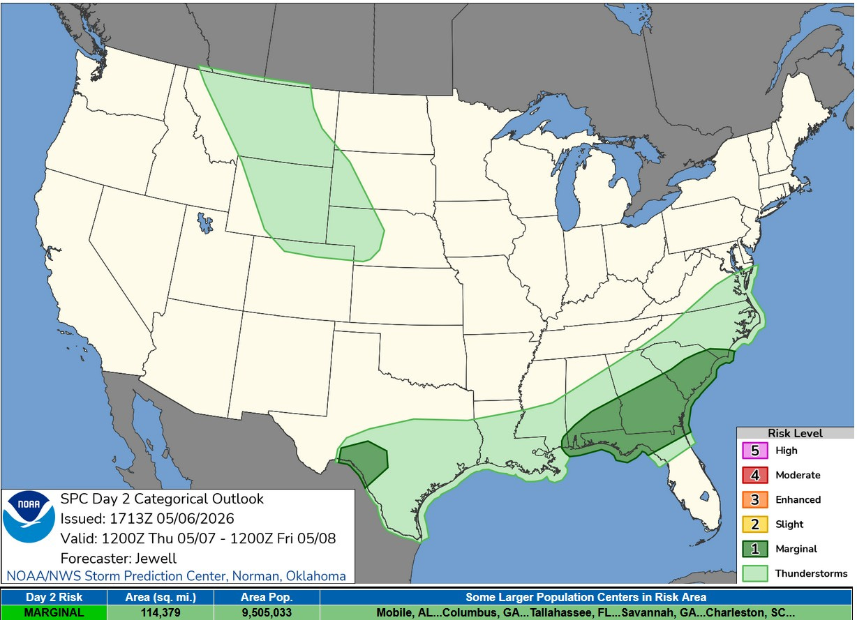
There’s a Marginal (level 1) risk of a severe thunderstorm in southwest Texas and from the Florida Panhandle to the Coastal Carolinas.
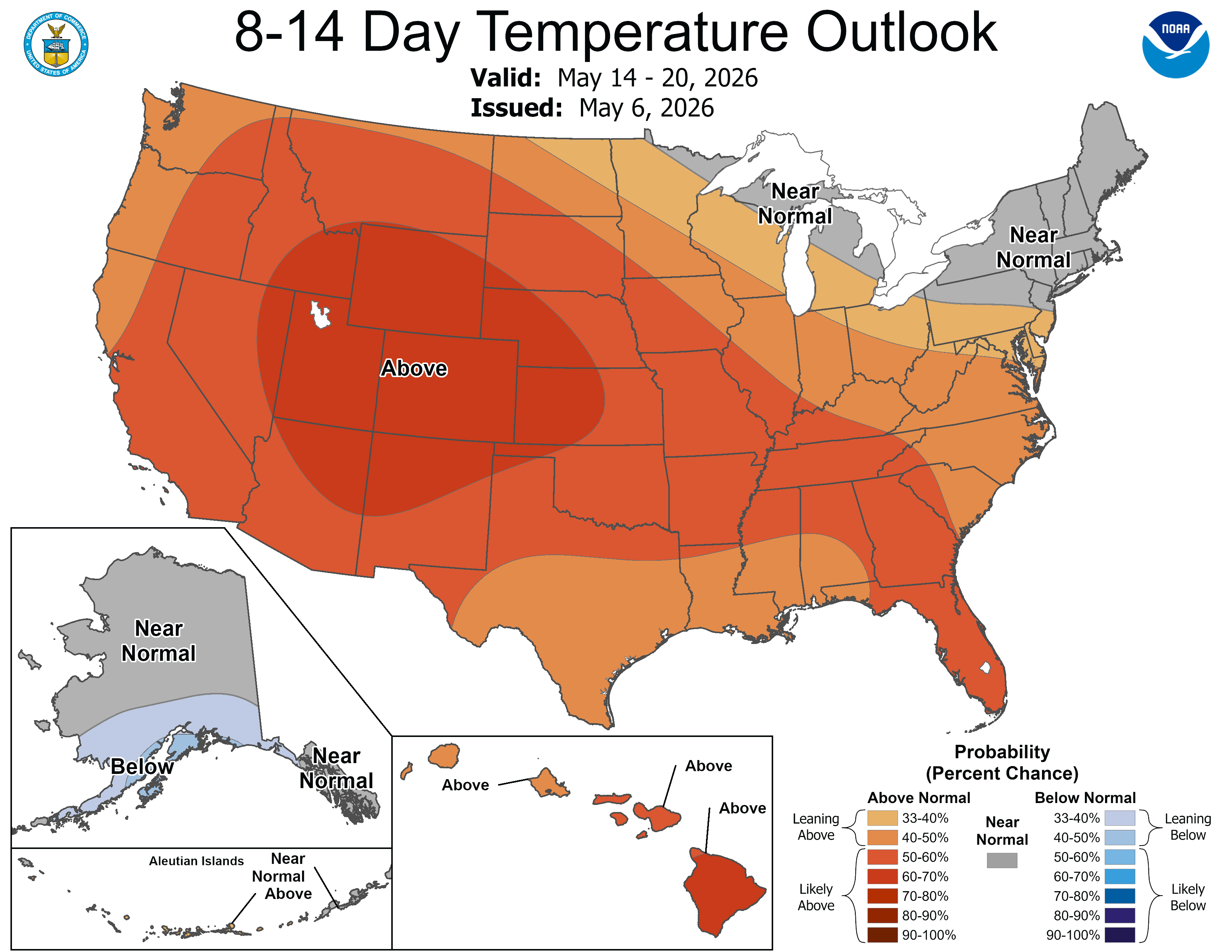
For the first time in what seems a couple weeks, the 8-14 day temperature outlook as West Michigan a touch warmer than average. As I’ve been mentioning…overall the first two weeks of May would likely be cooler than average and the last two weeks may turn out a touch warmer than average with the threat of frost diminishing after the middle of the month.
Check my blog tomorrow…I’m planning a 2-day trip with daughter #2. See where we land. Have a great day!