
Cool Monday, Warmer Mid-Week
Mostly dry week in West Michigan

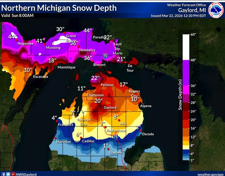
We’ll have a north-northwest wind today. That wind will be coming off the snow cover across the U.P. and northern Lower Michigan, so it’s not going to be a warm day. Sunday the high temperature at S. Ste. Marie was 34 and in Marquette it was 32. S. Ste. Marie reported 33” of snow on the ground Sunday and Marquette had a 40-inch snow cover.
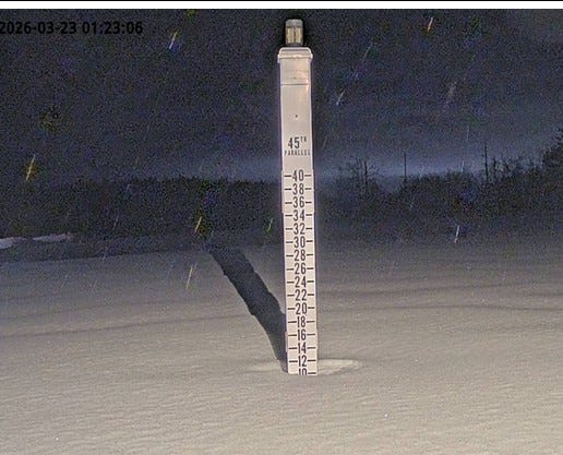
Here’s a pic. of the Gaylord snow stick Monday AM - showing around 10” of snow on the ground there. If you are interested, there’s still plenty of snow across northern Michigan to run the snowmobile or get the skis out one more time. You can see a few flurries in the pic. above. There is a chance you might catch a couple of snowflakes or drops of drizzle today, but mostly trace amounts.
A pretty strong cold front moved south through the Midwest and Great Lakes. On Saturday, Des Moines, Iowa reached a record-setting 91 degrees at 4:54 pm. Twenty-four hours later at 4:54 pm Sunday, the temperature in Des Moines was 47. That’s a drop of 54 degrees in one day!
In Grand Rapids, the temperature was 65 at 1:53 am Sunday. It fell to 33 at 1:53 am Monday.

Along the cold front, there were some severe thunderstorms. There were 16 reports of severe wind gusts and 112 reports of severe criteria hail (no tornadoes). Peak thunderstorm wind gusts included 69 mph at Columbus OH, 64 mph at Indianapolis and 58 mph at Cincinnati OH.
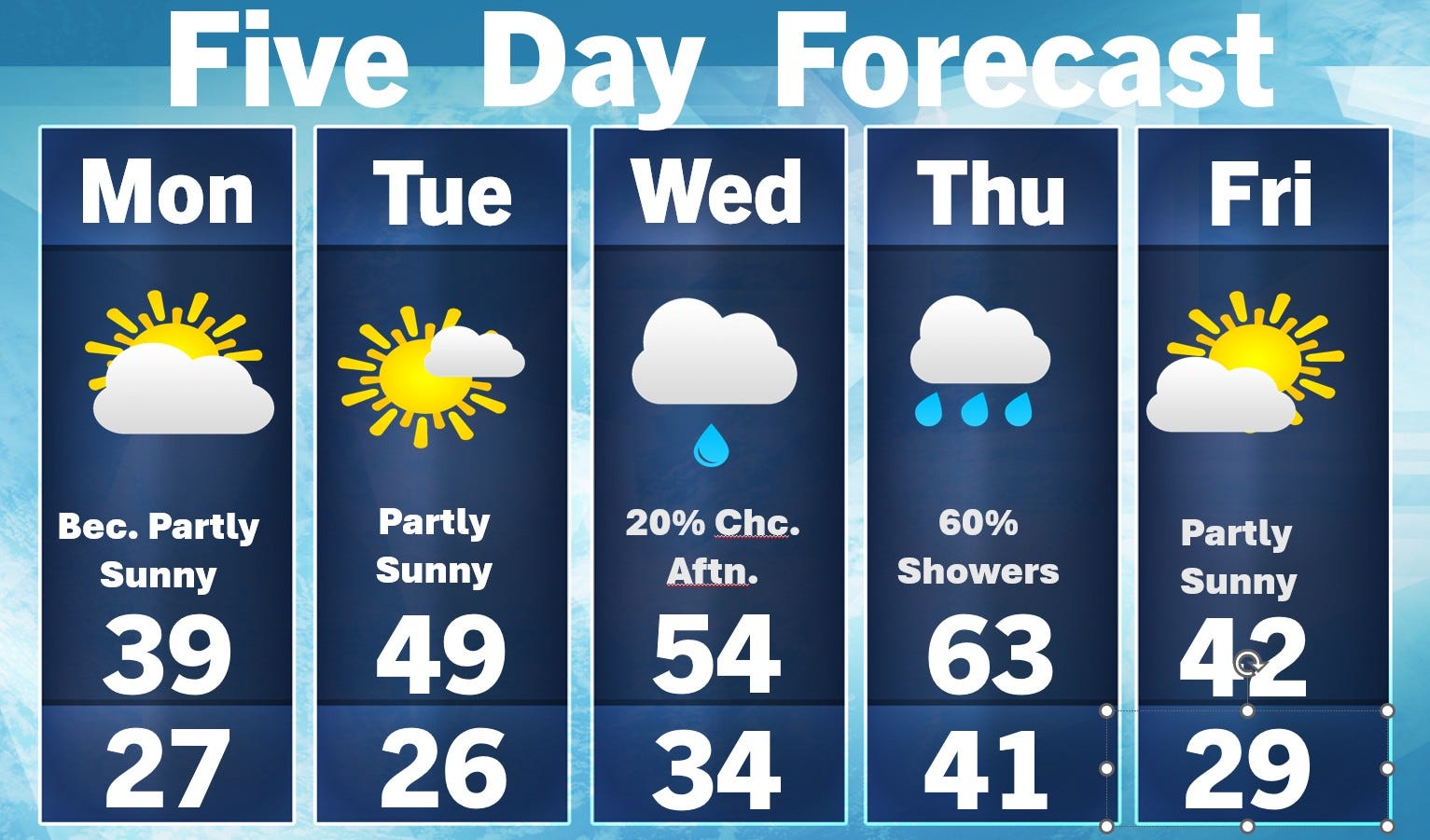
A cool day today - mid-upper 30s. We’re 10 degrees warmer on Tuesday, mid 50s on Wednesday and maybe low 60s on Thursday with a chance of showers (mostly light). Friday looks cool and dry and most of Palm Sunday weekend looks on the cool and dry side. More later - happy Monday!