
Cool and Mostly Dry Early This Week
Cool and Dry With Some Sunshine for the Whitecaps Opener

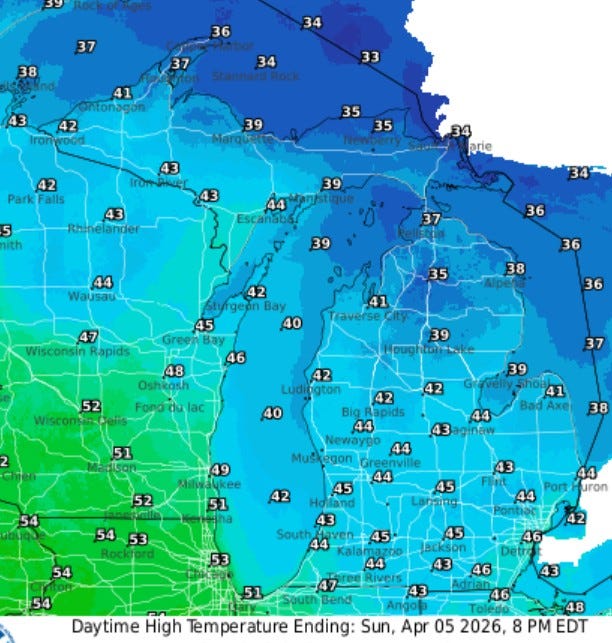
The average high temperature for today in Grand Rapids is 53. We’ll be on the cool side of average early this week, with highs in the low-mid 40s for Sunday, Monday and Tuesday. We could see a passing snow shower today (Easter Sunday), but just trace amounts to a dusting at most. Winds will be brisk, from the west at 15-20 mph.
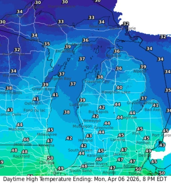
Here’s high temperatures for Monday…again, low-mid 40s. It’ll hold in the 30s across northern Lower Michigan and Upper Michigan.
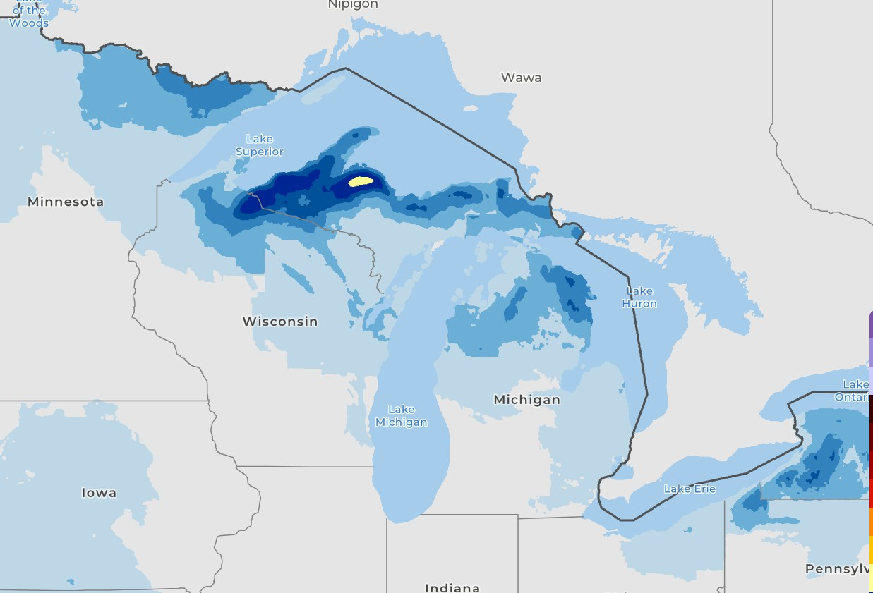
There’s another shot of snow coming for parts of Upper Michigan and northern Lower Michigan Sunday night and Monday. That yellow area west of Marquette is a forecast for 6” of new snow with much of the western U.P and Lake Superior shoreline in the 1-4” category. A couple inches will fall over a good portion of northern Lower Michigan with a few flakes east of Lansing and north of Big Rapids.
Marquette got another 1.4” of snow on Saturday - they’re up to 270.8” for the winter. They still have 37” of snow on the ground at the airport there. S. Ste. Marie is up to 186.5” for the winter and they have 24” of snow on the ground.
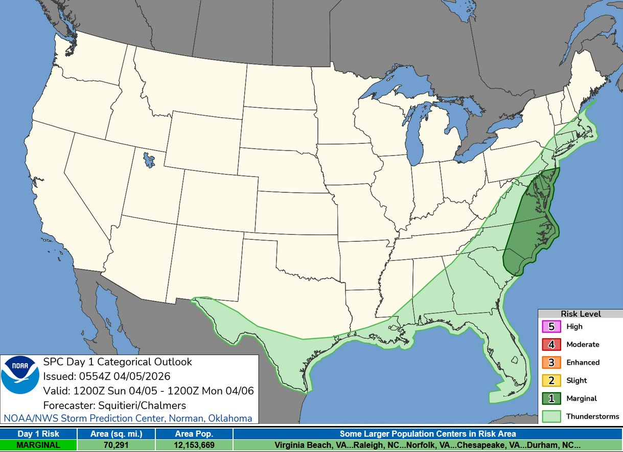
This is the Severe Weather Outlook Area for this Easter Sunday. There is a Marginal Risk from southern New Jersey to S. Carolina, mainly only for isolated strong wind report. The light green is a General Thunderstorm Outlook (not severe). There should be very little severe weather in the U.S. during the first half of this week.
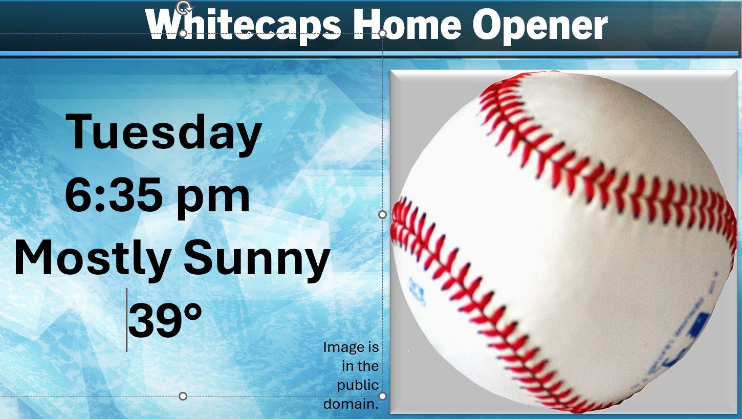
The weather will be fair, not foul for the Whitecaps opener Tuesday evening (April 7). We’ll see partly to mostly sunny skies. It will be cool - with game-time temperatures falling from the upper 30s to the mid 30s. I think they have fireworks after the game
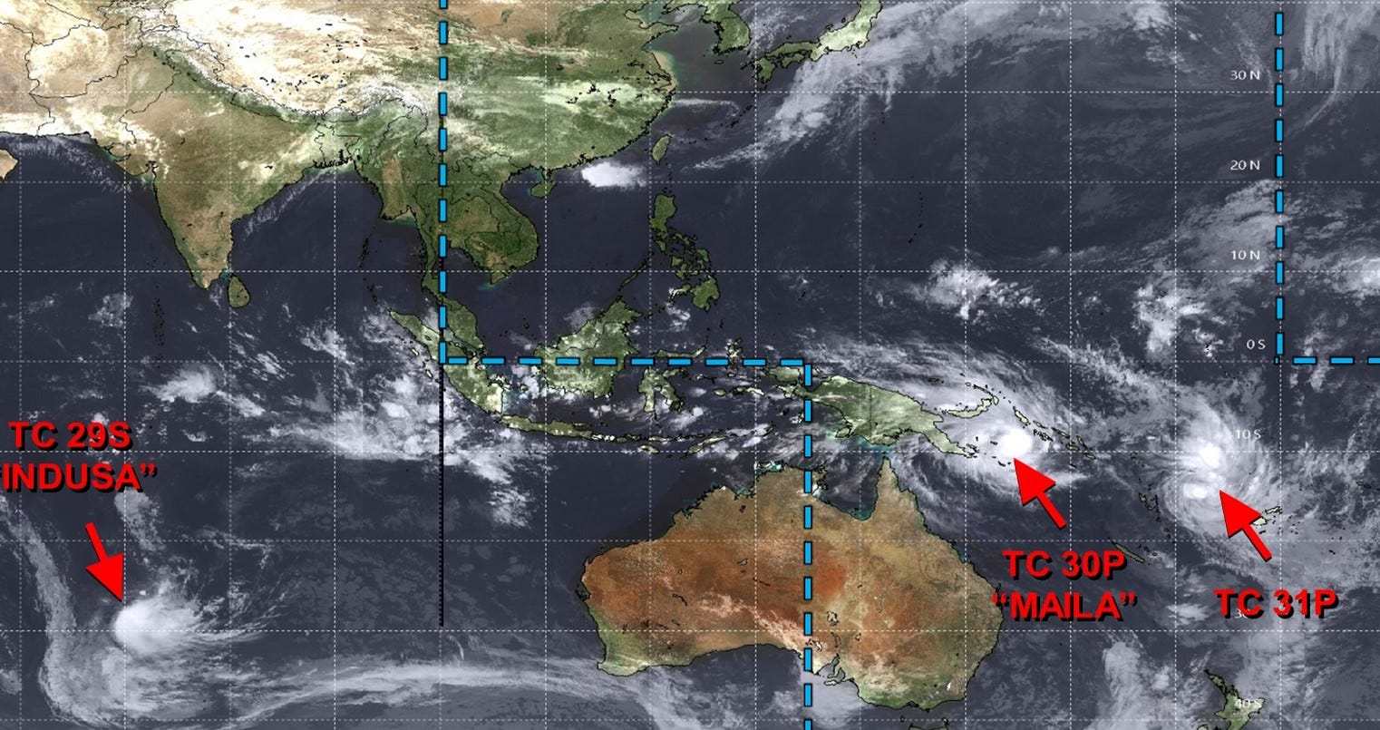
There are several tropical systems in the Southern Hemisphere (their late summer and fall is peak of the hurricane season in the Southern Hemisphere, though there is generally much less tropical storm activity in the Southern Hemisphere as opposed to the Northern Hemisphere. There is also more ocean and less land in the Southern Hemisphere.
Tropical Cyclone “Indusa” will drift north and weaken far from land. Tropical Cyclone “Maila” is well east of Papua New Guinea and is moving northwest. Tropical Cyclone 31P is moving northwest. It will strengthen to around 100 mph, then weaken. It’s well west of Tonga and shouldn’t seriously affect any land areas.
Thank you for the info on the SO. Hemisphere and the high winds /storms for the far-flung regions. Many of us have friends, family, *exchange students, or missionaries that travel to or are located in the 'Out-lyer' areas; it's good to know some of these forecasts.(Rotary does an EXCELLENT job working with parents, families, and students, both coming and going ).