
Chance of Snow Next Week
Models showing first Arctic air mass moving down into the Great Lakes

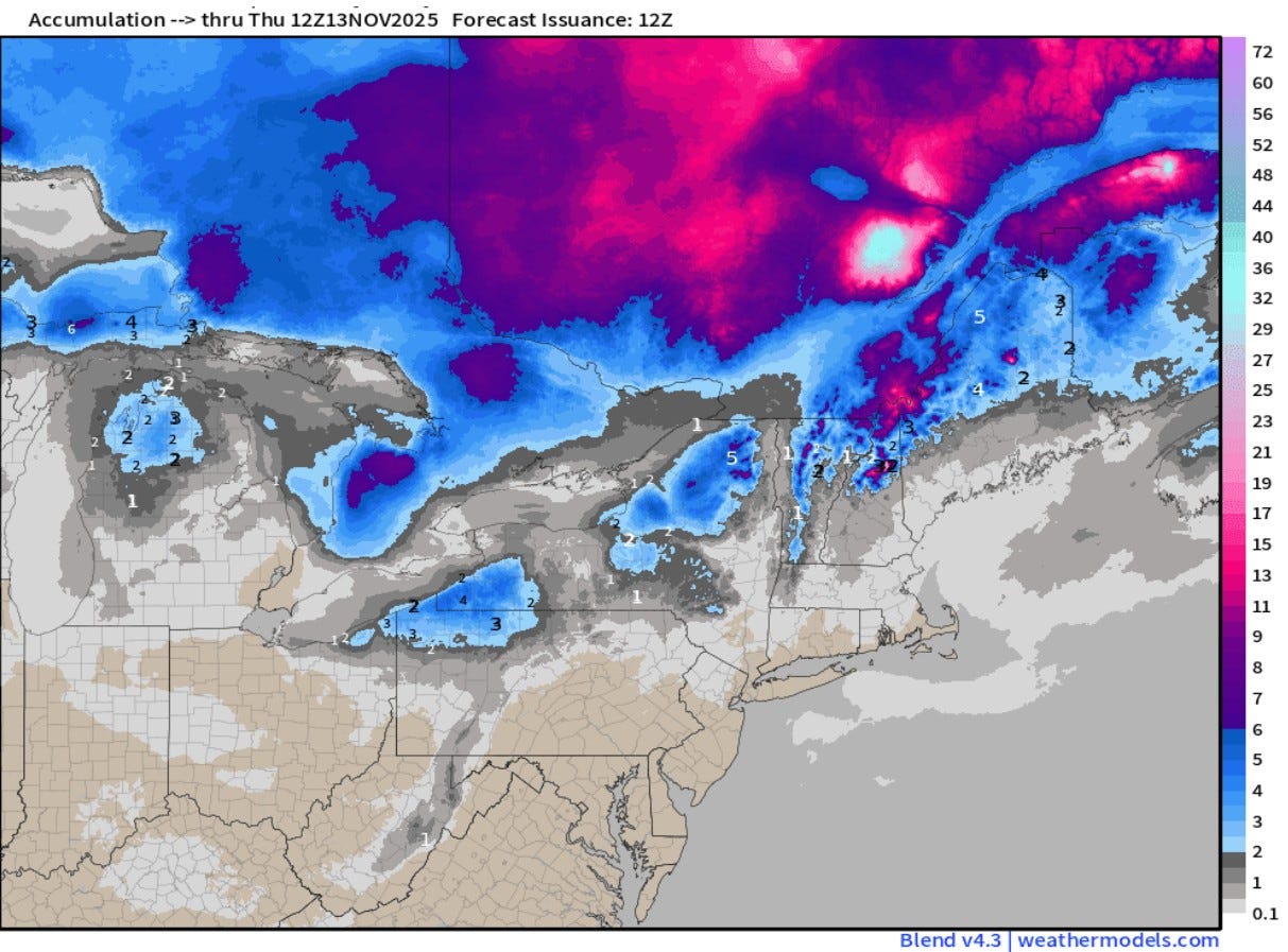
The first snowflakes of the season are possible in the Great Lakes next week. The map above (from Dr. Ryan Maue and weathermodels.com is the total forecast snowfall from the European model for the period from now to Thursday, Nov. 13. It shows lake-effect snow downwind from each of the Great Lakes with 1-3” north of Grand Rapids. 15-day European snowfall forecast.
Dr. Maue says: “Cold air out of Canada will dump into the Great Lakes and Northeast starting this weekend —> Lake Effect snowfall machine cranks up!” “Strong “polar vortex” trough in the middle-levels + surface high pressure = typical setup for an Canadian Arctic Blast of cold air with low temperatures 10°F to 15°F below normal by Tuesday morning.”
It’s still a long way off to get into specifics. For now…there’s a good chance of some fairly cold air to arrive early next week with the possibility of our first snowflakes of the season.
No snow please
Thank you Bill! My new winter layering clothes are arriving today! No bad weather…only bad clothes!