
Chance of More Showers & Storms
Heavy rain causing local flooding

It was a busy day for me yesterday and we had the severe weather in the evening. So, I didn’t start a new thread. I’ll update this when I get up in the AM - hopefully with new information on a possible tornado or two here in West Michigan Tuesday evening.
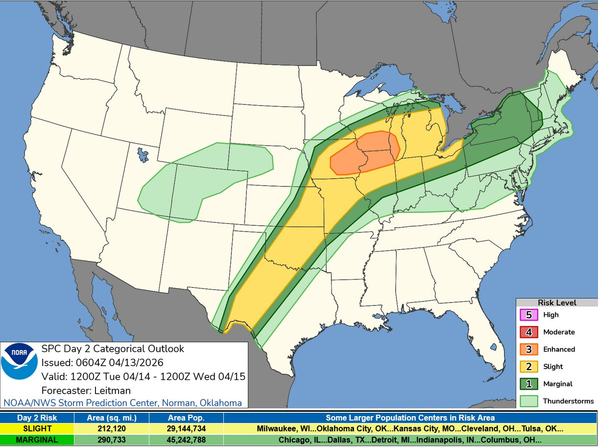
This was the Severe Weather Outlook Map from the Storm Prediction Center for Tuesday issued Tuesday AM. There was an Enhanced Outlook Area (level 3) across eastern Iowa, northern Illinois, southern Wisconsin and western Lake Michigan. That was surrounded by a Slight Risk Area (level 2) that ran from Mexico to Ontario...and that was surrounded by a Marginal Risk Area that ran south to Indianapolis and north to the Mackinac Bridge.
SPC says: “Severe thunderstorms are expected this afternoon through tonight from the southern Plains to the Great Lakes. Large to very large hail, a few tornadoes (some strong), and damaging wind gusts will be possible, particularly across parts of eastern Iowa, northern Illinois, and southern Wisconsin. Additional severe storms, mainly producing strong wind gusts will be possible.”
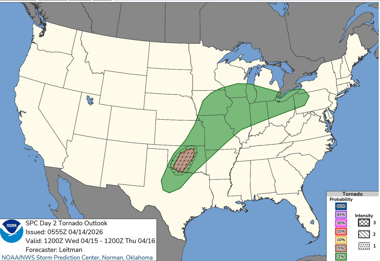
This map showed the odds of a tornado within 25 miles of a given point today/tonight. That’s a 5% risk in West Michigan (generally south of a line from Ludington to Mt. Clemens.
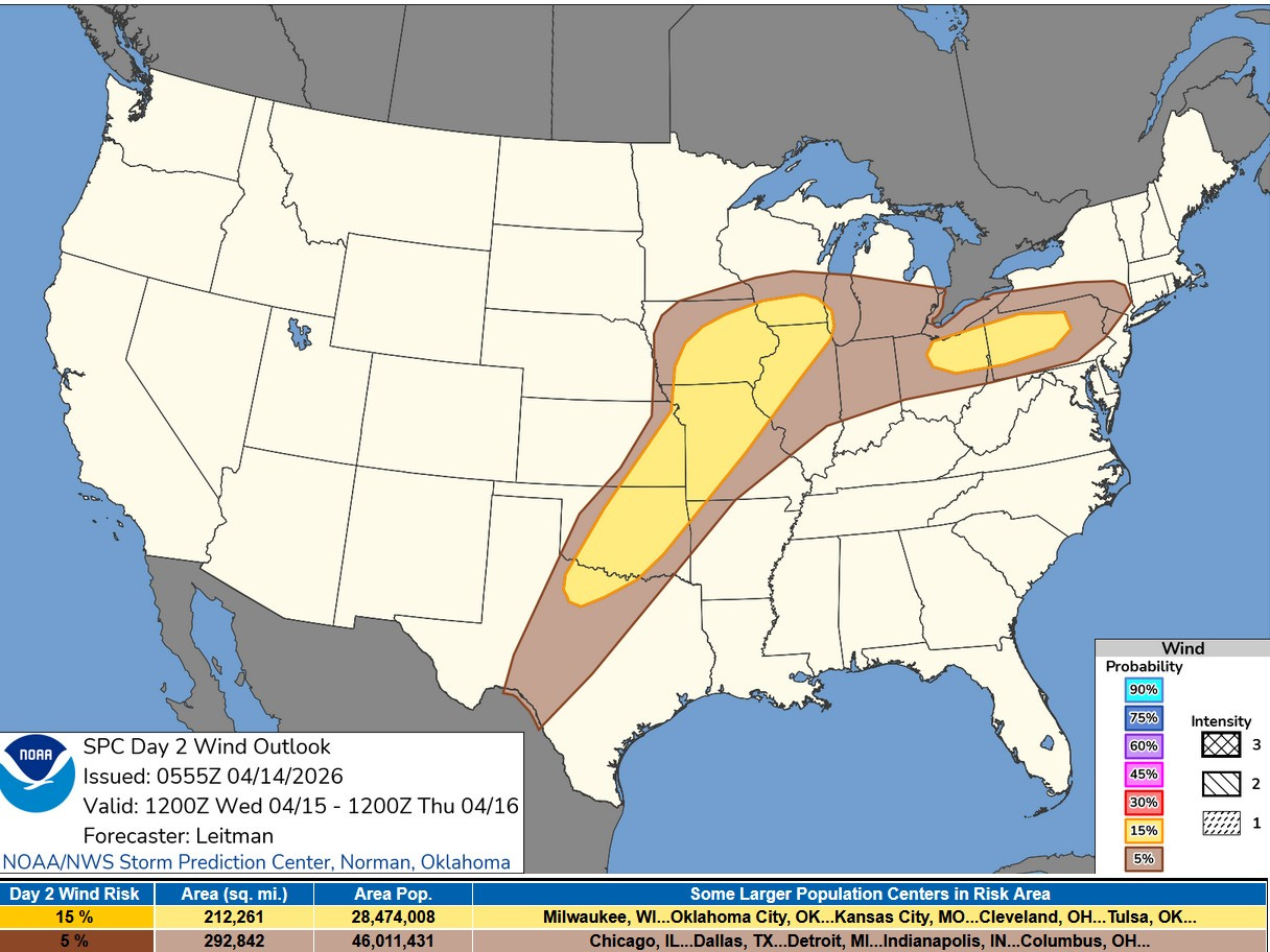
This is the Severe Wind Outlook for today/tonight. That’s a 5% risk for West Michigan. The higher 15% risk is from Milwaukee and Chicago to the southwest and to the east of Toledo.
Overnight, winds gusted to 48 mph at Muskegon, 47 mph at Holland, 45 mph at Fremont and 36 mph in Grand Rapids.
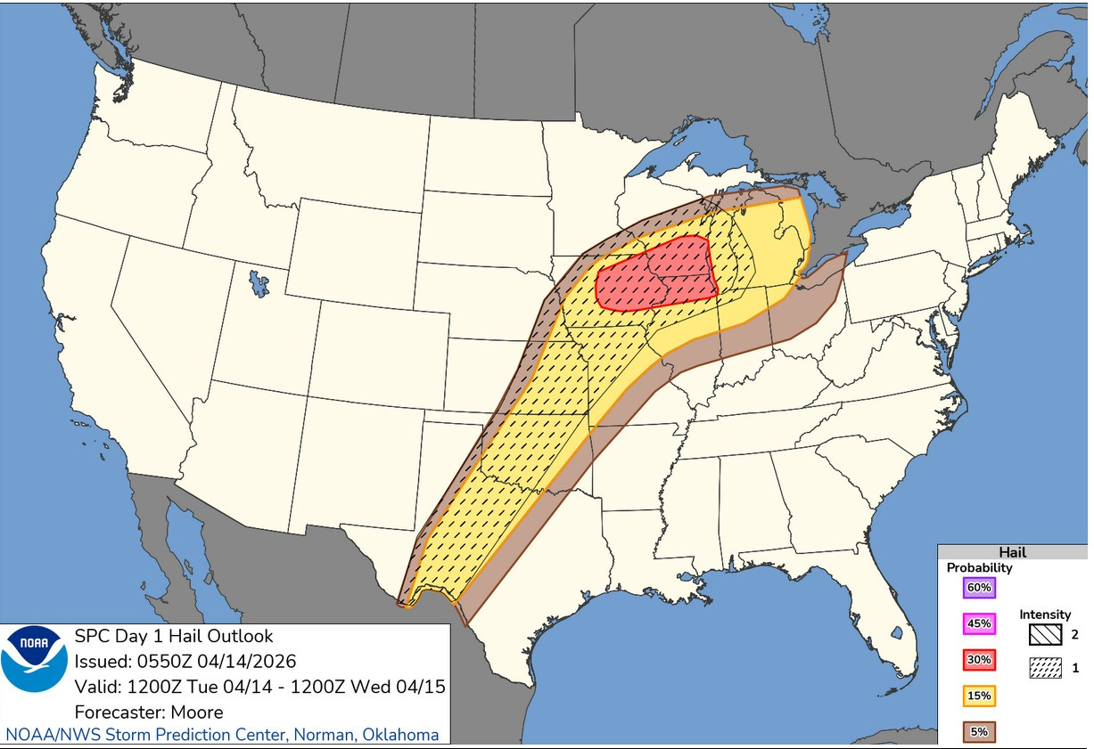
West Michigan is in the 15% hail outlook. That’s a 15% chance of a severe hail report within 25 miles of a given point. The higher 30% chance is across Lake Michigan in Wisconsin, Illinois and Iowa.
Here’s the Severe Weather Forecast Map for Wednesday/Wednesday Night. Southern Lower Michigan is in the Marginal (level 1) Risk Area. Most of the day it won’t be raining, but the odds of catching at least one shower or storm is 70%. Flooding continues to be an issue.
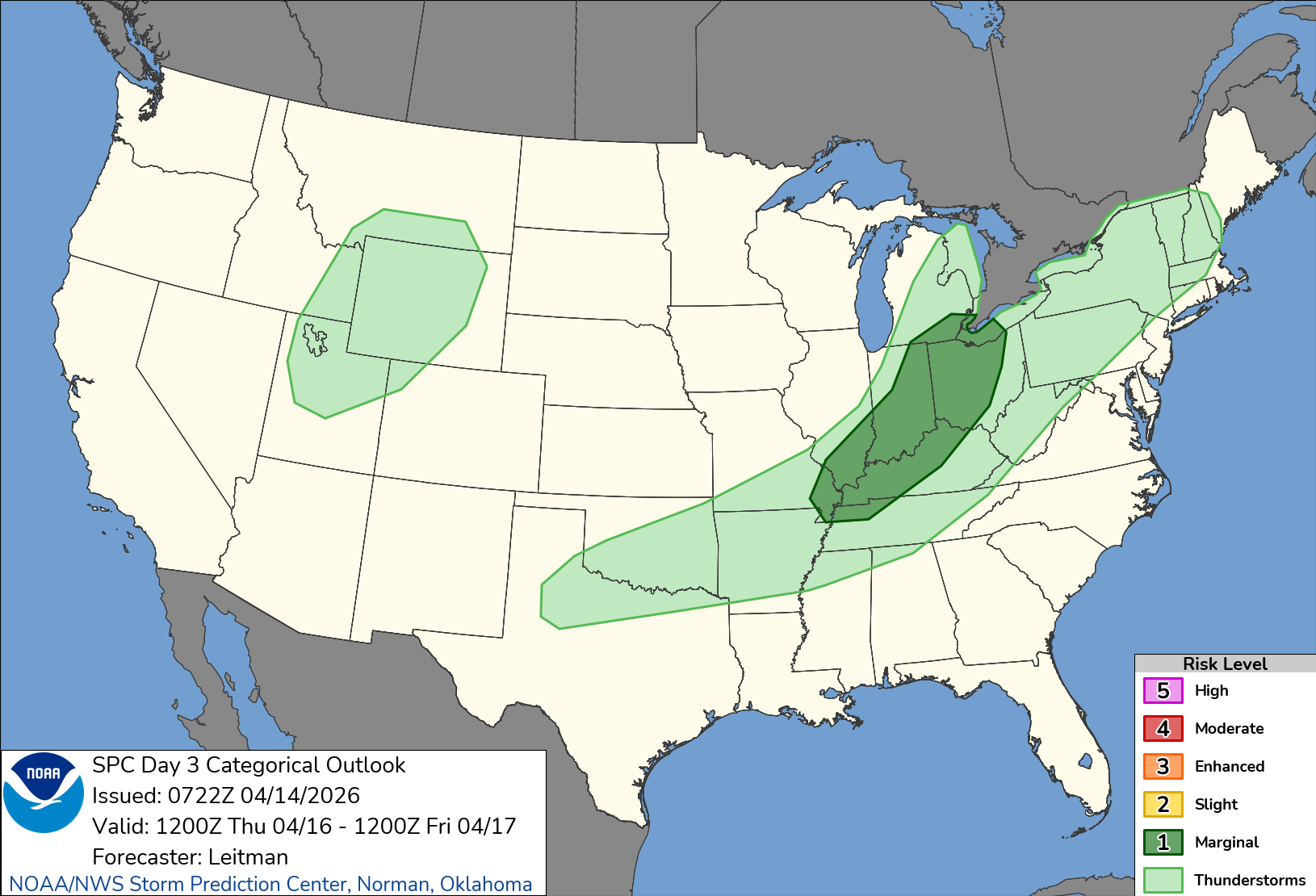
The Severe Weather Outlook Map for Thursday/Thursday night has just a level 1 Marginal Risk from the Missouri Bootheel to the Detroit area. Threats include an isolated strong wind gust, marginally severe hail and local flooding.
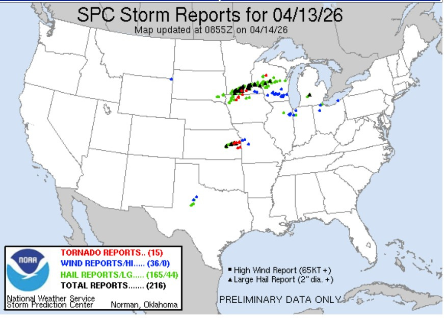
Here’s storm reports for Monday, 4/13 as of 5 am. The number is likely to go up a bit yet. There were 15 reported tornadoes - most relatively small and short-lived - 36 reports of wind damage and 165 reports of severe hail, with 44 reports of hail bigger than golf balls. Here in Michigan, we had 2” diameter hail at Portland in Ionia Co. and 1.25” diameter hail at Hastings in Barry Co.
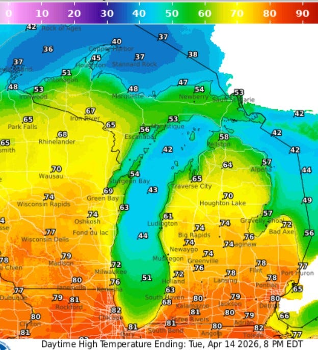
Here’s forecast high temperatures for this PM. We’ll see readings range from the low 80s south of Grand Rapids and inland from the lake to the 60s near Lake Michigan to just 40 degrees up at Copper Harbor in Upper Michigan. The average high temperature for mid-April is 57.
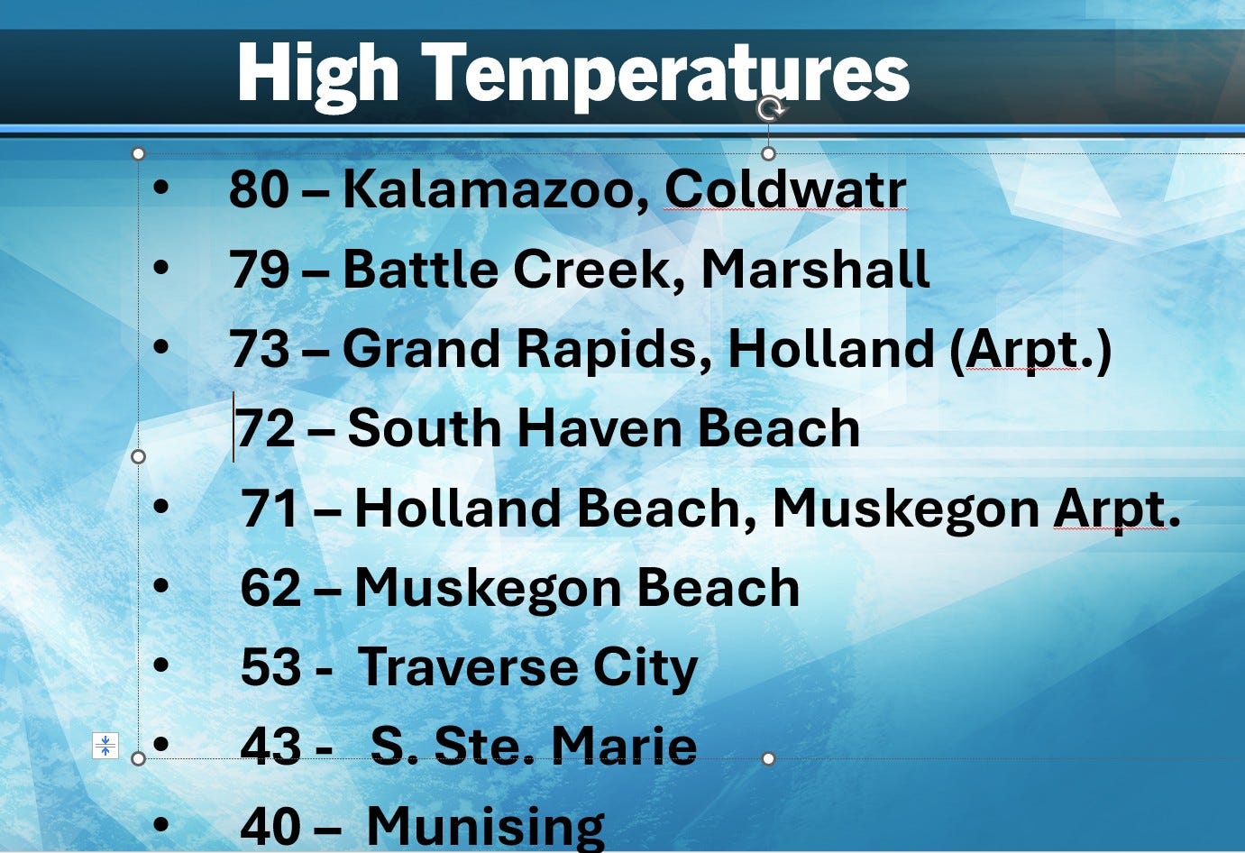
Here’s high temperatures from Monday. Again, a 40-degree spread from the Indiana border counties to the Keweenaw Peninsula. It was in the 70’s at Cadillac, but only low 50s at Traverse City.
Thanks much Bill for keeping all of us in the loop on the severe weather potential. Much appreciated
lotsa good info that past two days; thnx