
Bill and Daughter #2 Head to the Zoo
We've landed in Fort Wayne, Indiana


Daughter #2 and I share the same birthday, May 9. She was born exactly 30 years to the hour after I was born. We often like to share a special time together and this year, Marie suggested we visit the zoo in Fort Wayne, Indiana. We had a nice trip down here, stopped in the afternoon to visit a friend who lives here. We then went to play miniature golf (Marie won) and then had dinner at the nearby Olive Garden. We’ll head to the zoo tomorrow (Friday) morning.
We thought about seeing a Tin Caps baseball game, but this evening it’s sprinkling, breezy and chilly. Tomorrow evening is Pro Wrestling Night.
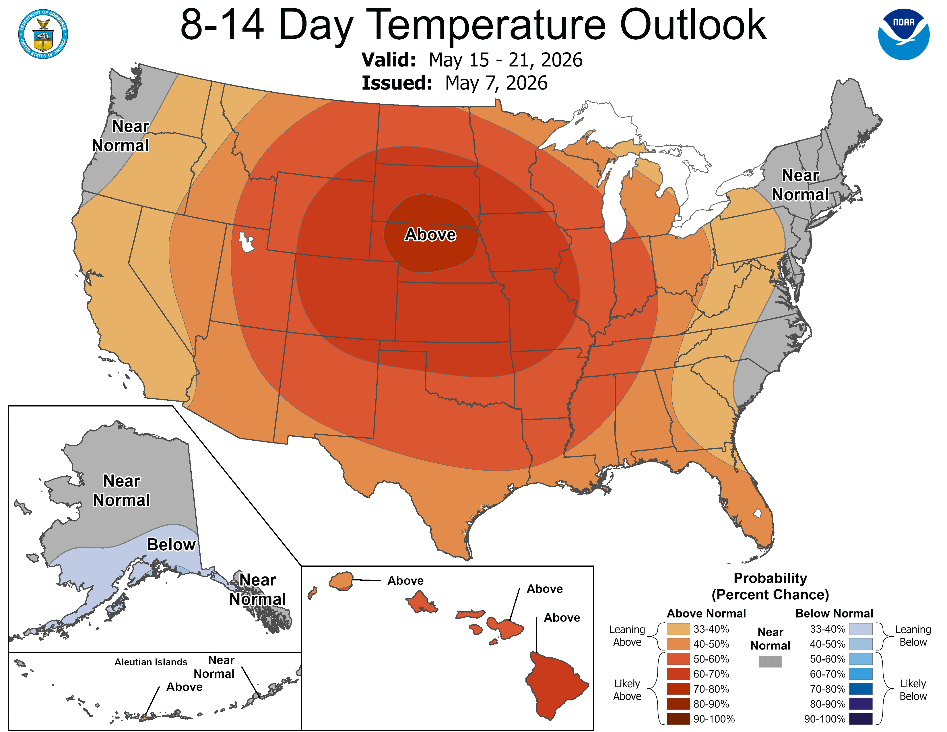
Here’s the latest 8-14 day temperature forecast from the Climate Prediction Center. This is for May 15-21. They forecast a heat bubble of sorts over the central U.S. with above average temperatures. This would mean high temperatures in the 70s and 80s….However:
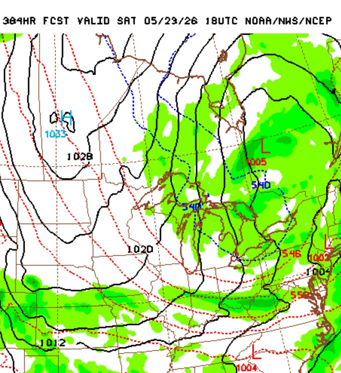
This is from the GFS model forecast for Saturday, May 23rd. There’s high pressure north of North Dakota and a cool flow of air from the Hudson Bay area (where there is still snow on the ground) to Michigan. It’s way too early to pin down anything this far out, but while the warmer air will get a bit stronger as we move into mid May, there is still the potential for a relatively cool period as long as all that snow, ice and cold water extends from Lake Superior to the Hudson Bay area.
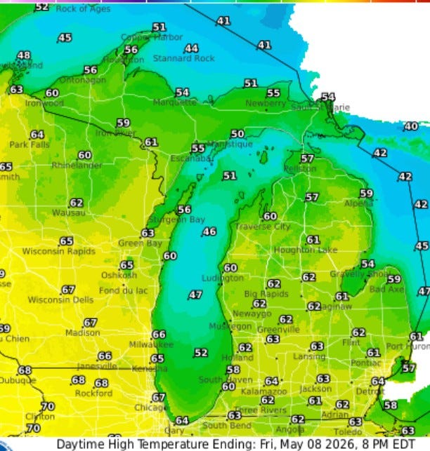
Here’s high temperatures for this Friday. We’ll see readings in the low-mid 60s in inland areas and mid-upper 50s near Lake Michigan. Readings should reach the mid 50s in the U.P. and approach 70 by the Mississippi River.
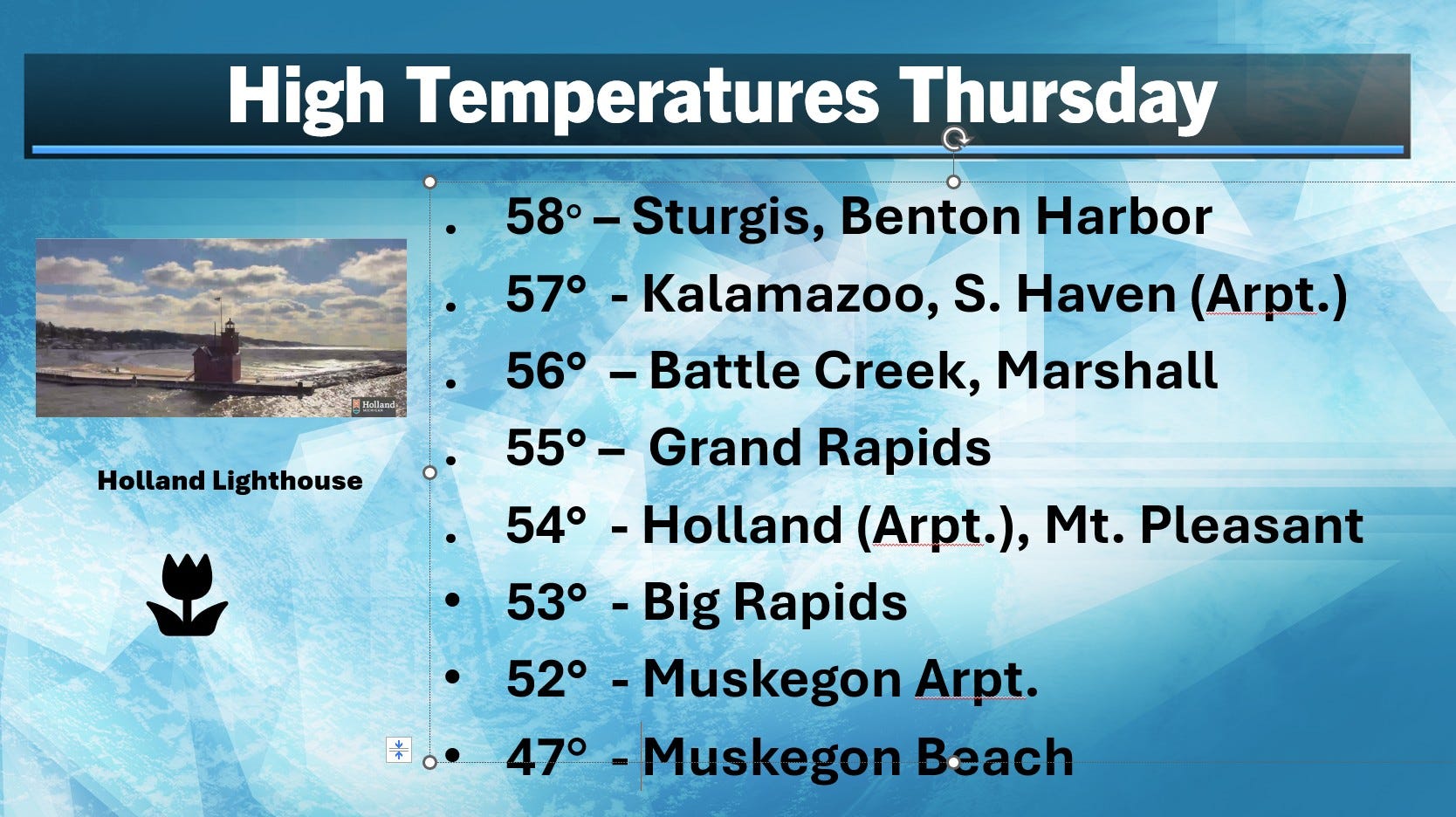
Here’s high temperatures from Thursday. Another cool day. The average high temperature for Grand Rapids is now 67, so the 55 reading was 12 cooler than average.
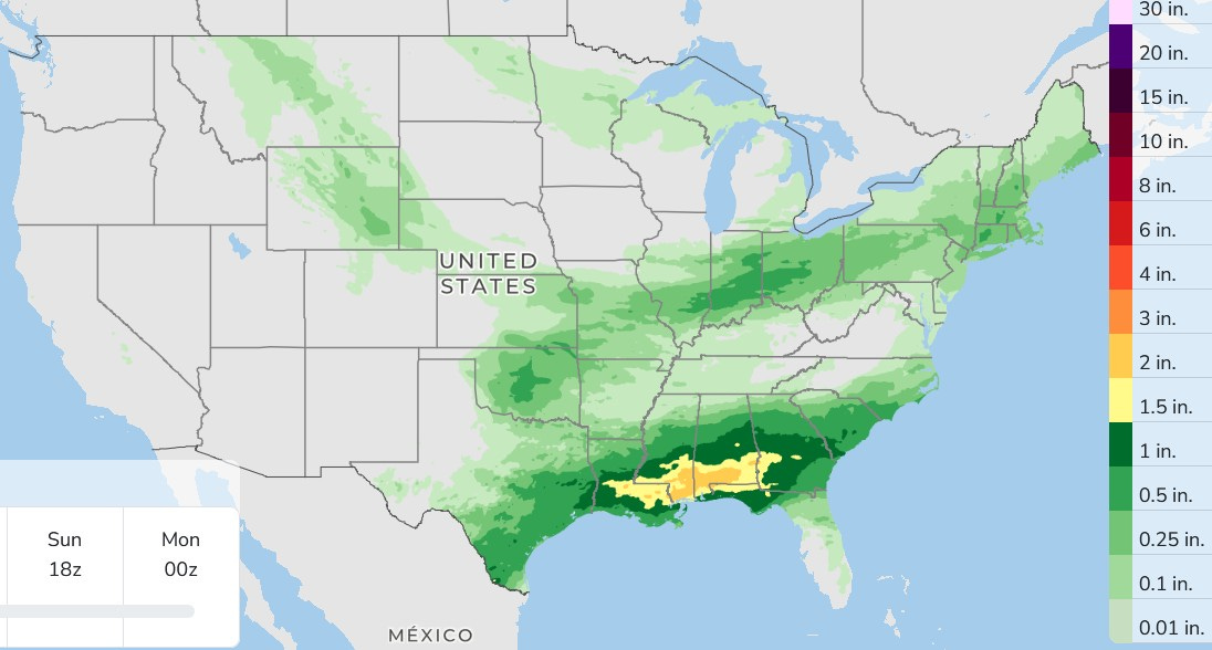
Here’s 3-day total rainfall. Again, lots of rain in the South and very little in Michigan. The main front across the South is the focus for the significant thunderstorms, while relatively dry air implies rainfall amounts will continue to be spotty and light in the Great Lakes.
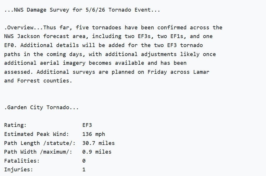
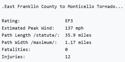
The NWS has confirmed two strong EF3 tornadoes Wednesday in Mississippi. One tornado was nearly a mile wide and the other over a mile wide. There were 13 injuries from these twisters and both were on the ground continuously for over 30 miles.
There will likely be more tornadoes confirmed from this event. Looks like over 400 homes were severely damaged or destroyed. Drone video of the damage.
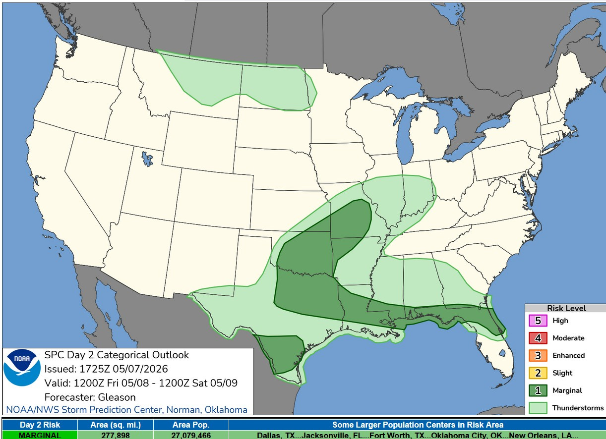
This PM, there is a level 1 or Marginal Risk of a severe storm from Missouri down to Texas, then east to Florida. They need the rain…hopefully, they won’t get much severe weather.
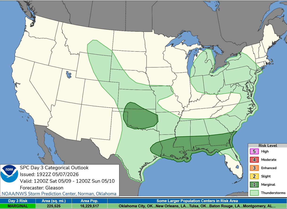
On Saturday, there is a chance of a non-severe thundershower in most of Lower Michigan. There’s a level 1 Marginal Risk over much of Oklahoma and from east Texas east to Jacksonville FL and Savannah GA.
Have fun with family. It's so disconcerting to read tornado reports even if not in our area.
BTW, it's 'ok' to have an occasional 'MISS' on a weather forecast, (re. predicted warmer weather. ) It was supposed to rain all day last Sat when I was in DC with grandkids...and we had balmy, sunny weather for the whole day ! All kids, and Dog had a great day, while parents enjoyed a local steeple-chase and various horse races, to celebrate the Derby . Thanks for your research and comments.
Have fun, you two!