
Arctic Cold Early Next Week
Daytime Temperatures in the Single Digits

This map shows forecast HIGH temperatures for next Monday. This is the “Arctic Express” with the air come straight from the North Pole down into the Central U.S. Grand Rapids is forecast to see an afternoon temperature of just 6 above zero even with a wind off Lake Michigan!
KGRR   GFSX MOS GUIDANCE   1/16/2025  0000 UTC
FHR  24| 36  48| 60  72| 84  96|108 120|132 144|156 168|180 192
THU  16| FRI 17| SAT 18| SUN 19| MON 20| TUE 21| WED 22| THU 23 CLIMO
X/N  32| 20  37| 23  24|  7  10|  2   4|  1   6|  1  17| 17  31 16 29
This is the overnight run of the GFSX model. The X/N row is the model forecast high and low temperatures for each day. The model gives Grand Rapids a high temperature of 10 on Sunday, just 4 above zero on Monday and 6 above on Tuesday. Wednesday, we’re back to 17° and then southwest winds should bring in air that is not quite as cold on Thursday, when we’re back to the low 30s, which is average for mid-January.
Look for highs in the mid-upper 40s Monday across the Rio Grande and down into northern Mexico.
The model forecasts a high temperature of 40° in Houston, and it’s not impossible that there could be snow flurries down to the Gulf of Mexico. New Orleans is forecast to have a high of just 41° on Monday. The cooler air hasn’t quite made it to far southern Florida, where Miami is still expected to climb to 74° on Monday. They’ll be cooler on Tuesday, but not super cold.
This is interesting. Often when it’s colder than average in winter in the central and eastern U.S., it’s warmer than average in Alaska - and vice versa.
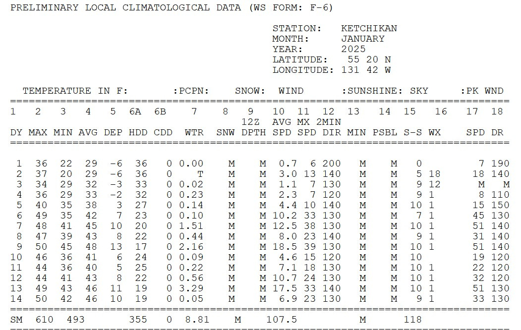
Above is the climate summary for the first two weeks of January for Ketchikan, Alaska. Ketchikan is located in the far southeast of the Alaska Peninsula and it’s the rain capital of Alaska. While our temperatures have been cooler than average in West Micigan, the last 9 days have been nearly 9 degrees warmer than average in Ketchikan.
From the 4th to the 13th, they had 8.74” of rain. They average 149.54” of rain per year and their record yearly rainfall was 202.55” in 1949. It’s a windy place. On the right side of the data above, you can see they had 3 days when the wind gusted to 51 mph. The wind is often blowing from the southeast. It can get cold enough for snow in Ketchikan. In January 1971, Ketchikan recorded 45.1” of snow. On very rare occasion, it can even get below zero. Summer high temperatures are in the low-mid 70s.
Look how much warmer it’s been in Ketchikan than in Grand Rapids. They haven’t been below 35 degrees since Jan. 4. Grand Rapids hasn’t been above 35 in January.

Back to West Michigan. Here’s some snowfall totals from Monday - Wednesday. Snow cover early Thursday morning: Kalamazoo 5”, Grand Rapids 6”, Muskegon 7”, Lansing 8”, Plainwell 10”, Gobles 11”, one spot near Holland reported 14” of snow on the ground.
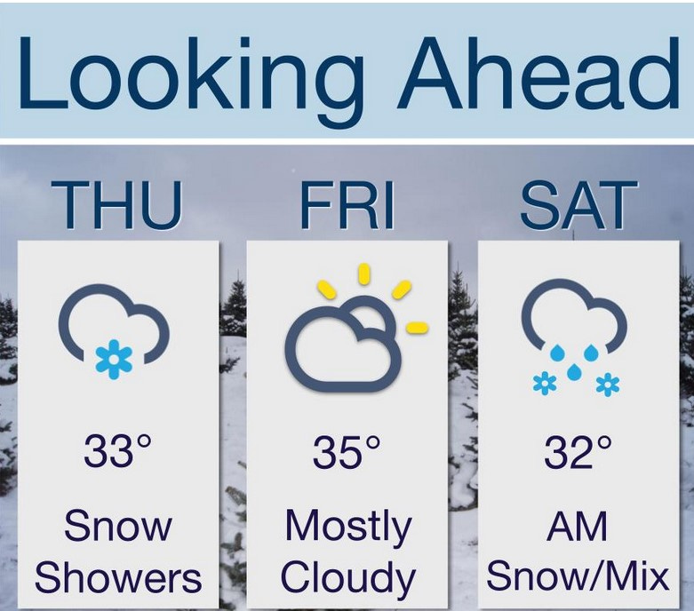
Here’s the next 3 days…chance of a lingering snow shower today - back up to the low-mid 30s this afternoon…a little sun possible between the clouds tomorrow and mid 30s. Saturday, we get some snow (outside chance of mixed precipitation). That high of 32 will occur early, with falling temperatures as the Arctic air arrives in the PM.
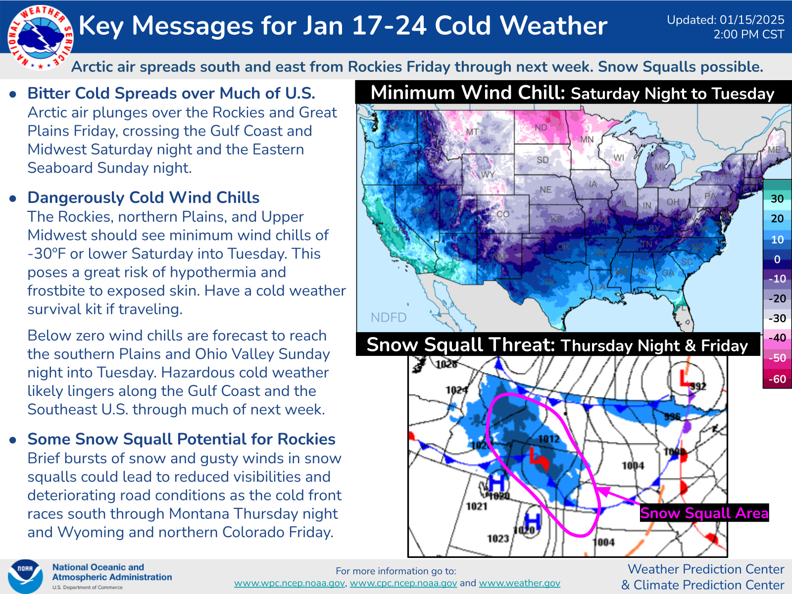
The top map in the graphic above shows the loest forecast wind chill next week. That’s wind hills approaching -50° in North Dakota. Lowest wind chills in West Michigan look to be in the -10° to -20° range.
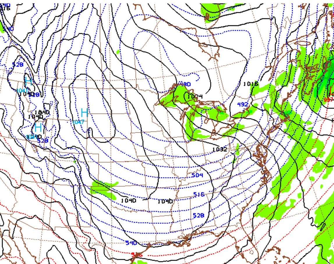
Here’s a forecast weather map for next Monday afternoon. There’s a huge high pressure center in southeast Montana. The circulation over the entire country is moving in a clockwise direction around that high. Here in West Michigan the green indicates where lake-effect snow is falling east of all the Great Lakes. The dotted lines show me how cold the air will be. We have a 487 thickness in Grand Rapids. With a thickness that low, we’ll be hard-pressed to reach 10 above zero, even with a west-northwest wind off Lake Michigan.
You know, I was thinking that this would be a perfect pattern for Santa and his reindeer on Christmas Eve. The “Polar Express” would give him a nice tailwind. He could be down here in record time.
Playoff game in Buffalo - chance of snow shower, temperatures may be only in the upper teens. In Detroit a mix of rain/snow in the AM will transition to light snow with temperatures falling from the low-mid 30s early in the day, to the low 20s at the start of the game to the mid teens on the way home. Watch for a random slick spot on mainly lesser-traveled roads.
Inauguration…probability low 20s much of the day (high 24), but with some sunshine.
So, enjoy the milder air today and tomorrow and plan on an Arctic blast early next week.