
Another Frost/Freeze Early Monday
And a Chance of Frost Tuesday AM

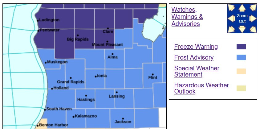
I wonder what the record is for most Frost Advisories/Freeze Warnings in the spring. We’ve got more cold weather Advisories and Warnings in Michigan for tonight (early Monday morning) and likely again tomorrow night (early Tuesday morning).
Tonight we have a Freeze Warning for Oceana, Newaygo, Mecosta and Isabella Counties to the north. It’s a Frost Advisory for Muskegon, Kent and Montcalm Counties to the south.
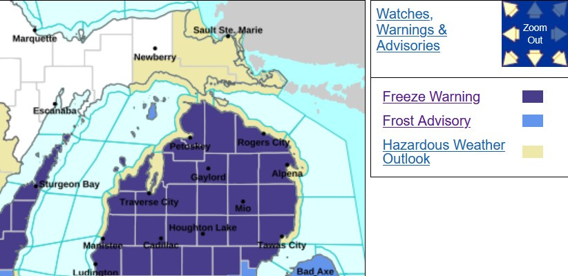
The Freeze Warning extends north to the Mackinac Bridge. It will likely get below freezing in parts of Upper Michigan, but vegetation isn’t far enough along to warrant Freeze Warnings for the U.P.
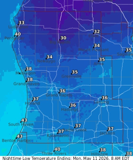
Here’s some forecast low temperatures for tonight (Sun. night). These temperatures are at eye-level, or around 5 feet off the ground. It can be as much as 5 degrees colder than that on a calm, clear night. The warmer temperatures at the lake are weather stations that are at the shore and the cooler readings are farther away from the lake. That’s why there is a difference between Holland (37) and South Haven (43).
Bottom line, if you can hold off planting anything frost sensitive until Wednesday, I think there’s a good chance that most all of us will be done from the Frost Advisories.
Also: Check this out…a winter panorama view of Main St. on Mackinac Island.